 Old Cumbria Gazetteer
 |
 |
|
| Heron Pike, Lakes | ||
| Heron Pike | ||
| civil parish:- | Lakes (formerly Westmorland) | |
| county:- | Cumbria | |
| locality type:- | hill | |
| coordinates:- | NY35600830 | |
| 1Km square:- | NY3508 | |
| 10Km square:- | NY30 | |
| altitude:- | 2008 feet | |
| altitude:- | 612m | |
|
|
||
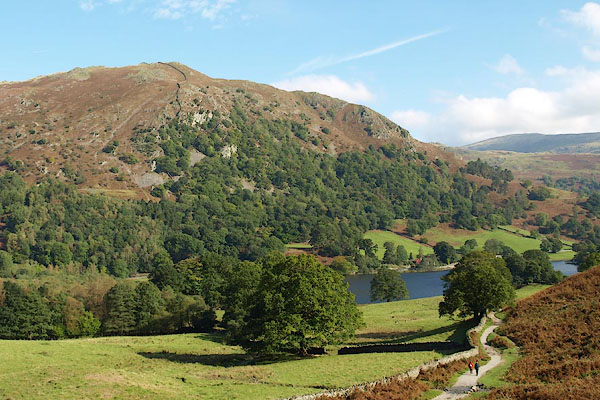 BPS06.jpg (taken 7.10.2008) 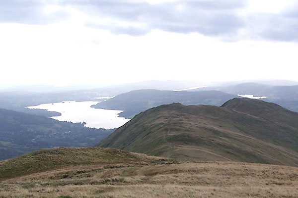 BRS36.jpg (taken 7.10.2009) |
||
|
|
||
| evidence:- | old map:- Jefferys 1770 (Wmd) |
|
| source data:- | Map, 4 sheets, The County of Westmoreland, scale 1 inch to 1
mile, surveyed 1768, and engraved and published by Thomas
Jefferys, London, 1770.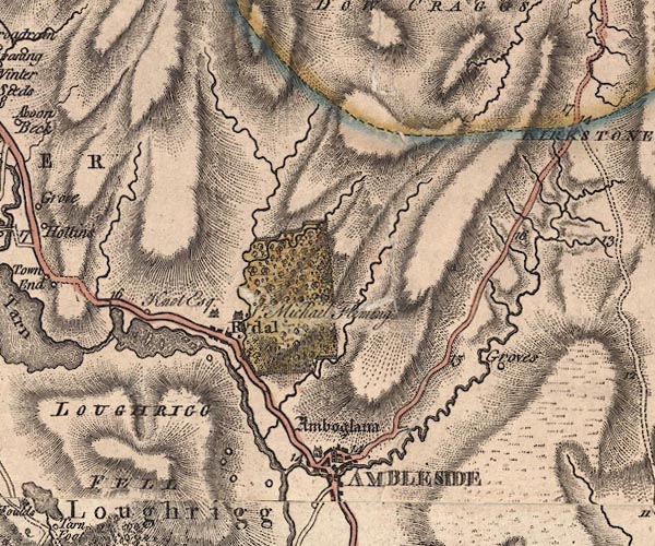 J5NY30NE.jpg hill hachuring; hill or mountain item:- National Library of Scotland : EME.s.47 Image © National Library of Scotland |
|
|
|
||
| evidence:- | old print with text:- Farington 1789 (plate 20) |
|
| source data:- | Print, engraving, The Bridge and part of the Village of Rydal, Westmorland, painted
by Joseph Farington, engraved by W Byrne and J Landseer, published by W Byrne, 69
Titchfield Street, London, 1785.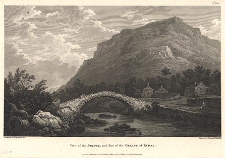 click to enlarge click to enlargeBMZ06.jpg Pelter Bridge over the River Rothay, Heron Pike in the background. Plate 20 from Views of the Lakes, &c, in Cumberland and Westmorland, published 1789; with descriptive text:- "VIEW near the VILLAGE of RYDAL." "THE Scene here represented includes Part of the Neighbourhood of Ambleside, ... Were a person at Leisure to attend to the various picturesque Situations he would meet with, he would allow the Subjects we have selected are not single instances, but are to be considered only as Specimens of the Style of the Country. The Bridge, ... with the Group of little Cottages near it, forms a beautiful Contrast to Rydal-fell, which rising in Alpine Grandeur, overshadows the Vale." item:- Dove Cottage : Lowther.7 Image © see bottom of page |
|
|
|
||
| evidence:- | outline view:- Black 1856 (23rd edn 1900) placename:- Forest Side Fell |
|
| source data:- | Print, lithograph, Outline Views, Grasmere and Coniston - Mountains as seen from Redbank,
Grasmere, and Mountains as seen a little beyond Tent Lodge on the Road from Coniston
to Ulverstone, by J Flintoft, Keswick, Cumberland, engraved by R Mason, Edinburgh,
Lothian, about 1900.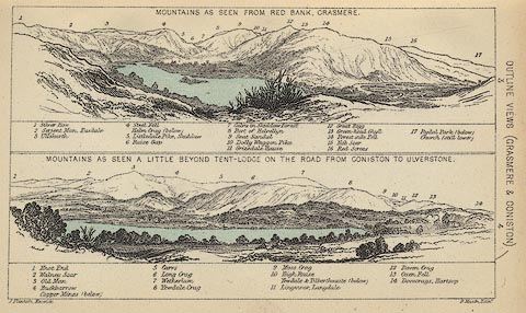 click to enlarge click to enlargeBC08E3.jpg "... 14 Forest side Fell ..." item:- JandMN : 37.12 Image © see bottom of page |
|
|
|
||
| evidence:- | probably outline view:- Black 1841 (3rd edn 1846) placename:- Forest Side Fell |
|
| source data:- | Print, engraving, outline view, Mountains as seen from Red Bank, Grasmere, and Mountains
as seen a little beyond Tent-Lodge on the Road from Coniston to Ulverston, by J Flintoft,
Keswick, Cumberland, engraved by R Mason, Edinburgh, Lothian, about 1846.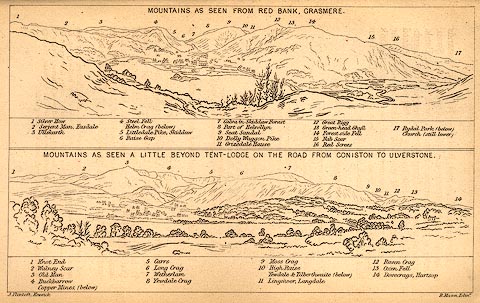 click to enlarge click to enlargeBC02E3.jpg "... 14 Forest side Fell ..." item:- JandMN : 32.5 Image © see bottom of page |
|
|
|
||
| evidence:- | old print with text:- Farington 1789 (plate 20) |
|
| source data:- | Print, engraving, The Bridge and part of the Village of Rydal, Westmorland, painted
by Joseph Farington, engraved by W Byrne and J Landseer, published by W Byrne, 69
Titchfield Street, London, 1785. click to enlarge BMZ06.jpg Pelter Bridge over the River Rothay, Heron Pike in the background. Plate 20 from Views of the Lakes, &c, in Cumberland and Westmorland, published 1789; with descriptive text:- "VIEW near the VILLAGE of RYDAL." "THE Scene here represented includes Part of the Neighbourhood of Ambleside, ... Were a person at Leisure to attend to the various picturesque Situations he would meet with, he would allow the Subjects we have selected are not single instances, but are to be considered only as Specimens of the Style of the Country. The Bridge, ... with the Group of little Cottages near it, forms a beautiful Contrast to Rydal-fell, which rising in Alpine Grandeur, overshadows the Vale." item:- Dove Cottage : Lowther.7 Image © see bottom of page |
|
|
|
||
 Lakes Guides menu.