 Old Cumbria Gazetteer
 |
 |
|
| High Borrans, Windermere | ||
| High Borrans | ||
| High Borrans Outdoor Education Centre | ||
| civil parish:- | Windermere (formerly Westmorland) | |
| county:- | Cumbria | |
| locality type:- | buildings | |
| coordinates:- | NY43200091 | |
| 1Km square:- | NY4300 | |
| 10Km square:- | NY40 | |
|
|
||
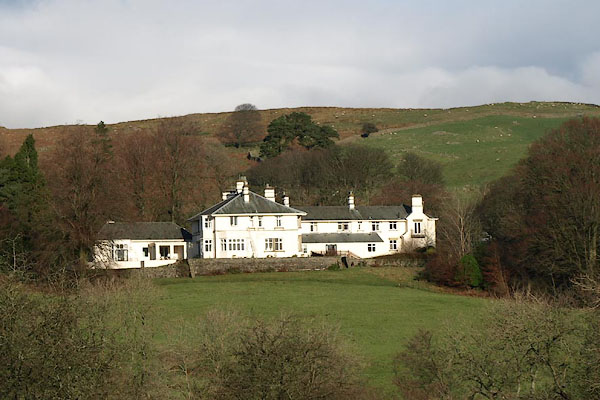 BRY02.jpg (taken 30.11.2009) 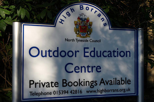 BRY03.jpg Sign - North Tyneside Council. (taken 30.11.2009) |
||
|
|
||
| evidence:- | old map:- OS County Series (Wmd 32 4) placename:- Borrans |
|
| source data:- | Maps, County Series maps of Great Britain, scales 6 and 25
inches to 1 mile, published by the Ordnance Survey, Southampton,
Hampshire, from about 1863 to 1948. |
|
|
|
||
| evidence:- | old map:- Jefferys 1770 (Wmd) placename:- Barrons |
|
| source data:- | Map, 4 sheets, The County of Westmoreland, scale 1 inch to 1
mile, surveyed 1768, and engraved and published by Thomas
Jefferys, London, 1770.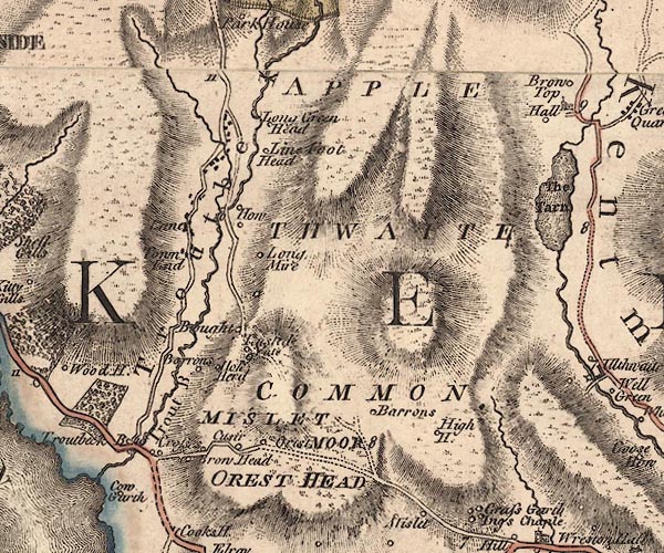 J5NY40SW.jpg "Barrons" circle, labelled in italic lowercase text; settlement, farm, house, or hamlet? item:- National Library of Scotland : EME.s.47 Image © National Library of Scotland |
|
|
|
||
| evidence:- | old map:- Cary 1789 (edn 1805) placename:- Barrans |
|
| source data:- | Map, uncoloured engraving, Westmoreland, scale about 2.5 miles
to 1 inch, by John Cary, London, 1789; edition 1805.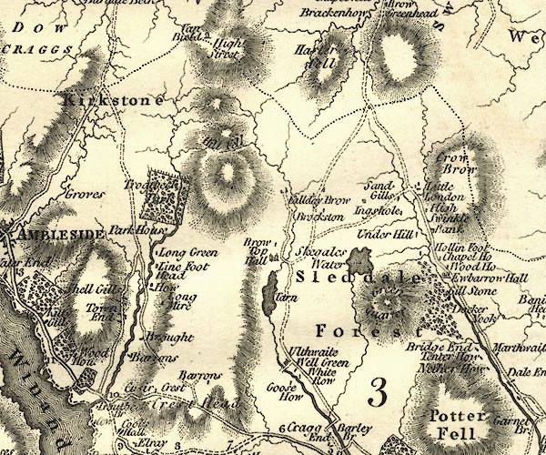 CY24NY40.jpg "Barrans" block/s, labelled in italic lowercase; house, or hamlet item:- JandMN : 129 Image © see bottom of page |
|
|
|
||
 Lakes Guides menu.