 Old Cumbria Gazetteer
 |
 |
|
| High Yewdale, Coniston | ||
| High Yewdale | ||
| locality:- | Yewdale | |
| civil parish:- | Coniston (formerly Lancashire) | |
| county:- | Cumbria | |
| locality type:- | buildings | |
| coordinates:- | SD31489973 | |
| 1Km square:- | SD3199 | |
| 10Km square:- | SD39 | |
|
|
||
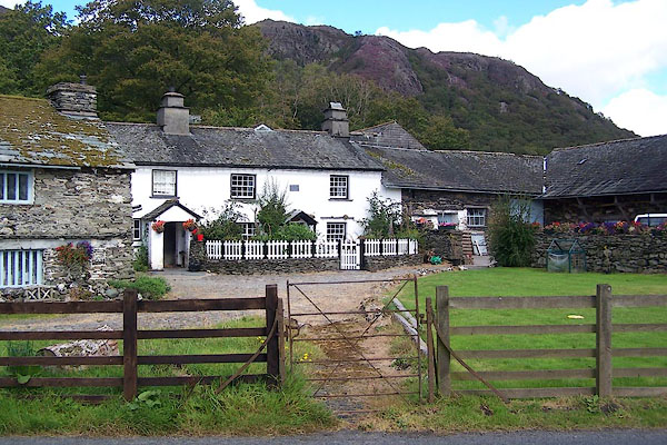 BOB93.jpg (taken 3.9.2007) 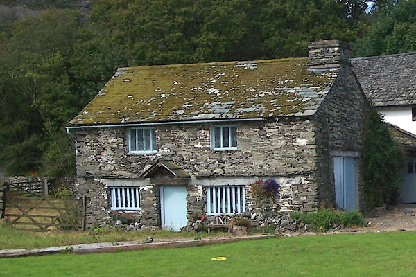 BOB94.jpg (taken 3.9.2007) |
||
|
|
||
| evidence:- | probably old map:- Garnett 1850s-60s H placename:- Yewdale |
|
| source data:- | Map of the English Lakes, in Cumberland, Westmorland and
Lancashire, scale about 3.5 miles to 1 inch, published by John
Garnett, Windermere, Westmorland, 1850s-60s.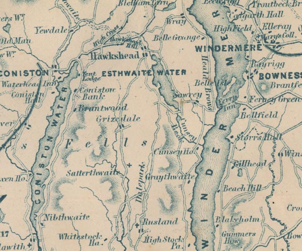 GAR2SD39.jpg "Yewdale" block, building item:- JandMN : 82.1 Image © see bottom of page |
|
|
|
||
| evidence:- | database:- Listed Buildings 2010 placename:- High Yewdale Farm |
|
| source data:- | courtesy of English Heritage "HIGH YEWDALE FARMHOUSE AND OUTBUILDINGS / / A 593 / CONISTON / SOUTH LAKELAND / CUMBRIA / II / 76787 / SD3149599741" |
|
|
|
||
| hearsay:- |
Double row of bee boles. |
|
|
|
||
 Lakes Guides menu.