 Old Cumbria Gazetteer
 |
 |
|
| Hodbarrow Point, Hodbarrow | ||
| Hodbarrow Point | ||
| locality:- | Hodbarrow | |
| civil parish:- | Millom (formerly Cumberland) | |
| county:- | Cumbria | |
| locality type:- | headland | |
| coordinates:- | SD18267806 | |
| 1Km square:- | SD1878 | |
| 10Km square:- | SD17 | |
|
|
||
| evidence:- | old map:- OS County Series (Cmd 90 7) placename:- Hodbarrow Point |
|
| source data:- | Maps, County Series maps of Great Britain, scales 6 and 25
inches to 1 mile, published by the Ordnance Survey, Southampton,
Hampshire, from about 1863 to 1948. |
|
|
|
||
| evidence:- | old map:- Donald 1774 (Cmd) placename:- Hodbarrow Point |
|
| source data:- | Map, hand coloured engraving, 3x2 sheets, The County of Cumberland, scale about 1
inch to 1 mile, by Thomas Donald, engraved and published by Joseph Hodskinson, 29
Arundel Street, Strand, London, 1774.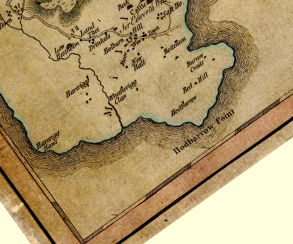 D4SD17NE.jpg "Hodbarrow Point" headland item:- Carlisle Library : Map 2 Image © Carlisle Library |
|
|
|
||
| evidence:- | old map:- West 1784 map placename:- Hedbarrow Point |
|
| source data:- | Map, hand coloured engraving, A Map of the Lakes in Cumberland,
Westmorland and Lancashire, scale about 3.5 miles to 1 inch,
engraved by Paas, 53 Holborn, London, about 1784.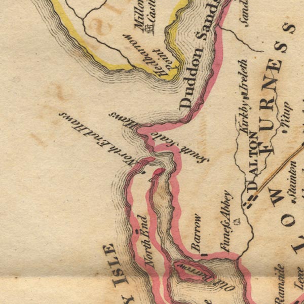 Ws02SD17.jpg item:- Armitt Library : A1221.1 Image © see bottom of page |
|
|
|
||
| evidence:- | old text:- Admiralty 1933 placename:- Hodbarrow Point |
|
| source data:- |  goto source goto sourcePage 383:- "..." "Hodbarrow point, situated about 2 1/4 miles eastward of Haverigg point, is the south-eastern extreme of a small promontory on which an extensive red hematite iron mine is worked. A sea wall, about a mile long, has been constructed on the southern side of this promontory, ..." |
|
|
|
||
Lakes Guides menu.