 Old Cumbria Gazetteer
 |
 |
|
| Holy Trinity, Carwath | ||
| Holy Trinity Church | ||
| Rosley Church | ||
| locality:- | Carwath | |
| civil parish:- | Westward (formerly Cumberland) | |
| county:- | Cumbria | |
| locality type:- | church | |
| coordinates:- | NY31554763 | |
| 1Km square:- | NY3147 | |
| 10Km square:- | NY34 | |
| references:- | : 2005: Diocese of Carlisle, Directory 2004/5 |
|
|
|
||
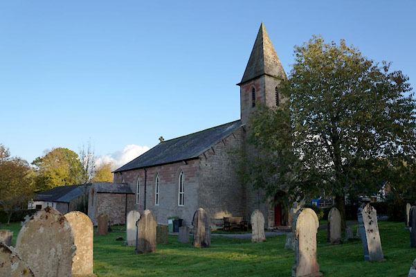 BZP76.jpg (taken 1.11.2013) |
||
|
|
||
| evidence:- | old map:- OS County Series (Cmd 29 12) placename:- Trinity Church |
|
| source data:- | Maps, County Series maps of Great Britain, scales 6 and 25
inches to 1 mile, published by the Ordnance Survey, Southampton,
Hampshire, from about 1863 to 1948. "Trinity Church (Chapel of Ease)" |
|
|
|
||
| evidence:- | old map:- Nurse 1918 |
|
| source data:- | Map, The Diocese of Carlisle, Cumberland, Westmorland, and
Lancashire North of the Sands, scale about 4 miles to 1 inch, by
Rev Euston J Nurse, published by Charles Thurnam and Sons, 11
English Street, Carlisle, Cumberland, 2nd edn 1939.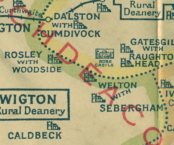 NUR1NY34.jpg "ROSLEY WITH WOODSIDE" item:- JandMN : 27 Image © see bottom of page |
|
|
|
||
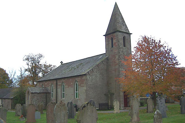 BOH95.jpg (taken 30.10.2007) 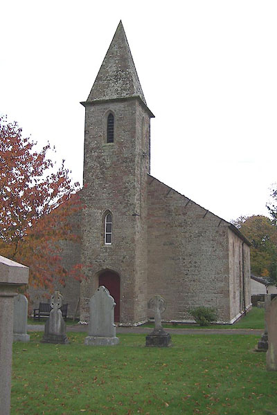 BOH96.jpg (taken 30.10.2007) 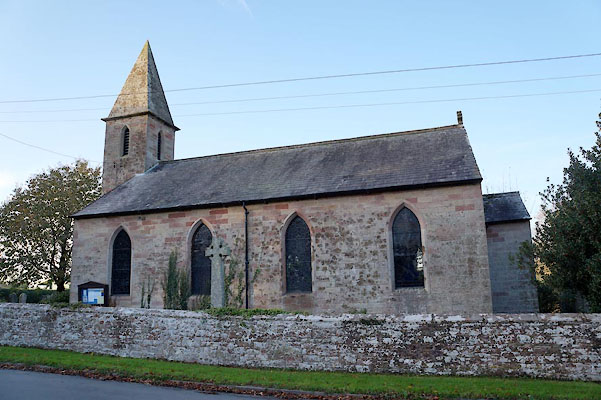 BZP75.jpg (taken 1.11.2013) |
||
|
|
||
| dedication | ||
| person:- | : Holy Trinity |
|
| place:- | Rosley / Carlisle Diocese | |
|
|
||
 Lakes Guides menu.