 Old Cumbria Gazetteer
 |
 |
|
| Ingwell, St Bees | ||
| Ingwell | ||
| Ingwell Hall | ||
| Ingwell School | ||
| civil parish:- | St Bees (formerly Cumberland) | |
| county:- | Cumbria | |
| locality type:- | buildings | |
| locality type:- | school | |
| coordinates:- | NX99571491 (etc) | |
| 1Km square:- | NX9914 | |
| 10Km square:- | NX91 | |
|
|
||
| evidence:- | old map:- OS County Series (Cmd 67 11) placename:- Ingwell |
|
| source data:- | Maps, County Series maps of Great Britain, scales 6 and 25
inches to 1 mile, published by the Ordnance Survey, Southampton,
Hampshire, from about 1863 to 1948. |
|
|
|
||
| evidence:- | possibly old map:- Donald 1774 (Cmd) placename:- Starmire |
|
| source data:- | Map, hand coloured engraving, 3x2 sheets, The County of Cumberland, scale about 1
inch to 1 mile, by Thomas Donald, engraved and published by Joseph Hodskinson, 29
Arundel Street, Strand, London, 1774.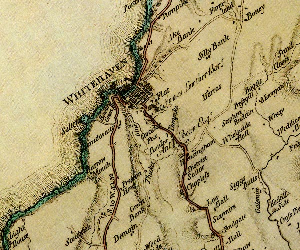 D4NX91NE.jpg "Starmire" block or blocks, labelled in lowercase; a hamlet or just a house item:- Carlisle Library : Map 2 Image © Carlisle Library |
|
|
|
||
| evidence:- | old print:- placename:- Ingwell |
|
| source data:- | Print, Ingwell, St Bees, Cumberland, 1840s.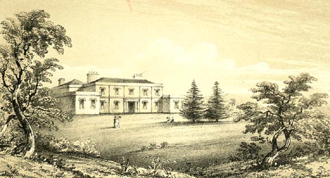 click to enlarge click to enlargePR1182.jpg Summertime; view of hall set in parkland with four figures on the sloping lawns in front of it. printed at bottom centre:- "INGWELL, CUMBERLAND, THE SEAT OF F.L.B. DYKES ESQ." printed at bottom right:- item:- Tullie House Museum : 1976.169.2.24.1 Image © Tullie House Museum |
|
|
|
||
 Lakes Guides menu.