 Old Cumbria Gazetteer
 |
 |
|
| Irish Sea | ||
| locality type:- | sea area | |
| 10Km square:- | NY04 | |
| 10Km square:- | NY03 | |
| 10Km square:- | NX93 | |
| 10Km square:- | NX92 | |
| 10Km square:- | NX91 | |
| 10Km square:- | NX90 | |
| 10Km square:- | NY00 | |
| 10Km square:- | SD09 | |
| 10Km square:- | SD08 | |
| 10Km square:- | SD18 | |
| 10Km square:- | SD17 | |
| 10Km square:- | SD16 | |
| 10Km square:- | SD26 | |
| 10Km square:- | SD36 | |
|
|
||
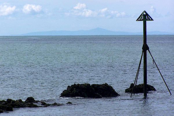 BNQ41.jpg Calm sea, from Harrington Harbour; the Isle of Man. (taken 14.5.2007) 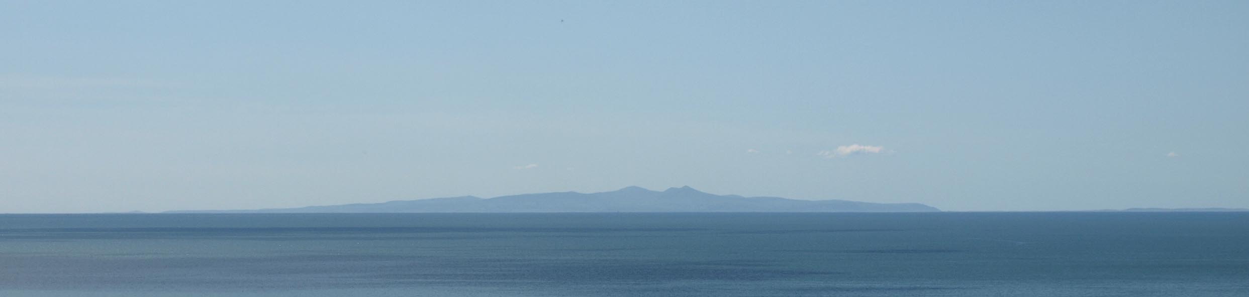 Click to enlarge BQN76.jpg The Isle of Man, from near St Bees. (taken 11.5.2009) |
||
|
|
||
| evidence:- | old map:- OS County Series (Cmd 35 13) placename:- Irish Sea |
|
| source data:- | Maps, County Series maps of Great Britain, scales 6 and 25
inches to 1 mile, published by the Ordnance Survey, Southampton,
Hampshire, from about 1863 to 1948. OS County Series (Cmd 44 8) OS County Series (Cmd 44 12) OS County Series (Cmd 53 3) OS County Series (Cmd 53 14) OS County Series (Cmd 72 1) OS County Series (Cmd 77 8) OS County Series (Cmd 77 16) OS County Series (Cmd 82 5) OS County Series (Cmd 85 6) OS County Series (Cmd 87 7) OS County Series (Cmd 89 8) OS County Series (Lan 21 10) OS County Series (Lan 27 7) |
|
|
|
||
| evidence:- | old map:- Ptolemy 1540 |
|
| source data:- | Map, copy, uncoloured lithograph? Anglia II Nova Tabula, New Map
of England, scale about 50 miles to 1 inch, data in the
Geographia by Claudius Ptolemy, engraved by Sebastian Munster,
Basle, Switzerland, 1540. click to enlarge click to enlargePTY4Cm.jpg sea area item:- private collection : 131 Image © see bottom of page |
|
|
|
||
| evidence:- | old map:- Saxton 1579 placename:- Oceanus |
|
| source data:- | Map, hand coloured engraving, Westmorlandiae et Cumberlandiae Comitatus ie Westmorland
and Cumberland, scale about 5 miles to 1 inch, by Christopher Saxton, London, engraved
by Augustinus Ryther, 1576, published 1579-1645. Sax9NX93.jpg 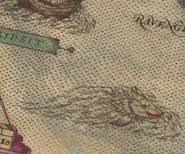 Sax9SC99.jpg "OCEANUS" With ships and sea monsters, down the west coast of Cumberland. item:- private collection : 2 Image © see bottom of page |
|
|
|
||
| evidence:- | old map:- Keer 1605 |
|
| source data:- | Map, hand coloured engraving, Westmorland and Cumberland, scale
about 16 miles to 1 inch, probably by Pieter van den Keere, or
Peter Keer, about 1605 edition perhaps 1676. click to enlarge click to enlargeKER8.jpg "OCEANUS" sea area item:- Dove Cottage : 2007.38.110 Image © see bottom of page |
|
|
|
||
| evidence:- | old map:- Speed 1611 (Cmd) placename:- Irish Sea, The |
|
| source data:- | Map, hand coloured engraving, Cumberland and the Ancient Citie
Carlile Described, scale about 4 miles to 1 inch, by John Speed,
1610, published by J Sudbury and George Humble, Popes Head
Alley, London, 1611-12.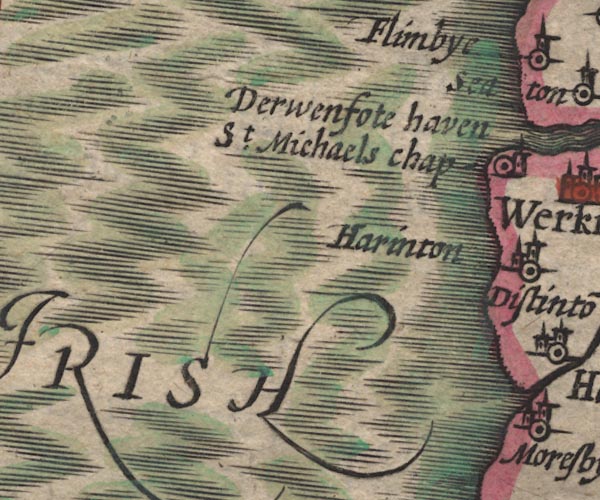 SP11NX92.jpg "THE IRISH SEA" sea moire effect, swash lettering item:- private collection : 16 Image © see bottom of page |
|
|
|
||
| evidence:- | old map:- Badeslade 1742 placename:- Irish Sea, The |
|
| source data:- | Map, uncoloured engraving, A Map of Cumberland North from
London, scale about 11 miles to 1 inch, with descriptive text,
by Thomas Badeslade, London, engraved and published by William
Henry Toms, Union Court, Holborn, London, 1742. click to enlarge click to enlargeBD10.jpg "THE IRISH SEA" sea area item:- JandMN : 115 Image © see bottom of page |
|
|
|
||
| evidence:- | old map:- Simpson 1746 map (Wmd) placename:- Irish Sea |
|
| source data:- | Map, uncoloured engraving, Westmorland, scale about 8 miles to 1
inch, printed by R Walker, Fleet Lane, London, 1746.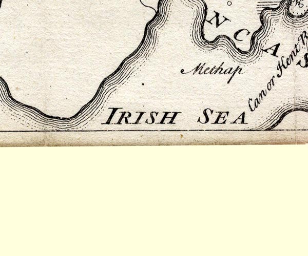 SMP2SDI.jpg "IRISH SEA" Sea area. item:- Dove Cottage : 2007.38.59 Image © see bottom of page |
|
|
|
||
| evidence:- | old map:- Bickham 1753-54 (Cmd) placename:- Irish Sea |
|
| source data:- | Map, uncoloured engraving, perspective map, Map of Cumberland
North from London, by George Bickham, James Street, Bunhill
Fields, London, 1753, published by F Jollie and Sons, Carlisle,
Cumberland, 1811.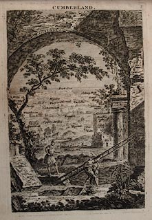 click to enlarge click to enlargeJL05.jpg "Irish Sea" view (sort of) item:- Carlisle Library : 4.2 Image © Carlisle Library |
|
|
|
||
| evidence:- | old map:- Donald 1774 (Cmd) placename:- Irish Sea, The |
|
| source data:- | Map, hand coloured engraving, 3x2 sheets, The County of Cumberland, scale about 1
inch to 1 mile, by Thomas Donald, engraved and published by Joseph Hodskinson, 29
Arundel Street, Strand, London, 1774. D4NX91SW.jpg "THE IRISH SEA" sea area item:- Carlisle Library : Map 2 Image © Carlisle Library |
|
|
|
||
| evidence:- | old text:- Mackenzie 1776 |
|
| source data:- | Charts, and sailing directions, Nautical Descriptions of the
West Coast of Great Britain, Bristol Channel to Cape Wrath, by
Murdoch Mackenzie, published London, 1776. goto source goto sourcePage 17:- "..." "A Description of the Tides, Rocks, Shoals, Sand-banks, Channels, Anchoring-places, and Harbours, between FORMBY POINT, and WALNEY ISLAND." "CHART X." "TIDES. Time of High-water. / From Formby, to St. Bee's Head, it is high water on the shore about eleven o'clock, on the full and change-days of the moon." "Rise of the Tide. / Spring-tide, on this part of the coast, rises 4½, or five fathoms perpendicular; neap-tide three. In the anchorage at Piel-of-Foudray, spring-tide, the second day after the change, rose six fathoms perpendicular" "Direction of the Stream. / The stream of flood along the coast, from Formby to Walney, runs northward; and, off the middle of that island, meets the stream which comes round the north coast of Ireland, and from thence runs southward through the Irish channel. The opposition of these two streams destroy each other's force, and renders their celerities scarce sensible in that neighbourhood; but, by accumulating the water in Piel-of-Foudray anchorage, occasions a greater rise of the tide there than in other parts." "SHOALS and SAND-BANKS. / There are no rocks along this part of the coast. Mad-wharf, off Formby, which dries at four hours of ebb, is the only sand-bank that does not lie within the mouths of the bays or rivers. But the coast from Formby, to the Point of Rossal, near Wyer Water, is all shallow for above two miles from the shore; the depth being not above three fathoms at that distance off. The banks, in the bays and rivers, will be well understood, by inspecting the draft, as by any description; and such as are near anchorage and harbours, will be described with them." "... ..." goto sourcePage 18:- "... ..." "A Description of the Tides, Rocks, Shoals, Channels, Anchoring-places, and Harbours, between PIEL-OF-FOUDRAY and St BEE's HEAD." "CHART XI." "TIDES / Tides between PIEL-OF-FOUDRAY and St. BEE's HEAD." "Time of High-water. / Between Piel-of-Foudray, and St. Bee's Head in Cumberland, it is high-water on the shore at eleven, on full and change days." "Rise of the Tides. / Spring-tide rises twenty feet perpendicular; neap-tide six or seven." "ROCKS and SHOALS. Helpsford Sand. Shoal off Walney. Selker Rock. Drig Rock. / The rocks and shoals to be avoided between Piel-of-Foudray and St. Bee's Head, are Helpsford Sand, which extends above a mile W. from the S. end of Walney: a shoal off the N. end of Walney, in the entry of Duddon Bay, with several patches of sand, near a league from the shore, that dry with spring-tide only: Selker Rock, a mile westward of Selker Point, the middle of which dries with very low spring-tide only; and Drig Rock, which is a small shoal, about three miles northward of Ravinglass, near a mile from the shore, on which six feet is the least water: at it N. St. Bee's Head is out near a handspike-length by the S. part of the Head. Keep above a league from from the N. end of Walney Island, and above a mile from the rest of the coast, and these rocks and shoals will be avoided." "ANCHORAGE. / Along this coast vessels may stop a tide in moderate weather any where, if the last-mentioned shoals are avoided." The charts and sailing directions have more about the Irish Sea, but not so relevant to Cumbria. |
|
|
|
||
| evidence:- | old map:- West 1784 map placename:- Irish Sea |
|
| source data:- | A Map of the Lakes in Cumberland, Westmorland and Lancashire,
scale about 3.5 miles to 1 inch, engraved by Paas, 53 Holborn,
London, included in the Guide to the Lakes by Thomas West,
published by William Pennington, Kendal, Westmorland, and in
London, from the 3rd edition 1784, to 1821. "THE IRISH SEA" |
|
|
|
||
| evidence:- | old map:- Ptolemy 1793 placename:- Hibernicus Oceanus |
|
| source data:- | Map, hand coloured engraving, Albion et Hibernia Britannicae
Insulae, from the data of Claudius Ptolemy, 2nd century, on the
example of Gerard Mercator, 16th century, scale about 55 miles
to 1 inch, engraved by Basire, published for the Society of
Antiquaries, 1793. click to enlarge click to enlargePTY3Cm.jpg "HIBERNICUS OCEANUS" item:- Hampshire Museums : FA2002.651 Image © see bottom of page |
|
|
|
||
| evidence:- | old map:- Cooper 1808 placename:- Irish Sea |
|
| source data:- | Map, uncoloured engraving, Cumberland, scale about 10.5 miles to
1 inch, drawn and engraved by Cooper, published by R Phillips,
Bridge Street, Blackfriars, London, 1808. click to enlarge click to enlargeCOP3.jpg "IRISH SEA" sea area item:- JandMN : 86 Image © see bottom of page |
|
|
|
||
| evidence:- | old map:- Ford 1839 map placename:- Irish Sea |
|
| source data:- | Map, uncoloured engraving, Map of the Lake District of
Cumberland, Westmoreland and Lancashire, scale about 3.5 miles
to 1 inch, published by Charles Thurnam, Carlisle, and by R
Groombridge, 5 Paternoster Row, London, 3rd edn 1843. FD02NX90.jpg "IRISH SEA"  FD02NX93.jpg "IRISH SEA" item:- JandMN : 100.1 Image © see bottom of page |
|
|
|
||
| evidence:- | old map:- Ford 1839 map placename:- Irish Sea |
|
| source data:- | Map, uncoloured engraving, Map of the Lake District of
Cumberland, Westmoreland and Lancashire, scale about 3.5 miles
to 1 inch, published by Charles Thurnam, Carlisle, and by R
Groombridge, 5 Paternoster Row, London, 3rd edn 1843. FD02NX90.jpg "IRISH SEA" FD02NX93.jpg "IRISH SEA" item:- JandMN : 100.1 Image © see bottom of page |
|
|
|
||
| evidence:- | text:- Mason 1907 (edn 1930) item:- coal mine; miner |
|
| source data:- | Text book, The Ambleside Geography Books bk.III, The Counties of
England, by Charlotte M Mason, published by Kegan Paul, Trench,
Trubner and Co, Broadway House, 68-74 Carter Lane, and the
Parents' Educational Union Office, 26 Victoria Street, London,
edn 1930. MSN1P025.txt Page 25:- "..." "A coal-field stretches from Wigton to Whitehaven. ... the collieries, which run out in some places two or three miles under the Irish Sea; ... the colliers can hear the sea rolling overhead as they are at work." |
|
|
|
||
| evidence:- | old painting:- item:- ship |
|
| source data:- | Painting, watercolour, Isle of Man from Seascale, Cumberland, by Frederick Clive Newcome,
1893.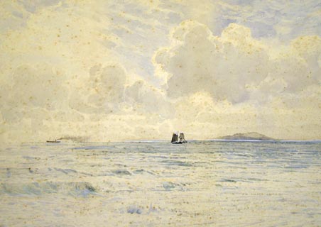 click to enlarge click to enlargePR1155.jpg Distant view of the Isle of Man across a calm sea with a steamer crossing the horizon to left of composition and a sailboat in the centre. signed &dated at bottom left:- "NEWCOME '93" item:- Tullie House Museum : 1974.60.3 Image © Tullie House Museum |
|
|
|
||
| evidence:- | old chart:- Gibson 1760 placename:- Irish Sea |
|
| source data:- | Chart, uncoloured engraving, A Correct Chart of the Irish Sea, scale about 43 miles
to 1 inch, engraved by J Gibson, published by the Gentleman's Magazine, 1760. click to enlarge click to enlargeGM20Cm.jpg Folded and tipped in opposite p.108 in the Gentleman's Magazine vol.30, 1760. There is descriptive text pp.107-112. printed at plain cartouche, lower left:- "A Correct Chart of the / IRISH SEA, &C. / exhibiting a View / of the / several Islands &Bays / lately touch'd at by / M. THUROT, / in his Attempt upon / IRELAND" printed at lower right:- "J. Gibson sculpt." printed at with scale line:- "A Scale of Miles 60 to a Degree" item:- Armitt Library : A5735 (5) Image © see bottom of page |
|
|
|
||
Lakes Guides menu.