 Old Cumbria Gazetteer
 |
 |
|
| Killhope Lead Mining Museum, Durham | ||
| Killhope Lead Mining Museum | ||
| locality:- | Killhope | |
| county:- | Durham | |
| locality type:- | museum | |
| locality type:- | lead mine | |
| locality type:- | mine | |
| 1Km square:- | NY8043 (?) | |
| 10Km square:- | NY84 | |
|
|
||
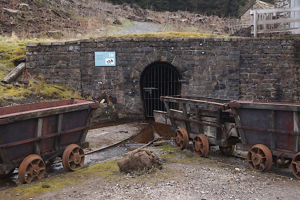 CEV95.jpg Mine entrance. (taken 15.4.2016) courtesy of Killhope Lead Mining Centre 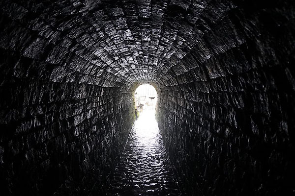 CEW11.jpg Mine entrance. (taken 15.4.2016) courtesy of Killhope Lead Mining Centre |
||
|
|
||
| MN photo:- |
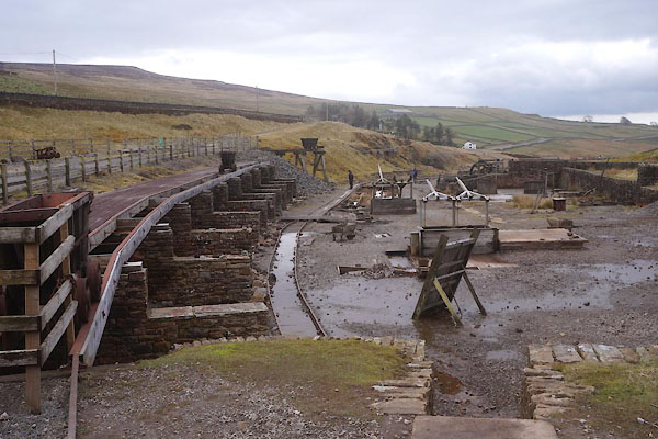
Old style washing floor for dressing the stone from the mine; with buddles, jiggers,
settling tanks, etc etc:- |
|
 CEV96.jpg (taken 15.4.2016) courtesy of Killhope Lead Mining Centre 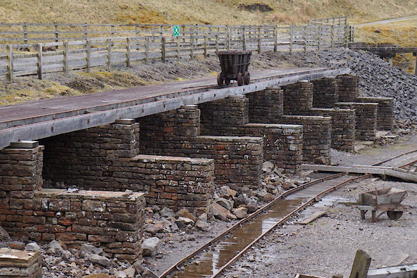 CEV97.jpg (taken 15.4.2016) courtesy of Killhope Lead Mining Centre 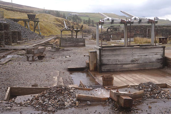 CEV98.jpg (taken 15.4.2016) courtesy of Killhope Lead Mining Centre 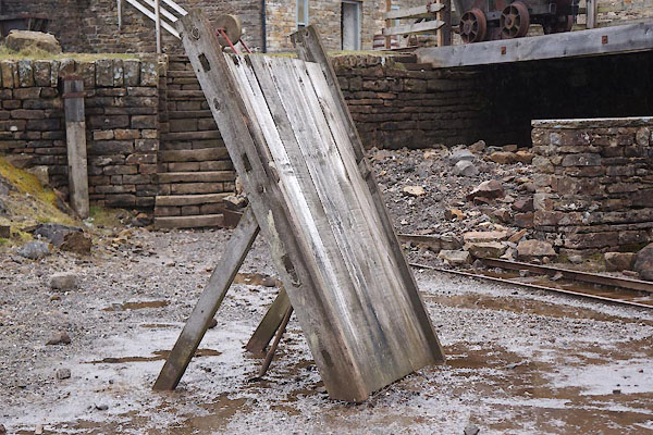 CEV99.jpg (taken 15.4.2016) courtesy of Killhope Lead Mining Centre 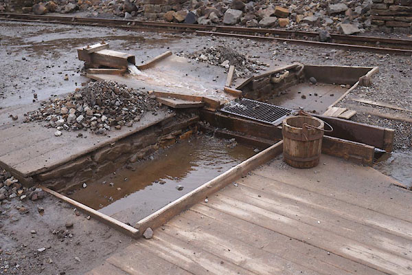 CEW01.jpg (taken 15.4.2016) courtesy of Killhope Lead Mining Centre 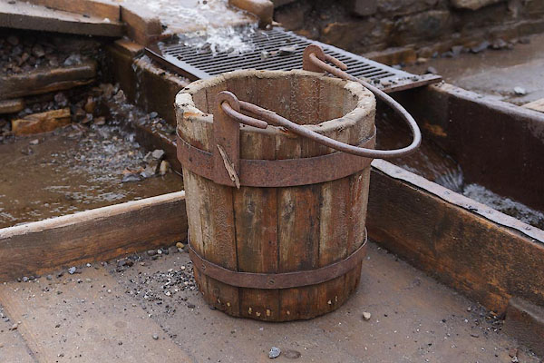 CEW02.jpg (taken 15.4.2016) courtesy of Killhope Lead Mining Centre 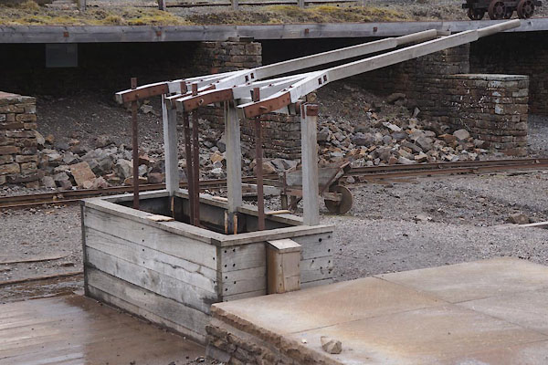 CEW03.jpg (taken 15.4.2016) courtesy of Killhope Lead Mining Centre  CEW04.jpg (taken 15.4.2016) courtesy of Killhope Lead Mining Centre 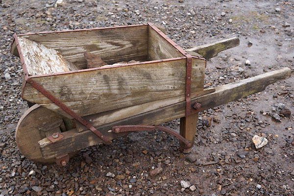 CEW05.jpg (taken 15.4.2016) courtesy of Killhope Lead Mining Centre 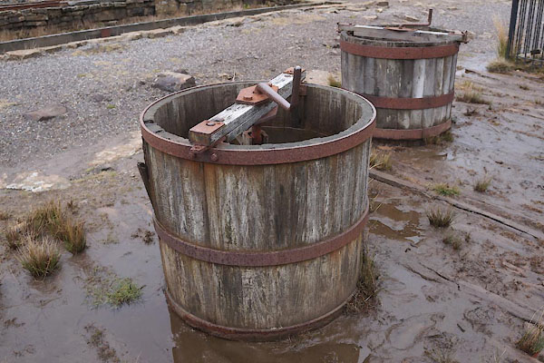 CEW06.jpg (taken 15.4.2016) courtesy of Killhope Lead Mining Centre 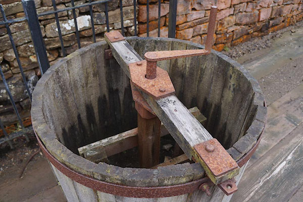 CEW07.jpg (taken 15.4.2016) courtesy of Killhope Lead Mining Centre 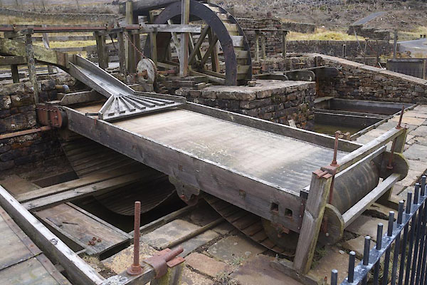 CEW08.jpg (taken 15.4.2016) courtesy of Killhope Lead Mining Centre 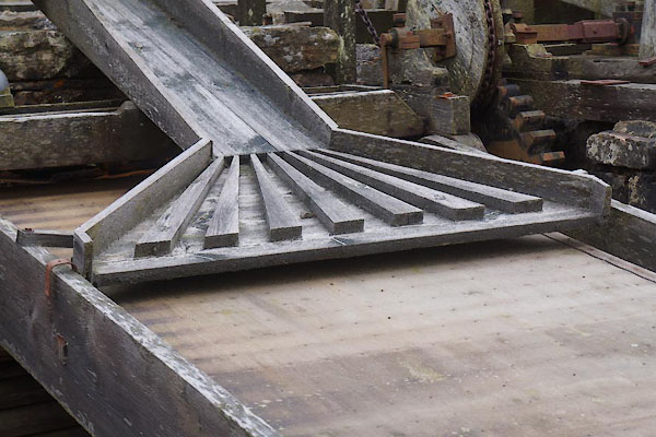 CEW09.jpg (taken 15.4.2016) courtesy of Killhope Lead Mining Centre 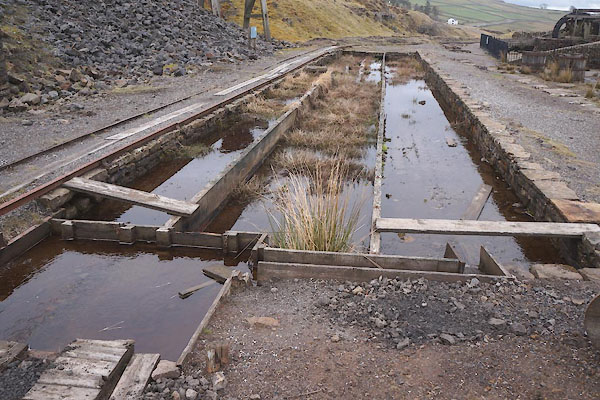 CEW10.jpg (taken 15.4.2016) courtesy of Killhope Lead Mining Centre |
||
|
|
||
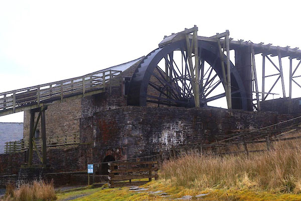
| MN photo:- |
New equipment installed about 1877; 33ft 8in diameter overshot water wheel, crusher,
jiggers, etc. |
|
 CEW13.jpg (taken 15.4.2016) courtesy of Killhope Lead Mining Centre 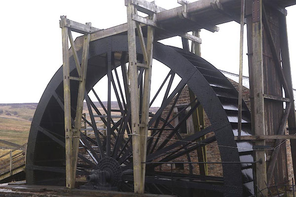 CEW14.jpg (taken 15.4.2016) courtesy of Killhope Lead Mining Centre 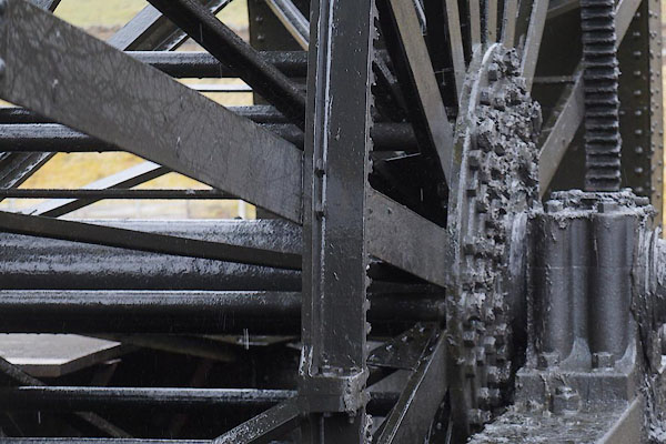 CEW15.jpg (taken 15.4.2016) courtesy of Killhope Lead Mining Centre  CEW16.jpg (taken 15.4.2016) courtesy of Killhope Lead Mining Centre 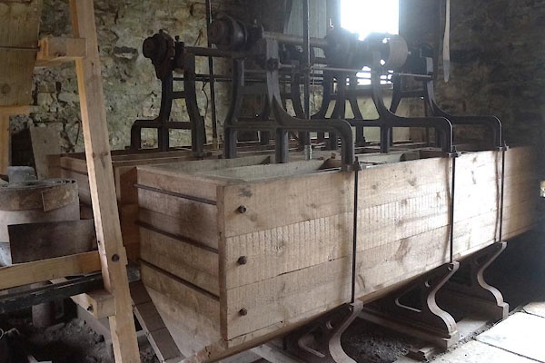 CEW17.jpg (taken 15.4.2016) courtesy of Killhope Lead Mining Centre 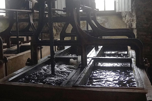 CEW18.jpg (taken 15.4.2016) courtesy of Killhope Lead Mining Centre 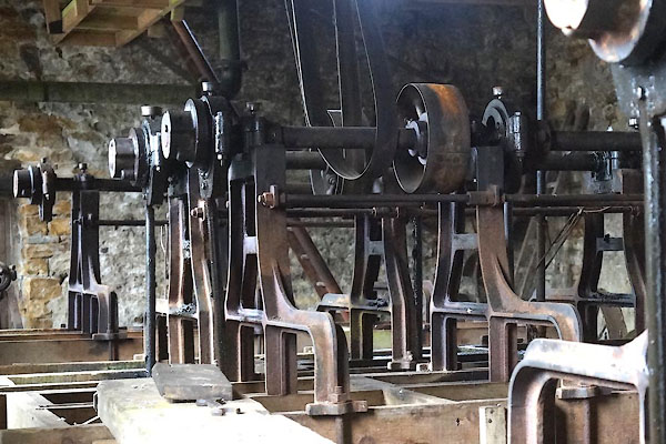 CEW19.jpg (taken 15.4.2016) courtesy of Killhope Lead Mining Centre 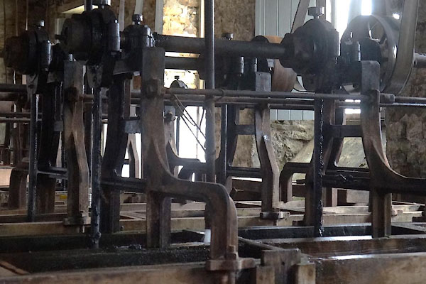 CEW20.jpg (taken 15.4.2016) courtesy of Killhope Lead Mining Centre 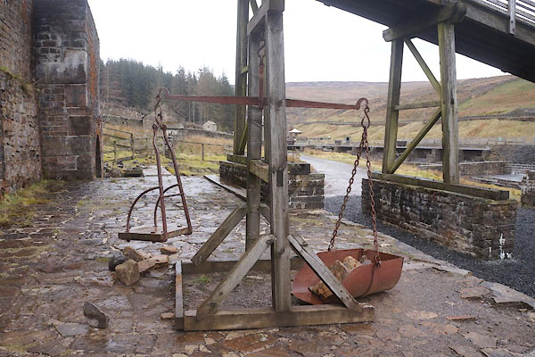 CEW21.jpg (taken 15.4.2016) courtesy of Killhope Lead Mining Centre |
||
|
|
||
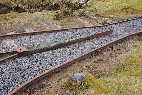
| MN photo:- |
Tramroad and mine tubs:- |
|
 CEV87.jpg (taken 15.4.2016) courtesy of Killhope Lead Mining Centre 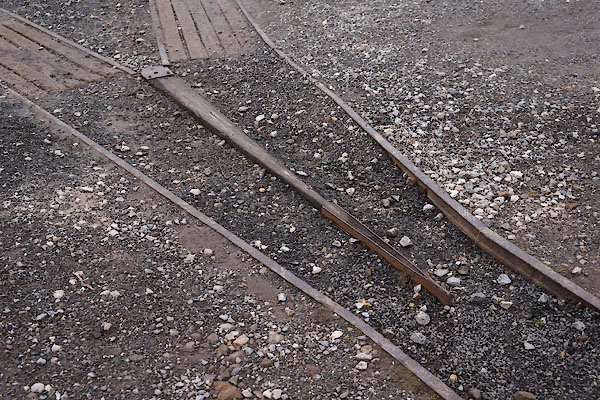 CEV88.jpg (taken 15.4.2016) courtesy of Killhope Lead Mining Centre 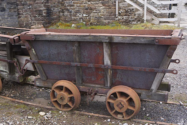 CEV89.jpg (taken 15.4.2016) courtesy of Killhope Lead Mining Centre 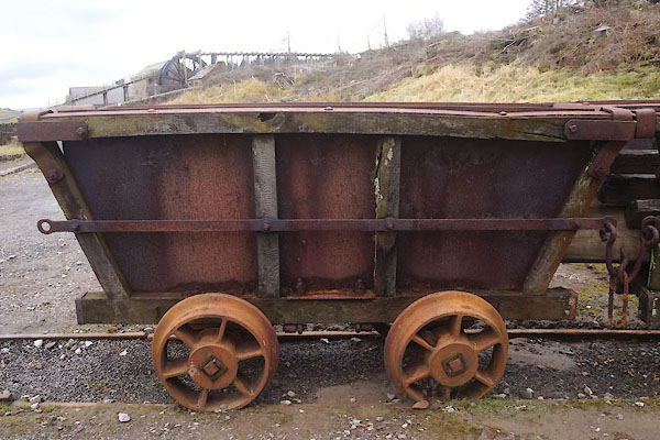 CEV90.jpg (taken 15.4.2016) courtesy of Killhope Lead Mining Centre 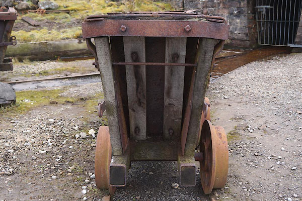 CEV91.jpg (taken 15.4.2016) courtesy of Killhope Lead Mining Centre 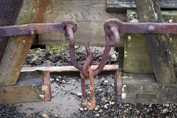 CEV92.jpg (taken 15.4.2016) courtesy of Killhope Lead Mining Centre 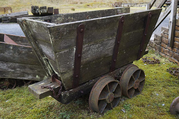 CEV93.jpg (taken 15.4.2016) courtesy of Killhope Lead Mining Centre 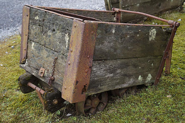 CEV94.jpg (taken 15.4.2016) courtesy of Killhope Lead Mining Centre |
||
|
|
||
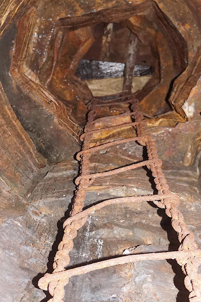 CEW12.jpg 'Riser' in the mine (taken 15.4.2016) courtesy of Killhope Lead Mining Centre 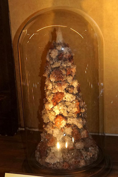 CEV77.jpg Spar box, from a west Cumberland iron mine; item 2008.199. (taken 15.4.2016) courtesy of Killhope Lead Mining Centre 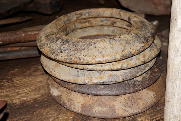 CEV85.jpg Quoits. (taken 15.4.2016) courtesy of Killhope Lead Mining Centre 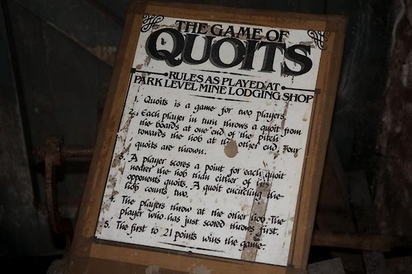 CEV86.jpg Rules for quoits. (taken 15.4.2016) courtesy of Killhope Lead Mining Centre |
||
|
|
||
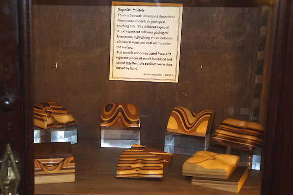
| MN photo:- |
Set of relief models showing strata, made as teaching aids by Thomas Sopwith, about
1841. Item 200.54. |
|
 CEV72.jpg (taken 15.4.2016) courtesy of Killhope Lead Mining Centre 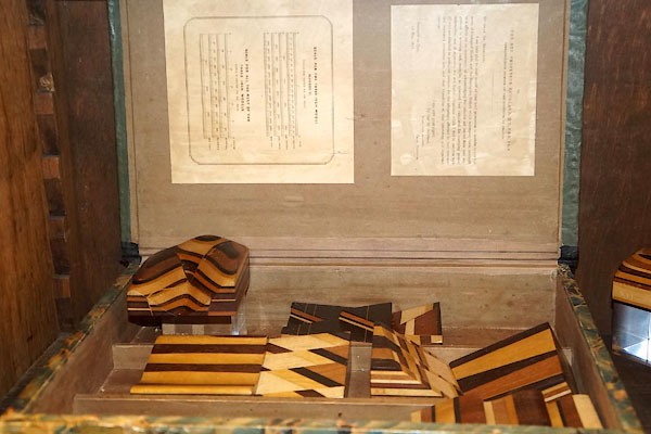 CEV73.jpg (taken 15.4.2016) courtesy of Killhope Lead Mining Centre 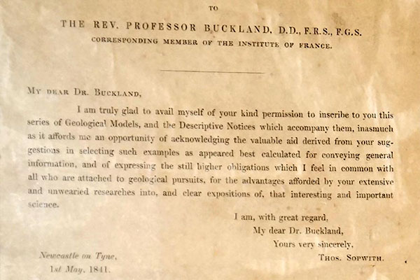 CEV74.jpg (taken 15.4.2016) courtesy of Killhope Lead Mining Centre 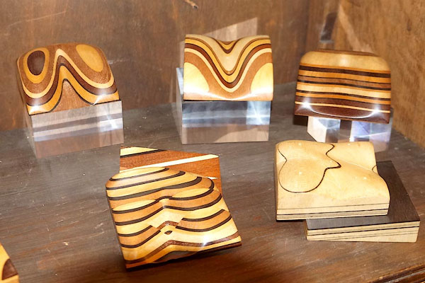 CEV75.jpg (taken 15.4.2016) courtesy of Killhope Lead Mining Centre |
||
|
|
||
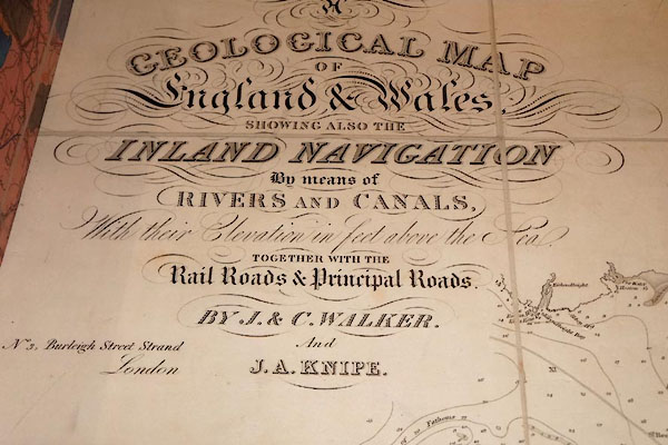
| MN photo:- |
Geological map of England and Wales by J and C Walker, and J A Knipe. Item ?. |
|
 CEV78.jpg (taken 15.4.2016) courtesy of Killhope Lead Mining Centre 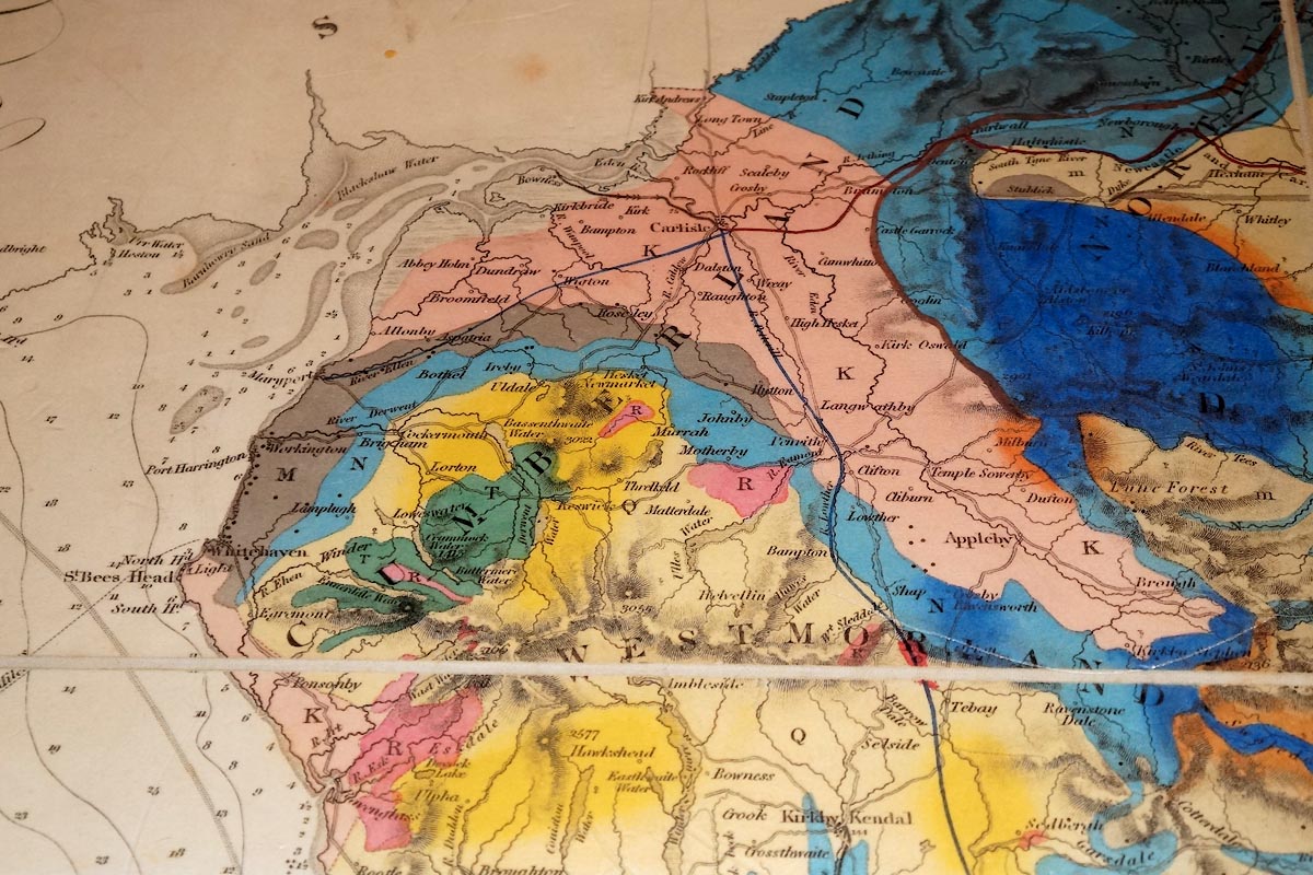 Click to enlarge CEV79.jpg (taken 15.4.2016) courtesy of Killhope Lead Mining Centre 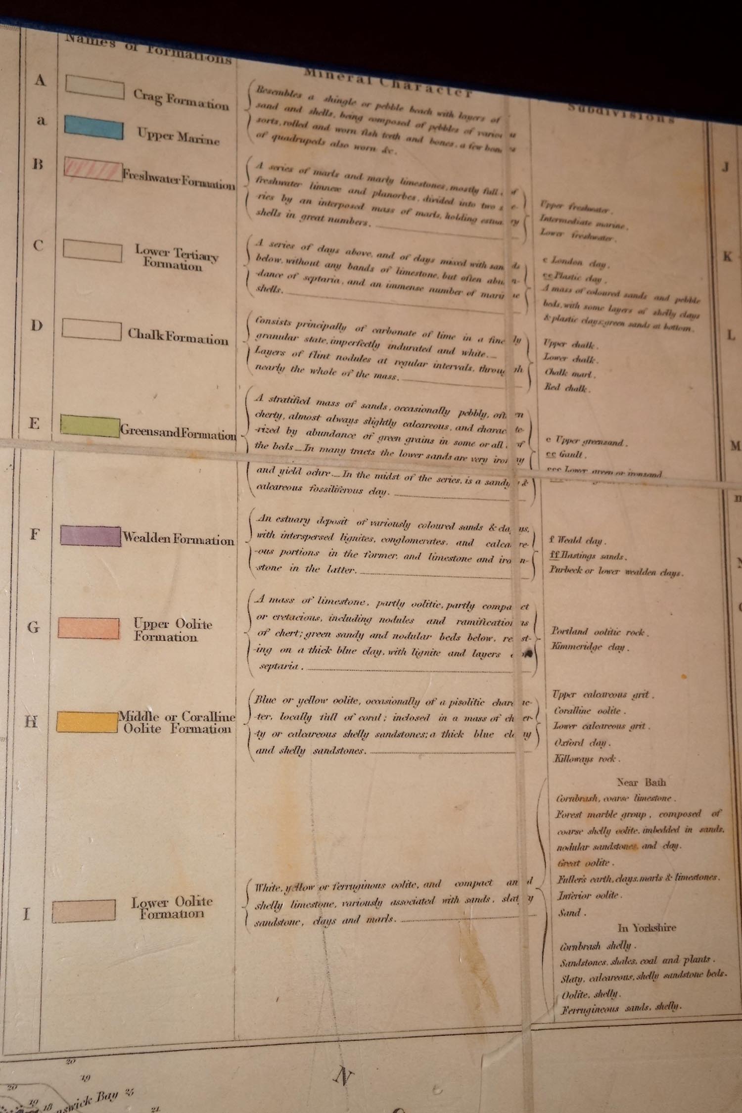 Click to enlarge CEV80.jpg (taken 15.4.2016) courtesy of Killhope Lead Mining Centre 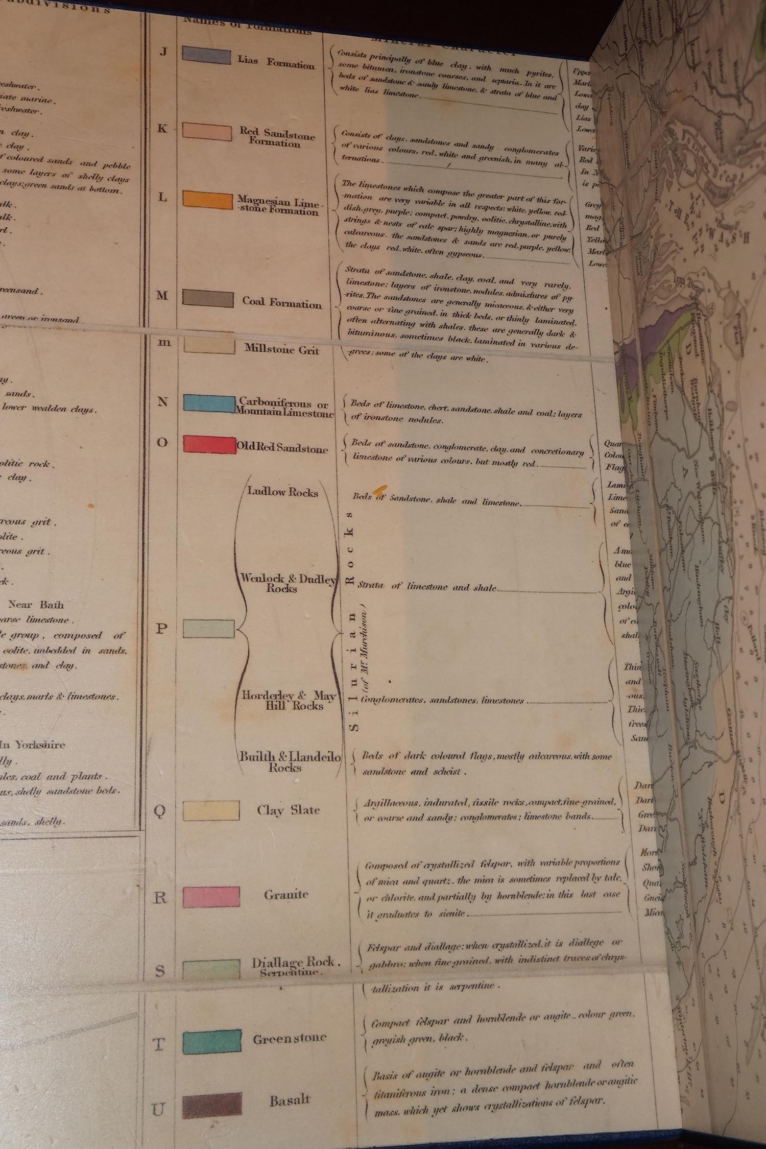 Click to enlarge CEV81.jpg (taken 15.4.2016) courtesy of Killhope Lead Mining Centre |
||
|
|
||
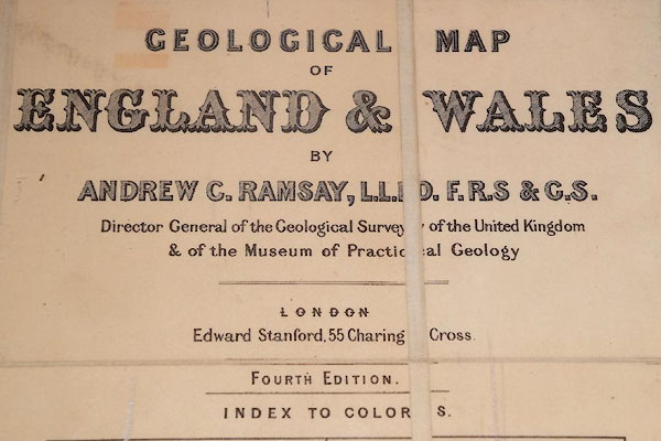
| MN photo:- |
Geological map of England and Wales by Andrew C Ramsay. Item ?. |
|
 CEV82.jpg (taken 15.4.2016) courtesy of Killhope Lead Mining Centre 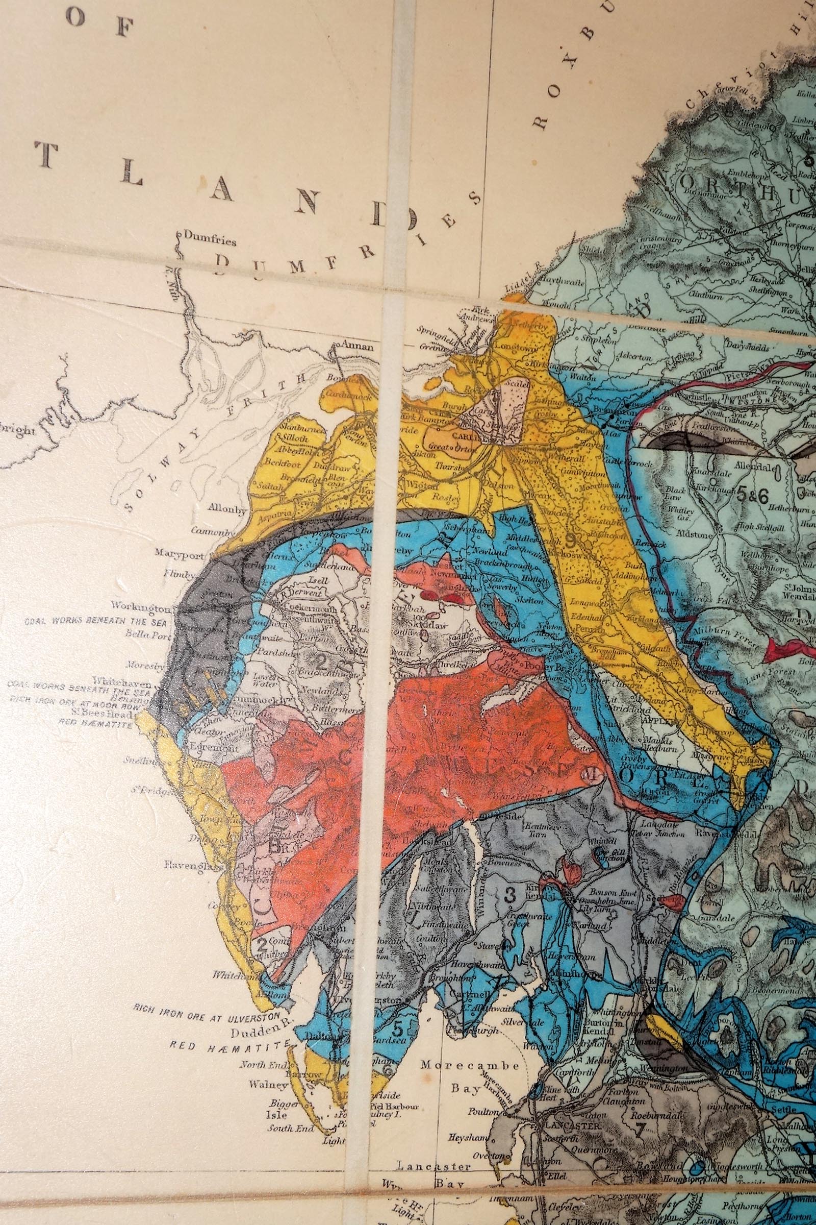 Click to enlarge CEV83.jpg (taken 15.4.2016) courtesy of Killhope Lead Mining Centre 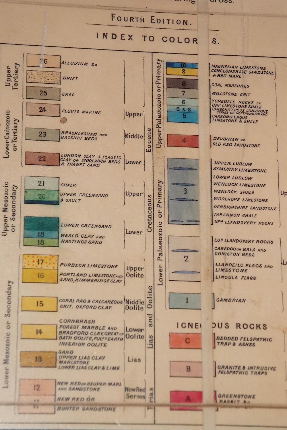 Click to enlarge CEV84.jpg (taken 15.4.2016) courtesy of Killhope Lead Mining Centre |
||
|
|
||
| notes:- |
A number of the items on display are reconstructions. |
|
|
|
||
 Lakes Guides menu.