 Old Cumbria Gazetteer
 |
 |
|
| King George IV, Eskdale Green | ||
| King George IV | ||
| King of Prussia | ||
| Tatty Garth | ||
| locality:- | Eskdale Green | |
| civil parish:- | Eskdale (formerly Cumberland) | |
| county:- | Cumbria | |
| locality type:- | inn | |
| coordinates:- | SD14889981 | |
| 1Km square:- | SD1499 | |
| 10Km square:- | SD19 | |
|
|
||
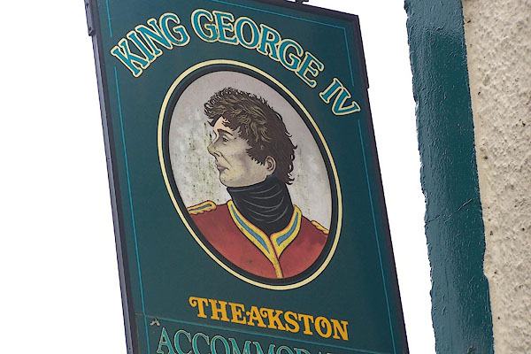 BLZ12.jpg Innsign; George IV (taken 24.4.2006) 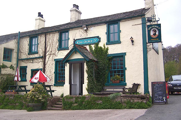 BLZ11.jpg (taken 24.4.2006) |
||
|
|
||
| evidence:- | old map:- OS County Series (Cmd 79 13) placename:- Moorwood placename:- King of Prussia |
|
| source data:- | Maps, County Series maps of Great Britain, scales 6 and 25
inches to 1 mile, published by the Ordnance Survey, Southampton,
Hampshire, from about 1863 to 1948. "Moorwood (King of Prussia) (P.H.)" |
|
|
|
||
| evidence:- | descriptive text:- placename:- King of Prussia |
|
| source data:- | Parker, C A: 1904 "There must be something very attractive about the 'King of Prussia', for every neighbouring
parish has a road leading directly from it to that well known inn." |
|
|
|
||
| evidence:- | old strip map:- Rumney 1899 placename:- King of Prussia Inn |
|
| source data:- | Road map, strip map and itinerary for Route XIX, Seascale to Eskdale, Cumberland,
scale about 2 miles to 1 inch, by A W Rumney, published by George Philip and Son,
32 Fleet Street, London, and Liverpool, 1899.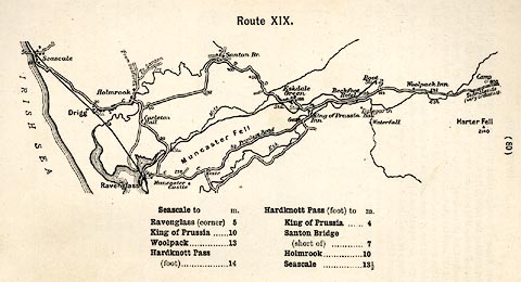 click to enlarge click to enlargeRUM130.jpg On p.80 of the Cyclist's Guide to the English Lake District, by A W Rumney. printed at top:- "Route XIX." item:- JandMN : 147.31 Image © see bottom of page |
|
|
|
||
 BLZ13.jpg (taken 24.4.2006) |
||
|
|
||
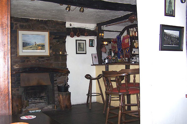
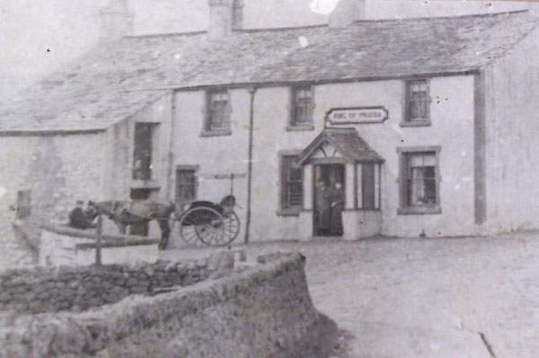 BLZ05.jpg King of Prussia Courtesy of the King George IV, Eskdale Green. 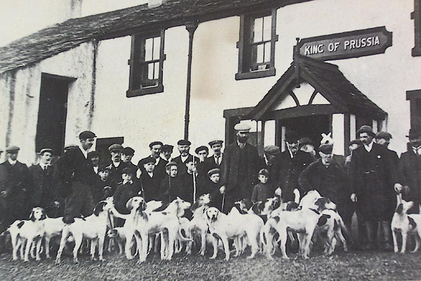 BLZ06.jpg Hunt meet outside the King of Prussia. (taken 24.4.2006) Courtesy of the King George IV, Eskdale Green. |
||
|
|
||
| hearsay:- |
The last change of name, abandoning the King of Prussia in favour of George IV, was
made in 1914 at the start of World War I. |
|
|
|
||
 Lakes Guides menu.