 Old Cumbria Gazetteer
 |
 |
|
| Knock Ore Gill | ||
| runs into:- |  Milburn Beck Milburn Beck |
|
|
|
||
| civil parish:- | Milburn (formerly Westmorland) | |
| county:- | Cumbria | |
| locality type:- | river | |
| 1Km square:- | NY7030 (etc) | |
| 10Km square:- | NY73 | |
|
|
||
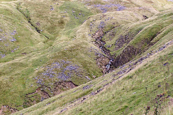 BRF39.jpg (taken 3.8.2009) |
||
|
|
||
| evidence:- | old map:- OS County Series (Wmd 5 8) placename:- Knock Ore Gill |
|
| source data:- | Maps, County Series maps of Great Britain, scales 6 and 25
inches to 1 mile, published by the Ordnance Survey, Southampton,
Hampshire, from about 1863 to 1948. |
|
|
|
||
| evidence:- | old map:- Morden 1695 (Wmd) placename:- Burnybeck River |
|
| source data:- | Map, hand coloured engraving, Westmorland, scale about 2.5 miles to 1 inch, by Robert
Morden, published by Abel Swale, the Unicorn, St Paul's Churchyard, Awnsham, and John
Churchill, the Black Swan, Paternoster Row, London, 1695.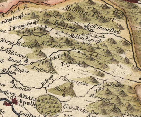 MD10NY72.jpg "Burnybeck R" item:- JandMN : 24 Image © see bottom of page |
|
|
|
||
| evidence:- | old map:- Simpson 1746 map (Wmd) placename:- Burnybeek River |
|
| source data:- | Map, uncoloured engraving, Westmorland, scale about 8 miles to 1
inch, printed by R Walker, Fleet Lane, London, 1746.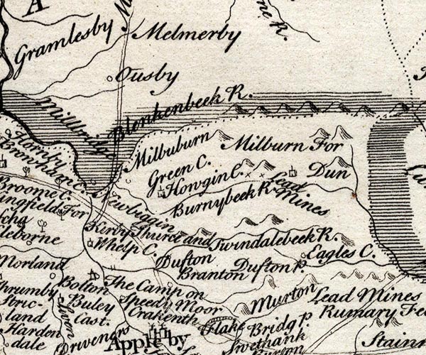 SMP2NYR.jpg "Burnybeek R." Wiggly line. item:- Dove Cottage : 2007.38.59 Image © see bottom of page |
|
|
|
||
Lakes Guides menu.