 Old Cumbria Gazetteer
 |
 |
|
| Lamiford, Bewcastle | ||
| Lamiford | ||
| civil parish:- | Bewcastle (formerly Cumberland) | |
| county:- | Cumbria | |
| 10Km square:- | NY58 | |
| SummaryText:- | Saxton is the evidence for this place. Could he just be labelling a 'lamb ford' over a stream into Northumberland or Scotland on a drove? | |
| references:- | Saxton 1579 |
|
|
|
||
| evidence:- | old map:- Saxton 1579 placename:- Lamiforde, The |
|
| source data:- | Map, hand coloured engraving, Westmorlandiae et Cumberlandiae Comitatus ie Westmorland
and Cumberland, scale about 5 miles to 1 inch, by Christopher Saxton, London, engraved
by Augustinus Ryther, 1576, published 1579-1645.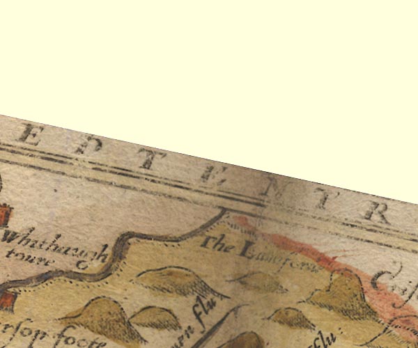 Sax9NY58.jpg "The Lamiforde" (Read clearly from another copy of Saxton's map.) item:- private collection : 2 Image © see bottom of page |
|
|
|
||
| evidence:- | old map:- Speed 1611 (Cmd) placename:- Lamiford, The |
|
| source data:- | Map, hand coloured engraving, Cumberland and the Ancient Citie
Carlile Described, scale about 4 miles to 1 inch, by John Speed,
1610, published by J Sudbury and George Humble, Popes Head
Alley, London, 1611-12.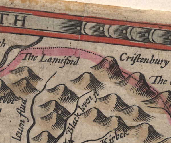 SP11NY58.jpg "The Lamiford" area on the border item:- private collection : 16 Image © see bottom of page |
|
|
|
||
| evidence:- | old map:- Jansson 1646 placename:- Lamiford, The |
|
| source data:- | Map, hand coloured engraving, Cumbria and Westmoria, ie
Cumberland and Westmorland, scale about 3.5 miles to 1 inch, by
John Jansson, Amsterdam, Netherlands, 1646.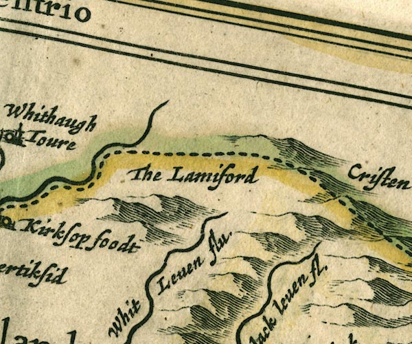 JAN3NY58.jpg "The Lamiford" Hillock on county boundary. item:- JandMN : 88 Image © see bottom of page |
|
|
|
||
| evidence:- | old map:- Morden 1695 (Nhm) placename:- Lamyford |
|
| source data:- | Maps, Westmorland, scale about 2.5 miles to 1 inch, Cumberland, scale about 4 miles
to 1 inch, and Lancashire, scale about 3.5 miles to 1 inch, by Robert Morden, 1695;
published 1695-1772. double line across the Kershope Burn "Lamijford" |
|
|
|
||
 Lakes Guides menu.