 Old Cumbria Gazetteer
 |
 |
|
| Langdale Fell, Great Langdale | ||
| Langdale Fell | ||
| locality:- | Great Langdale | |
| civil parish:- | Lakes (formerly Westmorland) | |
| county:- | Cumbria | |
| locality type:- | hill | |
| locality type:- | fell | |
| coordinates:- | NY26970695 (etc) | |
| 1Km square:- | NY2706 | |
| 10Km square:- | NY20 | |
|
|
||
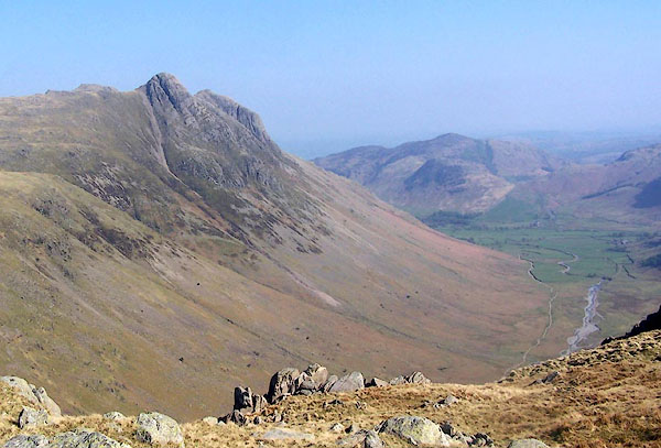 BQL59.jpg From Bow Fell. (taken 20.4.2009) |
||
|
|
||
| evidence:- | old map:- OS County Series (Wmd 25 2) placename:- Langdale Fell |
|
| source data:- | Maps, County Series maps of Great Britain, scales 6 and 25
inches to 1 mile, published by the Ordnance Survey, Southampton,
Hampshire, from about 1863 to 1948. |
|
|
|
||
| evidence:- | descriptive text:- Otley 1823 (5th edn 1834) item:- geology |
|
| source data:- | Guide book, A Concise Description of the English Lakes, the
mountains in their vicinity, and the roads by which they may be
visited, with remarks on the mineralogy and geology of the
district, by Jonathan Otley, published by the author, Keswick,
Cumberland now Cumbria, by J Richardson, London, and by Arthur
Foster, Kirkby Lonsdale, Cumbria, 1823; published 1823-49,
latterly as the Descriptive Guide to the English Lakes. goto source goto sourcePage 155:- "The SECOND division [of slate rocks] comprehends the mountains of Eskdale, Wasdale, Ennerdale, Borrowdale, Langdale, Grasmere, Patterdale, Martindale, Mardale, and some adjacent places; including the two highest mountains of the district, Scawfell and Helvellyn, as well as the Old Man at Coniston. All our fine towering crags belong to it; and most of the cascades among the lakes fall over it. There are indeed some lofty precipices in the former division; ..." "..." |
|
|
|
||
| evidence:- | perhaps old drawing:- Aspland 1840s-60s |
|
| source data:- | Drawing, pencil, Langdale Fells, including Langdale Pikes, Westmorland, by Theophilus
Lindsey Aspland, 1860s?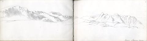 click to enlarge click to enlargeAS0404.jpg "from Sawrey Tarn" page number "4" item:- Armitt Library : 2008.60.4 Image © see bottom of page |
|
|
|
||
| evidence:- | perhaps old drawing:- Aspland 1840s-60s |
|
| source data:- | Drawing, pencil, Langdale Fell etc? Westmorland, by Theophilus Lindsey Aspland, about
1849.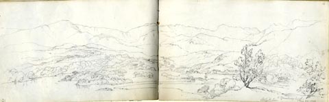 click to enlarge click to enlargeAS0121.jpg "to Strawberry bank / Skelgill Lane / Aug 24. 1849" item:- Armitt Library : 1958.487.21 Image © see bottom of page |
|
|
|
||
| evidence:- | old photograph:- Bell 1880s-1940s |
|
| source data:- | Photograph, sepia, Great Langdale, Westmorland, by Herbert Bell, photographer, Ambleside,
Westmorland, 1890s.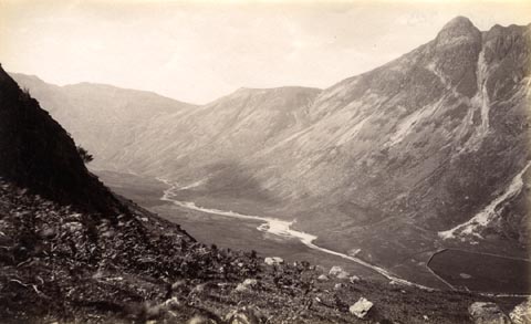 click to enlarge click to enlargeHB0640.jpg Mickleden Beck in the valley bottom; Pike of Stickle on the right, Stake Pass vaguely recognizable towards the left. item:- Armitt Library : ALPS303 Image © see bottom of page |
|
|
|
||
Lakes Guides menu.