 Old Cumbria Gazetteer
 |
 |
|
| West Lodge, Edenhall | ||
| West Lodge | ||
| site name:- | Eden Hall | |
| civil parish:- | Langwathby (formerly Cumberland) | |
| locality:- | Townhead | |
| locality:- | Edenhall | |
| county:- | Cumbria | |
| locality type:- | buildings | |
| locality type:- | gate | |
| locality type:- | gate piers | |
| coordinates:- | NY55733158 | |
| 1Km square:- | NY5531 | |
| 10Km square:- | NY53 | |
|
|
||
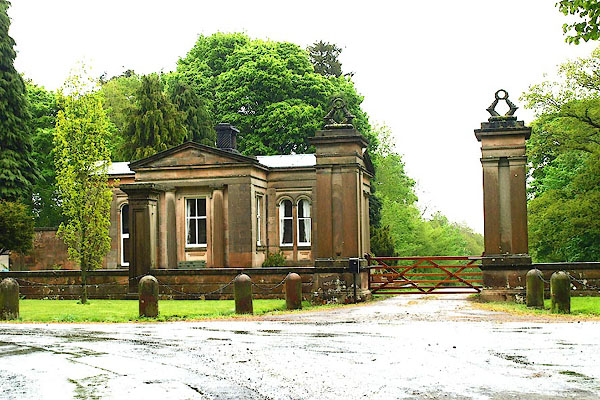 BQM22.jpg (taken 8.5.2009) 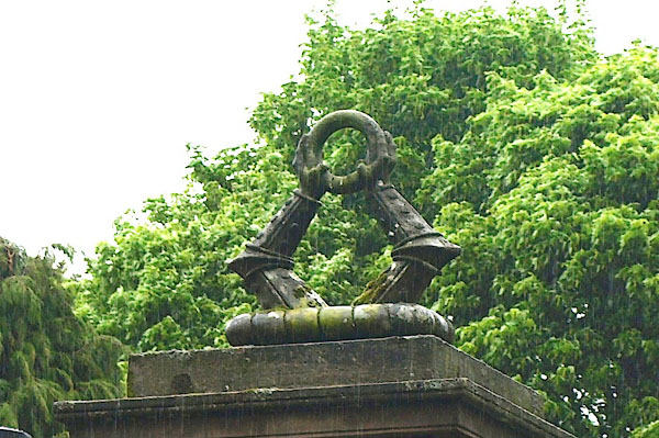 BQM23.jpg Two arms in armour gaunletted grasping an annulet; the Musgrave crest. (taken 8.5.2009) |
||
|
|
||
| evidence:- | old map:- OS County Series (Cmd 50 14) |
|
| source data:- | Maps, County Series maps of Great Britain, scales 6 and 25
inches to 1 mile, published by the Ordnance Survey, Southampton,
Hampshire, from about 1863 to 1948. "Lodge" |
|
|
|
||
| evidence:- | database:- Listed Buildings 2010 placename:- West Lodge |
|
| source data:- | courtesy of English Heritage "WEST LODGE / / / LANGWATHBY / EDEN / CUMBRIA / II / 74296 / NY5573031589" |
|
|
|
||
| evidence:- | database:- Listed Buildings 2010 |
|
| source data:- | courtesy of English Heritage "GATEPIERS AND WALL SOUTH EAST OF WEST LODGE / / / LANGWATHBY / EDEN / CUMBRIA / II / 74298 / NY5571631550" |
|
|
|
||
| evidence:- | database:- Listed Buildings 2010 |
|
| source data:- | courtesy of English Heritage "GATEPIERS AND WALL WEST OF WEST LODGE / / / LANGWATHBY / EDEN / CUMBRIA / II / 74299 / NY5569831577" |
|
|
|
||
 Lakes Guides menu.