Old Cumbria Gazetteer
 |
 |
|
||
| Low Birker Pool | ||||
| runs into:- |  Force Gill (2) Force Gill (2) |
|||
|
|
||||
| civil parish:- | Eskdale (formerly Cumberland) | |||
| county:- | Cumbria | |||
| locality type:- | river | |||
| 1Km square:- | SD1899 | |||
| 10Km square:- | SD19 | |||
|
|
||||
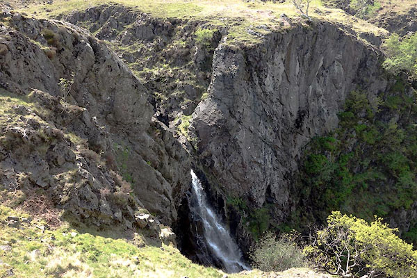
 CDF11.jpg (taken 4.6.2015) |
||||
|
|
||||
| evidence:- | old map:- OS County Series (Cmd 83 3) placename:- Low Birker Pool placename:- Birker Pool, Low |
|||
| source data:- | Maps, County Series maps of Great Britain, scales 6 and 25
inches to 1 mile, published by the Ordnance Survey, Southampton,
Hampshire, from about 1863 to 1948. |
|||
|
|
||||
| evidence:- | old print:- Rose 1832-35 |
|||
| source data:- | Print, engraving, Birker Force, Cumberland, by Thomas Allom,
engraved by H Bond, 1833. click to enlarge click to enlargeR247.jpg "Birker Force, Cumberland" item:- JandMN : 96.15 Image © see bottom of page |
|||
|
|
||||
| places:- |
|
|||
Lakes Guides menu.