 Old Cumbria Gazetteer
 |
 |
|
| Low Fell, Loweswater | ||
| Low Fell | ||
| civil parish:- | Loweswater (formerly Cumberland) | |
| county:- | Cumbria | |
| locality type:- | hill | |
| locality type:- | fell | |
| coordinates:- | NY13732263 | |
| 1Km square:- | NY1322 | |
| 10Km square:- | NY12 | |
| altitude:- | 1388 feet | |
| altitude:- | 423m | |
|
|
||
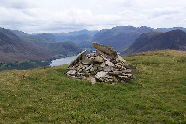 BXK31.jpg Cairn at summit. (taken 23.9.2012) |
||
|
|
||
| evidence:- | old map:- OS County Series (Cmd 63 5) placename:- Low Fell placename:- Fell, Low |
|
| source data:- | Maps, County Series maps of Great Britain, scales 6 and 25
inches to 1 mile, published by the Ordnance Survey, Southampton,
Hampshire, from about 1863 to 1948. |
|
|
|
||
| evidence:- | descriptive text:- West 1778 (11th edn 1821) placename:- Lowfell |
|
| source data:- | Guide book, A Guide to the Lakes, by Thomas West, published by
William Pennington, Kendal, Cumbria once Westmorland, and in
London, 1778 to 1821. goto source goto sourcePage 139:- "... Behind all, Low-fell raises its verdant front; a sweet contrast to his murky neighbours, and a pleasing termination, either as seen from the top of this rock [Buttermere Hause], ..." |
|
|
|
||
| evidence:- | outline view:- Tattersall 1836 (version 1869) placename:- Low Fell |
|
| source data:- | Print, hand coloured, Loweswater, from the North West, Cumberland, drawn by George
Tattersall, 1836, engraved by W F Topham, published by T J Allman, 463 Oxford Street,
London, 1869.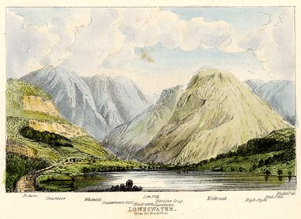 click to enlarge click to enlargeTAT216.jpg Included in The Lakes of England, by W F Topham. printed at bottom:- "LOWESWATER, / from the North West." printed at bottom:- "Bottom. / Grasmoor. / Whiteless. / Buttermere Moss. / Hindscarth. / Low Fell. / Glaramara. / Honister Crag. / Melbreak. / High Style. / Red Pike. / Blake Fell." item:- Armitt Library : A1067.16 Image © see bottom of page |
|
|
|
||
| evidence:- | outline view:- Tattersall 1836 placename:- Low Fell |
|
| source data:- | Print, engraving, Loweswater from the North West, Cumberland, drawn by George Tattersall,
engraved by W F Topham, published by Sherwood and Co, Paternoster Row, London, about
1836.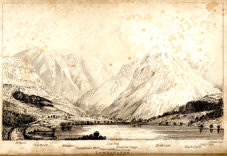 click to enlarge click to enlargeTAT134.jpg The print is captioned with mountain names and acts as an outline view. Frontispiece to The Lakes of England, by George Tattersall (listed to be inserted opposite p.35). printed at bottom:- "LOWESWATER. / from the North West." printed at bottom left to right:- "Bottom. / Grasmoor. / Whiteless. / Buttermere &Moss. / Hindscarth. / Low Fell. / Glaramara. / Honister Crag. / Melbreak. / High Style. / Red Pike. / Blake Fell." item:- Armitt Library : A1204.35 Image © see bottom of page |
|
|
|
||
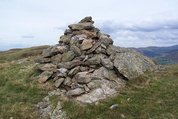 BXK29.jpg Cairn, (taken 23.9.2012)  BXK30.jpg Rock in cairn. (taken 23.9.2012) |
||
|
|
||
Lakes Guides menu.