 Old Cumbria Gazetteer
 |
 |
|
| Low Tarn, Nether Wasdale | ||
| runs into:- |  Brimfull Beck Brimfull Beck |
|
|
|
||
| Low Tarn | ||
| civil parish:- | Nether Wasdale (formerly Cumberland) | |
| county:- | Cumbria | |
| locality type:- | tarn | |
| coordinates:- | NY16160934 (etc) | |
| 1Km square:- | NY1609 | |
| 10Km square:- | NY10 | |
| altitude:- | 1704 feet | |
| altitude:- | 519m | |
|
|
||
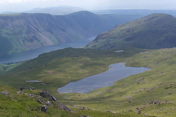 BTF08.jpg (taken 13.7.2010) 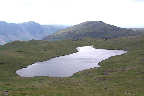 BTF09.jpg (taken 13.7.2010) |
||
|
|
||
| evidence:- | old map:- OS County Series (Cmd 74 10) placename:- Low Tarn placename:- Tarn, Low |
|
| source data:- | Maps, County Series maps of Great Britain, scales 6 and 25
inches to 1 mile, published by the Ordnance Survey, Southampton,
Hampshire, from about 1863 to 1948. |
|
|
|
||
| evidence:- | perhaps descriptive text:- Otley 1823 (5th edn 1834) |
|
| source data:- | Guide book, A Concise Description of the English Lakes, the
mountains in their vicinity, and the roads by which they may be
visited, with remarks on the mineralogy and geology of the
district, by Jonathan Otley, published by the author, Keswick,
Cumberland now Cumbria, by J Richardson, London, and by Arthur
Foster, Kirkby Lonsdale, Cumbria, 1823; published 1823-49,
latterly as the Descriptive Guide to the English Lakes. goto source Page 39:- "There are some other small tarns, of little consequence in themselves, and seldom seen by strangers; therefore they scarcely require to be noticed. Such are ... and the two tarns above Bowderdale in the Wasdale mountains." |
|
|
|
||
| evidence:- | old map:- Garnett 1850s-60s H |
|
| source data:- | Map of the English Lakes, in Cumberland, Westmorland and
Lancashire, scale about 3.5 miles to 1 inch, published by John
Garnett, Windermere, Westmorland, 1850s-60s.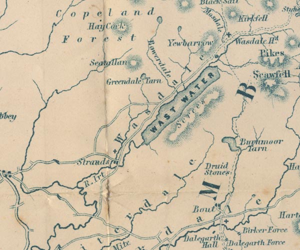 GAR2NY10.jpg outline with shore form lines, lake or tarn item:- JandMN : 82.1 Image © see bottom of page |
|
|
|
||
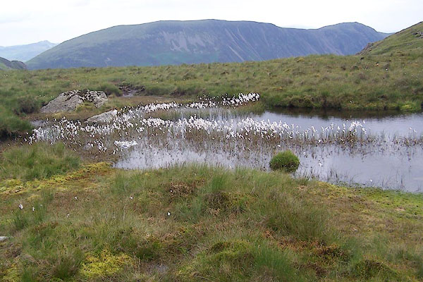 BTF10.jpg Cotton grass, Eriophorum angustifolium (taken 13.7.2010) |
||
|
|
||
Lakes Guides menu.