 Old Cumbria Gazetteer
 |
 |
|
| Lowgill Viaduct, Beck Foot | ||
| Lowgill Viaduct | ||
| site name:- | Low Gill and Ingleton branch railway | |
| site name:- | Lummer Gill | |
| locality:- | Beck Foot | |
| locality:- | Lowgill | |
| locality:- | Dillicar | |
| civil parish:- | Grayrigg (formerly Westmorland) | |
| civil parish:- | Firbank (formerly Westmorland) | |
| county:- | Cumbria | |
| locality type:- | railway viaduct | |
| locality type:- | viaduct | |
| coordinates:- | SD61679653 | |
| coordinates:- | SD61669634 | |
| 1Km square:- | SD6196 | |
| 10Km square:- | SD69 | |
|
|
||
 BLT09.jpg (taken 31.3.2006) 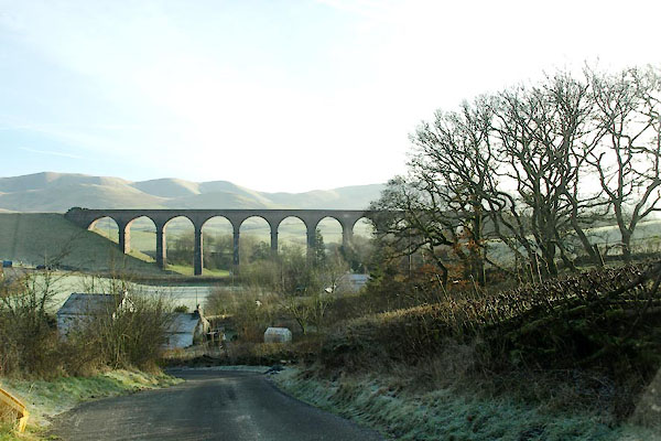 BVU34.jpg (taken 13.1.2012) |
||
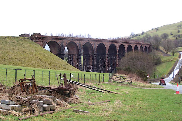
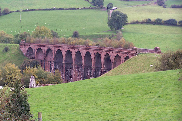
| 11 arches. |
||
|
|
||
| evidence:- | old map:- OS County Series (Wmd 34 12) placename:- Lowgill Viaduct item:- railway milepost |
|
| source data:- | Maps, County Series maps of Great Britain, scales 6 and 25
inches to 1 mile, published by the Ordnance Survey, Southampton,
Hampshire, from about 1863 to 1948.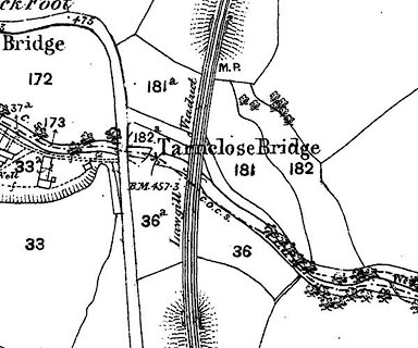 click to enlarge click to enlargeCSRY0203.jpg "Lowgill Viaduct / M.P." over the "Lummer Gill" |
|
|
|
||
| evidence:- | database:- Listed Buildings 2010 placename:- Lowgill Viaduct |
|
| source data:- | courtesy of English Heritage "LOWGILL VIADUCT / / / FIRBANK / SOUTH LAKELAND / CUMBRIA / II / 75637 / SD6166596458" |
|
| source data:- | courtesy of English Heritage "Railway viaduct. 1859 by Joseph Locke and John Errington. For Ingleton branch of the London and North Western Railway. Rock-faced sandstone. 11 round arches on slightly battered piers with impost bands; cornice and blocking course. End piers have dentilled cornices and triangular-headed caps." |
|
|
|
||
 BMW75.jpg (taken 20.10.2006) 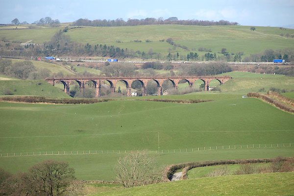 BOX76.jpg (taken 31.3.2008) |
||
|
|
||
 Lakes Guides menu.