 Old Cumbria Gazetteer
 |
 |
|
| Lupton Tower, Lupton | ||
| Lupton Tower | ||
| locality:- | Lupton | |
| civil parish:- | Lupton (formerly Westmorland) | |
| county:- | Cumbria | |
| locality type:- | tower | |
| coordinates:- | SD55788085 | |
| 1Km square:- | SD5580 | |
| 10Km square:- | SD58 | |
|
|
||
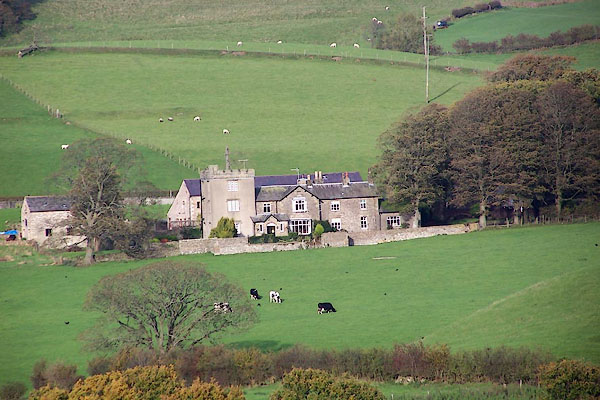 BMY04.jpg (taken 29.10.2006) |
||
|
|
||
| evidence:- | old map:- OS County Series (Wmd 47 2) placename:- Boxtree |
|
| source data:- | Maps, County Series maps of Great Britain, scales 6 and 25
inches to 1 mile, published by the Ordnance Survey, Southampton,
Hampshire, from about 1863 to 1948. |
|
|
|
||
| evidence:- | old map:- Jefferys 1770 (Wmd) placename:- Box Tree |
|
| source data:- | Map, 4 sheets, The County of Westmoreland, scale 1 inch to 1
mile, surveyed 1768, and engraved and published by Thomas
Jefferys, London, 1770.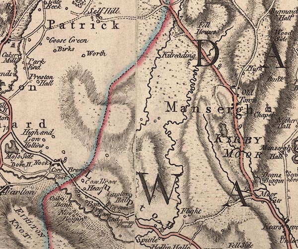 J5SD58SE.jpg "B[ox] Tree" circle, labelled in italic lowercase text; settlement, farm, house, or hamlet? item:- National Library of Scotland : EME.s.47 Image © National Library of Scotland |
|
|
|
||
| evidence:- | database:- Listed Buildings 2010 placename:- Boxtree Farm placename:- Lupton Tower |
|
| source data:- | courtesy of English Heritage "BOXTREE FARMHOUSE AND LUPTON TOWER / / A65 / LUPTON / SOUTH LAKELAND / CUMBRIA / II / 75704 / SD5578080850" |
|
|
|
||
| evidence:- | database:- Listed Buildings 2010 item:- date stone (1712); date stone (1731) |
|
| source data:- | courtesy of English Heritage "BARN TO NORTH OF BOXTREE FARMHOUSE / / A65 / LUPTON / SOUTH LAKELAND / CUMBRIA / DL / 75705 / SD5579180881" |
|
|
|
||
 Lakes Guides menu.