 Old Cumbria Gazetteer
 |
 |
|
| Mardale, Shap Rural | ||
| Mardale | ||
| civil parish:- | Shap Rural (formerly Westmorland) | |
| county:- | Cumbria | |
| locality type:- | valley | |
| locality type:- | locality | |
| locality type:- | buildings | |
| coordinates:- | NY47301170 (etc) | |
| 1Km square:- | NY4711 | |
| 10Km square:- | NY41 | |
|
|
||
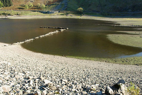 BTR92.jpg Old walls in the lake, about level with The Rigg (taken 20.10.2010) |
||
|
|
||
| evidence:- | old map:- OS County Series (Wmd 20 2) placename:- Mardale |
|
| source data:- | Maps, County Series maps of Great Britain, scales 6 and 25
inches to 1 mile, published by the Ordnance Survey, Southampton,
Hampshire, from about 1863 to 1948. |
|
|
|
||
| evidence:- | hearth tax returns:- Hearth Tax 1675 placename:- Mardale |
|
| source data:- | Records, hearth tax survey returns, Westmorland, 1674/75. "Mardale" in "Bampton Pattricke" |
|
|
|
||
| evidence:- | old print:- Green 1815 placename:- Mardale |
|
| source data:- | Print, coloured aquatint, View down Haws Water from Mardale, Shap Rural, Westmorland,
by William Green, Ambleside, Westmorland, 1815.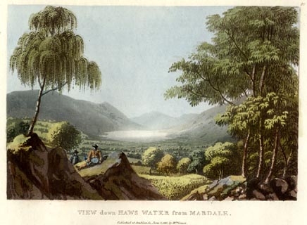 click to enlarge click to enlargeGN0524.jpg Plate 26 in Lake Scenery. printed at upper right:- "26" printed at bottom:- "VIEW down HAWS WATER from MARDALE. / Published at Ambleside, June 1, 1815, by Wm. Green." item:- Armitt Library : A6646.24 Image © see bottom of page |
|
|
|
||
| evidence:- | old map:- Otley 1818 placename:- Mardale |
|
| source data:- | Map, uncoloured engraving, The District of the Lakes,
Cumberland, Westmorland, and Lancashire, scale about 4 miles to
1 inch, by Jonathan Otley, 1818, engraved by J and G Menzies,
Edinburgh, Scotland, published by Jonathan Otley, Keswick,
Cumberland, et al, 1833.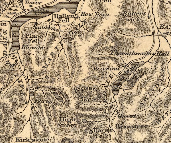 OT02NY41.jpg "MARDALE" item:- JandMN : 48.1 Image © see bottom of page |
|
|
|
||
| evidence:- | descriptive text:- Otley 1823 (5th edn 1834) item:- geology |
|
| source data:- | Guide book, A Concise Description of the English Lakes, the
mountains in their vicinity, and the roads by which they may be
visited, with remarks on the mineralogy and geology of the
district, by Jonathan Otley, published by the author, Keswick,
Cumberland now Cumbria, by J Richardson, London, and by Arthur
Foster, Kirkby Lonsdale, Cumbria, 1823; published 1823-49,
latterly as the Descriptive Guide to the English Lakes. goto source goto sourcePage 155:- "The SECOND division [of slate rocks] comprehends the mountains of Eskdale, Wasdale, Ennerdale, Borrowdale, Langdale, Grasmere, Patterdale, Martindale, Mardale, and some adjacent places; including the two highest mountains of the district, Scawfell and Helvellyn, as well as the Old Man at Coniston. All our fine towering crags belong to it; and most of the cascades among the lakes fall over it. There are indeed some lofty precipices in the former division; ..." "..." |
|
|
|
||
| evidence:- | old map:- Garnett 1850s-60s H placename:- Mardale |
|
| source data:- | Map of the English Lakes, in Cumberland, Westmorland and
Lancashire, scale about 3.5 miles to 1 inch, published by John
Garnett, Windermere, Westmorland, 1850s-60s.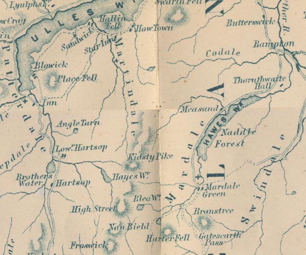 GAR2NY41.jpg "Mardale" area item:- JandMN : 82.1 Image © see bottom of page |
|
|
|
||
 Martineau Directory 1855 Martineau Directory 1855 |
||
|
|
||
| evidence:- | old text:- Martineau 1855 item:- weather |
|
| source data:- | Guide book, A Complete Guide to the English Lakes, by Harriet
Martineau, published by John Garnett, Windermere, Westmorland,
and by Whittaker and Co, London, 1855; published 1855-76. goto source Page 174:- "... will depend much on weather, of course; and we wish the traveller something more of a choice than was permitted to us when we were last there, when the wind laid the whole party fLat on the summit of the pass [Nan Bield], and put all thought of High Street quite out of the question. The account of the weather given by a resident not far off is "It donks and it dozzles; and whiles its a bit siftering: but it don't often mak no girt pel." That is,- it is misty, and drizzles; and it is sometimes showery; but there is not often a great down pour. The wind however is often strong; and the exhaustion from a high wind on high ground is greater than any would believe who has not experienced it." "There is no difficulty in the ascent from Mardale Green; but the traveller indulges in frequent rests, for the sake of looking back upon the singularly-secluded valley, with its winding stream, its faintly-marked track, and its little inn, ..." |
|
|
|
||
| evidence:- | old map:- Post Office 1850s-1900s placename:- Mardale |
|
| source data:- | Post road maps, General Post Office Circulation Map for England
and Wales, for the General Post Office, London, 1850s-1900s. click to enlarge click to enlargePOF7Cm.jpg "Mardale" map date 1909 |
|
|
|
||
| :- |
images courtesy of the British Postal Museum and Hampshire CC Museums |
|
|
|
||
| evidence:- | outline view:- Tattersall 1836 (version 1869) |
|
| source data:- | Print, hand coloured, Hawes Water, from Thwaite Force, Westmorland, drawn by George
Tattersall, 1836, engraved by W F Topham, published by T J Allman, 463 Oxford Street,
London, 1869.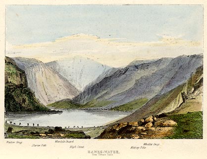 click to enlarge click to enlargeTAT217.jpg Included in The Lakes of England, by W F Topham. printed at bottom:- "HAWES-WATER, / from Thwaite Force." printed at bottom:- "Wallow Crag. / Harter Fell. / Mardale Chapel. / High Street. / Kidsay Pike. / Whelter Crag." item:- Armitt Library : A1067.17 Image © see bottom of page |
|
|
|
||
| evidence:- | outline view:- Tattersall 1836 placename:- Mardale |
|
| source data:- | Print, engraving, Hawes Water, from Thwaite Force, Westmorland, drawn by George Tattersall,
engraved by W F Topham, published by Sherwood and Co, Paternoster Row, London, about
1836.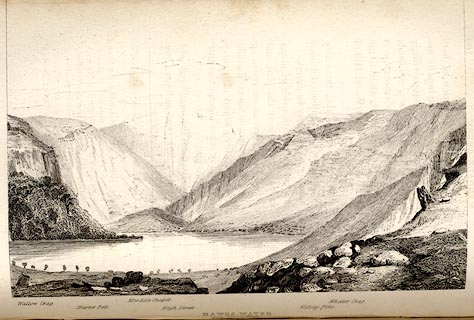 click to enlarge click to enlargeTAT139.jpg The print is captioned with mountain names and acts as an outline view. Tipped in opposite p.109 of The Lakes of England, by George Tattersall. printed at bottom:- "HAWES-WATER, / from Thwaite Force." printed at bottom left to right:- "Wallow Crag. / Harter Fell. / Mardale Chapel. / High Street. / Kidsay Pike. / Whelter Crag." item:- Armitt Library : A1204.40 Image © see bottom of page |
|
|
|
||
| evidence:- | old print:- Rose 1832-35 |
|
| source data:- | Print, engraving, Mardale Head, Westmorland, by Thomas Allom, engraved by E Challis,
1833.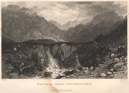 click to enlarge click to enlargeR155.jpg item:- JandMN : 66.56 Image © see bottom of page |
|
|
|
||
| evidence:- | old print:- Rose 1832-35 |
|
| source data:- | Print, hand coloured engraving, Small Water Tarn, from Nanbield, Looking into Mardale,
Westmorland, by Thomas Allom, engraved by J Sands, 1834.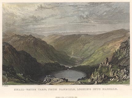 click to enlarge click to enlargeR268.jpg item:- JandMN : 40 Image © see bottom of page |
|
|
|
||
| evidence:- | old print:- Green 1815 (plate 26) placename:- Mardale |
|
| source data:- | Print, colour aquatint, View Down Haws Water from Mardale, Shap Rural, Westmorland,
by William Green, Ambleside, Westmorland, 1815.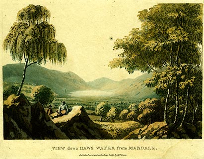 click to enlarge click to enlargePR0120.jpg Plate 26 in a set of prints, Lake Scenery. printed at bottom:- "VIEW DOWN HAWS WATER from MARDALE. / Published at Ambleside, June 1. 1815, by Wm. Green." item:- Dove Cottage : 2008.107.120 Image © see bottom of page |
|
|
|
||
| evidence:- | old print:- Green 1815 (plate 26) placename:- Mardale |
|
| source data:- | Print, colour aquatint, View Down Haws Water from Mardale, Shap Rural, Westmorland,
by William Green, Ambleside, Westmorland, 1815.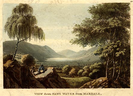 click to enlarge click to enlargePR0397.jpg Plate 26 in a set of prints, Lake Scenery. printed at top right:- "26" printed at bottom:- "VIEW DOWN HAWS WATER from MARDALE." item:- JandMN : 170 Image © see bottom of page |
|
|
|
||
 BVN57.jpg courtesy of John Bennet |
||
|
|
||
| story:- |
Once, when Mardale was a remote valley, it was the refuge of outlaws. From 1209, it
is said, they had their own dynasty of Kings of Mardale. The first was Hugh Holme,
who conspired against King John in the Canterbury Conspiracy. For a while Hugh had
to hide in a cave in Riggindale. The last was Hugh Parker Holme, died 1885. |
|
|
|
||
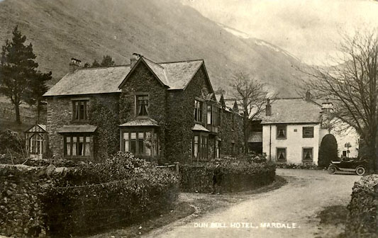
| notes:- |
Mardale as a settlement was flooded by Haweswater Reservoir, which was completed in
1941, and filled by 1942. |
|
|
|
||
Lakes Guides menu.