 Old Cumbria Gazetteer
 |
 |
|
| Martindale Common, Martindale | ||
| Martindale Common | ||
| Martindale Forest | ||
| civil parish:- | Martindale (formerly Westmorland) | |
| county:- | Cumbria | |
| locality type:- | common | |
| locality type:- | forest | |
| coordinates:- | NY42951672 (etc) | |
| 1Km square:- | NY4216 | |
| 10Km square:- | NY41 | |
|
|
||
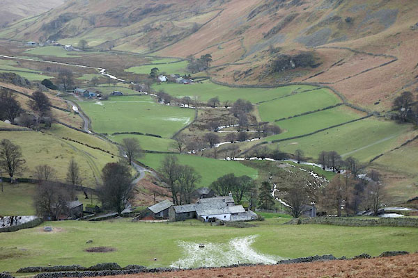 BZZ07.jpg (taken 27.2.2014) 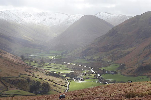 BZZ08.jpg (taken 27.2.2014) |
||
|
|
||
| evidence:- | old map:- OS County Series (Wmd 12 12) placename:- Martindale Common |
|
| source data:- | Maps, County Series maps of Great Britain, scales 6 and 25
inches to 1 mile, published by the Ordnance Survey, Southampton,
Hampshire, from about 1863 to 1948. OS County Series (Wmd 13 9) |
|
|
|
||
| evidence:- | old map:- Morden 1695 (Wmd) placename:- Martendale Forrest |
|
| source data:- | Map, hand coloured engraving, Westmorland, scale about 2.5 miles to 1 inch, by Robert
Morden, published by Abel Swale, the Unicorn, St Paul's Churchyard, Awnsham, and John
Churchill, the Black Swan, Paternoster Row, London, 1695.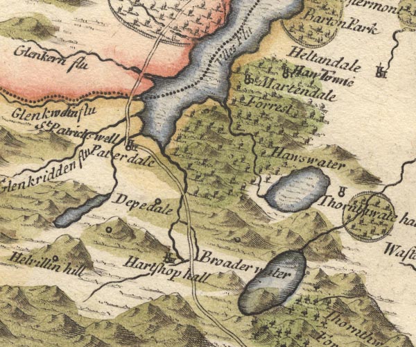 MD10NY41.jpg "Martendale Forrest" Trees. item:- JandMN : 24 Image © see bottom of page |
|
|
|
||
| evidence:- | presumably descriptive text:- Simpson 1746 placename:- Martindale Forest |
|
| source data:- | Atlas, three volumes of maps and descriptive text published as
'The Agreeable Historian, or the Compleat English Traveller
...', by Samuel Simpson, 1746. goto source goto sourcePage 1021:- "..." "... there are divers Forests in the Barony of Westmoreland, as ... Martindale-Forest, which extends almost the whole Length of Ulleswater; ..." |
|
|
|
||
| evidence:- | old map:- Simpson 1746 map (Wmd) placename:- Markendale Forrest |
|
| source data:- | Map, uncoloured engraving, Westmorland, scale about 8 miles to 1
inch, printed by R Walker, Fleet Lane, London, 1746.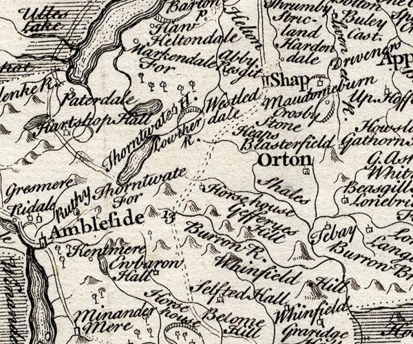 SMP2NYK.jpg "Markendale For" Tree symbols. item:- Dove Cottage : 2007.38.59 Image © see bottom of page |
|
|
|
||
| evidence:- | old map:- Bowen and Kitchin 1760 placename:- Martendale Forest |
|
| source data:- | Map, hand coloured engraving, A New Map of the Counties of
Cumberland and Westmoreland Divided into their Respective Wards,
scale about 4 miles to 1 inch, by Emanuel Bowen and Thomas
Kitchin et al, published by T Bowles, Robert Sayer, and John
Bowles, London, 1760.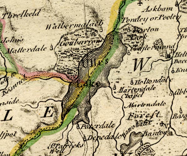 BO18NY31.jpg "Martendale Forest" trees or bushes item:- Armitt Library : 2008.14.10 Image © see bottom of page |
|
|
|
||
| evidence:- | old map:- Jefferys 1770 (Wmd) placename:- Martindale Forest |
|
| source data:- | Map, 4 sheets, The County of Westmoreland, scale 1 inch to 1
mile, surveyed 1768, and engraved and published by Thomas
Jefferys, London, 1770.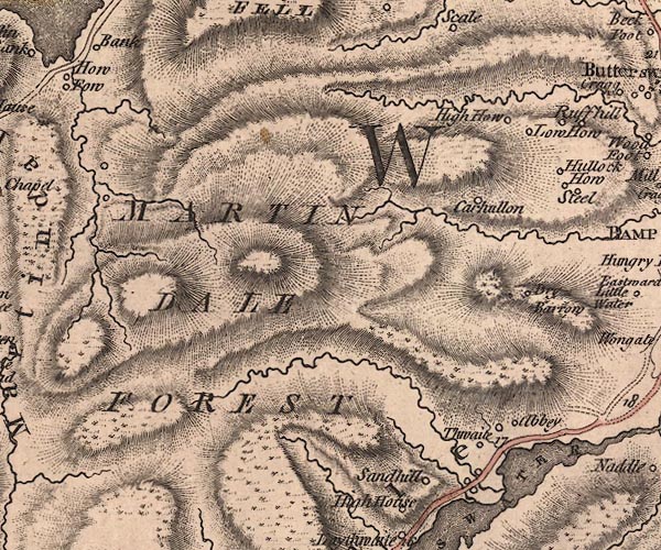 J5NY41NE.jpg "MARTINDALE FOREST" area item:- National Library of Scotland : EME.s.47 Image © National Library of Scotland |
|
|
|
||
| evidence:- | old map:- West 1784 map placename:- Martindale Forest |
|
| source data:- | Map, hand coloured engraving, A Map of the Lakes in Cumberland,
Westmorland and Lancashire, scale about 3.5 miles to 1 inch,
engraved by Paas, 53 Holborn, London, about 1784.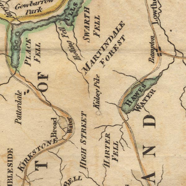 Ws02NY41.jpg "MARTINDALE FOREST" item:- Armitt Library : A1221.1 Image © see bottom of page |
|
|
|
||
| evidence:- | old text:- Clarke 1787 item:- land tenure; forest tenure; deer; red deer; deer hunt; hunting; boon day |
|
| source data:- | Guide book, A Survey of the Lakes of Cumberland, Westmorland,
and Lancashire, written and published by James Clarke, Penrith,
Cumberland, and in London etc, 1787; published 1787-93. goto source Page 34:- "... The forest lands are held on the common forest tenure; the tenants having what grass they can take with the sythe. They likewise covenant not to drive the lord's deer out of it at any time of the year: In Summer, however, the deer seldom come there, they being mostly red deer, which always frequent the tops of the mountains in that season. Whenever the lord goes to hunt the stag, the Bailiff summons all the tenants, before sun-set the preceding night, to attend their strones or stations: these stations are at two places, viz. Bampskin [Rampskin] and Bannerdale, where the deer chiefly lye, and where the tenants stand with their dogs to prevent the deer from escaping into the mountains. This service, which they are to render once a year, is called a Boon Day, and for this every tenant has his dinner and a quart of ale: it is also a custom here, that the person who first seizes the hunted deer shall have his head for his trouble. It is remarkable that the first buck taken here was seized by a woman: she, for the sake of his head, laid hold upon him as he stood at bay upon a dunghill, threw him down, and getting upon his neck, held him fast. The late Mr Hassel frequently called upon the tenants for this service, and held upon these occasions a brilliant company of both sexes: his hunting was not, however, very successful; for I was told by one of the tenants, who had frequently attended his stand, that he never saw a stag either taken by the hounds, or by them driven to Ulswater, as one of our authors in a most pompous manner informs us. I have myself seen deer take the water; but they were, I think, always either such as had been wounded by shot, and afterwards pursued by the Bailiff's hounds, or such as had strayed from Barton or Patterdale, and had lain among the farmer's corn. A red deer swims the quickest and strongest of any animal except a swine: one of the latter I once pursued upon this Lake in a boat, which run remarkably quickly with oars; notwithstanding, the animal was only ten weeks" goto sourcePage 35:- "old, and had swam two miles before I set forward. Such was its swiftness and perseverance, that, had it not been partly through compassion to the owner, and partly through fear of the ridicule of the spectators, I had certainly given up the chace." "..." |
|
|
|
||
| evidence:- | old text:- Clarke 1787 item:- deer; red deer |
|
| source data:- | Guide book, A Survey of the Lakes of Cumberland, Westmorland,
and Lancashire, written and published by James Clarke, Penrith,
Cumberland, and in London etc, 1787; published 1787-93. goto source Page 190:- "..." "Of quadrupeds. - The first is the red deer, which is bred upon the tops of the mountains in Martindale, and are exceeding wild, never being fed in Winter; they always seek for and abide in the highest places, and feed on herds; one always keeping watch in the day-time, which keeps snuffing and looking about: this is always a stag, and so delicate is their smell, that they will give notice of an enemy at 300 yards distance, if on the wind-side of them. ... If a stag is wounded, and yet able to follow the herd, he joins them, and does not shew the least pain or uneasiness, though he will sometimes fall down in sight of you; at others, if you can perceive him wounded, and have a dog to hunt him, he will be found hid in the heath or rocks as soon as ever he has got out of your sight: They will sometimes take several shots to kill them after the first wounding, but if you have a hound dog with you they will not turn." "The stag sometimes in harvest, in the dead of the night, leaves the mountains and comes into the corn-fields, lays himself down on one side to feed, and slides in that situation along a furrow to fresh places, not getting upon his feet, and thus with his body destroys more corn than he eats; if he stays two or three days, he so over-eats himself that he is easily run down. In 1786, one in Martindale did not run above two miles before a couple of hounds till he dropt down dead. In rutting time, if two stags meet that are each of them masters of herds, a battle ensues, and dreadful is the conflict; they are next to the game-cock for agility; they walk round each other to get a push at the body if they can, but the other generally catches his adversary's head with his own, and such a clash of horns is then heard as would astonish any man; then they will push at each other like two bulls, then fetch a run like two rams; and so fixed are their eyes upon each other, that a person may sometimes get within twenty yards of them, and a good while before either of them discover him. Their engagement often lasts half an hour, and they frequently break their horns, sometimes near the head, or near the middle: which ever is conquered generally flies his country several miles, often crossing Ulswater, and never again returning; the other then reigns sovereign of both herds, and unites them as a conquered country to his own. The conquered stag hath been known to live many years quite alone: ..." |
|
|
|
||
| evidence:- | old map:- Cary 1789 (edn 1805) placename:- Martin Dale Forest |
|
| source data:- | Map, uncoloured engraving, Westmoreland, scale about 2.5 miles
to 1 inch, by John Cary, London, 1789; edition 1805.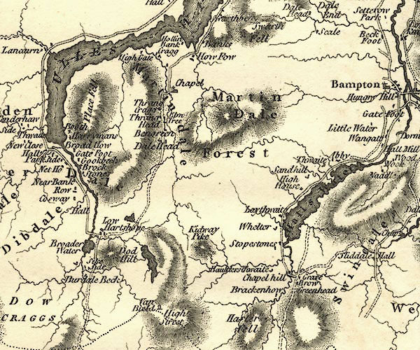 CY24NY41.jpg "Martin Dale Forest" hill hachuring item:- JandMN : 129 Image © see bottom of page |
|
|
|
||
| evidence:- | old map:- Aikin 1790 (Wmd) placename:- Martindale Forest |
|
| source data:- | Map, uncoloured engraving, Westmoreland ie Westmorland, scale
about 8.5 miles to 1 inch, by John Aikin, London, 1790. click to enlarge click to enlargeAIK2.jpg "Martindale Forest" area item:- JandMN : 51 Image © see bottom of page |
|
|
|
||
| hearsay:- |
A herd of 2 or 300 red deer is based here. Their summer grazing is in Yewgrove Gill,
The Nab. Other times they spread out as far as Longsleddale, Kentmere, Shap, as well
as the surrounding fells. |
|
|
|
||
Lakes Guides menu.