 Old Cumbria Gazetteer
 |
 |
|
| Mickledore, Eskdale | ||
| Mickledore | ||
| civil parish:- | Eskdale (formerly Cumberland) | |
| county:- | Cumbria | |
| locality type:- | pass | |
| coordinates:- | NY21000688 (etc) | |
| 1Km square:- | NY2106 | |
| 10Km square:- | NY20 | |
|
|
||
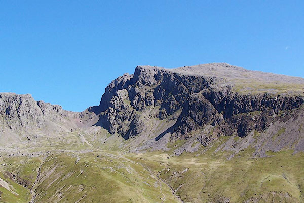
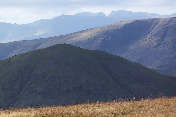 BPV11.jpg From The Knowe, looking across Froswick. (taken 17.11.2008) 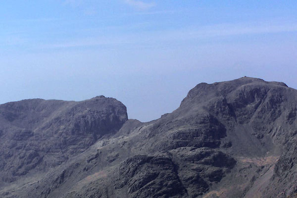 BQL57.jpg Sca Fell, Mickledore and Scafell Pikes from Bow Fell. (taken 20.4.2009) |
||
|
|
||
| evidence:- | old map:- OS County Series (Cmd 74 16) placename:- Mickle Door |
|
| source data:- | Maps, County Series maps of Great Britain, scales 6 and 25
inches to 1 mile, published by the Ordnance Survey, Southampton,
Hampshire, from about 1863 to 1948. |
|
|
|
||
| evidence:- | old print:- Fielding and Walton 1821 (plate 29) |
|
| source data:- | Print, coloured aquatint, Wast Water, Nether Wasdale, Cumberland, drawn by Theodore
H A Fielding, published by R Ackermann, 101 Strand, London, 1821.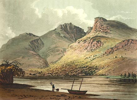 click to enlarge click to enlargeFW0129.jpg Scafell Pike, Mickledore, and Sca Fell in the background. Tipped in opposite p.196 in A Picturesque Tour of the English Lakes. item:- Dove Cottage : 1993.R566.29 Image © see bottom of page |
|
|
|
||
| evidence:- | descriptive text:- Otley 1823 (5th edn 1834) placename:- Mickle Door |
|
| source data:- | Guide book, A Concise Description of the English Lakes, the
mountains in their vicinity, and the roads by which they may be
visited, with remarks on the mineralogy and geology of the
district, by Jonathan Otley, published by the author, Keswick,
Cumberland now Cumbria, by J Richardson, London, and by Arthur
Foster, Kirkby Lonsdale, Cumbria, 1823; published 1823-49,
latterly as the Descriptive Guide to the English Lakes. goto source goto sourcePage 65:- "..." "The lower of these points, lying to the south-west, is a bulky mountain - the proper Scawfell; the higher rising from a narrower base, has been called the Pikes. For want of a designation sufficiently explicit, strangers have sometimes been mistakenly directed to the secondary point; and to cross the deep chasm of Mickle Door, by which they are separated, is a work of considerable difficulty; although the direct distance does not exceed three quarters of a mile. ..." |
|
|
|
||
| evidence:- | old text:- Martineau 1855 |
|
| source data:- | Guide book, A Complete Guide to the English Lakes, by Harriet
Martineau, published by John Garnett, Windermere, Westmorland,
and by Whittaker and Co, London, 1855; published 1855-76. goto source Page 157:- "... The two summits [Sca Fell and Scafell Pike] are about three-quarters of a-mile apart, in a straight line; but the great chasm between them, called Mickledore, renders a wide circuit necessary. There have been fool-hardy persons who have passed Mickledore without losing their lives; and there are strangers, almost every season, who attempt the ascent without a guide. These last usually pay the penalty of their rashness in hours of uneasy wandering and excessive fatigue. ..." |
|
|
|
||
| evidence:- | old photograph:- Bell 1880s-1940s |
|
| source data:- | Photograph, black and white, Sca Fell face and Mickledore, Eskdale, Cumberland, by
Herbert Bell, photographer, Ambleside, Westmorland, 1890s.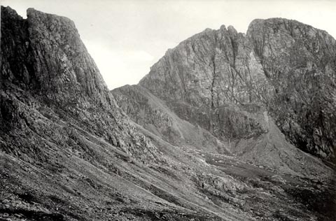 click to enlarge click to enlargeHB0907.jpg stamped at reverse:- "HERBERT BELL / Photographer / AMBLESIDE" item:- Armitt Library : ALPS582 Image © see bottom of page |
|
|
|
||
| evidence:- | outline view:- Seascale 1920s-30s placename:- Mickledore Chasm |
|
| source data:- | Print, uncoloured engraving, outline view, mountains from Seascale, published by Edward
Burrow and Son, Cheltenham, Gloucestershire, 1920s-30s.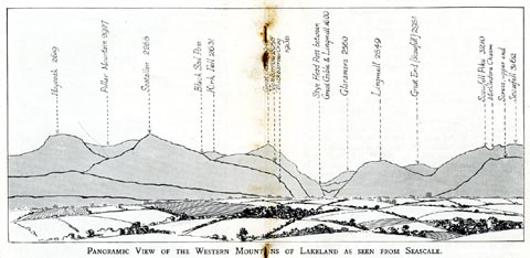 click to enlarge click to enlargeSES113.jpg "PANORAMIC VIEW OF THE WESTERN MOUNTAINS OF LAKELAND AS SEEN FROM SEASCALE." "... Mickledore Chasm ..." item:- JandMN : 1079.13 Image © see bottom of page |
|
|
|
||
| evidence:- | outline view:- Jenkinson 1875 placename:- Mickledore Chasm |
|
| source data:- | Print, lithograph, outline view, Panoramic Sketches from Scawfell Pike, Cumberland,
by Edwin A Pettitt, London, published by Edward Stanford, 55 Charing Cross, London,
1875.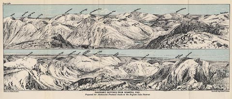 click to enlarge click to enlargeJk01E3.jpg "... Mickledore Chasm ..." item:- JandMN : 28.9 Image © see bottom of page |
|
|
|
||
 BQO29.jpg Scafell Crag, Mickledore and Hollowstones. (taken 12.5.2009) 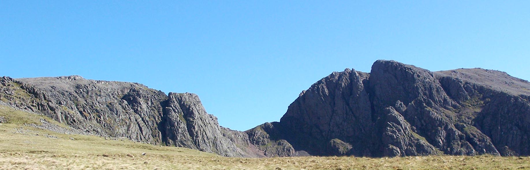 Click to enlarge BQO30.jpg Scafell Crag, Mickledore and Hollowstones. (taken 12.5.2009) 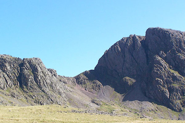 BQO31.jpg Scafell Crag, Mickledore and Hollowstones. (taken 12.5.2009) |
||
|
|
||
Lakes Guides menu.