 Old Cumbria Gazetteer
 |
 |
|
| milestone, Hutton (2) | ||
| site name:- | road, Penrith to Keswick | |
| civil parish:- | Hutton (formerly Cumberland) | |
| county:- | Cumbria | |
| locality type:- | milestone | |
| coordinates:- | NY43122751 | |
| 1Km square:- | NY4327 | |
| 10Km square:- | NY42 | |
|
|
||
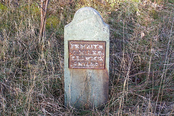 BLP69.jpg cast iron plate on a stone:- "PENRITH 6. MILES KESWICK 12 MILES" (taken 4.2.2006) |
||
|
|
||
| evidence:- | old map:- OS County Series (Cmd 58 9) |
|
| source data:- | Maps, County Series maps of Great Britain, scales 6 and 25
inches to 1 mile, published by the Ordnance Survey, Southampton,
Hampshire, from about 1863 to 1948. "M.S. Penrith .. 6 Keswick ..12" |
|
|
|
||
 Lakes Guides menu.