 Old Cumbria Gazetteer
 |
 |
|
| milestone, Heversham | ||
| site name:- | road, Milnthorpe to Kendal | |
| locality:- | Leasgill | |
| civil parish:- | Heversham (formerly Westmorland) | |
| county:- | Cumbria | |
| locality type:- | milestone | |
| coordinates:- | SD49648394 | |
| 1Km square:- | SD4983 | |
| 10Km square:- | SD48 | |
|
|
||
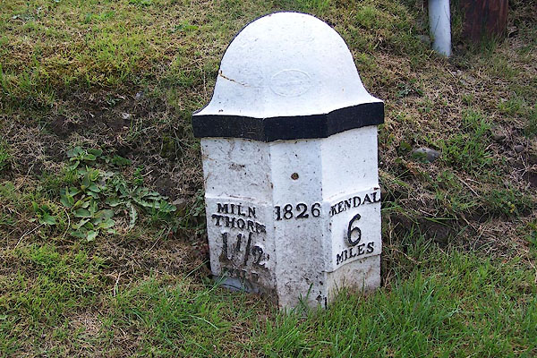 BJR85.jpg Cast iron:- "[T: WINDER GATEBECK FOUNDRY] / 1826 / MILNE THORPE 1½ MILE / KENDAL 6 MILES" (taken 12.8.2005) |
||
|
|
||
| evidence:- | old map:- OS County Series (Wmd 42 11) |
|
| source data:- | Maps, County Series maps of Great Britain, scales 6 and 25
inches to 1 mile, published by the Ordnance Survey, Southampton,
Hampshire, from about 1863 to 1948. "M.S. Kendal .. 6 Milnthorpe .. 1 1/2" |
|
|
|
||
 Lakes Guides menu.