Old Cumbria Gazetteer
 |
 |
|
||
| Millom | ||||
| civil parish:- | Millom (formerly Cumberland) | |||
| county:- | Cumbria | |||
| locality type:- | locality | |||
| locality type:- | buildings | |||
| locality type:- | selected place | |||
| coordinates:- | SD17148021 (etc) | |||
| 1Km square:- | SD1780 | |||
| 10Km square:- | SD18 | |||
| 10Km square:- | SD17 | |||
| latitude; longitude:- | 3d 16.1m W; 54d 12.6m N | |||
|
|
||||
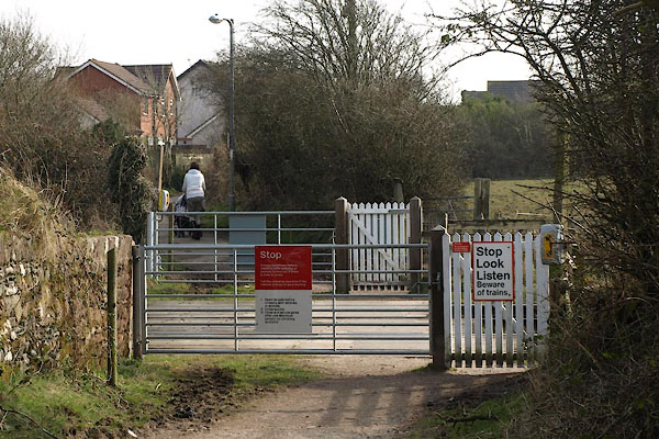
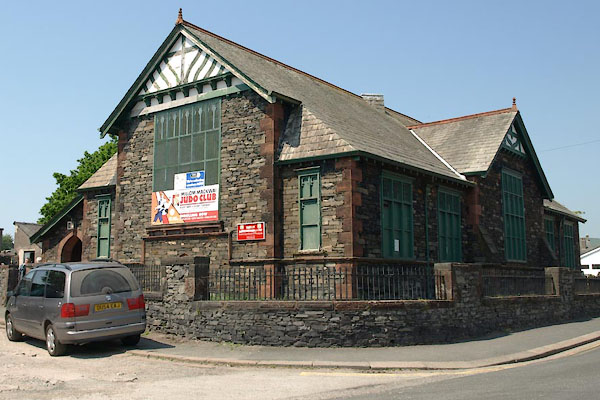
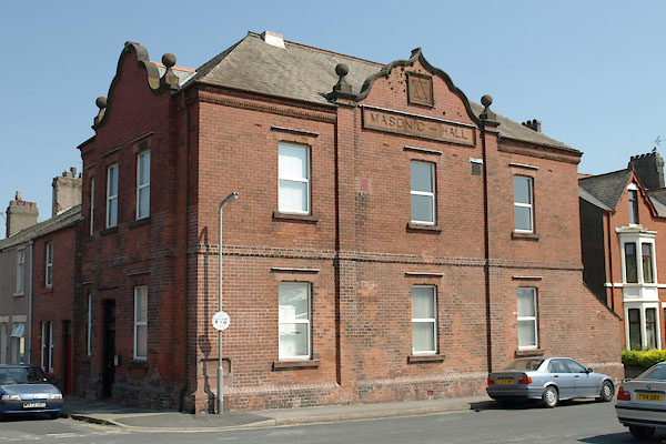
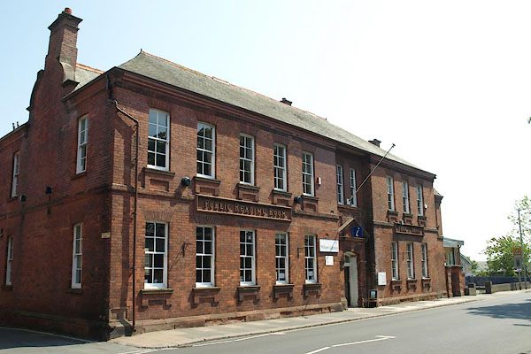
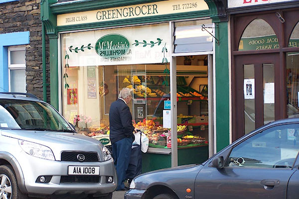
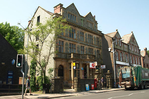
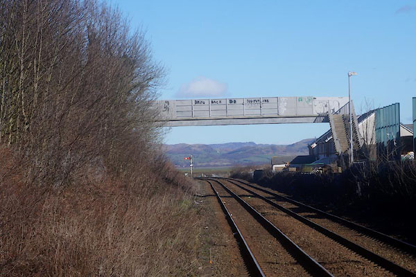
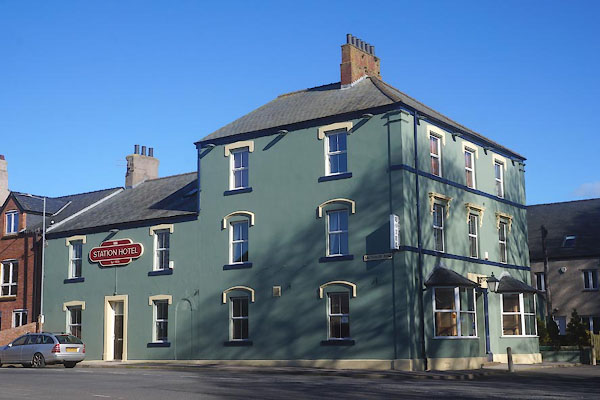
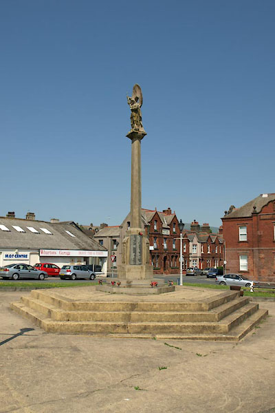
 Click to enlarge CEP06.jpg (taken 23.2.2106) |
||||
|
|
||||
| evidence:- | old map:- OS County Series (Cmd 90 2) |
|||
| source data:- | Maps, County Series maps of Great Britain, scales 6 and 25
inches to 1 mile, published by the Ordnance Survey, Southampton,
Hampshire, from about 1863 to 1948. |
|||
|
|
||||
| evidence:- | old map:- Lloyd 1573 placename:- Mylton |
|||
| source data:- | Map, hand coloured copper plate engraving, Angliae Regni,
Kingdom of England, with Wales, scale about 24 miles to 1 inch, authored by Humphrey
Lloyd, Denbigh, Clwyd, drawn and engraved
by Abraham Ortelius, Netherlands, 1573.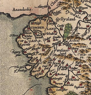 click to enlarge click to enlargeLld1Cm.jpg "Mylton" item:- Hampshire Museums : FA1998.69 Image © see bottom of page |
|||
|
|
||||
| evidence:- | old map:- Saxton 1579 placename:- Millum |
|||
| source data:- | Map, hand coloured engraving, Westmorlandiae et Cumberlandiae Comitatus ie Westmorland
and Cumberland, scale about 5 miles to 1 inch, by Christopher Saxton, London, engraved
by Augustinus Ryther, 1576, published 1579-1645. Sax9SD18.jpg Church, symbol for a parish or village, with a parish church. "Millu~" item:- private collection : 2 Image © see bottom of page |
|||
|
|
||||
| evidence:- | old map:- Speed 1611 (Cmd) placename:- Millum |
|||
| source data:- | Map, hand coloured engraving, Cumberland and the Ancient Citie
Carlile Described, scale about 4 miles to 1 inch, by John Speed,
1610, published by J Sudbury and George Humble, Popes Head
Alley, London, 1611-12. SP11SD17.jpg "Millum" circle, building, tower item:- private collection : 16 Image © see bottom of page |
|||
|
|
||||
| evidence:- | old map:- Jansson 1646 placename:- Millum |
|||
| source data:- | Map, hand coloured engraving, Cumbria and Westmoria, ie
Cumberland and Westmorland, scale about 3.5 miles to 1 inch, by
John Jansson, Amsterdam, Netherlands, 1646. JAN3SD18.jpg "Millum" Buildings and tower. item:- JandMN : 88 Image © see bottom of page |
|||
|
|
||||
| evidence:- | old map:- Sanson 1679 placename:- Millum |
|||
| source data:- | Map, hand coloured engraving, Ancien Royaume de Northumberland
aujourdhuy Provinces de Nort, ie the Ancient Kingdom of
Northumberland or the Northern Provinces, scale about 9.5 miles
to 1 inch, by Nicholas Sanson, Paris, France, 1679. click to enlarge click to enlargeSAN2Cm.jpg "Millum" circle, building and tower, flag; town? item:- Dove Cottage : 2007.38.15 Image © see bottom of page |
|||
|
|
||||
| evidence:- | old map:- Seller 1694 (Cmd) placename:- Millum |
|||
| source data:- | Map, uncoloured engraving, Cumberland, scale about 12 miles to 1
inch, by John Seller, 1694. click to enlarge click to enlargeSEL9.jpg "Millum" circle, italic lowercase text; settlement or house item:- Dove Cottage : 2007.38.89 Image © see bottom of page |
|||
|
|
||||
| evidence:- | old map:- Morden 1695 (Cmd) placename:- Millum |
|||
| source data:- | Map, uncoloured engraving, Cumberland, scale about 4 miles to 1
inch, by Robert Morden, 1695, published by Abel Swale, the
Unicorn, St Paul's Churchyard, Awnsham, and John Churchill, the
Black Swan, Paternoster Row, London, 1695-1715.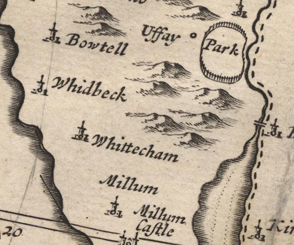 MD12SD18.jpg "Millum" Circle, building and tower. item:- JandMN : 90 Image © see bottom of page |
|||
|
|
||||
| evidence:- | old map:- Bowen and Kitchin 1760 placename:- Millum |
|||
| source data:- | Map, hand coloured engraving, A New Map of the Counties of
Cumberland and Westmoreland Divided into their Respective Wards,
scale about 4 miles to 1 inch, by Emanuel Bowen and Thomas
Kitchin et al, published by T Bowles, Robert Sayer, and John
Bowles, London, 1760.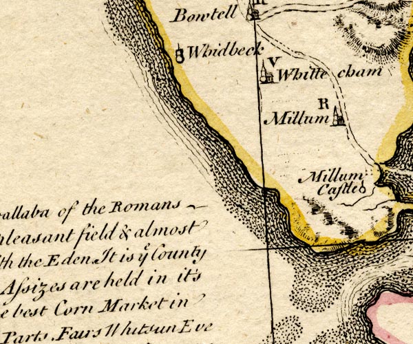 BO18SD07.jpg "Millum / R" circle, building and tower, rectory item:- Armitt Library : 2008.14.10 Image © see bottom of page |
|||
|
|
||||
| evidence:- | old map:- Donald 1774 (Cmd) |
|||
| source data:- | Map, hand coloured engraving, 3x2 sheets, The County of Cumberland, scale about 1
inch to 1 mile, by Thomas Donald, engraved and published by Joseph Hodskinson, 29
Arundel Street, Strand, London, 1774.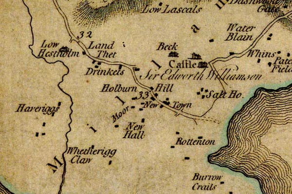 DN04Mllm.jpg A group of settlements including Holborn Hill and New Town, but no Millom. item:- Carlisle Library : Map 2 Image © Carlisle Library |
|||
|
|
||||
| evidence:- | old text:- Camden 1789 (Gough Additions) placename:- Millum placename:- Meol Holme |
|||
| source data:- | Book, Britannia, or A Chorographical Description of the Flourishing Kingdoms of England,
Scotland, and Ireland, by William Camden, 1586, translated from the 1607 Latin edition
by Richard Gough, published London, 1789. Page 179:- "..." "... Millum, q.d. Meol holme, being a plain ground running with a sharp point into the sea. It belonged to the Huddlestones from the reign of Henry III. and William, the last male heir of that family, at his death left two daughters, the elder of whereof married sir Hedworth Williamson, of Monkwearmouth in the county palatine of Durham, bart. and perpetual high-sheriff of that county under the bishop; and the younger daughter having only a legacy in money and no part of the estate, the same was sold to sir James Lowther, bart. (now earl of Lonsdale), but it was a considerable number of years before the purchase-money was fully paid." |
|||
|
|
||||
| evidence:- | old map:- Cooke 1802 placename:- Millam |
|||
| source data:- | Map, Cumberland, scale about 15.5 miles to 1 inch, by George
Cooke, 1802, bound in Gray's New Book of Roads, 1824, published
by Sherwood, Jones and Co, Paternoster Road, London, 1824. click to enlarge click to enlargeGRA1Cd.jpg "Millam" blocks, italic lowercase text, village, hamlet, locality item:- Hampshire Museums : FA2000.62.2 Image © see bottom of page |
|||
|
|
||||
| evidence:- | old text:- Capper 1808 placename:- Millom placename:- Millum item:- population; market |
|||
| source data:- | Gazetteer, A Topographical Dictionary of the United Kingdom,
compiled by Benjamin Pitts Capper, published by Richard
Phillips, Bridge Street, Blackfriars, London, 1808; published
1808-29. goto source goto source"..." "MILLOM or MILLUM, a parish in Allerdale ward, above Derwent, Cumberland, lying between the rivers Dudden and Esk, 7 miles from Ravenglass, and 286 from London; it is the most southerly manor in the county, and contains 125 houses and 589 inhabitants. The ruins of an ancient mansion, the seat of the Hudlestons, are to be seen ... Millom, was formerly a market-town. The chief business carried on is at the iron mills and mines in the neighbourhood. It is a vicarage, value 8l. 5s. 8d. in the patronage of the king as duke of Lancaster." "..." |
|||
|
|
||||
| evidence:- | old map:- Cooper 1808 placename:- Millam |
|||
| source data:- | Map, uncoloured engraving, Cumberland, scale about 10.5 miles to
1 inch, drawn and engraved by Cooper, published by R Phillips,
Bridge Street, Blackfriars, London, 1808. click to enlarge click to enlargeCOP3.jpg "Millam" circle; village or hamlet item:- JandMN : 86 Image © see bottom of page |
|||
|
|
||||
| evidence:- | old map:- Wallis 1810 (Cmd) placename:- Millam |
|||
| source data:- | Road map, hand coloured engraving, Cumberland, scale about 16
miles to 1 inch, by James Wallis, 77 Berwick Stree, Soho,
London, 1810. click to enlarge click to enlargeWL13.jpg "Millam" village, hamlet, house, ... item:- Dove Cottage : 2009.81.10 Image © see bottom of page |
|||
|
|
||||
| evidence:- | old map:- Otley 1818 placename:- Millum |
|||
| source data:- | Map, uncoloured engraving, The District of the Lakes,
Cumberland, Westmorland, and Lancashire, scale about 4 miles to
1 inch, by Jonathan Otley, 1818, engraved by J and G Menzies,
Edinburgh, Scotland, published by Jonathan Otley, Keswick,
Cumberland, et al, 1833. OT02SD18.jpg item:- JandMN : 48.1 Image © see bottom of page |
|||
|
|
||||
| evidence:- | old text:- Gents Mag |
|||
| source data:- | Magazine, The Gentleman's Magazine or Monthly Intelligencer or
Historical Chronicle, published by Edward Cave under the
pseudonym Sylvanus Urban, and by other publishers, London,
monthly from 1731 to 1922. goto source Gentleman's Magazine 1819 part 1 p.507 From the Compendium of County History:- "Huddleston, Sir Richard, knight banneret at Agincourt, Millom." "Huddleston, William, recovered the Royal Standards at Edge-hill, Millom." |
|||
|
|
||||
| evidence:- | presumably old map:- Hall 1820 (Cmd) placename:- New Town |
|||
| source data:- | Map, hand coloured engraving, Cumberland, scale about 21 miles
to 1 inch, engraved by Sidney Hall, published by S Leigh, 18
Strand, London, 1820-31. click to enlarge click to enlargeHA14.jpg "New Town" circle, italic lowercase text; settlement item:- JandMN : 91 Image © see bottom of page |
|||
|
|
||||
| evidence:- | descriptive text:- Otley 1823 (5th edn 1834) placename:- Millum item:- geology |
|||
| source data:- | Guide book, A Concise Description of the English Lakes, the
mountains in their vicinity, and the roads by which they may be
visited, with remarks on the mineralogy and geology of the
district, by Jonathan Otley, published by the author, Keswick,
Cumberland now Cumbria, by J Richardson, London, and by Arthur
Foster, Kirkby Lonsdale, Cumbria, 1823; published 1823-49,
latterly as the Descriptive Guide to the English Lakes. goto source Page 161:- "A superincumbent bed of limestone, by some called the mountain, by others the upper transition limestone, mantles round these mountains, in a position unconformable to the strata of the slaty and other rocks upon which it reposes. It bassets out near ..." goto sourcePage 162:- "... Dalton and Millum, from whence for some distance its place is occupied by the sea, ..." |
|||
|
|
||||
| evidence:- | old map:- Greenwood 1824 placename:- Millom |
|||
| source data:- | Map, engraving, Map of the County of Cumberland, scale about 1
inch to 1 mile, etc, by Christopher and John Greenwood,
published by George Pringle jnr, 70 Queen Street, Cheapside,
London, 1823. gw12mllm.jpg "Millom" the label is at the castle, there is a scatter of settlements where Millom is now, Holborn Hill etc. item:- National Library of Scotland : EME.b.3.11 Image © National Library of Scotland |
|||
|
|
||||
| evidence:- | old map:- Ford 1839 map placename:- Millom New Town |
|||
| source data:- | Map, uncoloured engraving, Map of the Lake District of
Cumberland, Westmoreland and Lancashire, scale about 3.5 miles
to 1 inch, published by Charles Thurnam, Carlisle, and by R
Groombridge, 5 Paternoster Row, London, 3rd edn 1843.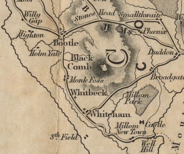 FD02SD18.jpg "Millom New Town" item:- JandMN : 100.1 Image © see bottom of page |
|||
|
|
||||
| evidence:- | old text:- Admiralty 1933 placename:- Millom item:- population, Millom |
|||
| source data:- | goto source Page 383:- "..." "Millom, a town which, in 1931, had a population of 7,406, is situated on the northern side of the promontory, about a mile northward of Hodbarrow point." |
|||
|
|
||||
| evidence:- | market notes:- placename:- Millum item:- market |
|||
| source data:- | www.history.ac.uk/cmh/gaz/gazweb2.htmPalmer's Index No.93:: Public Record Office | |||
|
|
||||
| evidence:- | old map:- Post Office 1850s-1900s placename:- Millom |
|||
| source data:- | Post road maps, General Post Office Circulation Map for England
and Wales, for the General Post Office, London, 1850s-1900s. click to enlarge click to enlargePOF7Cm.jpg "Millom" map date 1909 |
|||
|
|
||||
| evidence:- | old map:- Post Office 1850s-1900s placename:- Millom |
|||
| source data:- | Post road maps, General Post Office Circulation Map for England
and Wales, for the General Post Office, London, 1850s-1900s. click to enlarge click to enlargePF10Cm.jpg "Millom" map date 1892 |
|||
|
|
||||
| evidence:- | old map:- Post Office 1850s-1900s placename:- Millom |
|||
| source data:- | Post road maps, General Post Office Circulation Map for England
and Wales, for the General Post Office, London, 1850s-1900s. click to enlarge click to enlargePOF2Cm.jpg "Millom" map date 1890 |
|||
|
|
||||
| evidence:- | old map:- Post Office 1850s-1900s placename:- Holborn Hill |
|||
| source data:- | Post road maps, General Post Office Circulation Map for England
and Wales, for the General Post Office, London, 1850s-1900s. click to enlarge click to enlargePOF8Cm.jpg "Holborn Hill / Stn." map date 1873 |
|||
|
|
||||
| :- |
images courtesy of the British Postal Museum and Hampshire CC Museums |
|||
|
|
||||
| hearsay:- |
Norman Nicholson, poet, lived at St George's Terrace, Millom. He was awarded the Queen's
Medal for Poetry, 1987. |
|||
|
|
||||
| personal | ||||
| person:- | poet : Nicholson, Norman |
|||
| place:- | home | |||
|
|
||||
| places:- |
|
|||
|
||||
|
||||
|
||||
|
||||
|
||||
|
||||
|
||||
|
||||
|
||||
|
||||
|
||||
|
||||
|
||||
|
||||
|
||||
|
||||
|
||||
|
||||
|
||||
|
||||
|
||||
|
||||
|
||||
|
||||
|
||||
|
||||
|
||||
|
||||
|
||||
|
||||
|
||||
|
||||
|
||||
|
||||
|
||||
|
||||
|
||||
|
||||
|
||||
|
||||
|
||||
|
||||
|
||||
|
||||
|
||||
|
||||
|
||||
|
||||
Lakes Guides menu.