 Old Cumbria Gazetteer
 |
 |
|
| Milnthorpe Sands, Beetham | ||
| Milnthorpe Sands | ||
| locality:- | Kent Estuary | |
| civil parish:- | Beetham (formerly Westmorland) | |
| civil parish:- | Witherslack (formerly Westmorland) | |
| county:- | Cumbria | |
| locality type:- | foreshore | |
| coordinates:- | SD47038086 (etc) | |
| 1Km square:- | SD4780 | |
| 10Km square:- | SD48 | |
|
|
||
| evidence:- | old map:- Saxton 1579 |
|
| source data:- | Map, hand coloured engraving, Westmorlandiae et Cumberlandiae Comitatus ie Westmorland
and Cumberland, scale about 5 miles to 1 inch, by Christopher Saxton, London, engraved
by Augustinus Ryther, 1576, published 1579-1645.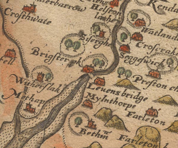 Sax9SD48.jpg item:- private collection : 2 Image © see bottom of page |
|
|
|
||
| evidence:- | old map:- Sanson 1679 placename:- Ken Sandes |
|
| source data:- | Map, hand coloured engraving, Ancien Royaume de Northumberland
aujourdhuy Provinces de Nort, ie the Ancient Kingdom of
Northumberland or the Northern Provinces, scale about 9.5 miles
to 1 inch, by Nicholas Sanson, Paris, France, 1679. click to enlarge click to enlargeSAN2Cm.jpg "Ken Sandes" foreshore sands item:- Dove Cottage : 2007.38.15 Image © see bottom of page |
|
|
|
||
| evidence:- | old print:- Rose 1832-35 |
|
| source data:- | Print, engraving, Milnthorpe Sands, Westmorland, by Thomas Allom, engraved by J Tingle,
1830s.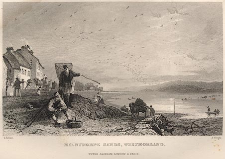 click to enlarge click to enlargeR2E57.jpg item:- JandMN : 66.40 Image © see bottom of page |
|
|
|
||
 Lakes Guides menu.