 Old Cumbria Gazetteer
 |
 |
|
| Milton Hill, Milton | ||
| Milton Hill | ||
| locality:- | Milton | |
| civil parish:- | Brampton (formerly Cumberland) | |
| county:- | Cumbria | |
| locality type:- | buildings | |
| coordinates:- | NY54976058 | |
| 1Km square:- | NY5460 | |
| 10Km square:- | NY56 | |
|
|
||
| evidence:- | old map:- OS County Series (Cmd 18 6) placename:- Milton Hill |
|
| source data:- | Maps, County Series maps of Great Britain, scales 6 and 25
inches to 1 mile, published by the Ordnance Survey, Southampton,
Hampshire, from about 1863 to 1948. |
|
|
|
||
| evidence:- | perhaps old map:- Ogilby 1675 (plate 86) |
|
| source data:- | Road strip map, uncoloured engraving, the Road from Tinmouth ...
to Carlisle, scale about 1 inch to 1 mile, by John Ogilby,
London, 1675.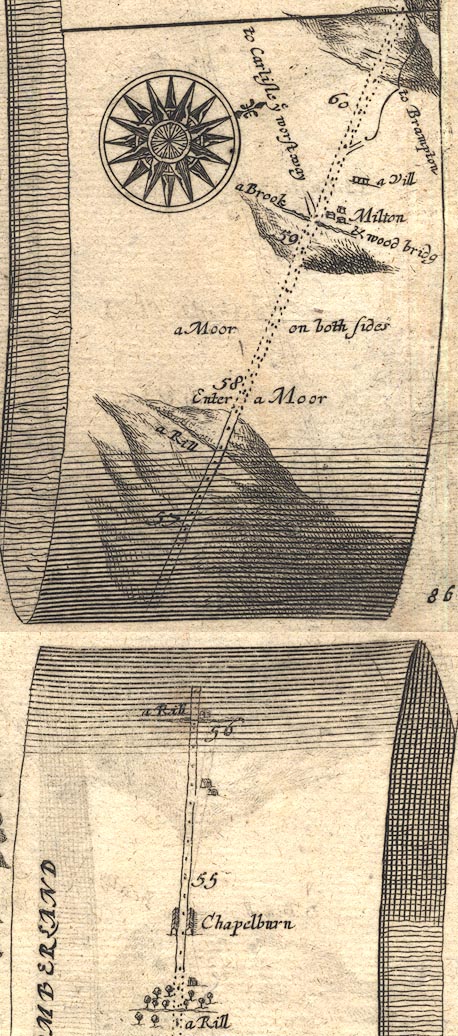 OG86m055.jpg In mile 59, Cumberland. "a Vill" houses off the right of the road. item:- JandMN : 73 Image © see bottom of page |
|
|
|
||
| evidence:- | old map:- Donald 1774 (Cmd) placename:- Milton Hill |
|
| source data:- | Map, hand coloured engraving, 3x2 sheets, The County of Cumberland, scale about 1
inch to 1 mile, by Thomas Donald, engraved and published by Joseph Hodskinson, 29
Arundel Street, Strand, London, 1774.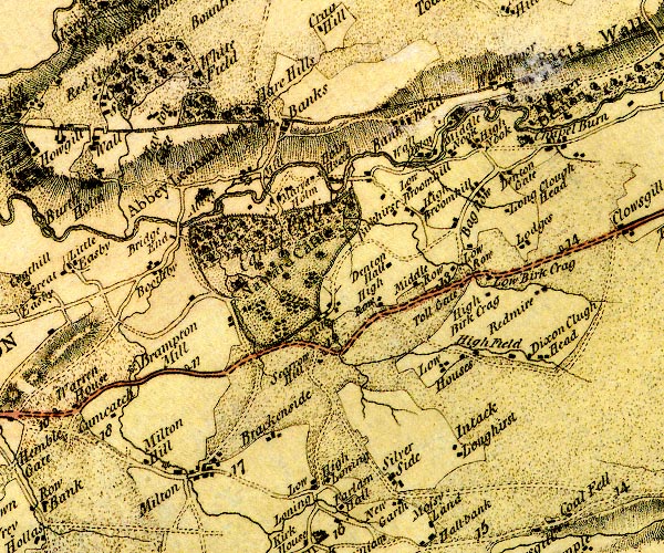 D4NY56SE.jpg "Milton Hill" block or blocks, labelled in lowercase; a hamlet or just a house item:- Carlisle Library : Map 2 Image © Carlisle Library |
|
|
|
||
 Lakes Guides menu.