 Old Cumbria Gazetteer
 |
 |
|
| Miterdale, Eskdale | ||
| Miterdale | ||
| civil parish:- | Eskdale (formerly Cumberland) | |
| county:- | Cumbria | |
| locality type:- | valley | |
| locality type:- | locality | |
| coordinates:- | NY15560159 (etc) | |
| 1Km square:- | NY1501 | |
| 10Km square:- | NY10 | |
|
|
||
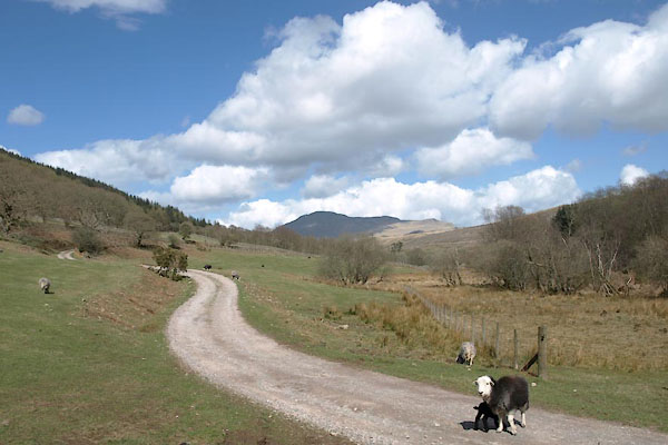 BYG01.jpg (taken 27.4.2013) |
||
|
|
||
| evidence:- | old map:- Saxton 1579 placename:- Myterdale |
|
| source data:- | Map, hand coloured engraving, Westmorlandiae et Cumberlandiae Comitatus ie Westmorland
and Cumberland, scale about 5 miles to 1 inch, by Christopher Saxton, London, engraved
by Augustinus Ryther, 1576, published 1579-1645.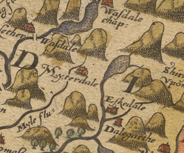 Sax9NY10.jpg Building, symbol for a hamlet, which may or may not have a nucleus. "Myterdale" item:- private collection : 2 Image © see bottom of page |
|
|
|
||
| evidence:- | old map:- Speed 1611 (Cmd) placename:- Myterdale |
|
| source data:- | Map, hand coloured engraving, Cumberland and the Ancient Citie
Carlile Described, scale about 4 miles to 1 inch, by John Speed,
1610, published by J Sudbury and George Humble, Popes Head
Alley, London, 1611-12.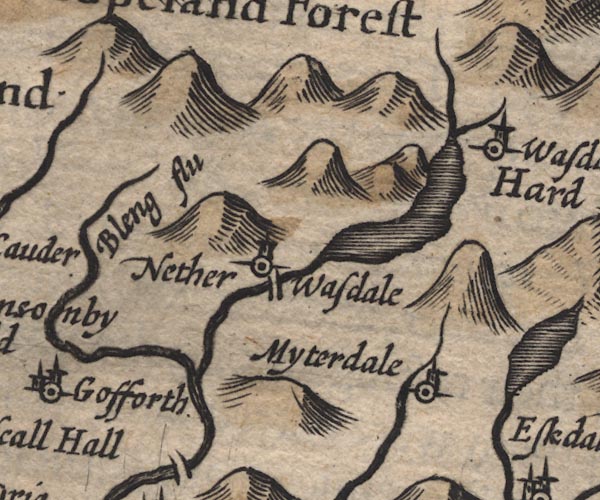 SP11NY10.jpg "Myterdale" circle, tower item:- private collection : 16 Image © see bottom of page |
|
|
|
||
| evidence:- | old map:- Drayton 1612/1622 placename:- Niterdale |
|
| source data:- | Map, hand coloured engraving, Cumberlande and Westmorlande, by
Michael Drayton, probably engraved by William Hole, scale about
4 or 5 miles to 1 inch, published by John Mariott, John
Grismand, and Thomas Dewe, London, 1622.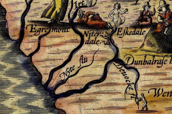 DRY521.jpg "Niterdale" Lady reclining. item:- JandMN : 168 Image © see bottom of page |
|
|
|
||
| evidence:- | old map:- Jansson 1646 placename:- Myterdale |
|
| source data:- | Map, hand coloured engraving, Cumbria and Westmoria, ie
Cumberland and Westmorland, scale about 3.5 miles to 1 inch, by
John Jansson, Amsterdam, Netherlands, 1646.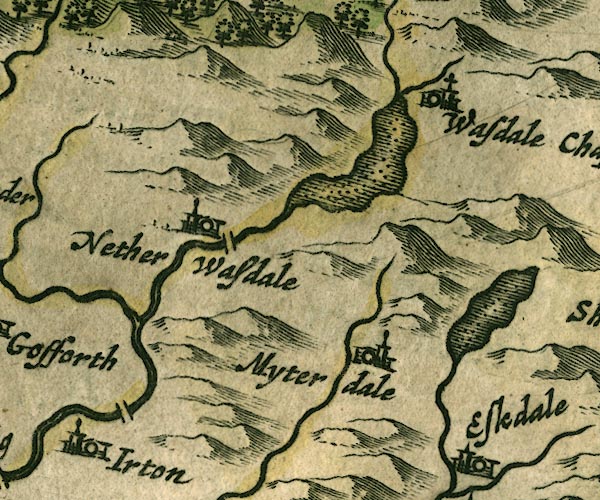 JAN3NY10.jpg "Myterdale" Buildings and tower. item:- JandMN : 88 Image © see bottom of page |
|
|
|
||
| evidence:- | old map:- Morden 1695 (Cmd) placename:- Miterdale |
|
| source data:- | Map, uncoloured engraving, Cumberland, scale about 4 miles to 1
inch, by Robert Morden, 1695, published by Abel Swale, the
Unicorn, St Paul's Churchyard, Awnsham, and John Churchill, the
Black Swan, Paternoster Row, London, 1695-1715.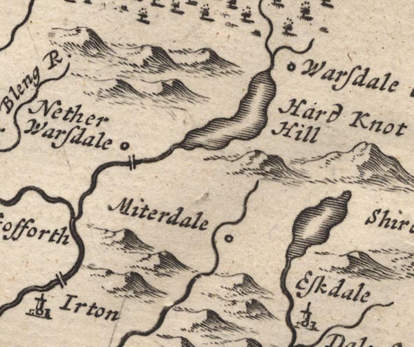 MD12NY10.jpg "Miterdale" Circle. item:- JandMN : 90 Image © see bottom of page |
|
|
|
||
| evidence:- | old map:- Badeslade 1742 placename:- Miterdale |
|
| source data:- | Map, uncoloured engraving, A Map of Cumberland North from
London, scale about 11 miles to 1 inch, with descriptive text,
by Thomas Badeslade, London, engraved and published by William
Henry Toms, Union Court, Holborn, London, 1742. click to enlarge click to enlargeBD10.jpg "Miterdale" circle, italic lowercase text; village, hamlet or locality item:- JandMN : 115 Image © see bottom of page |
|
|
|
||
| evidence:- | probably old map:- Bowen and Kitchin 1760 placename:- Miterton |
|
| source data:- | Map, hand coloured engraving, A New Map of the Counties of
Cumberland and Westmoreland Divided into their Respective Wards,
scale about 4 miles to 1 inch, by Emanuel Bowen and Thomas
Kitchin et al, published by T Bowles, Robert Sayer, and John
Bowles, London, 1760.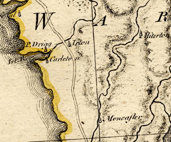 BO18SD09.jpg "Miterton" circle, tower item:- Armitt Library : 2008.14.10 Image © see bottom of page |
|
|
|
||
| evidence:- | old map:- Donald 1774 (Cmd) placename:- Miterdale |
|
| source data:- | Map, hand coloured engraving, 3x2 sheets, The County of Cumberland, scale about 1
inch to 1 mile, by Thomas Donald, engraved and published by Joseph Hodskinson, 29
Arundel Street, Strand, London, 1774. D4NY10SE.jpg "Miterdale" area item:- Carlisle Library : Map 2 Image © Carlisle Library |
|
|
|
||
| evidence:- | old map:- Otley 1818 placename:- Miterdale |
|
| source data:- | Map, uncoloured engraving, The District of the Lakes,
Cumberland, Westmorland, and Lancashire, scale about 4 miles to
1 inch, by Jonathan Otley, 1818, engraved by J and G Menzies,
Edinburgh, Scotland, published by Jonathan Otley, Keswick,
Cumberland, et al, 1833.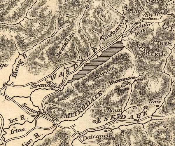 OT02NY10.jpg "MITERDALE" item:- JandMN : 48.1 Image © see bottom of page |
|
|
|
||
| evidence:- | old map:- Garnett 1850s-60s H placename:- Miterdale |
|
| source data:- | Map of the English Lakes, in Cumberland, Westmorland and
Lancashire, scale about 3.5 miles to 1 inch, published by John
Garnett, Windermere, Westmorland, 1850s-60s.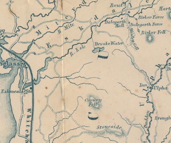 GAR2SD19.jpg "Miterdale" river valley item:- JandMN : 82.1 Image © see bottom of page |
|
|
|
||
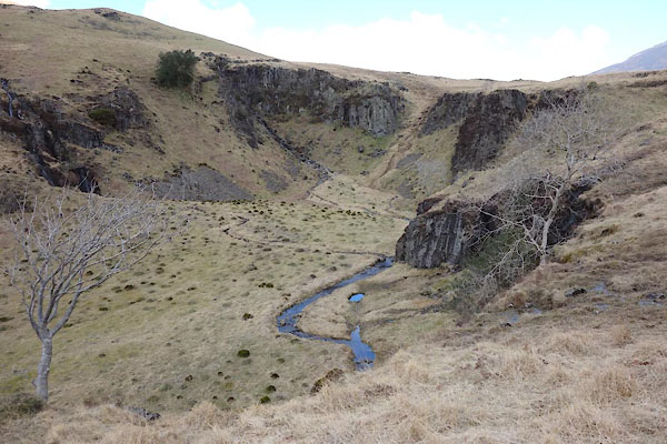 BYG40.jpg Head of the valley, (taken 27.4.2013) 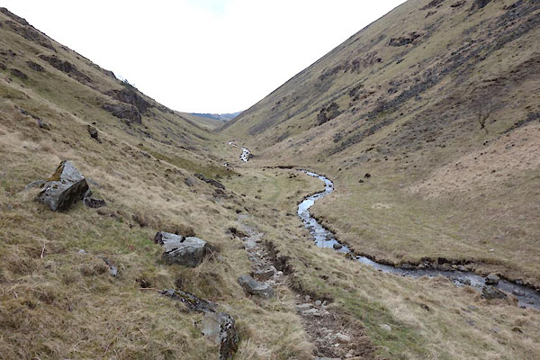 BYG42.jpg Looking down from the head of the valley. (taken 27.4.2013) 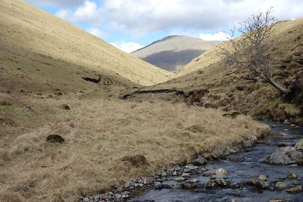 BYG43.jpg Looking up, towards Sca Fell. (taken 27.4.2013) 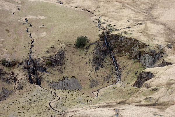 BYG39.jpg Head of the valley, (taken 27.4.2013) |
||
|
|
||
| story:- |
The tale of the Beckside Boggle. |
|
| A young wife and her child were left in their farm in the Miterdale valley, by the
farmer who had business in Whitehaven. At dusk a stranger woman, her head wrapped
in a shawl asked for lodging, and was made welcome. She sat down at the fire side
where the wife was making tallow candles. The stranger fell asleep, the shawl slipped,
revealing a coarse featured man carrying a fearsome knife. The wife, terrified, lifted
her heavy pan from the fire, and poured it over the strange man, choking him in boiling
mutton fat. Early next day the farmer returned to find his distraught wife, with a
ghastly corpse hidden on a ledge. They buried the body, and kept silent about it.
The valley has ever since been haunted. |
||
|
|
||
 Lakes Guides menu.