 Old Cumbria Gazetteer
 |
 |
|
| Moorhouse Hall, Warwick-on-Eden | ||
| Moorhouse Hall | ||
| locality:- | Warwick-on-Eden | |
| civil parish:- | Wetheral (formerly Cumberland) | |
| county:- | Cumbria | |
| locality type:- | buildings | |
| coordinates:- | NY46165616 | |
| 1Km square:- | NY4656 | |
| 10Km square:- | NY45 | |
|
|
||
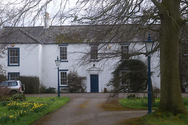 CEV13.jpg (taken 8.4.2016) 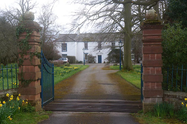 CEV14.jpg Gate piers. (taken 8.4.2016) |
||
|
|
||
| evidence:- | old map:- OS County Series (Cmd 24 2) placename:- Moorhouse Hall |
|
| source data:- | Maps, County Series maps of Great Britain, scales 6 and 25
inches to 1 mile, published by the Ordnance Survey, Southampton,
Hampshire, from about 1863 to 1948. |
|
|
|
||
| evidence:- | database:- Listed Buildings 2010 placename:- Moorhouse Hall |
|
| source data:- | courtesy of English Heritage "MOORHOUSE HALL / / / WETHERAL / CARLISLE / CUMBRIA / II / 77745 / NY4616656161" |
|
|
|
||
| evidence:- | database:- Listed Buildings 2010 |
|
| source data:- | courtesy of English Heritage "GATE PIERS RAILINGS AND WALL TO NORTH OF MOORHOUSE HALL / / / WETHERAL / CARLISLE / CUMBRIA / II / 77746 / NY4614856228" |
|
|
|
||
 Lakes Guides menu.