 Old Cumbria Gazetteer
 |
 |
|
| Near Sawrey, Claife | ||
| Near Sawrey | ||
| civil parish:- | Claife (formerly Lancashire) | |
| county:- | Cumbria | |
| locality type:- | buildings | |
| coordinates:- | SD37029563 (etc) | |
| 1Km square:- | SD3695 | |
| 10Km square:- | SD39 | |
|
|
||
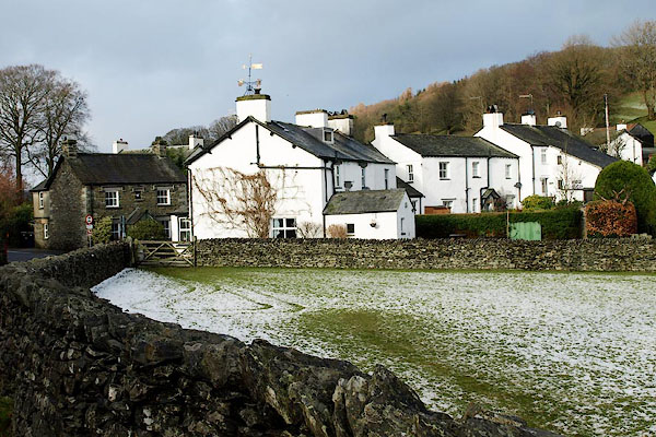
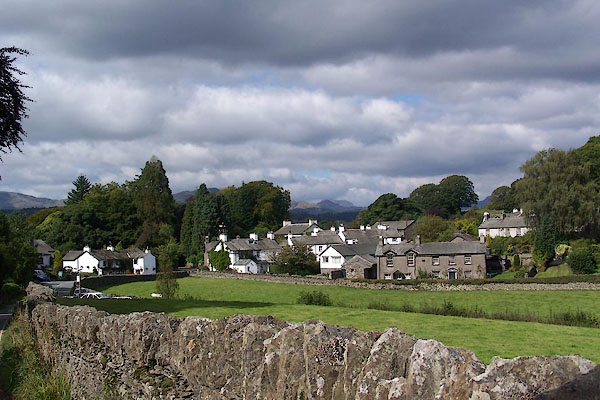 BJV19.jpg From the south. (taken 16.9.2005) 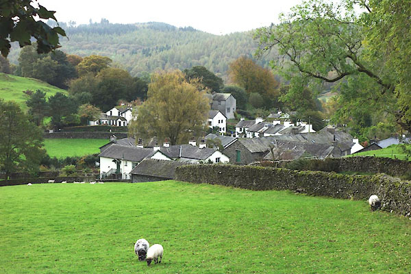 CGS35.jpg From the north. (taken 12.10.2017) |
||
|
|
||
| evidence:- | old map:- OS County Series (Lan 5 6) placename:- Near Sawrey placename:- Sawrey, Near |
|
| source data:- | Maps, County Series maps of Great Britain, scales 6 and 25
inches to 1 mile, published by the Ordnance Survey, Southampton,
Hampshire, from about 1863 to 1948. |
|
|
|
||
| evidence:- | old map:- Jefferys 1770 (Wmd) placename:- Sawray |
|
| source data:- | Map, 4 sheets, The County of Westmoreland, scale 1 inch to 1
mile, surveyed 1768, and engraved and published by Thomas
Jefferys, London, 1770.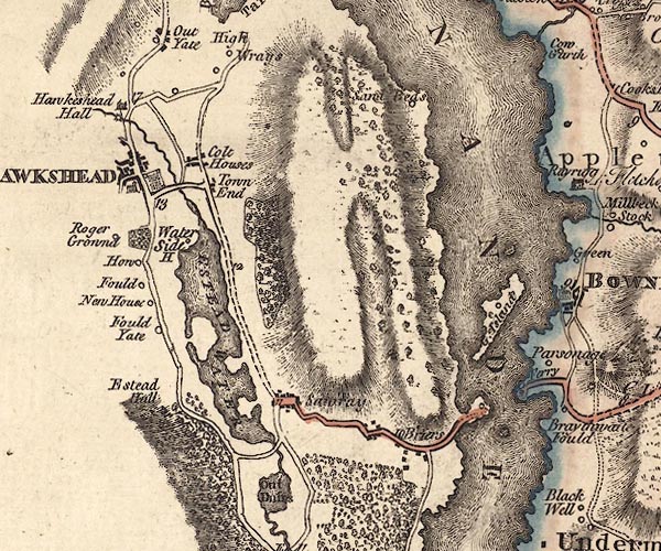 J5SD39NE.jpg "Sawray" blocks, labelled in italic lowercase text; settlement, village? item:- National Library of Scotland : EME.s.47 Image © National Library of Scotland |
|
|
|
||
| evidence:- | old map:- Crosthwaite 1783-94 (Win/Ble) placename:- Sawrey |
|
| source data:- | Map, uncoloured engraving, An Accurate Map of the Grand Lake of
Windermere, scale about 2 inches to 1 mile, by Peter
Crosthwaite, Keswick, Cumberland, 1783, version published 1819.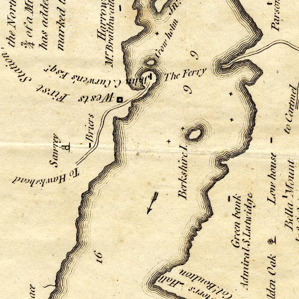 CT9SD39X.jpg "Sawrey" circle and tower, village? item:- Armitt Library : 2008.14.102 Image © see bottom of page |
|
|
|
||
| evidence:- | probably old map:- West 1784 map placename:- Sawrey |
|
| source data:- | Map, hand coloured engraving, A Map of the Lakes in Cumberland,
Westmorland and Lancashire, scale about 3.5 miles to 1 inch,
engraved by Paas, 53 Holborn, London, about 1784.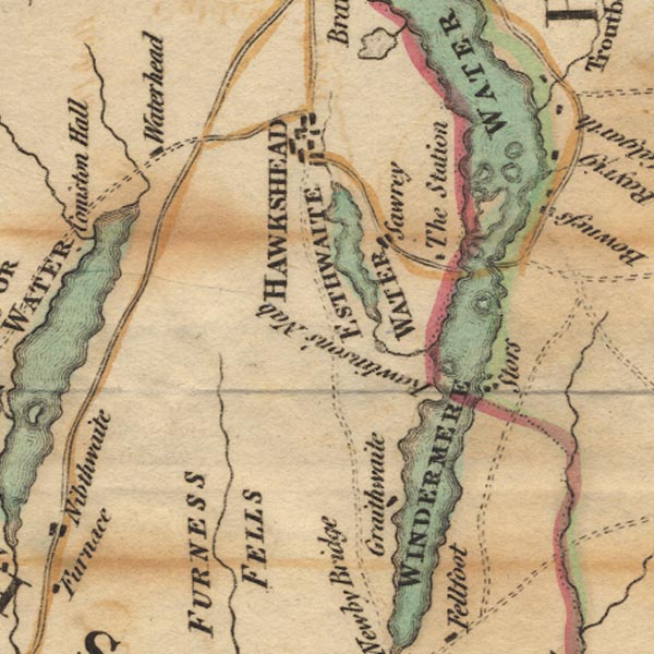 Ws02SD39.jpg item:- Armitt Library : A1221.1 Image © see bottom of page |
|
|
|
||
| evidence:- | old map:- Cary 1789 (edn 1805) placename:- Sawbay |
|
| source data:- | Map, uncoloured engraving, Westmoreland, scale about 2.5 miles
to 1 inch, by John Cary, London, 1789; edition 1805.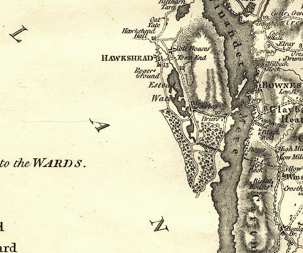 CY24SD39.jpg "Sa[w]bay" block/s, labelled in italic lowercase; house, or hamlet item:- JandMN : 129 Image © see bottom of page |
|
|
|
||
| evidence:- | probably old map:- Wallis 1810 (Wmd) placename:- Sawbay |
|
| source data:- | Road map, Westmoreland, scale about 19 miles to 1 inch, by James
Wallis, 77 Berwick Street, Soho, 1810, published by W Lewis,
Finch Lane, London, 1835? click to enlarge click to enlargeWAL5.jpg "Sawbay" village, hamlet, house, ... item:- JandMN : 63 Image © see bottom of page |
|
|
|
||
| evidence:- | old map:- Otley 1818 placename:- Sawrey |
|
| source data:- | Map, uncoloured engraving, The District of the Lakes,
Cumberland, Westmorland, and Lancashire, scale about 4 miles to
1 inch, by Jonathan Otley, 1818, engraved by J and G Menzies,
Edinburgh, Scotland, published by Jonathan Otley, Keswick,
Cumberland, et al, 1833.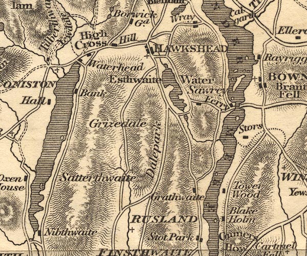 OT02SD39.jpg item:- JandMN : 48.1 Image © see bottom of page |
|
|
|
||
| evidence:- | old map:- Ford 1839 map placename:- Sowrey |
|
| source data:- | Map, uncoloured engraving, Map of the Lake District of
Cumberland, Westmoreland and Lancashire, scale about 3.5 miles
to 1 inch, published by Charles Thurnam, Carlisle, and by R
Groombridge, 5 Paternoster Row, London, 3rd edn 1843.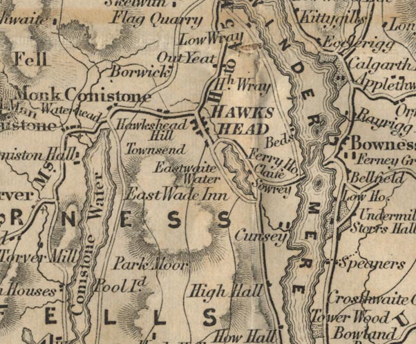 FD02SD39.jpg "Sowrey" item:- JandMN : 100.1 Image © see bottom of page |
|
|
|
||
| evidence:- | old drawing:- Aspland 1840s-60s placename:- Sawrey |
|
| source data:- | Drawing, pencil, a lane at Sawrey, Claife, Lancashire, by Theophilus Lindsey Aspland,
August 1867.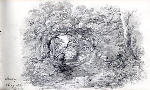 click to enlarge click to enlargeAS0416.jpg "Sawrey. / Aug 1867 / H [P]" page number "19" item:- drawing Armitt Library : 2008.60.16 Image © see bottom of page |
|
|
|
||
| evidence:- | perhaps old drawing:- Aspland 1840s-60s |
|
| source data:- | Drawing, pencil, a hay cart, Claife, Lancashire? by Theophilus Lindsey Aspland, 27
August 1867.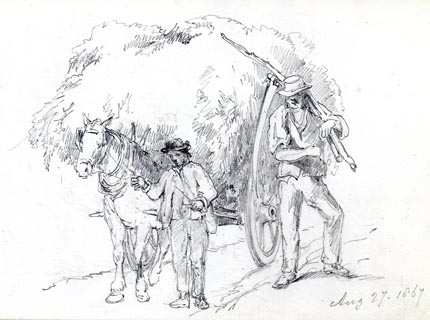 click to enlarge click to enlargeAS0417.jpg "Aug 27. 1867" item:- Armitt Library : 2008.60.17 Image © see bottom of page |
|
|
|
||
| evidence:- | perhaps old drawing:- Aspland 1840s-60s |
|
| source data:- | Drawing, pencil, a hay cart, Claife, Lancashire? by Theophilus Lindsey Aspland, 27
August 1867.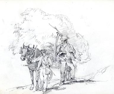 click to enlarge click to enlargeAS0418.jpg page number "20" item:- Armitt Library : 2008.60.18 Image © see bottom of page |
|
|
|
||
 Martineau Directory 1855 Martineau Directory 1855 |
||
|
|
||
| evidence:- | old text:- Martineau 1855 item:- Scotch Gate |
|
| source data:- | Guide book, A Complete Guide to the English Lakes, by Harriet
Martineau, published by John Garnett, Windermere, Westmorland,
and by Whittaker and Co, London, 1855; published 1855-76. goto source goto sourcePage 30:- "... a trace of the rebellion of 1745 in the name of a lane, called "Scotch Gate" (way.) It was here that the fearful Highlanders were looked for, on their march to Derby; and here they might have had all their own way if they had come; for Sawrey had no idea of showing fight. All the inhabitants, carrying all their valuables, hied away, and took refuge together in a solitary building which was called Cook's braw bog-house. And braw it must have been, to hold all the Sawreyans. ..." |
|
|
|
||
| evidence:- | old map:- Post Office 1850s-1900s placename:- Sawrey |
|
| source data:- | Post road maps, General Post Office Circulation Map for England
and Wales, for the General Post Office, London, 1850s-1900s. click to enlarge click to enlargePOF7Cm.jpg "Sawrey" map date 1909 |
|
|
|
||
| evidence:- | old map:- Post Office 1850s-1900s placename:- Sawrey |
|
| source data:- | Post road maps, General Post Office Circulation Map for England
and Wales, for the General Post Office, London, 1850s-1900s.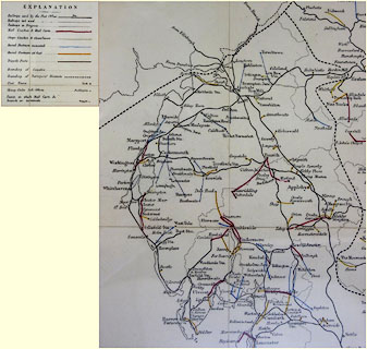 click to enlarge click to enlargePF10Cm.jpg "Sawrey" map date 1892 |
|
|
|
||
| :- |
images courtesy of the British Postal Museum and Hampshire CC Museums |
|
|
|
||
 BPY32.jpg (taken 23.1.2009) 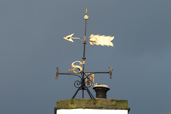 BPY35.jpg Weathervane on Meadow Croft. (taken 16.9.2005) |
||
|
|
||
| hearsay:- |
Beatrix Potter wrote:- |
|
| "It is as near perfect a little place as I ever lived in." |
||
| Potter, Beatrix &Linder, Leslie (ed): 1966: Journal of Beatrix Potter, 1881-1897 |
||
|
|
||
Lakes Guides menu.