 Old Cumbria Gazetteer
 |
 |
|
| New Hall, Nether Staveley | ||
| New Hall | ||
| New Hall Farm | ||
| civil parish:- | Nether Staveley (formerly Westmorland) | |
| county:- | Cumbria | |
| locality type:- | buildings | |
| coordinates:- | SD46309713 | |
| 1Km square:- | SD4697 | |
| 10Km square:- | SD49 | |
|
|
||
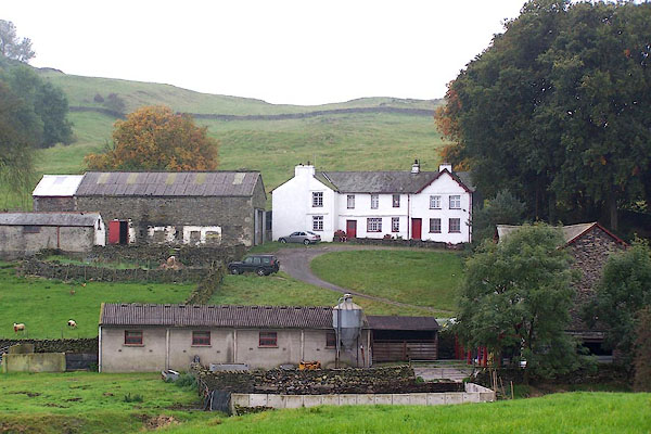 BJX57.jpg (taken 7.10.2005) 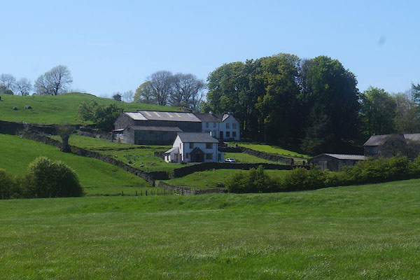 CDB84.jpg (taken 23.5.2015) |
||
|
|
||
| evidence:- | old map:- OS County Series (Wmd 33 10) placename:- New Hall placename:- Hall, New |
|
| source data:- | Maps, County Series maps of Great Britain, scales 6 and 25
inches to 1 mile, published by the Ordnance Survey, Southampton,
Hampshire, from about 1863 to 1948. |
|
|
|
||
| evidence:- | hearth tax returns:- Hearth Tax 1675 placename:- Newhall |
|
| source data:- | Records, hearth tax survey returns, Westmorland, 1674/75. "Newhall" in "Nether Stavaley" |
|
|
|
||
| evidence:- | possibly old map:- Jefferys 1770 (Wmd) placename:- Wood Hall |
|
| source data:- | Map, 4 sheets, The County of Westmoreland, scale 1 inch to 1
mile, surveyed 1768, and engraved and published by Thomas
Jefferys, London, 1770.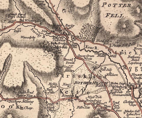 J5SD49NE.jpg "Wood H." circle, labelled in italic lowercase text; settlement, farm, house, or hamlet? item:- National Library of Scotland : EME.s.47 Image © National Library of Scotland |
|
|
|
||
 Lakes Guides menu.