 Old Cumbria Gazetteer
 |
 |
|
| Nibthwaite Grange, Colton | ||
| Nibthwaite Grange | ||
| Street:- | Bletherbarrow Lane | |
| locality:- | Nibthwaite | |
| civil parish:- | Colton (formerly Lancashire) | |
| county:- | Cumbria | |
| locality type:- | buildings | |
| coordinates:- | SD29618815 | |
| 1Km square:- | SD2988 | |
| 10Km square:- | SD28 | |
|
|
||
| evidence:- | probably old map:- Bowen and Kitchin 1760 placename:- Nibthwate |
|
| source data:- | Map, hand coloured engraving, A New Map of the Counties of
Cumberland and Westmoreland Divided into their Respective Wards,
scale about 4 miles to 1 inch, by Emanuel Bowen and Thomas
Kitchin et al, published by T Bowles, Robert Sayer, and John
Bowles, London, 1760.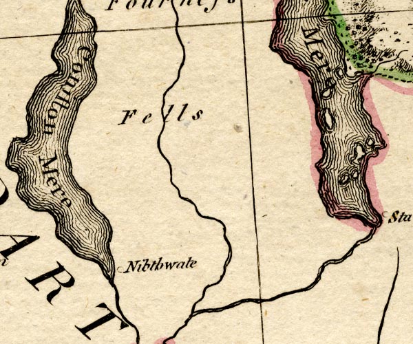 BO18SD28.jpg "Nibthwate" circle item:- Armitt Library : 2008.14.10 Image © see bottom of page |
|
|
|
||
| evidence:- | probably old map:- Ford 1839 map placename:- Grange |
|
| source data:- | Map, uncoloured engraving, Map of the Lake District of
Cumberland, Westmoreland and Lancashire, scale about 3.5 miles
to 1 inch, published by Charles Thurnam, Carlisle, and by R
Groombridge, 5 Paternoster Row, London, 3rd edn 1843.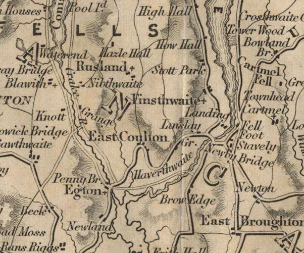 FD02SD38.jpg "Grange" item:- JandMN : 100.1 Image © see bottom of page |
|
|
|
||
| evidence:- | database:- Listed Buildings 2010 placename:- Nibthwaite Grange |
|
| source data:- | courtesy of English Heritage "NIBTHWAITE GRANGE / / BLETHERBARROW LANE / COLTON / SOUTH LAKELAND / CUMBRIA / II / 421182 / SD2961188150" |
|
|
|
||
 Lakes Guides menu.