 Old Cumbria Gazetteer
 |
 |
|
||||||||||||||||
| Nine Standards, Hartley | ||||||||||||||||||
| Nine Standards | ||||||||||||||||||
| site name:- | Nine Standards Rigg | |||||||||||||||||
| civil parish:- | Hartley (formerly Westmorland) | |||||||||||||||||
| civil parish:- | Winton (formerly Westmorland) (as well?) | |||||||||||||||||
| county:- | Cumbria | |||||||||||||||||
| locality type:- | cairn | |||||||||||||||||
| coordinates:- | NY82490655 (etc) | |||||||||||||||||
| 1Km square:- | NY8206 | |||||||||||||||||
| 10Km square:- | NY80 | |||||||||||||||||
|
|
||||||||||||||||||
 BQI96.jpg (taken 3.4.2009) 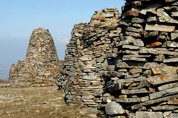 BQI97.jpg (taken 3.4.2009) |
||||||||||||||||||
|
|
||||||||||||||||||
| evidence:- | old map:- Jefferys 1770 (Wmd) placename:- Nine Standards |
|||||||||||||||||
| source data:- | Map, 4 sheets, The County of Westmoreland, scale 1 inch to 1
mile, surveyed 1768, and engraved and published by Thomas
Jefferys, London, 1770.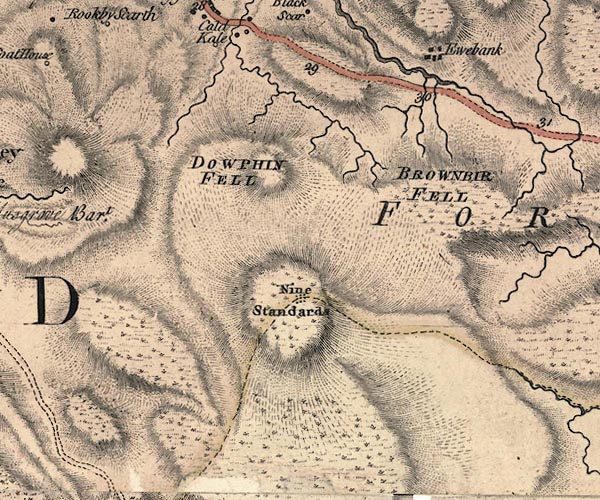 J5NY80NW.jpg "Nine Standards" nine dots, on county boundary item:- National Library of Scotland : EME.s.47 Image © National Library of Scotland |
|||||||||||||||||
|
|
||||||||||||||||||
| evidence:- | descriptive text:- Otley 1823 (5th edn 1834) item:- latitude; longitude; lat and long |
|||||||||||||||||
| source data:- | Guide book, A Concise Description of the English Lakes, the
mountains in their vicinity, and the roads by which they may be
visited, with remarks on the mineralogy and geology of the
district, by Jonathan Otley, published by the author, Keswick,
Cumberland now Cumbria, by J Richardson, London, and by Arthur
Foster, Kirkby Lonsdale, Cumbria, 1823; published 1823-49,
latterly as the Descriptive Guide to the English Lakes. goto source goto sourcePage 78:- "STATION II.- SKIDDAW." "Latitude 54° 39′ 12″ N. Longitude 3° 8′ 9″W. Height 3022 feet."
|
|||||||||||||||||
|
|
||||||||||||||||||
| evidence:- | database:- Listed Buildings 2010 placename:- Nine Standards |
|||||||||||||||||
| source data:- | courtesy of English Heritage "NINE STANDARDS / / / HARTLEY / EDEN / CUMBRIA / II / 73327 / NY8248406538" |
|||||||||||||||||
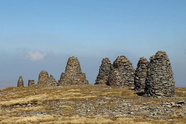
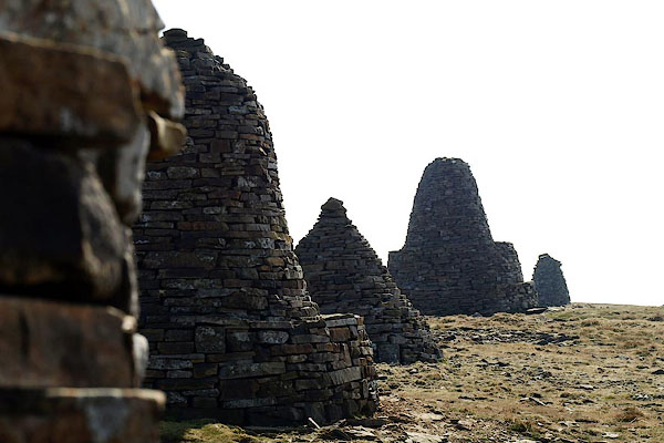
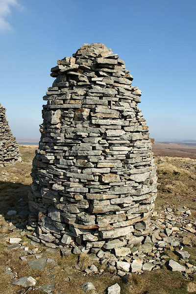
| source data:- | courtesy of English Heritage "Group of nine cairns crossing boundary between Hartley and Winton parishes; mentioned 1635. Drystone construction c10-12 ft high tapering towards top. Very prominent in landscape." |
|||||||||||||||||
|
|
||||||||||||||||||
 BQI98.jpg (taken 3.4.2009) 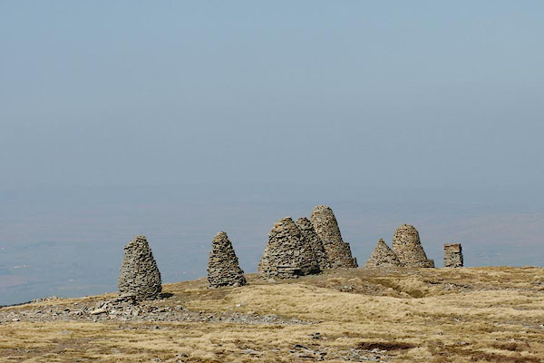 BQI99.jpg (taken 3.4.2009) 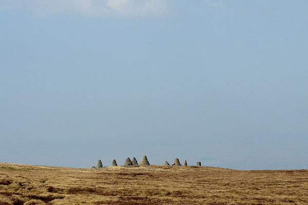 BQJ12.jpg (taken 3.4.2009) 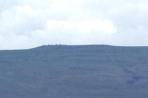 BMI03.jpg From near Whygill Head, a long way away! (taken 7.7.2006) |
||||||||||||||||||
|
|
||||||||||||||||||
| MN photo:- |
The nine cairns from S to N:- |
|||||||||||||||||
 BQJ01.jpg (taken 3.4.2009) 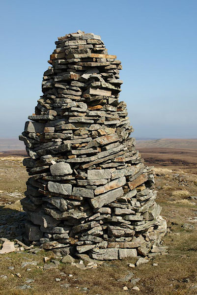 BQJ02.jpg (taken 3.4.2009) 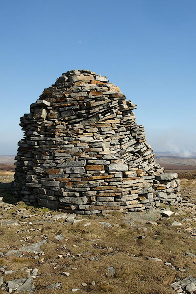 BQJ03.jpg (taken 3.4.2009) 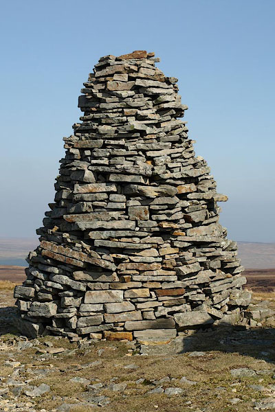 BQJ04.jpg (taken 3.4.2009) 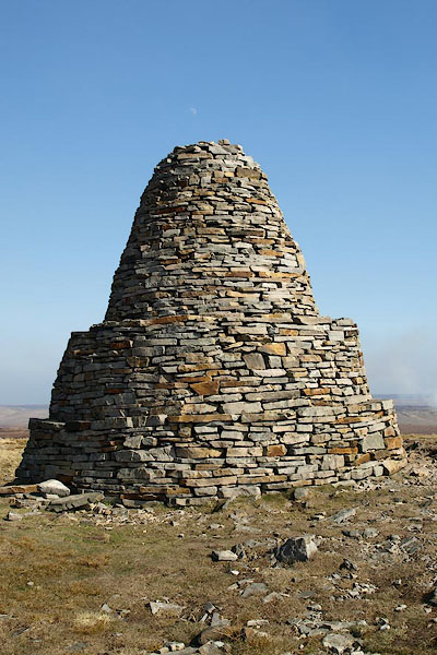 BQJ05.jpg (taken 3.4.2009) 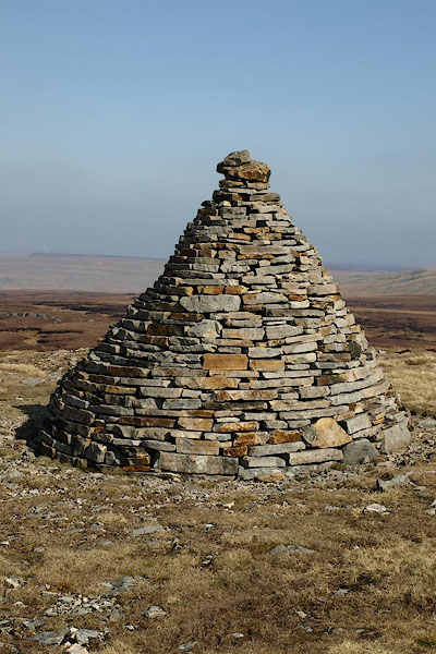 BQJ06.jpg (taken 3.4.2009) 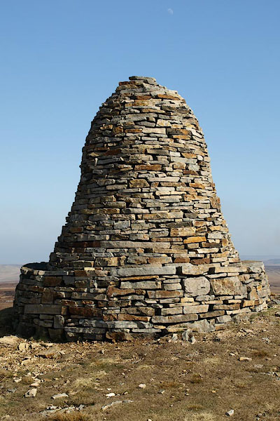 BQJ07.jpg (taken 3.4.2009) 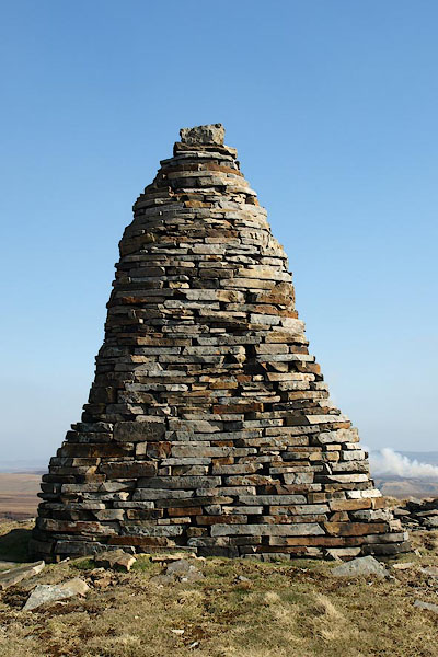 BQJ08.jpg (taken 3.4.2009) 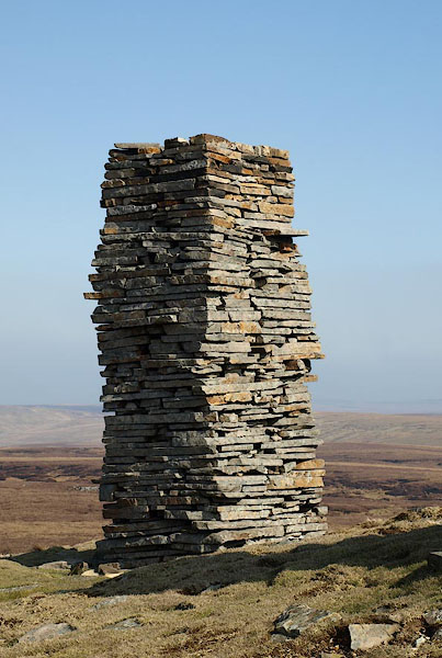 BQJ09.jpg (taken 3.4.2009) |
||||||||||||||||||
|
|
||||||||||||||||||
| hearsay:- |
It is said that the cairns were made to frighten off invading Scots, who were meant
to think that an english army was camped on the hill. |
|||||||||||||||||
|
|
||||||||||||||||||
Lakes Guides menu.