Old Cumbria Gazetteer
 |
 |
|
||
| Patterdale | ||||
| civil parish:- | Patterdale (formerly Westmorland) | |||
| county:- | Cumbria | |||
| locality type:- | locality | |||
| locality type:- | buildings | |||
| locality type:- | valley | |||
| coordinates:- | NY39411608 (etc) | |||
| 1Km square:- | NY3916 | |||
| 10Km square:- | NY31 | |||
|
|
||||
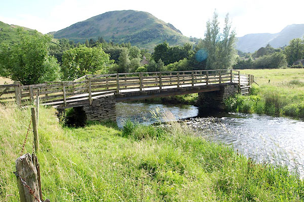
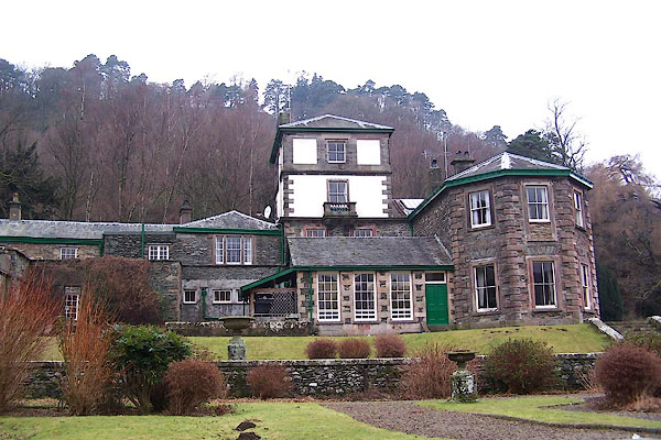
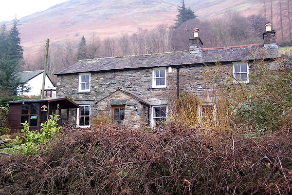
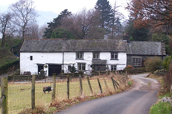
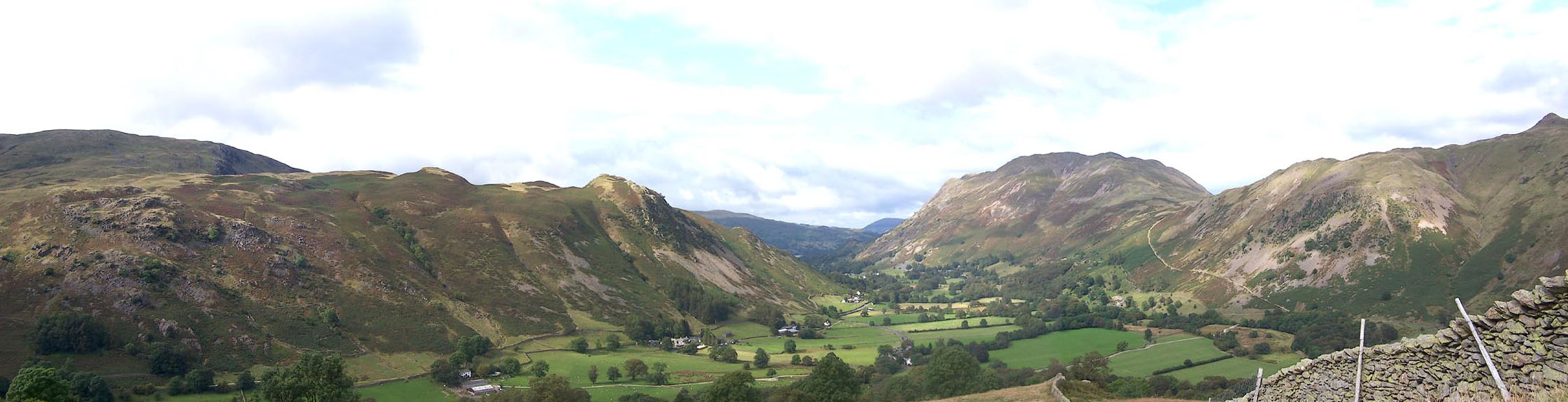
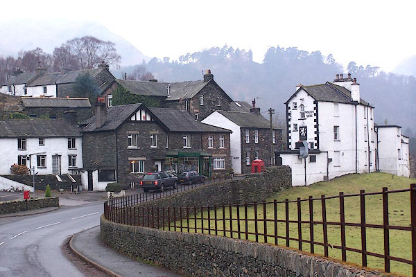 BLN66.jpg (taken 7.1.2006) 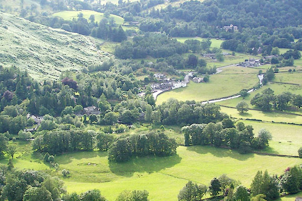 BRA10.jpg From Patterdale Common. (taken 6.7.2009) |
||||
|
|
||||
| evidence:- | old map:- OS County Series (Wmd 12 11) placename:- Patterdale |
|||
| source data:- | Maps, County Series maps of Great Britain, scales 6 and 25
inches to 1 mile, published by the Ordnance Survey, Southampton,
Hampshire, from about 1863 to 1948. |
|||
|
|
||||
| evidence:- | old map:- Saxton 1579 placename:- Paterdale |
|||
| source data:- | Map, hand coloured engraving, Westmorlandiae et Cumberlandiae Comitatus ie Westmorland
and Cumberland, scale about 5 miles to 1 inch, by Christopher Saxton, London, engraved
by Augustinus Ryther, 1576, published 1579-1645.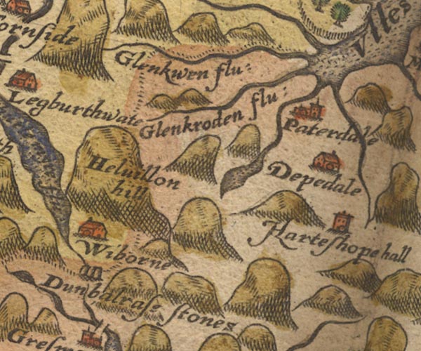 Sax9NY31.jpg Church, symbol for a parish or village, with a parish church. "Paterdale" item:- private collection : 2 Image © see bottom of page |
|||
|
|
||||
| evidence:- | old map:- Keer 1605 placename:- Paterdale |
|||
| source data:- | Map, hand coloured engraving, Westmorland and Cumberland, scale
about 16 miles to 1 inch, probably by Pieter van den Keere, or
Peter Keer, about 1605 edition perhaps 1676. click to enlarge click to enlargeKER8.jpg "Paterdale" dot, circle and tower; village item:- Dove Cottage : 2007.38.110 Image © see bottom of page |
|||
|
|
||||
| evidence:- | old map:- Speed 1611 (Cmd) placename:- Paterdale |
|||
| source data:- | Map, hand coloured engraving, Cumberland and the Ancient Citie
Carlile Described, scale about 4 miles to 1 inch, by John Speed,
1610, published by J Sudbury and George Humble, Popes Head
Alley, London, 1611-12.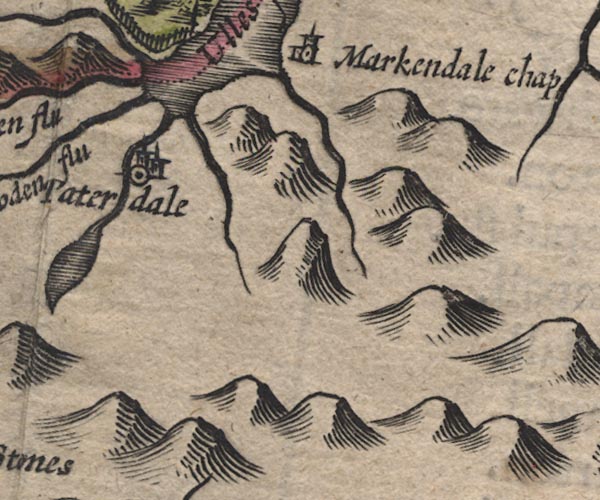 SP11NY41.jpg "Paterdale" circle, building, tower; Westmorland item:- private collection : 16 Image © see bottom of page |
|||
|
|
||||
| evidence:- | old map:- Speed 1611 (Wmd) placename:- Paterdale |
|||
| source data:- | Map, hand coloured engraving, The Countie Westmorland and
Kendale the Cheif Towne, scale about 2.5 miles to 1 inch, by
John Speed, 1610, published by George Humble, Popes Head Alley,
London, 1611-12.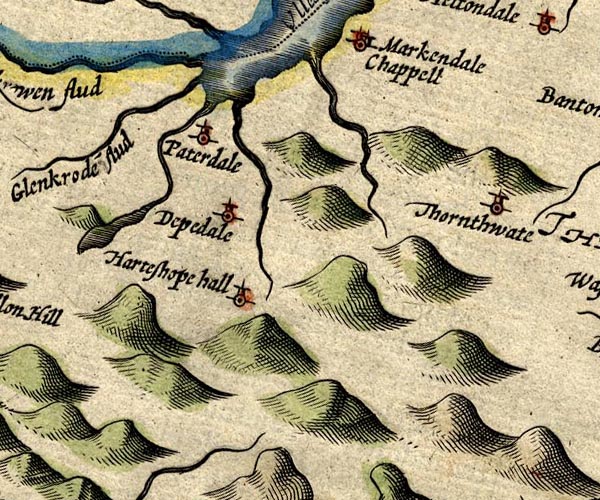 SP14NY41.jpg "Paterdale" circle, tower item:- Armitt Library : 2008.14.5 Image © see bottom of page |
|||
|
|
||||
| evidence:- | old map:- Jenner 1643 placename:- Patterdale |
|||
| source data:- | Table of distances, with map, hand coloured engraving,
Westmerland ie Westmorland, scale about 16 miles to 1 inch,
engraved by Jacob van Langeren, published by Thomas Jenner,
Cornhill, London, 1643. JEN3Sq.jpg "Patterdale" dot, circle, tower item:- private collection : 52.Wmd Image © see bottom of page |
|||
|
|
||||
| evidence:- | old map:- Jansson 1646 placename:- Paterdale |
|||
| source data:- | Map, hand coloured engraving, Cumbria and Westmoria, ie
Cumberland and Westmorland, scale about 3.5 miles to 1 inch, by
John Jansson, Amsterdam, Netherlands, 1646.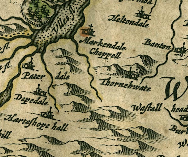 JAN3NY41.jpg "Paterdale" Buildings and tower. item:- JandMN : 88 Image © see bottom of page |
|||
|
|
||||
| evidence:- | hearth tax returns:- Hearth Tax 1670 placename:- Patterdaill |
|||
| source data:- | Records, hearth tax returns, exchequer duplicates, Westmorland,
1670. "Patterdaill" |
|||
|
|
||||
| evidence:- | old map:- Seller 1694 (Wmd) placename:- Paterdale |
|||
| source data:- | Map, hand coloured engraving, Westmorland, scale about 8 miles
to 1 inch, by John Seller, 1694. click to enlarge click to enlargeSEL7.jpg "Paterdale" circle, italic lowercase text; settlement or house item:- Dove Cottage : 2007.38.87 Image © see bottom of page |
|||
|
|
||||
| evidence:- | old map:- Morden 1695 (Cmd) placename:- Paterdale |
|||
| source data:- | Map, uncoloured engraving, Cumberland, scale about 4 miles to 1
inch, by Robert Morden, 1695, published by Abel Swale, the
Unicorn, St Paul's Churchyard, Awnsham, and John Churchill, the
Black Swan, Paternoster Row, London, 1695-1715. MD12NY41.jpg "Paterdale" Circle, building and tower. item:- JandMN : 90 Image © see bottom of page |
|||
|
|
||||
| evidence:- | old map:- Morden 1695 (Wmd) placename:- Paterdale |
|||
| source data:- | Map, hand coloured engraving, Westmorland, scale about 2.5 miles to 1 inch, by Robert
Morden, published by Abel Swale, the Unicorn, St Paul's Churchyard, Awnsham, and John
Churchill, the Black Swan, Paternoster Row, London, 1695.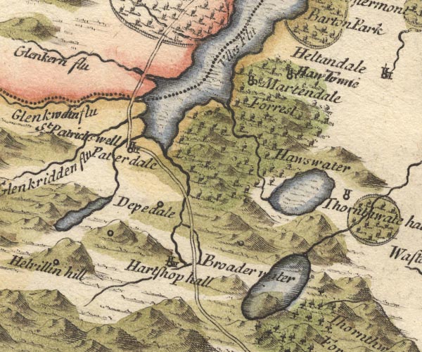 MD10NY41.jpg "Paterdale" Circle, building and tower. item:- JandMN : 24 Image © see bottom of page |
|||
|
|
||||
| evidence:- | old map:- Badeslade 1742 placename:- Paterdale |
|||
| source data:- | Map, uncoloured engraving, A Map of Westmorland North from
London, scale about 10 miles to 1 inch, with descriptive text,
by Thomas Badeslade, London, engraved and published by William
Henry Toms, Union Court, Holborn, London, 1742. click to enlarge click to enlargeBD12.jpg "Paterdale" circle, italic lowercase text; village, hamlet or locality item:- Dove Cottage : 2007.38.62 Image © see bottom of page |
|||
|
|
||||
| evidence:- | old map:- Simpson 1746 map (Wmd) placename:- Paterdale |
|||
| source data:- | Map, uncoloured engraving, Westmorland, scale about 8 miles to 1
inch, printed by R Walker, Fleet Lane, London, 1746.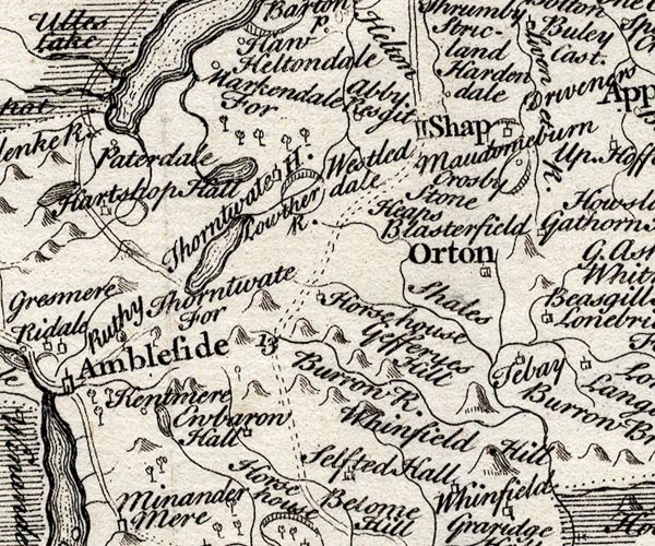 SMP2NYK.jpg "Paterdale" Circle. item:- Dove Cottage : 2007.38.59 Image © see bottom of page |
|||
|
|
||||
| evidence:- | old map:- Bowen and Kitchin 1760 placename:- Paterdale |
|||
| source data:- | Map, hand coloured engraving, A New Map of the Counties of
Cumberland and Westmoreland Divided into their Respective Wards,
scale about 4 miles to 1 inch, by Emanuel Bowen and Thomas
Kitchin et al, published by T Bowles, Robert Sayer, and John
Bowles, London, 1760.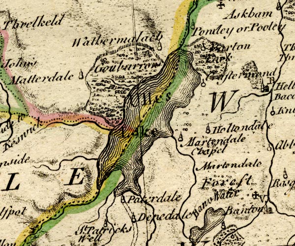 BO18NY31.jpg "Paterdale" circle, tower item:- Armitt Library : 2008.14.10 Image © see bottom of page |
|||
|
|
||||
| evidence:- | old map:- Jefferys 1770 (Wmd) placename:- Patterdale |
|||
| source data:- | Map, 4 sheets, The County of Westmoreland, scale 1 inch to 1
mile, surveyed 1768, and engraved and published by Thomas
Jefferys, London, 1770.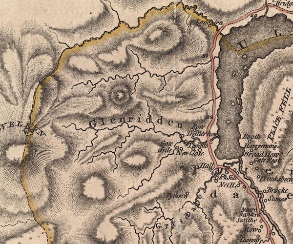 J5NY31NE.jpg 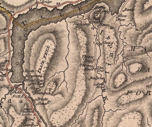 J5NY41NW.jpg "Patterdale" area item:- National Library of Scotland : EME.s.47 Images © National Library of Scotland |
|||
|
|
||||
| evidence:- | old map:- Donald 1774 (Cmd) placename:- Patterdale |
|||
| source data:- | Map, hand coloured engraving, 3x2 sheets, The County of Cumberland, scale about 1
inch to 1 mile, by Thomas Donald, engraved and published by Joseph Hodskinson, 29
Arundel Street, Strand, London, 1774.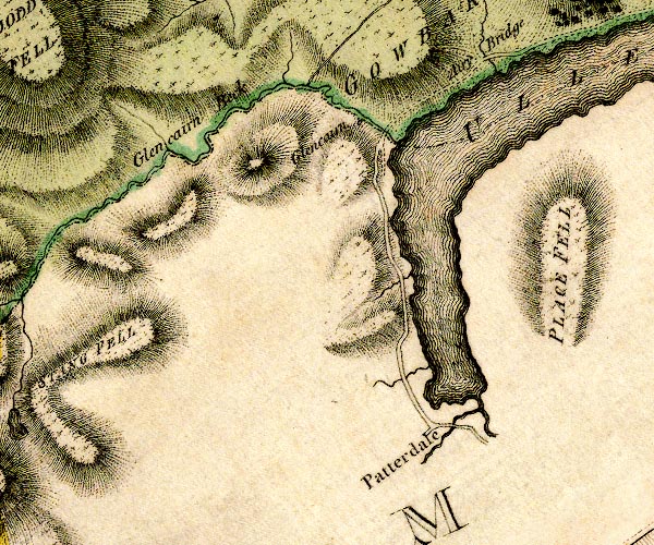 D4NY31NE.jpg "Patterdale" no symbol, labelled in upright lowercase as a village item:- Carlisle Library : Map 2 Image © Carlisle Library |
|||
|
|
||||
| evidence:- | descriptive text:- West 1778 (11th edn 1821) placename:- Patrick's Dale |
|||
| source data:- | Guide book, A Guide to the Lakes, by Thomas West, published by
William Pennington, Kendal, Cumbria once Westmorland, and in
London, 1778 to 1821. goto source goto sourceMr Cumberland's Ode to the Sun, 1776 Page 228:- "... let her naiads yield to thee, / And lowly bend the subject knee, / Imperial lake of Patrick's dale! [1] / ..." "[1] This alludes to the great lake of Ulls-water, situate in Patterdale, i.e. Patrick's dale, a scene of grandeur and sublimity ..." |
|||
|
|
||||
| evidence:- | old map:- West 1784 map placename:- Patterdale |
|||
| source data:- | Map, hand coloured engraving, A Map of the Lakes in Cumberland,
Westmorland and Lancashire, scale about 3.5 miles to 1 inch,
engraved by Paas, 53 Holborn, London, about 1784.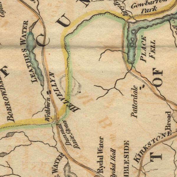 Ws02NY31.jpg item:- Armitt Library : A1221.1 Image © see bottom of page |
|||
|
|
||||
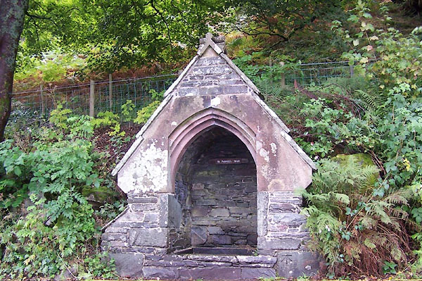
| evidence:- | old text:- Clarke 1787 placename:- Patterdale placename:- Patrickdale item:- mining |
|||
| source data:- | Guide book, A Survey of the Lakes of Cumberland, Westmorland,
and Lancashire, written and published by James Clarke, Penrith,
Cumberland, and in London etc, 1787; published 1787-93. goto source Page 32:- "..." "Patterdale belonged formerly to the barons of Kendale, one tenement excepted, which is now the property of John Mounsey, Esq; of Patterdale Hall. Accordingly we find in Hartsop Hall in Patterdale, the same armorial bearings as in Barton Church, viz. three stags heads, which Guillim says were the bearing of the name of Faldo, in the county of Kent. After some alienations by marriage, the manors of Pless-Fell in Patterdale, Barton, Griesdale, and Martindale, were purchased of Barbara and Anne, the daughters of the Earl of Sussex, by Sir William Musgrave. The whole Dale consists at present of five small manors; Hartsop, the property of the Earl of Lonsdale; Deep-Dale, of the Duke of Norfolk; Griesdale and Pless-Fell, of William Hassel, Esq; of Dalemain; and Glenridding, of John Mounsey, Esquire." "Patterdale is called in the Bishop's register Patrickdale, which is probably its proper name; the corruption being very easy, and the church being dedicated to St Patrick, makes it still more probable. A little below the Hall is a well called St Patrick's Well, ..." goto sourcePage 33:- "..." "Patterdale, though now the poorest place that I am acquainted with, was once the seat of peace and plenty. Almost every man had a small freehold, whose annual produce, (though perhaps not equal to the daily expenditure of the rich and gay,) not only maintained him and his family in a comfortable manner, but even enabled many among them to amass small sums of money. The scene is now changed; vice and poverty sit pictured in almost every countenance, and the rustic fireside is no longer the abode of peace and contentment. The lamentable change took place about thirty years ago: at that time some lead mines wre (sic) wrought in this Dale, ..." |
|||
|
|
||||
| evidence:- | old text:- Clarke 1787 placename:- Patterdale item:- fox; fox hound |
|||
| source data:- | Guide book, A Survey of the Lakes of Cumberland, Westmorland,
and Lancashire, written and published by James Clarke, Penrith,
Cumberland, and in London etc, 1787; published 1787-93. goto source Page 192 (numbered 188):- "..." "Foxes we have not many, owing to the pains the shepherds take to destroy them: of their cunning it is unnecessary to say any thing, ... Some foxes run when hunted a long time, others not so much, as some hares. A remarkable instance of one I shall here give the reader: A farmer of the Duke of Norfolk's in Patterdale, went out one Saturday afternoon a shepherding, his hound dog (Mountain) followed him, and upon a mountain-side unkenneled a fox; this was about two o'clock, and the farmer being busy did not pursue them; the dog did not return home that evening, nor was heard of till next day; when, as the people were coming out of the church (Patterdale) the dog was just passing it, hardly ever giving mouth, and the fox was about forty yards before him; he made shift to get half a mile further, when he run into a garden and laid him down under a gooseberry tree; the dog was so fatigued that he lay down beside him, without offering to lay hold of him, and a man with a pitch-fork killed the fox: they afterwards heard that the dog and fox had been at Rydal, and on the Saturday evening at Wythburn, and at Legberthwaite on the Sunday morning; they must therefore have run twenty hours, which at ten miles an hour is 200 miles: but I am willing to believe that they run many more miles, as when seen at the different places the dog was never far behind him, for no one of those who saw them ever gave an account of them being more than three or 400 yards distant. The dog was a very swift one, and when they passed Patterdale church they were above a footman's pace, yet all ran from the church, men, women, and children. The owner of the dog is still living, his name is Anthony Thompson: when that dog grew old, he never run with the other hounds after a fox was unkenneled, but took a road of his own, was generally in at the death, and often had killed the fox before the other dogs came up, unless the fox run directly to his holds." |
|||
|
|
||||
| evidence:- | old map:- Clarke 1787 map (Ullswater) |
|||
| source data:- | Map, A Map of the Lake Ullswater and its Environs, scale about
6.5 ins to 1 mile, by James Clarke, engraved by S J Neele, 352
Strand, published by James Clarke, Penrith, Cumberland and in
London etc, 1787.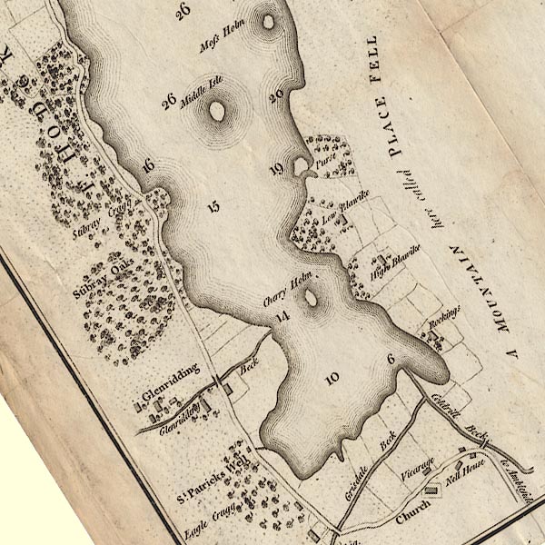 CL4NY31Y.jpg item:- private collection : 10.4 Image © see bottom of page |
|||
|
|
||||
| evidence:- | old map:- Cary 1789 (edn 1805) placename:- Pater Dale |
|||
| source data:- | Map, uncoloured engraving, Westmoreland, scale about 2.5 miles
to 1 inch, by John Cary, London, 1789; edition 1805.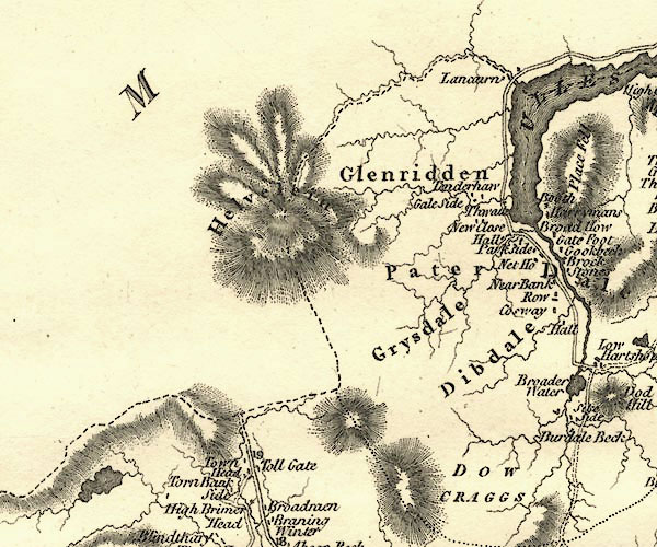 CY24NY31.jpg "Pater Dale" area item:- JandMN : 129 Image © see bottom of page |
|||
|
|
||||
| evidence:- | old map:- Laurie and Whittle 1806 placename:- Patterdale |
|||
| source data:- | Road map, Completion of the Roads to the Lakes, scale about 10
miles to 1 inch, by Nathaniel Coltman? 1806, published by Robert
H Laurie, 53 Fleet Street, London, 1834. click to enlarge click to enlargeLw18.jpg "Patterdale" village or other place item:- private collection : 18.18 Image © see bottom of page |
|||
|
|
||||
| evidence:- | old map:- Cooper 1808 placename:- Patterdale |
|||
| source data:- | Map, hand coloured engraving, Westmoreland ie Westmorland, scale
about 9 miles to 1 inch, by H Cooper, 1808, published by R
Phillips, Bridge Street, Blackfriars, London, 1808. click to enlarge click to enlargeCOP4.jpg "Patterdale" circle; village or hamlet item:- Dove Cottage : 2007.38.53 Image © see bottom of page |
|||
|
|
||||
| evidence:- | old print:- Green 1810 (plate 56) placename:- Vale of Patterdale |
|||
| source data:- | Print, soft ground etching, Vale of Patterdale, Westmorland, by William Green, Ambleside,
Westmorland, 1808.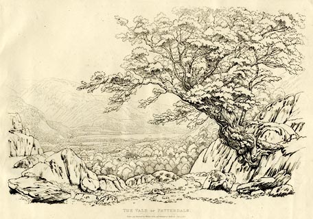 click to enlarge click to enlargeGN1256.jpg Plate 56 in Sixty Studies from Nature, 1810. printed at top right:- "[56]" printed at bottom:- "VALE OF PATTERDALE. / Drawn and Engraved by William Green, and Published at Ambleside, June 24, 1808." watermark:- "J WHATMAN / 1813" item:- Armitt Library : A6641.56 Image © see bottom of page |
|||
|
|
||||
| evidence:- | old text:- Wordsworth 1810 placename:- Patterdale item:- 1745 Rebellion; communication |
|||
| source data:- | Guide book, A Description of the Scenery of the Lakes, later A
Guide through the District of The Lakes, by William Wordsworth,
1810-35. goto source page 129 "[written 1805] ... In the rebellion of the year 1745, people fled with their valuables from the open country to Patterdale, as a place of refuge secure from the incursions of strangers. At that time, news such as we heard [Battle of Trafalgar] might have been long in penetrating so far into the recesses of the mountains; but now, as you know, the approach is easy, and the communication, in summer time, almost hourly; nor is this strange, for travellers after pleasure are become not less active, and more numerous than those who formerly left their homes for purposes of gain. The priest on the banks of the remotest stream of Lapland will talk familiarly of Buonaparte's last conquests, and discuss the progress of the French revolution, having acquired much of his information from adventurers impelled by curiosity alone. ..." |
|||
|
|
||||
| evidence:- | old print with text:- Farington 1816 placename:- Patterdale placename:- St Patrick's Dale |
|||
| source data:- | Print, uncoloured engraving and descriptive text, The Head of Ulswater, Patterdale,
and the Mountain Helvellyn, Westmorland, drawn by Joseph Farington, engraved by Samuel
Middiman, published by T Cadell and W Davies, Strand, London, 1815.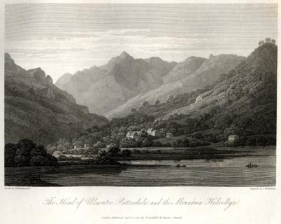 click to enlarge click to enlargeFA0404.jpg printed, bottom left, right, centre "Drawn by J. Farington R.A. / Engraved by S. Middiman. / The Head of Ulswater, Patterdale, and the Mountain Helvellyn. / London Published Septr. 15, 1815, by T. Cadell &W. Davies, Strand." Descriptive text:- "THE HEAD OF ULSWATER, PATTERDALE, AND THE MOUNTAIN HELVELLYN." "THE view, delineated in this engraving, represents the grandest part of the whole scenery. The village of Patterdale, which is situated on a rising ground, and one or two white farm-houses, peep out from among trees, beneath scowling mountains, with corn and meadow land sloping gently in front to the Lake, and here and there a scattered grove. Patterdale, or Patrick's-dale, takes its name from the baptisms, which are reported to have been here performed by that Saint, about fourteen hundred years ago: its truly pastoral valley is watered by the river Coldrill, which contributes to replenish the Lake. Nothing can surpass the verdure of its inclosures, which are unhappily exposed to frequent inundations, and have sometimes been under water half the season. ..." item:- Armitt Library : A6666.4 Image © see bottom of page |
|||
|
|
||||
| evidence:- | old map:- Otley 1818 placename:- Patterdale |
|||
| source data:- | Map, uncoloured engraving, The District of the Lakes,
Cumberland, Westmorland, and Lancashire, scale about 4 miles to
1 inch, by Jonathan Otley, 1818, engraved by J and G Menzies,
Edinburgh, Scotland, published by Jonathan Otley, Keswick,
Cumberland, et al, 1833.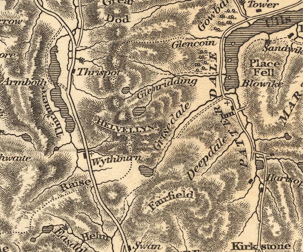 OT02NY31.jpg "PATTERDALE" item:- JandMN : 48.1 Image © see bottom of page |
|||
|
|
||||
| evidence:- | descriptive text:- Otley 1823 (5th edn 1834) item:- geology |
|||
| source data:- | Guide book, A Concise Description of the English Lakes, the
mountains in their vicinity, and the roads by which they may be
visited, with remarks on the mineralogy and geology of the
district, by Jonathan Otley, published by the author, Keswick,
Cumberland now Cumbria, by J Richardson, London, and by Arthur
Foster, Kirkby Lonsdale, Cumbria, 1823; published 1823-49,
latterly as the Descriptive Guide to the English Lakes. goto source Page 155:- "The SECOND division [of slate rocks] comprehends the mountains of Eskdale, Wasdale, Ennerdale, Borrowdale, Langdale, Grasmere, Patterdale, Martindale, Mardale, and some adjacent places; including the two highest mountains of the district, Scawfell and Helvellyn, as well as the Old Man at Coniston. All our fine towering crags belong to it; and most of the cascades among the lakes fall over it. There are indeed some lofty precipices in the former division; ..." "..." |
|||
|
|
||||
| evidence:- | old map:- Ford 1839 map placename:- Patterdale |
|||
| source data:- | Map, uncoloured engraving, Map of the Lake District of
Cumberland, Westmoreland and Lancashire, scale about 3.5 miles
to 1 inch, published by Charles Thurnam, Carlisle, and by R
Groombridge, 5 Paternoster Row, London, 3rd edn 1843.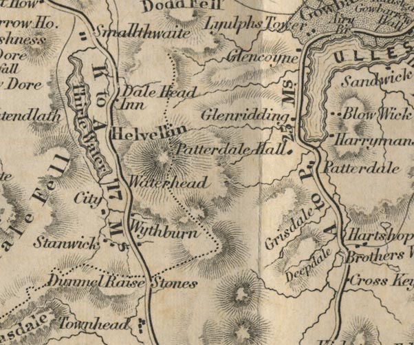 FD02NY31.jpg "Patterdale" item:- JandMN : 100.1 Image © see bottom of page |
|||
|
|
||||
| evidence:- | old map:- Garnett 1850s-60s H placename:- Patterdale |
|||
| source data:- | Map of the English Lakes, in Cumberland, Westmorland and
Lancashire, scale about 3.5 miles to 1 inch, published by John
Garnett, Windermere, Westmorland, 1850s-60s.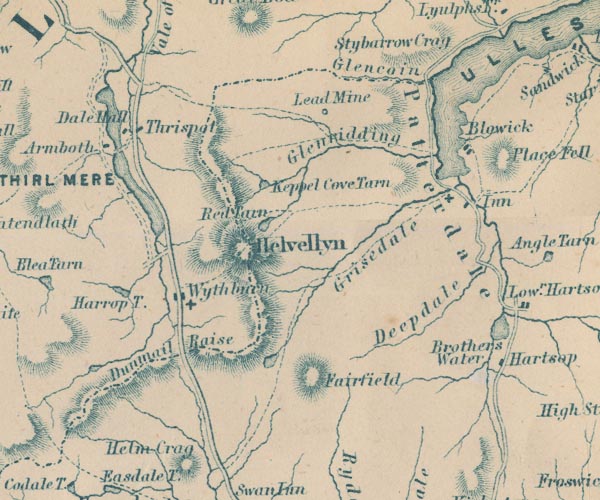 GAR2NY31.jpg "Patterdale" area item:- JandMN : 82.1 Image © see bottom of page |
|||
|
|
||||
 Martineau Directory 1855 Martineau Directory 1855 |
||||
|
|
||||
| evidence:- | old text:- Martineau 1855 item:- placename, Patterdale; Pater noster |
|||
| source data:- | Guide book, A Complete Guide to the English Lakes, by Harriet
Martineau, published by John Garnett, Windermere, Westmorland,
and by Whittaker and Co, London, 1855; published 1855-76. goto source Page 104:- "... Judging from our own experience [Hutton Moor] ... we should say that this part of the journey is always broiling hot or bitterly cold. A bleak high-lying tract it certainly is, where the old monks no doubt suffered much and often in their expeditions. Their paternosters said among the perils of Ullswater, and their Ave Marys here are supposed to have given the names of Patterdale and Matterdale, which become more interesting as soon as their origin is known. ..." |
|||
|
|
||||
| evidence:- | perhaps old map:- Postlethwaite 1877 (3rd edn 1913) |
|||
| source data:- | Map, uncoloured engraving, Map of the Lake District Mining Field, Westmorland, Cumberland,
Lancashire, scale about 5 miles to 1 inch, by John Postlethwaite, published by W H
Moss and Sons, 13 Lowther Street, Whitehaven, Cumberland, 1877 edn 1913.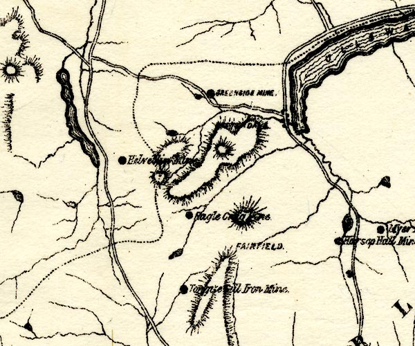 PST2NY31.jpg "[ ]DA[ ]" dots, roads item:- JandMN : 162.2 Image © see bottom of page |
|||
|
|
||||
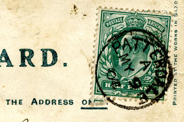 CCS57.jpg Postmark:- "PATTERDALE / A / MY 9 / 0[4]" Stamp - Edward VII, halfpenny, blue green |
||||
|
|
||||
| evidence:- | old map:- Post Office 1850s-1900s placename:- Patterdale |
|||
| source data:- | Post road maps, General Post Office Circulation Map for England
and Wales, for the General Post Office, London, 1850s-1900s. click to enlarge click to enlargePF10Cm.jpg "Patterdale" map date 1892 |
|||
|
|
||||
| evidence:- | old map:- Post Office 1850s-1900s placename:- Patterdale |
|||
| source data:- | Post road maps, General Post Office Circulation Map for England
and Wales, for the General Post Office, London, 1850s-1900s. click to enlarge click to enlargePOF2Cm.jpg "Patterdale" map date 1890 |
|||
|
|
||||
| evidence:- | old map:- Post Office 1850s-1900s placename:- Patterdale |
|||
| source data:- | Post road maps, General Post Office Circulation Map for England
and Wales, for the General Post Office, London, 1850s-1900s. click to enlarge click to enlargePOF8Cm.jpg "Patterdale" map date 1873 |
|||
|
|
||||
| evidence:- | old map:- Post Office 1850s-1900s placename:- Patterdale |
|||
| source data:- | Post road maps, General Post Office Circulation Map for England
and Wales, for the General Post Office, London, 1850s-1900s. click to enlarge click to enlargePOF9Cm.jpg "Patterdale" map date 1863 |
|||
|
|
||||
| :- |
images courtesy of the British Postal Museum and Hampshire CC Museums |
|||
|
|
||||
| evidence:- | old print:- Pearson 1900s placename:- Patterdale |
|||
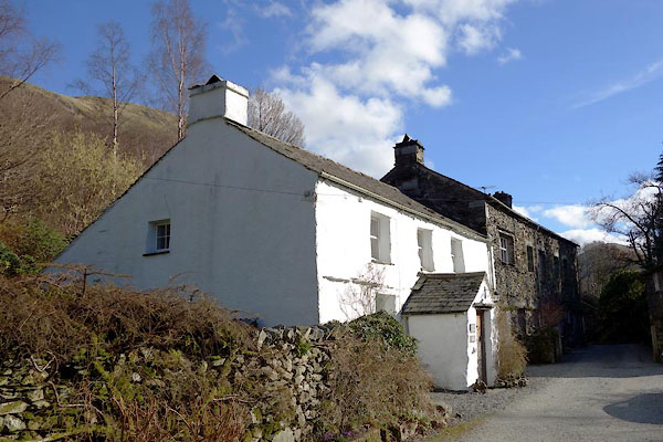
| source data:- | Print, halftone photograph, Old Cottage, near Patterdale Village, Westmorland, published
by C Arthur Pearson, Henrietta Street, London, 1900s.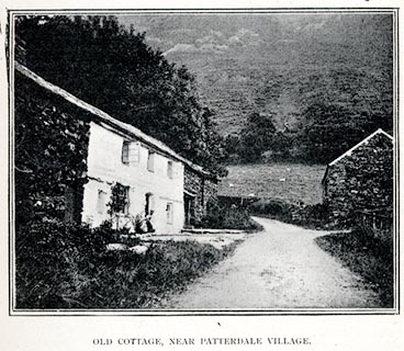 click to enlarge click to enlargePS1E75.jpg On p.213 of Pearson's Gossipy Guide to the English Lakes and Neighbouring Districts. printed at bottom:- "OLD COTTAGE, NEAR PATTERDALE VILLAGE." item:- Armitt Library : A1188.82 Image © see bottom of page |
|||
|
|
||||
| evidence:- | old print:- placename:- Patterdale |
|||
| source data:- | Print, uncoloured engraving, Patterdale, Westmorland, drawn by Dastin? published late
19th century?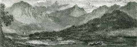 click to enlarge click to enlargePR0345.jpg On a page of The Land We Live In. printed at bottom:- "8.- PATTERDALE." item:- Dove Cottage : 2008.107.345 Image © see bottom of page |
|||
|
|
||||
| evidence:- | old advertisement:- Atkinson 1847 (5th edn 1850) placename:- Patterdale item:- coach; Helvellyn, The; Skiddaw, The |
|||
| source data:- | Advertisement for coaches, Thet Helvellyn and The Skiddaw, running between Ambleside
and Patterdale, Westmorland, and Penrith, Cumberland, 1850.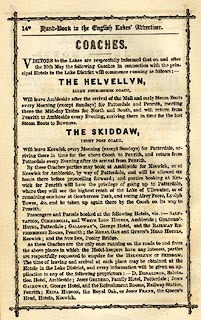 click to enlarge click to enlargeAK2A12.jpg At the end of a Handbook to the English Lakes, 5th edn. item:- Armitt Library : A1144.21 Image © see bottom of page |
|||
|
|
||||
| evidence:- | old print:- Rose 1832-35 |
|||
| source data:- | Print, engraving, Patterdale, going towards Ambleside, Westmorland, by Thomas Allom,
engraved by W Taylor, 1834.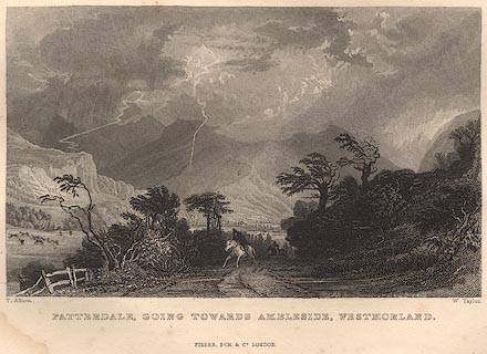 click to enlarge click to enlargeR252.jpg item:- JandMN : 66.30 Image © see bottom of page |
|||
|
|
||||
| evidence:- | old print:- placename:- Patterdale |
|||
| source data:- | Print, uncoloured engraving, Patterdale, drawn by J M W Turner, engraved by J Heath,
published by J Mawman, Poultry, London, 1805.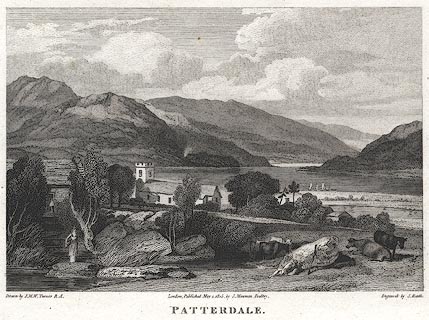 click to enlarge click to enlargePR0376.jpg St Patrick's Church in the midground. printed at bottom left, right, centre:- "Drawn by J. M. W. Turner R.A. / Engrav'd by J. Heath. / London, Published May 1. 1805, by J. Mawman, Poultry. / PATTERDALE." item:- Dove Cottage : 2008.107.376 Image © see bottom of page |
|||
|
|
||||
| evidence:- | old print:- placename:- Patterdale |
|||
| source data:- | Print, engraving, Patterdale, painted by P J de Loutherbourg, engraved by Thomas,
published by J Sewell, Cornhill, London, 1790.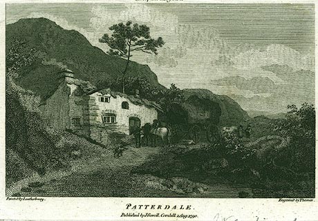 click to enlarge click to enlargePR0361.jpg printed at top:- "European Magazine" printed at bottom left, right, centre:- "Painted by Loutherbourg / Engraved by Thomas. / PATTERDALE. / Published by J Sewell, Cornhill 1 Aug. 1790." item:- Dove Cottage : 2008.107.361 Image © see bottom of page |
|||
|
|
||||
| evidence:- | old print with text:- Farington 1789 (plate 12) |
|||
| source data:- | Print, engraving, Patterdale from Martendale Fell, painted by Joseph Farington, engraved
by W Byrne and T Medland, published by W Byrne, 79 Titchfield Street, London, 1788.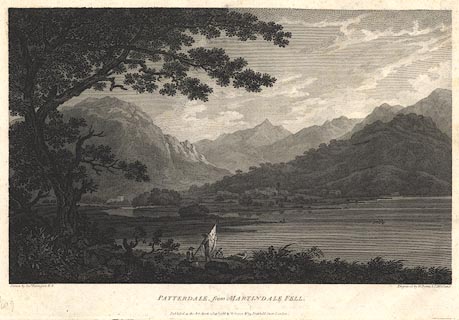 click to enlarge click to enlargeBNF13.jpg Behind St Patrick's Church is St Sunday Crag, the peak in the background is perhaps Striding Edge end on, Patterdale Hall is right of centre. Plate 12 from Views of the Lakes, &c, in Cumberland and Westmorland, published 1789; with descriptive text:- "PATTERDALE, from MARTINDALE-FELL." "THE View here represented is taken from the Edge of Martindale-Fell, looking over a Bay of the Lake, directly into Patterdale, where the Chapel and Palace are conspicuous. The Mountains seen in the Distance belong to the same Chain with Helvellyn. These Hills having their Summits sharp and pointed resemble more the Alpine Forms than any which are to be met with in this Country. It is worthy of Remark that in any one Range or System of Mountains a great Similarity of Outline generally prevails; the same Strata perhaps, by whatever Cause the Inequalities of the Earth's Surface might have been produced, naturally disposing themselves into the same or similar Forms." item:- Dove Cottage : Lowther.26 Image © see bottom of page |
|||
|
|
||||
| evidence:- | old print:- Lowther 1780s-90s |
|||
| source data:- | Print, engraving, Patterdale, painted by Loutherbourg, engraved by Thomas, late 18th
century.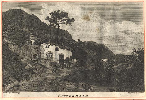 click to enlarge click to enlargeBNF12.jpg item:- Dove Cottage : Lowther.25 Image © see bottom of page |
|||
|
|
||||
 Click to enlarge BOE36.jpg View north from a little way up Deepdale. (taken 11.9.2007) |
||||
|
|
||||
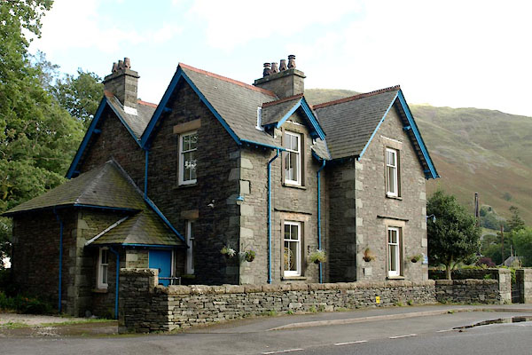
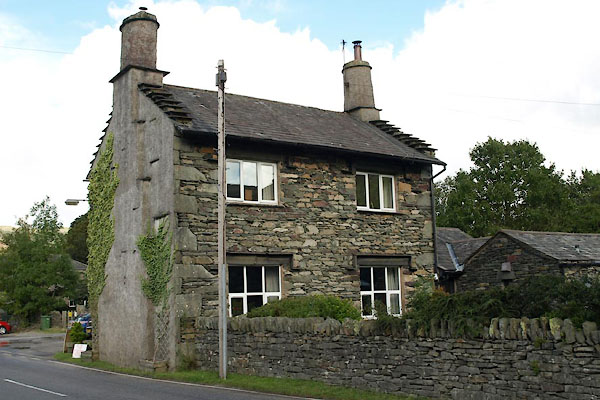
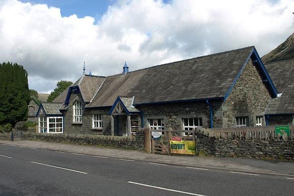
| places:- |
|
|||
|
||||
|
||||
|
||||
|
||||
|
||||
|
||||
|
||||
|
||||
|
||||
|
||||
|
||||
|
||||
|
||||
|
||||
|
||||
|
||||
|
||||
|
||||
|
||||
|
||||
|
||||
|
||||
|
||||
|
||||
|
||||
|
||||
|
||||
|
||||
|
||||
|
||||
|
||||
|
||||
|
||||
|
||||
|
||||
|
||||
|
||||
|
||||
|
||||
Lakes Guides menu.