Old Cumbria Gazetteer
 |
 |
|
||
| Petteril, River | ||||
| runs into:- |  Eden, River Eden, River |
|||
|
|
||||
| civil parish:- | Hutton (formerly Cumberland) | |||
| civil parish:- | Greystoke (formerly Cumberland) | |||
| civil parish:- | Dacre (formerly Cumberland) | |||
| civil parish:- | Catterlen (formerly Cumberland) | |||
| civil parish:- | Skelton (formerly Cumberland) | |||
| civil parish:- | Penrith (formerly Cumberland) | |||
| civil parish:- | Hesket (formerly Cumberland) | |||
| civil parish:- | St Cuthbert Without (formerly Cumberland) | |||
| civil parish:- | Carlisle (formerly Cumberland) | |||
| county:- | Cumbria | |||
| locality type:- | river | |||
| locality type:- | boundary | |||
| locality type:- | parish boundary | |||
| 1Km square:- | NY4935 (etc etc) | |||
| 10Km square:- | NY32 | |||
| 10Km square:- | NY42 | |||
| 10Km square:- | NY43 | |||
| 10Km square:- | NY44 | |||
| 10Km square:- | NY45 | |||
|
|
||||
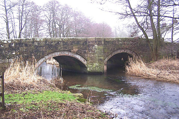
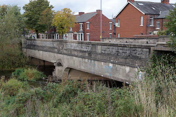
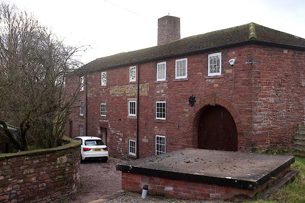
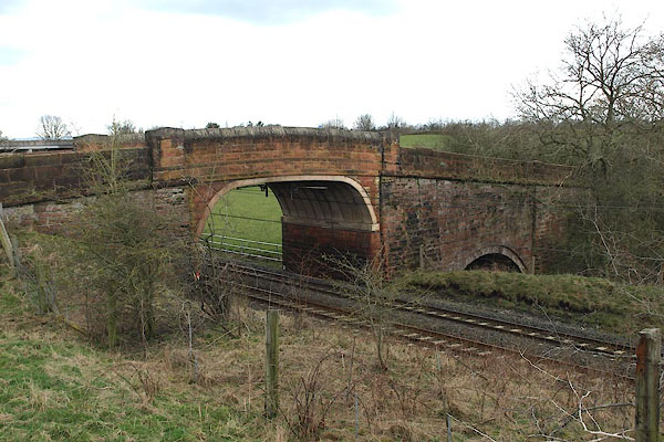
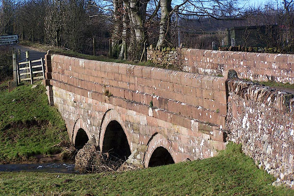
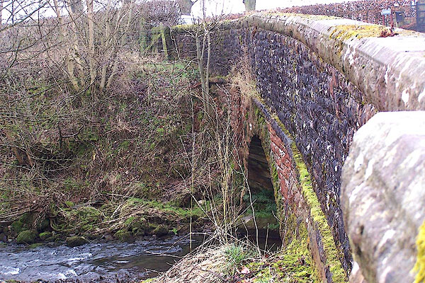
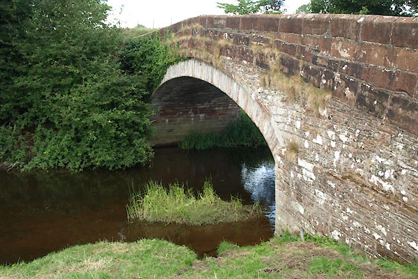
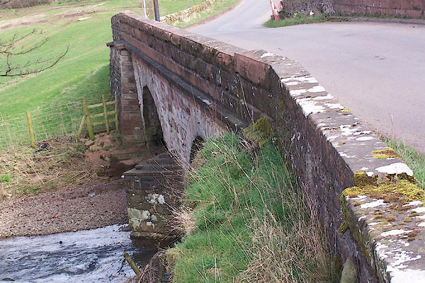
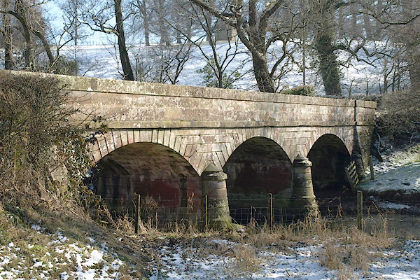
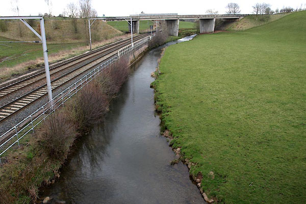
 BQG06.jpg At Storch Bridge. (taken 14.3.2009) 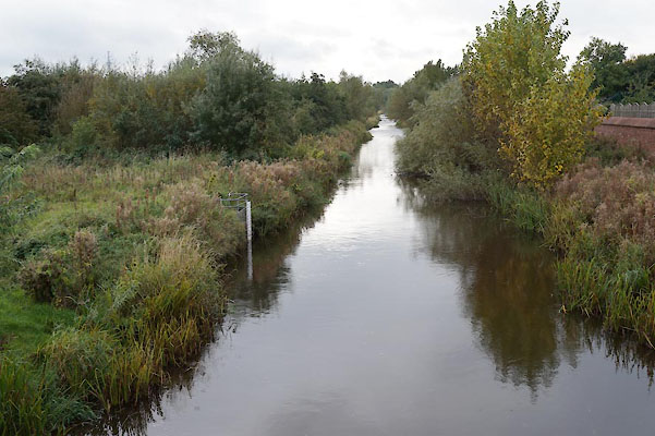 BZN16.jpg At Botcherby Bridge. (taken 20.10.2013) |
||||
|
|
||||
| evidence:- | old map:- OS County Series (Cmd 23 4) placename:- Petterill, River |
|||
| source data:- | Maps, County Series maps of Great Britain, scales 6 and 25
inches to 1 mile, published by the Ordnance Survey, Southampton,
Hampshire, from about 1863 to 1948. OS County Series (Cmd 23 12) OS County Series (Cmd 39 6) OS County Series (Cmd 49 14) OS County Series (Cmd 49 15) OS County Series (Cmd 58 1) "River Petterill" |
|||
|
|
||||
| evidence:- | old map:- Gough 1350s-60s |
|||
| source data:- | Map, colour photozincograph copy, reduced size facsimile, Gough
Map of Britain, scale about 28.5 miles to 1 inch, published by
the Ordnance Survey, Southampton, Hampshire, 1875.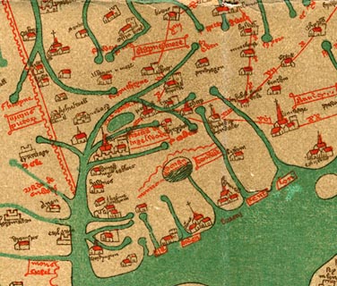 click to enlarge click to enlargeGgh1Cm.jpg "fl [ ]erell" Tributary to the Eden. item:- JandMN : 33 Image © see bottom of page |
|||
|
|
||||
| evidence:- | old map:- Gough 1350s-60s |
|||
| source data:- | Map, lithograph facsimile, Gough Map of Britain, 20 miles to 1
inch? published by the Ordnance Survey, Southampton, Hampshire,
1935.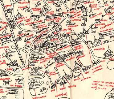 click to enlarge click to enlargeGgh2Cm.jpg "fl [ ]erell" Tributary to the Eden. item:- JandMN : 34 Image © see bottom of page |
|||
|
|
||||
| evidence:- | old map:- Saxton 1579 placename:- Petterell Flu. |
|||
| source data:- | Map, hand coloured engraving, Westmorlandiae et Cumberlandiae Comitatus ie Westmorland
and Cumberland, scale about 5 miles to 1 inch, by Christopher Saxton, London, engraved
by Augustinus Ryther, 1576, published 1579-1645.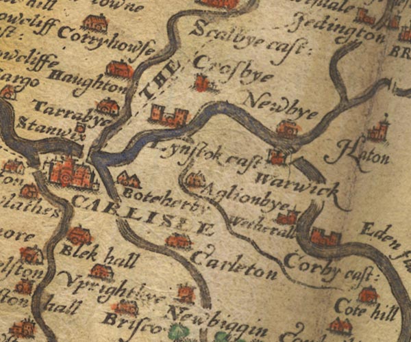 Sax9NY45.jpg 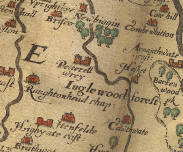 Sax9NY44.jpg 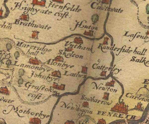 Sax9NY43.jpg 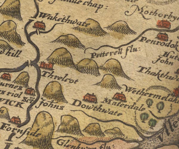 Sax9NY32.jpg "Petterell flu:" item:- private collection : 2 Image © see bottom of page |
|||
|
|
||||
| evidence:- | old map:- Mercator 1595 (edn?) placename:- |
|||
| source data:- | Map, hand coloured engraving, Northumbria, Cumberlandia, et
Dunelmensis Episcopatus, ie Northumberland, Cumberland and
Durham etc, scale about 6.5 miles to 1 inch, by Gerard Mercator,
Duisberg, Germany, about 1595.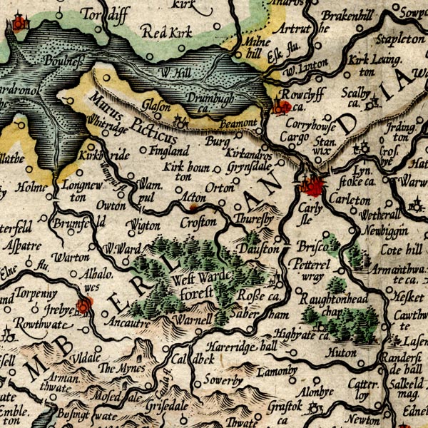 MER8CumC.jpg "" double line with stream lines; river, running into the Eden 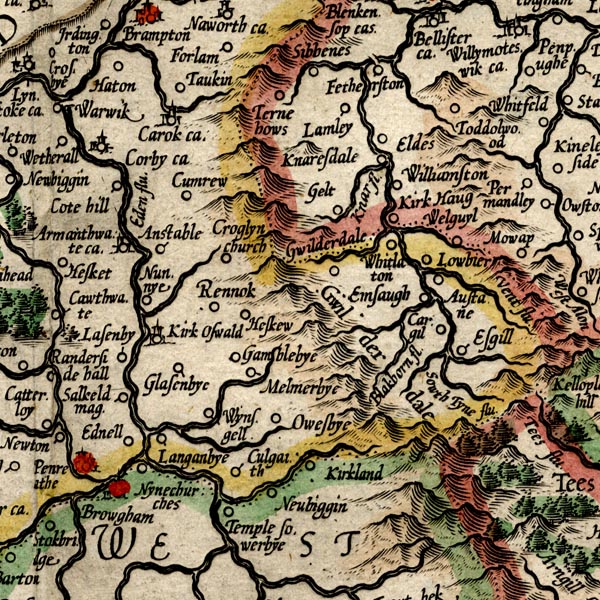 MER8CumD.jpg "" double line with stream lines; river, incorrectly shown running into the Eamont at Brougham 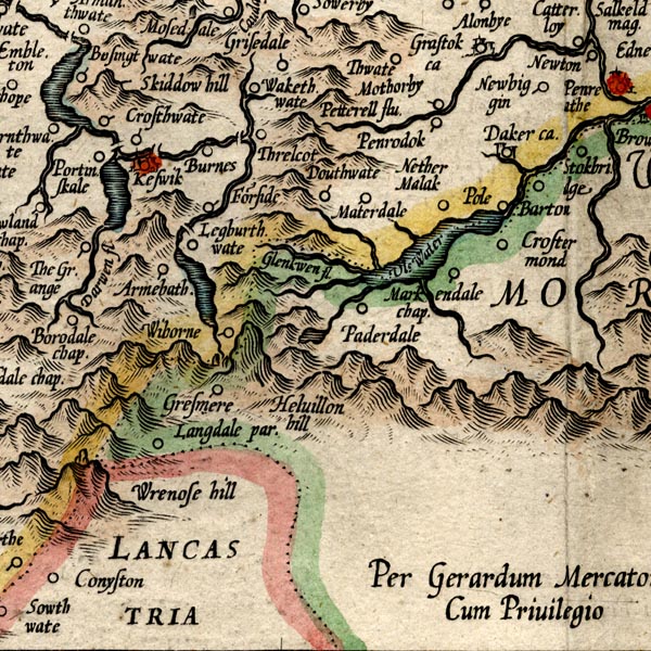 MER8CumF.jpg "Petterell flu." double line with stream lines; river item:- JandMN : 169 Image © see bottom of page |
|||
|
|
||||
| evidence:- | old map:- Keer 1605 |
|||
| source data:- | Map, hand coloured engraving, Westmorland and Cumberland, scale
about 16 miles to 1 inch, probably by Pieter van den Keere, or
Peter Keer, about 1605 edition perhaps 1676. click to enlarge click to enlargeKER8.jpg "" double wiggly line, tapering to single; river item:- Dove Cottage : 2007.38.110 Image © see bottom of page |
|||
|
|
||||
| evidence:- | probably old map:- Speed 1611 (Cum/EW) |
|||
| source data:- | Map, hand coloured engraving, Kingdome of Great Britaine and
Ireland, scale about 36 miles to 1 inch, by John Speed, about
1610-11, published by Thomas Bassett, Fleet Street and Richard
Chiswell, St Paul's Churchyard, London, 1676?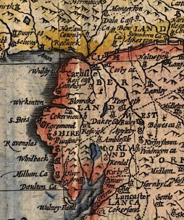 click to enlarge click to enlargeSPD6Cm.jpg tapering wiggly line item:- private collection : 85 Image © see bottom of page |
|||
|
|
||||
| evidence:- | old map:- Speed 1611 (Cmd) placename:- Petterell flud |
|||
| source data:- | Map, hand coloured engraving, Cumberland and the Ancient Citie
Carlile Described, scale about 4 miles to 1 inch, by John Speed,
1610, published by J Sudbury and George Humble, Popes Head
Alley, London, 1611-12.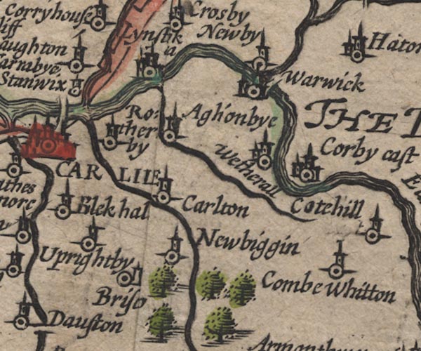 SP11NY45.jpg double line, runs into the Eden 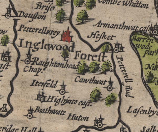 SP11NY44.jpg "Petterell flud" double line item:- private collection : 16 Image © see bottom of page |
|||
|
|
||||
| evidence:- | poem:- Drayton 1612/1622 text placename:- Petterell |
|||
| source data:- | Poem, Poly Olbion, by Michael Drayton, published by published by
John Marriott, John Grismand and Thomas Dewe, and others?
London, part 1 1612, part 2 1622. goto source page 167:- "... Petterell from her Springs, (Not farre from Skidows foot, whence dainty Cauda creeps) Along to overtake her Soveraigne Eden sweeps, ..." |
|||
|
|
||||
| evidence:- | old map:- Drayton 1612/1622 placename:- Petterel Fl. |
|||
| source data:- | Map, hand coloured engraving, Cumberlande and Westmorlande, by
Michael Drayton, probably engraved by William Hole, scale about
4 or 5 miles to 1 inch, published by John Mariott, John
Grismand, and Thomas Dewe, London, 1622.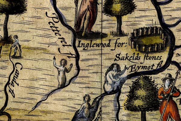 DRY510.jpg "Petterel fl" River, naiad. item:- JandMN : 168 Image © see bottom of page |
|||
|
|
||||
| evidence:- | possibly table of distances:- Simons 1635 |
|||
| source data:- | Table of distances, uncoloured engraving, Cumberland, with a
thumbnail map, scale about 41 miles to 1 inch, by Mathew Simons,
published in A Direction for the English Traviller, 1635.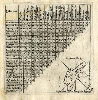 click to enlarge click to enlargeSIM4.jpg on thumbnail map item:- private collection : 50.11 Image © see bottom of page |
|||
|
|
||||
| evidence:- | old map:- Jenner 1643 |
|||
| source data:- | Tables of distances with a maps, Westmerland, scale about 16
miles to 1 inch, and Cumberland, scale about 21 miles to 1 inch,
published by Thomas Jenner, London, 1643; published 1643-80.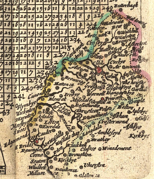 JEN4Sq.jpg wiggly line |
|||
|
|
||||
| evidence:- | old map:- Jansson 1646 |
|||
| source data:- | Map, hand coloured engraving, Cumbria and Westmoria, ie
Cumberland and Westmorland, scale about 3.5 miles to 1 inch, by
John Jansson, Amsterdam, Netherlands, 1646.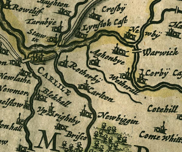 JAN3NY45.jpg 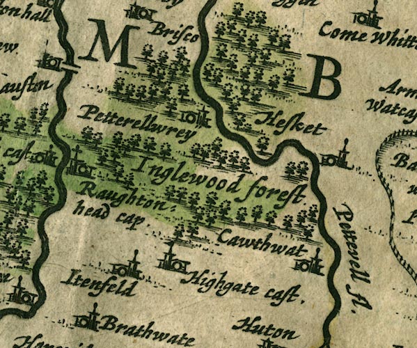 JAN3NY44.jpg "Pettevell fl." 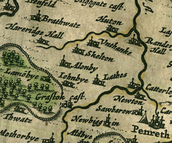 JAN3NY43.jpg 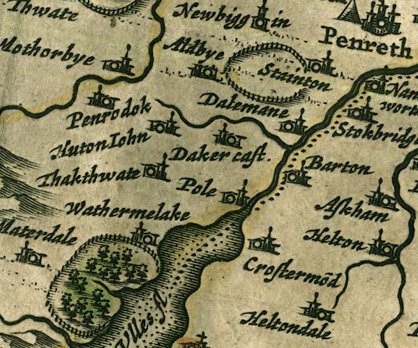 JAN3NY42.jpg 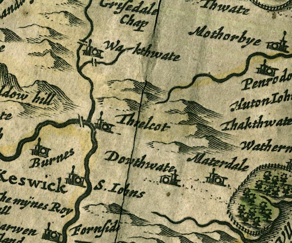 JAN3NY32.jpg Double wiggly line, tapering to single. item:- JandMN : 88 Image © see bottom of page |
|||
|
|
||||
| evidence:- | old map:- Ogilby 1675 (plate 86) placename:- Petterel Fluvius |
|||
| source data:- | Road strip map, uncoloured engraving, the Road from Tinmouth ...
to Carlisle, scale about 1 inch to 1 mile, by John Ogilby,
London, 1675.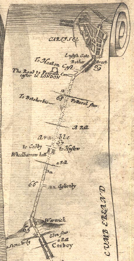 OG86m065.jpg In mile 68, Cumberland. "Petterel fluv:" drawn across the road. item:- JandMN : 73 Image © see bottom of page |
|||
|
|
||||
| evidence:- | old map:- Ogilby 1675 (plate 38) |
|||
| source data:- | Road strip map, hand coloured engraving, continuation of the
Road from London to Carlisle, scale about 1 inch to 1 mile, by
John Ogilby, London, 1675.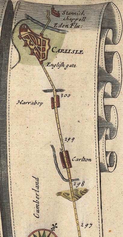 OG38m297.jpg In mile 300, Cumberland. River crossed by the road over a bridge. item:- JandMN : 21 Image © see bottom of page |
|||
|
|
||||
| evidence:- | old map:- Sanson 1679 |
|||
| source data:- | Map, hand coloured engraving, Ancien Royaume de Northumberland
aujourdhuy Provinces de Nort, ie the Ancient Kingdom of
Northumberland or the Northern Provinces, scale about 9.5 miles
to 1 inch, by Nicholas Sanson, Paris, France, 1679. click to enlarge click to enlargeSAN2Cm.jpg tapering wiggly line; river item:- Dove Cottage : 2007.38.15 Image © see bottom of page |
|||
|
|
||||
| evidence:- | old map:- Seller 1694 (Cmd) |
|||
| source data:- | Map, uncoloured engraving, Cumberland, scale about 12 miles to 1
inch, by John Seller, 1694. click to enlarge click to enlargeSEL9.jpg tapering wiggly line; river item:- Dove Cottage : 2007.38.89 Image © see bottom of page |
|||
|
|
||||
| evidence:- | old map:- Morden 1695 (EW) |
|||
| source data:- | Map, hand coloured engraving, England, including Wales, scale
about 27 miles to 1 inch, by Robert Morden, published by Abel
Swale Awnsham and John Churchil, London, about 1695. click to enlarge click to enlargeMRD3Cm.jpg tapering wiggly line item:- JandMN : 339 Image © see bottom of page |
|||
|
|
||||
| evidence:- | old map:- Morden 1695 (Cmd) placename:- Petterel River |
|||
| source data:- | Map, uncoloured engraving, Cumberland, scale about 4 miles to 1
inch, by Robert Morden, 1695, published by Abel Swale, the
Unicorn, St Paul's Churchyard, Awnsham, and John Churchill, the
Black Swan, Paternoster Row, London, 1695-1715.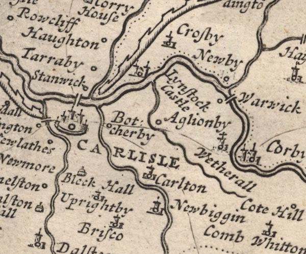 MD12NY45.jpg 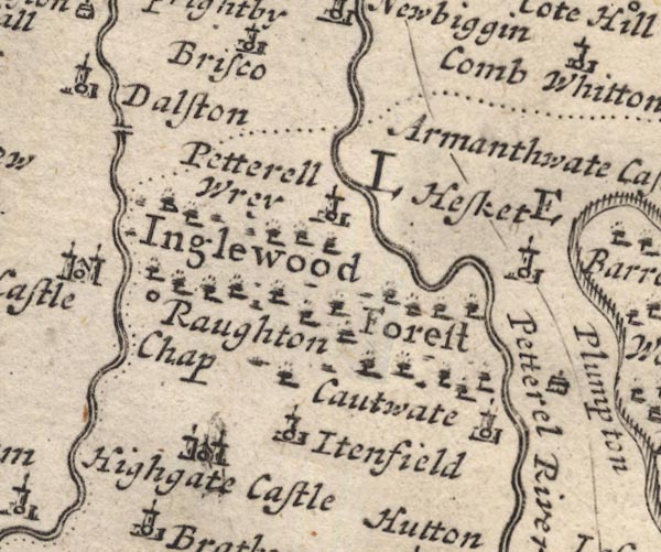 MD12NY44.jpg "Petterel River" 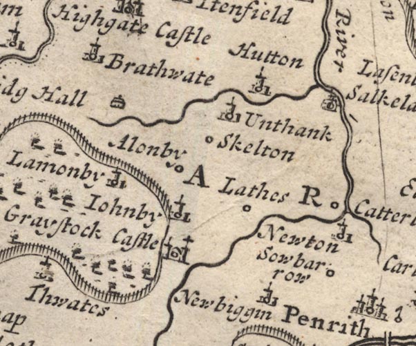 MD12NY43.jpg 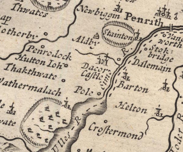 MD12NY42.jpg 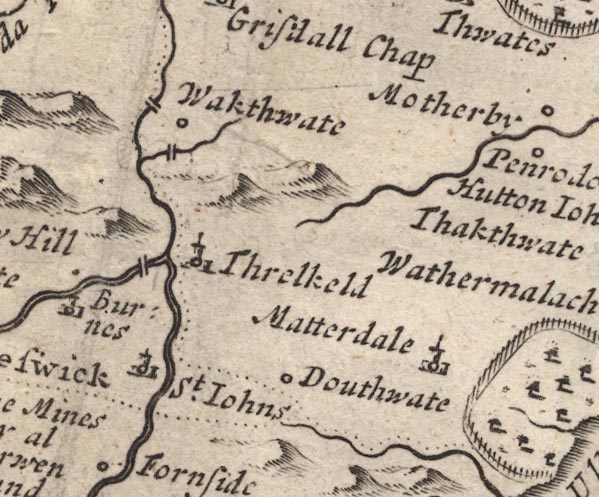 MD12NY32.jpg item:- JandMN : 90 Image © see bottom of page |
|||
|
|
||||
| evidence:- | old map:- Bowen 1720 (plate 232) placename:- Petterel Flu. |
|||
| source data:- | Road strip map, road map, pl.232, part of The Road from Tinmouth
to Carlisle, scale about 2 miles to 1 inch, with sections in
Northumberland and Cumberland, published by Emanuel Bowen, St
Katherines, London, 1720.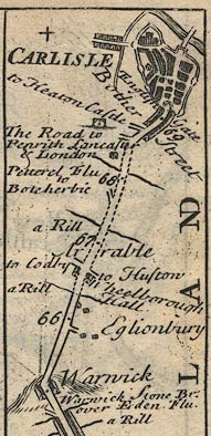 B232m65.jpg "Petterel Flu" Mile 68. item:- JandMN : 65.232 Image © see bottom of page |
|||
|
|
||||
| evidence:- | descriptive text:- Defoe 1724-26 placename:- Potterell, River |
|||
| source data:- | Tour through England and Wales, by Daniel Defoe, published in
parts, London, 1724-26. "... Carlisle is strong by situation, being almost surrounded with rivers. On the east it has the River Potterell, ..." |
|||
|
|
||||
| evidence:- | old map:- Badeslade 1742 placename:- Peteril River |
|||
| source data:- | Map, uncoloured engraving, A Map of Cumberland North from
London, scale about 11 miles to 1 inch, with descriptive text,
by Thomas Badeslade, London, engraved and published by William
Henry Toms, Union Court, Holborn, London, 1742. click to enlarge click to enlargeBD10.jpg "Peteril R" tapering wiggly line item:- JandMN : 115 Image © see bottom of page |
|||
|
|
||||
| evidence:- | descriptive text:- Simpson 1746 placename:- Peterell, River |
|||
| source data:- | Atlas, three volumes of maps and descriptive text published as
'The Agreeable Historian, or the Compleat English Traveller
...', by Samuel Simpson, 1746. goto source "Upon the Banks of the little River Peterell, lay Plompton-Park, ..." goto source"..." "The Eden now drawing near the AEstuary receives two little Rivers almost at the same Place, viz. the Peterell and the Caude, which coming from the S. keep all along at almost equal Distance, ..." |
|||
|
|
||||
| evidence:- | old map:- Simpson 1746 map (Wmd) placename:- Petterett River |
|||
| source data:- | Map, uncoloured engraving, Westmorland, scale about 8 miles to 1
inch, printed by R Walker, Fleet Lane, London, 1746.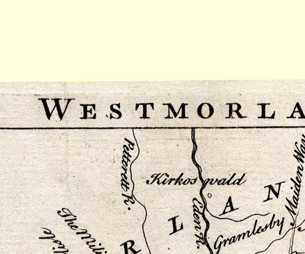 SMP2NYM.jpg "Petterett R." 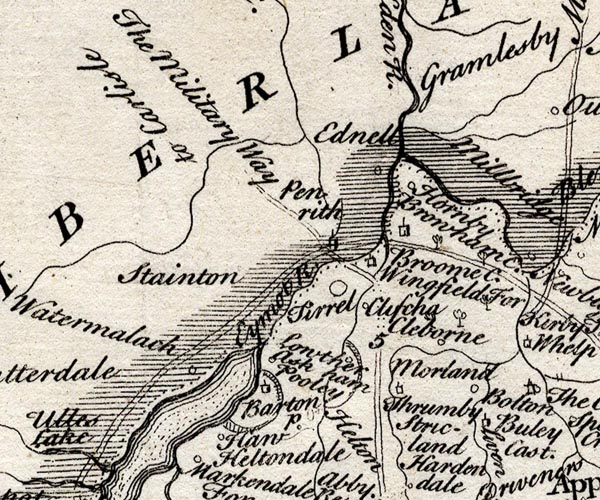 SMP2NYL.jpg Wiggly line. item:- Dove Cottage : 2007.38.59 Image © see bottom of page |
|||
|
|
||||
| evidence:- | old map:- Bowen and Kitchin 1760 |
|||
| source data:- | Map, hand coloured engraving, A New Map of the Counties of
Cumberland and Westmoreland Divided into their Respective Wards,
scale about 4 miles to 1 inch, by Emanuel Bowen and Thomas
Kitchin et al, published by T Bowles, Robert Sayer, and John
Bowles, London, 1760.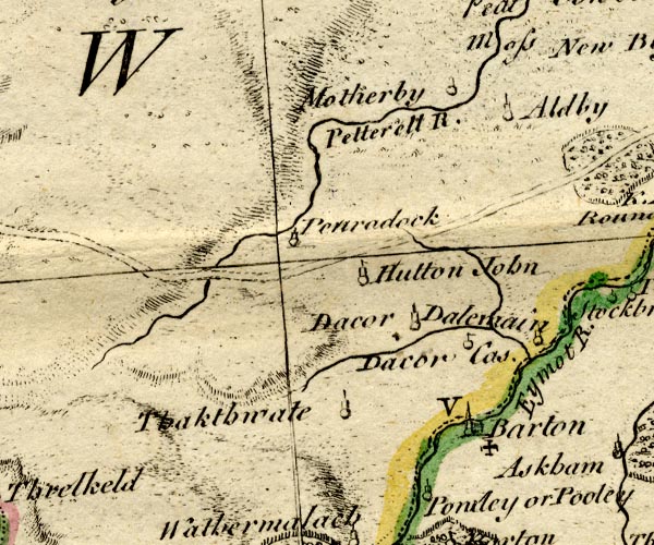 BO18NY32.jpg "Petterell R." wiggly line 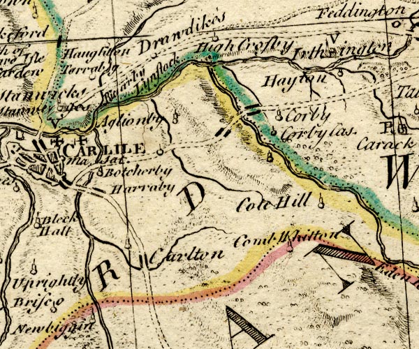 BO18NY45.jpg double line with stream lines, into the Eden item:- Armitt Library : 2008.14.10 Image © see bottom of page |
|||
|
|
||||
| evidence:- | old map:- Donald 1774 (Cmd) placename:- Pettrill River |
|||
| source data:- | Map, hand coloured engraving, 3x2 sheets, The County of Cumberland, scale about 1
inch to 1 mile, by Thomas Donald, engraved and published by Joseph Hodskinson, 29
Arundel Street, Strand, London, 1774.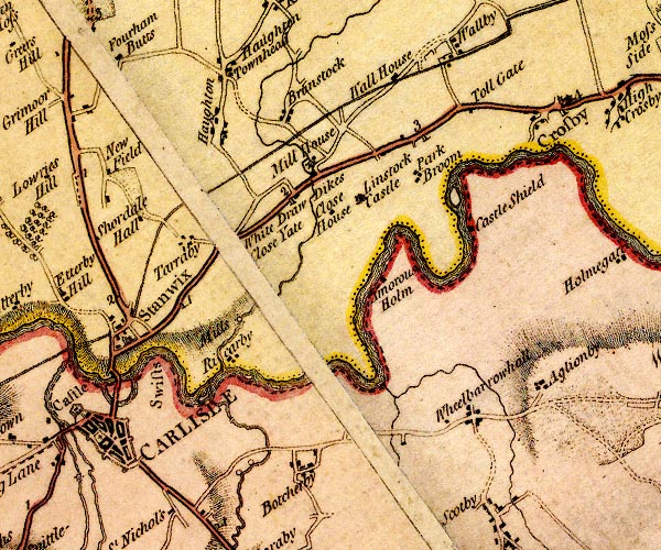 D4NY45NW.jpg 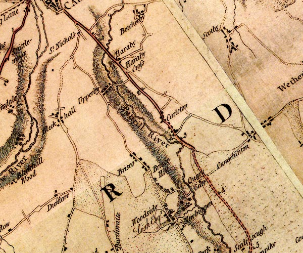 D4NY45SW.jpg "Pettrill River" 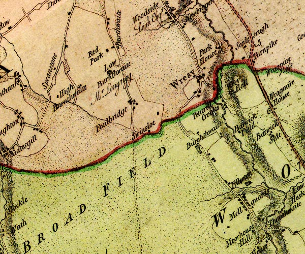 D4NY44NW.jpg 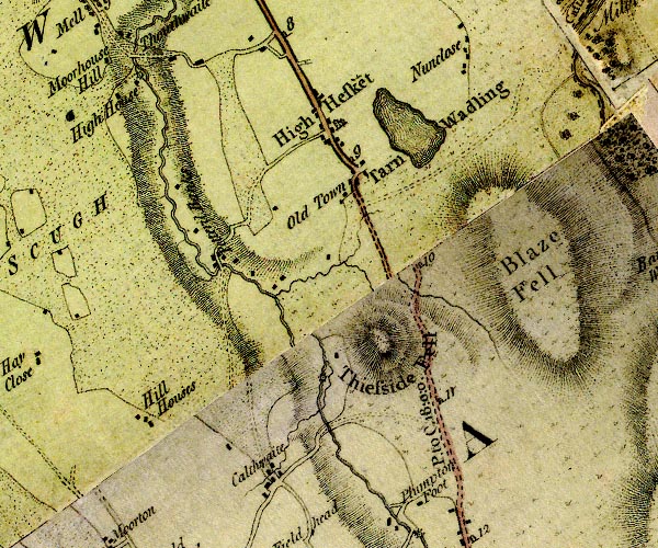 D4NY44SE.jpg 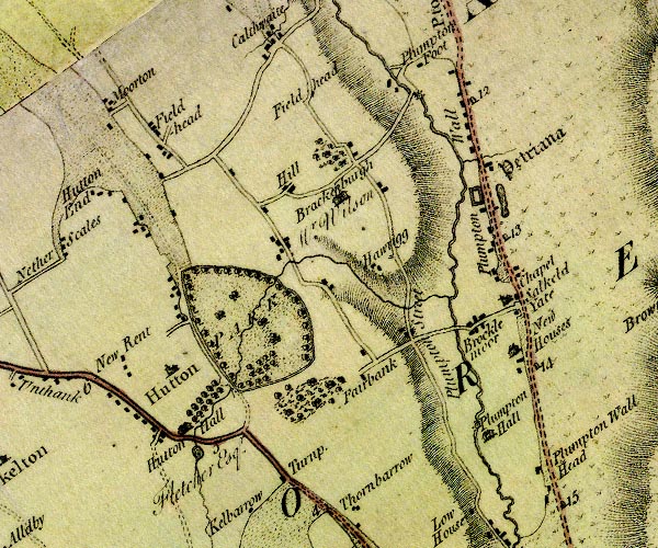 D4NY43NE.jpg 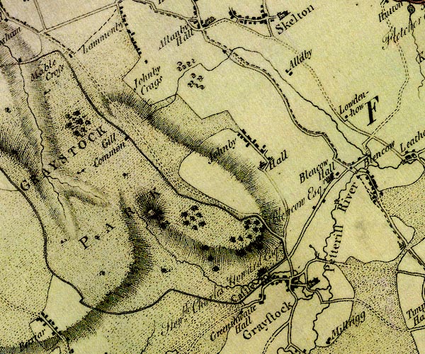 D4NY43SW.jpg "Petterill River" 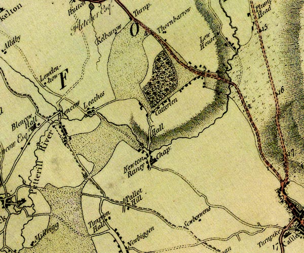 D4NY43SE.jpg single or double wiggly line; a river into the Eden item:- Carlisle Library : Map 2 Images © Carlisle Library |
|||
|
|
||||
| evidence:- | descriptive text:- West 1778 (11th edn 1821) placename:- Petteral |
|||
| source data:- | Guide book, A Guide to the Lakes, by Thomas West, published by
William Pennington, Kendal, Cumbria once Westmorland, and in
London, 1778 to 1821. goto source Page 146:- "... Also, on the banks of the Petteral, ..." goto sourcePage 147:- "... whether the station [roman fort, Old Plumpton ?] took its name from the river, as being upon its banks, and was called the Petriana, or whether the station gave name to the river (which is perhaps the least probable) let him who can determine." |
|||
|
|
||||
| evidence:- | old map:- West 1784 map placename:- Petterill River |
|||
| source data:- | Map, hand coloured engraving, A Map of the Lakes in Cumberland,
Westmorland and Lancashire, scale about 3.5 miles to 1 inch,
engraved by Paas, 53 Holborn, London, about 1784.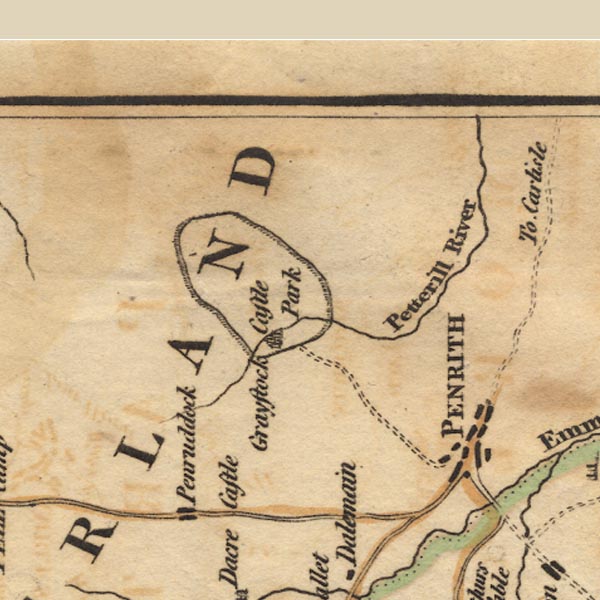 Ws02NY43.jpg item:- Armitt Library : A1221.1 Image © see bottom of page |
|||
|
|
||||
| evidence:- | old text:- Clarke 1787 placename:- Petterell, River item:- pump; water supply, Penrith |
|||
| source data:- | Guide book, A Survey of the Lakes of Cumberland, Westmorland,
and Lancashire, written and published by James Clarke, Penrith,
Cumberland, and in London etc, 1787; published 1787-93. goto source Page 20:- "[Penrith] ... in the year 1748 [1468], Bishop Strickland of Carlisle remedied the former of these wants [water], by purchasing of the owners of certain Mills, (particularly Vaux of Catterlin,) so much of the water of the river Petterell as would flow through the eye of a mill-stone. This he generously, at his own expence, conveyed to Penrith, and the water still continues to flow in the same quantity, and no more. Since the general use of pumps, no town perhaps is better supplied" goto sourcePage 21:- "with water; scarce any house being so inconsiderable as not to be provided with one of those useful engines." |
|||
|
|
||||
| evidence:- | old text:- Clarke 1787 placename:- Petteral, River |
|||
| source data:- | Guide book, A Survey of the Lakes of Cumberland, Westmorland,
and Lancashire, written and published by James Clarke, Penrith,
Cumberland, and in London etc, 1787; published 1787-93. goto source Page 50:- "... Between Penruddock and this village [Motherby] is the head of the river Petteral, ..." |
|||
|
|
||||
| evidence:- | old text:- Camden 1789 placename:- Pete Rill |
|||
| source data:- | Book, Britannia, or A Chorographical Description of the Flourishing Kingdoms of England,
Scotland, and Ireland, by William Camden, 1586, translated from the 1607 Latin edition
by Richard Gough, published London, 1789. goto source Page 173:- "..." "... For the use, however, of the town [Penrith], W. Stricland, bishop of Carlisle, of a famous family in these parts, cut, at his own expence, a chanel from Pete-rill ..." |
|||
|
|
||||
| evidence:- | old map:- Aikin 1790 (Cmd) placename:- Petterel River |
|||
| source data:- | Map, uncoloured engraving, Cumberland, by John Aikin, London,
1790.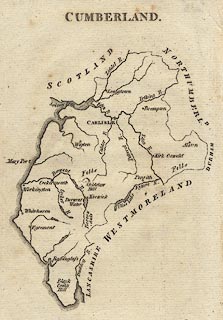 click to enlarge click to enlargeAIK3.jpg "Petterel R." river item:- JandMN : 145 Image © see bottom of page |
|||
|
|
||||
| evidence:- | old map:- Bailey 1797 placename:- Petteril River |
|||
| source data:- | Map, soil etc, uncoloured engraving, Cumberland, scale about 21
miles to 1 inch, by J Bailey, engraved by Neele, Strand,
published by Messrs Robinson, Paternoster Row and G Nicol, Pall
Mall, London, 1797. click to enlarge click to enlargeBY04.jpg "Petteril R." river item:- Armitt Library : A680.2 Image © see bottom of page |
|||
|
|
||||
| evidence:- | road book:- Cary 1798 (2nd edn 1802) placename:- Petteril, River |
|||
| source data:- | Road book, itineraries, Cary's New Itinerary, by John Cary, 181
Strand, London, 2nd edn 1802. goto source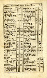 click to enlarge click to enlargeC38267.jpg page 267-268 "Cross the Petteril River." goto source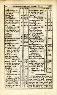 click to enlarge click to enlargeC38283.jpg page 283-284 "Cross the Petteril River" item:- JandMN : 228.1 Image © see bottom of page |
|||
|
|
||||
| evidence:- | old map:- Skrine 1801 placename:- Petteril River |
|||
| source data:- | Map, uncoloured engraving, rivers in Cumberland, Westmorland,
Lancashire and Cheshire, scale about 23 miles to 1 inch, by
Henry Skrine, published by P Elmsly, London, 1801.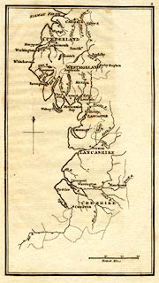 click to enlarge click to enlargeM076.jpg "Petteril R." river item:- JandMN : 421 Image © see bottom of page |
|||
|
|
||||
| evidence:- | old map:- Cooke 1802 |
|||
| source data:- | Map, Cumberland, scale about 15.5 miles to 1 inch, by George
Cooke, 1802, bound in Gray's New Book of Roads, 1824, published
by Sherwood, Jones and Co, Paternoster Road, London, 1824. click to enlarge click to enlargeGRA1Cd.jpg tapering wiggly line; river item:- Hampshire Museums : FA2000.62.2 Image © see bottom of page |
|||
|
|
||||
| evidence:- | old map:- Cooke 1802 placename:- Petterill River |
|||
| source data:- | Map, The Lakes, Westmorland and Cumberland, scale about 8.5
miles to 1 inch, engravedby Neele and Son, published by
Sherwood, Jones and Co, Paternoster Road, London, 1824. click to enlarge click to enlargeGRA1Lk.jpg "Petterill R." tapering wiggly line; river item:- Hampshire Museums : FA2000.62.5 Image © see bottom of page |
|||
|
|
||||
| evidence:- | old map:- Laurie and Whittle 1806 placename:- Petterill River |
|||
| source data:- | Road map, Completion of the Roads to the Lakes, scale about 10
miles to 1 inch, by Nathaniel Coltman? 1806, published by Robert
H Laurie, 53 Fleet Street, London, 1834. click to enlarge click to enlargeLw18.jpg "Petterill R." river item:- private collection : 18.18 Image © see bottom of page |
|||
|
|
||||
| evidence:- | old map:- Cooper 1808 placename:- Petterill River |
|||
| source data:- | Map, uncoloured engraving, Cumberland, scale about 10.5 miles to
1 inch, drawn and engraved by Cooper, published by R Phillips,
Bridge Street, Blackfriars, London, 1808. click to enlarge click to enlargeCOP3.jpg "Petterill R." tapering wiggly line; river item:- JandMN : 86 Image © see bottom of page |
|||
|
|
||||
| evidence:- | old map:- Otley 1818 placename:- Petterill River |
|||
| source data:- | Map, uncoloured engraving, The District of the Lakes,
Cumberland, Westmorland, and Lancashire, scale about 4 miles to
1 inch, by Jonathan Otley, 1818, engraved by J and G Menzies,
Edinburgh, Scotland, published by Jonathan Otley, Keswick,
Cumberland, et al, 1833.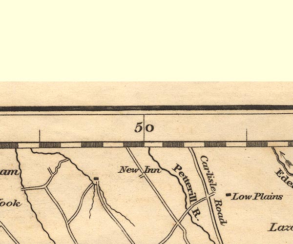 OT02NY44.jpg "Petterill R." item:- JandMN : 48.1 Image © see bottom of page |
|||
|
|
||||
| evidence:- | old map:- Hall 1820 (Cmd) |
|||
| source data:- | Map, hand coloured engraving, Cumberland, scale about 21 miles
to 1 inch, engraved by Sidney Hall, published by S Leigh, 18
Strand, London, 1820-31. click to enlarge click to enlargeHA14.jpg tapering wiggly line; river item:- JandMN : 91 Image © see bottom of page |
|||
|
|
||||
| evidence:- | descriptive text:- Otley 1823 (5th edn 1834) placename:- Petterill, River |
|||
| source data:- | Guide book, A Concise Description of the English Lakes, the
mountains in their vicinity, and the roads by which they may be
visited, with remarks on the mineralogy and geology of the
district, by Jonathan Otley, published by the author, Keswick,
Cumberland now Cumbria, by J Richardson, London, and by Arthur
Foster, Kirkby Lonsdale, Cumbria, 1823; published 1823-49,
latterly as the Descriptive Guide to the English Lakes. goto source Page 40:- "... the Petterill, which rises near Greystoke; ..." |
|||
|
|
||||
| evidence:- | old map:- Ford 1839 map placename:- Petteril River |
|||
| source data:- | Map, uncoloured engraving, Map of the Lake District of
Cumberland, Westmoreland and Lancashire, scale about 3.5 miles
to 1 inch, published by Charles Thurnam, Carlisle, and by R
Groombridge, 5 Paternoster Row, London, 3rd edn 1843.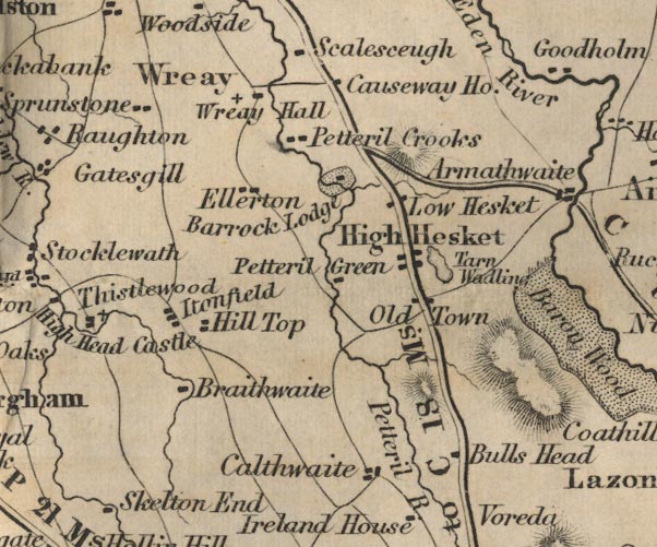 FD02NY44.jpg "Petteril R." item:- JandMN : 100.1 Image © see bottom of page |
|||
|
|
||||
| evidence:- | old map:- Garnett 1850s-60s H placename:- Petterill, River |
|||
| source data:- | Map of the English Lakes, in Cumberland, Westmorland and
Lancashire, scale about 3.5 miles to 1 inch, published by John
Garnett, Windermere, Westmorland, 1850s-60s. GAR2NY45.jpg wiggly line, river  GAR2NY44.jpg "R Petterill"  GAR2NY43.jpg "R. Petterill" item:- JandMN : 82.1 Image © see bottom of page |
|||
|
|
||||
| evidence:- | old map:- Postlethwaite 1877 (3rd edn 1913) placename:- Petterill, River |
|||
| source data:- | Map, uncoloured engraving, Map of the Lake District Mining Field, Westmorland, Cumberland,
Lancashire, scale about 5 miles to 1 inch, by John Postlethwaite, published by W H
Moss and Sons, 13 Lowther Street, Whitehaven, Cumberland, 1877 edn 1913.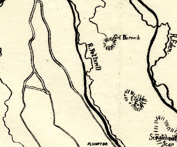 PST2NY44.jpg "R. Petterill" wiggly line item:- JandMN : 162.2 Image © see bottom of page |
|||
|
|
||||
| evidence:- | old painting:- item:- snow; sunset |
|||
| source data:- | Painting, watercolour, Sunset, by the River Petteril, Cumberland, by John James Hodgson,
about 1904.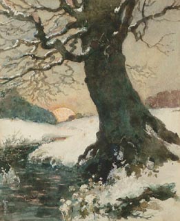 click to enlarge click to enlargePR1297.jpg Tree beside a river bank surrounded in snow with sunset behind. item:- Tullie House Museum : 1978.109.1 Image © Tullie House Museum |
|||
|
|
||||
| evidence:- | old painting:- |
|||
| source data:- | Painting, watercolour, Trees near Botcherby Mill, Carlisle, Cumberland, by John James
Hodgson, about 1900.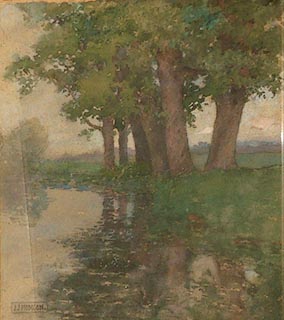 click to enlarge click to enlargePR0978.jpg Summertime; a stand of oak trees on the right bank of a wide river are reflected in its waters. Dusk approaches; there is a faint tinge of pink to the sky above the horizon where hills rise in the misty distance. signed at bottom left:- "J J HODGSON" item:- Tullie House Museum : 1958.9.5 Image © Tullie House Museum |
|||
|
|
||||
| evidence:- | old painting:- item:- cattle |
|||
| source data:- | Painting, watercolour, On the Petteril, Newbiggin Bridge, Near Carlisle, St Cuthbert
Without, Cumberland, by Thomas Bushby, 1888.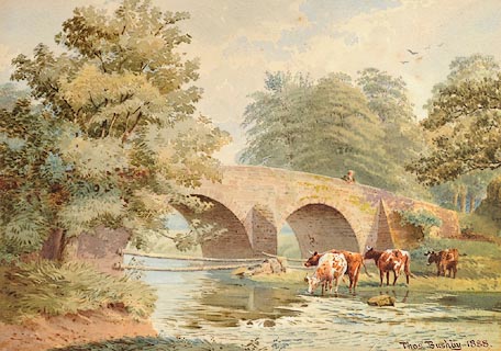 click to enlarge click to enlargePR1046.jpg Cattle at a shallow river's edge; across centre of composition stretches a stone bridge upon which stands a figure watching them. Wooden poles are fastened across the arches of the bridge to prevent the cattle from straying. Meadows and woodland beyond. signed &dated at bottom right:- "Thos. Bushby. 1888." inscribed at reverse on mount:- "On the Petteril, Newbiggin Bridge, Nr. Carlisle. Thos. Bushby. 1891" item:- Tullie House Museum : 1970.33.31 Image © Tullie House Museum |
|||
|
|
||||
| evidence:- | old painting:- item:- fish; trout |
|||
| source data:- | Painting, oil painting, Petteril Trout, by the River Petteril, Cumberland, by Robert
Harrington, 1850s.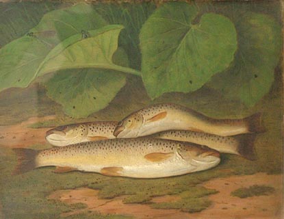 click to enlarge click to enlargePR0953.jpg Three dead trout laid out on a sandy riverbank; behind them dragonflies rest on the leaves of a butterburr plant. item:- Tullie House Museum : 1947.8.2 Image © Tullie House Museum |
|||
|
|
||||
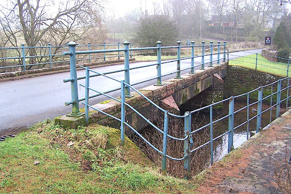
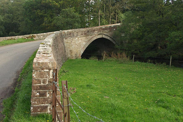
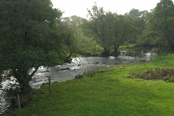
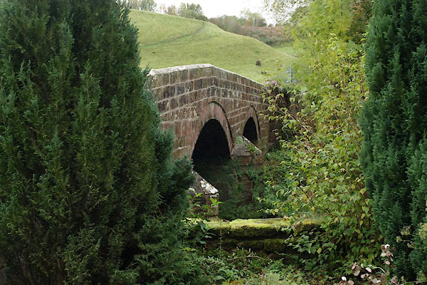
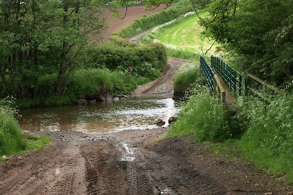
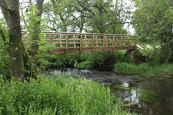
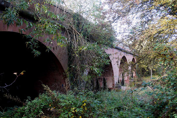
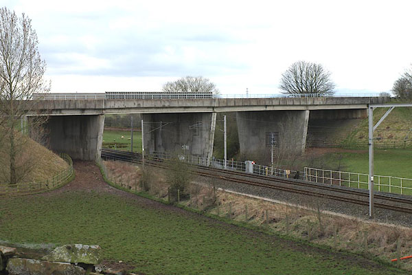
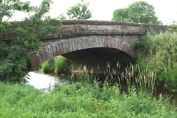
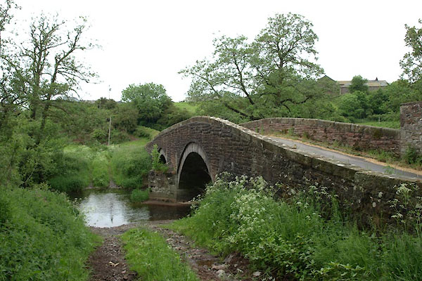
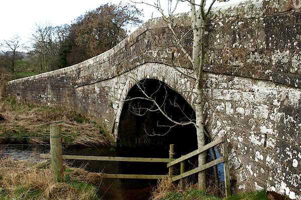
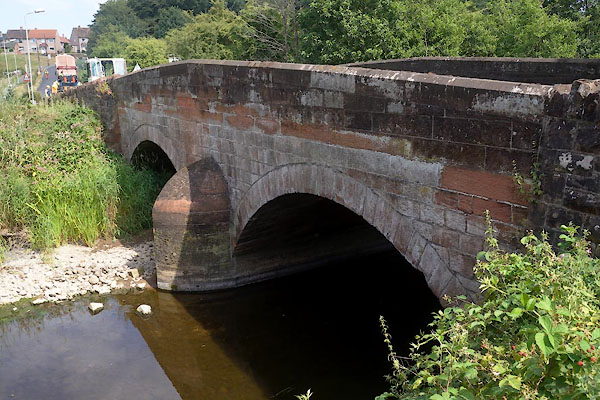
 BOY32.jpg At Catterlen Bridge. (taken 4.4.2008)  CDM51.jpg At Little Blencow, (taken 3.7.2015)  BYX95.jpg At Middle Bridge, (taken 2.8.2013) 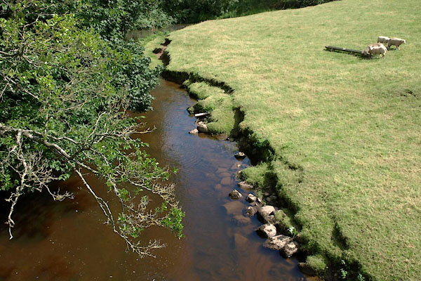 BYY30.jpg At Plumptonfoot, (taken 2.8.2013) 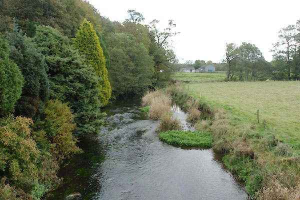 BTS21.jpg At Crooks Bridge, (taken 22.10.2010) 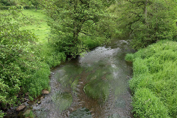 BWR33.jpg At Petterilbank Bridge, (taken 8.6.2012) 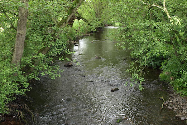 BWR64.jpg At a ford, (taken 8.6.2012) 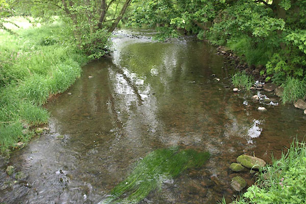 BWS22.jpg At a ford? (taken 8.6.2012) 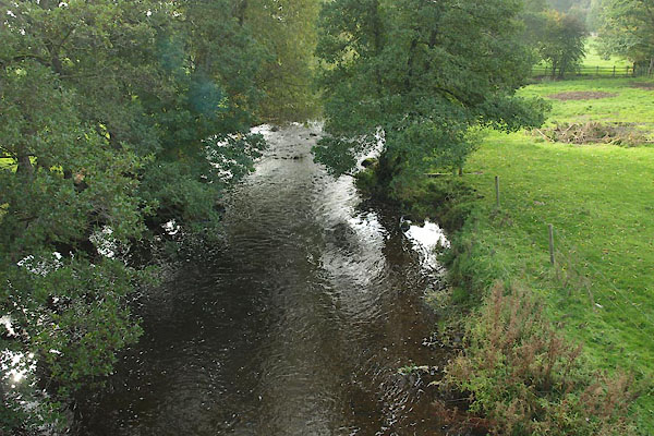 BTP81.jpg Up from Calthwaite Bridge. (taken 8.10.2010) 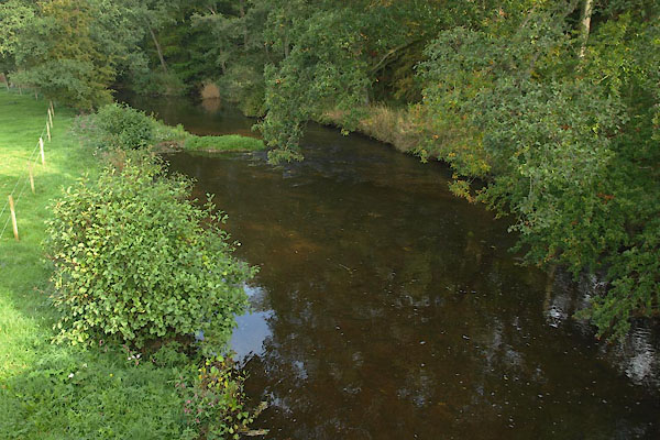 BTP82.jpg Down from Calthwaite Bridge. (taken 8.10.2010) 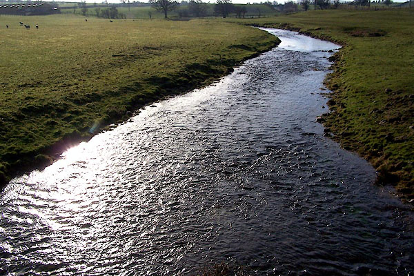 BND47.jpg From Kitchenhill Bridge. (taken 3.2.2007) 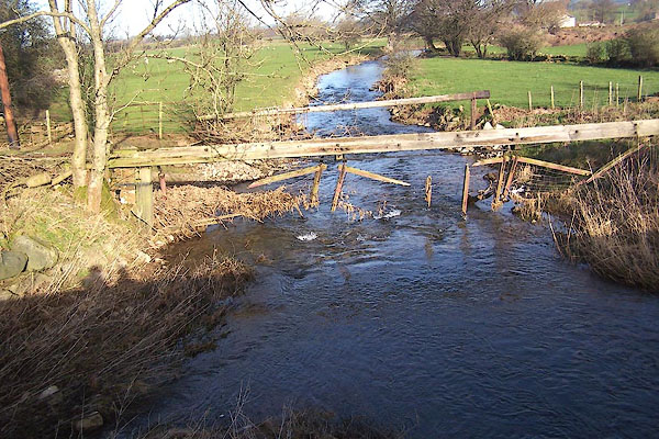 BND48.jpg From Kitchenhill Bridge. (taken 3.2.2007) 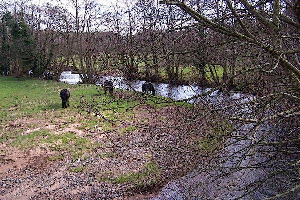 BNI20.jpg From the bridge at Southwaite. (taken 9.3.2007) 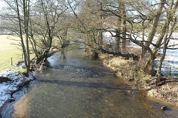 BSF34.jpg At Wreay Bridge, (taken 2.3.2010) 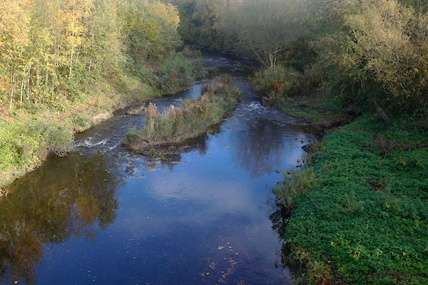 CFQ45.jpg At Harraby Bridge, (taken 4.11.2016) |
||||
|
|
||||
| places:- |
|
|||
|
||||
|
||||
|
||||
|
||||
|
||||
|
||||
|
||||
|
||||
|
||||
|
||||
|
||||
|
||||
|
||||
|
||||
|
||||
|
||||
|
||||
|
||||
|
||||
|
||||
|
||||
|
||||
|
||||
|
||||
|
||||
|
||||
|
||||
|
||||
|
||||
|
||||
|
||||
|
||||
|
||||
|
||||
|
||||
|
||||
|
||||
|
||||
|
||||
|
||||
|
||||
|
||||
Lakes Guides menu.