 Old Cumbria Gazetteer
 |
 |
|
| Raven Crag, Longsleddale | ||
| Raven Crag | ||
| civil parish:- | Longsleddale (formerly Westmorland) | |
| county:- | Cumbria | |
| locality type:- | rocks | |
| coordinates:- | NY47320781 | |
| 1Km square:- | NY4707 | |
| 10Km square:- | NY40 | |
|
|
||
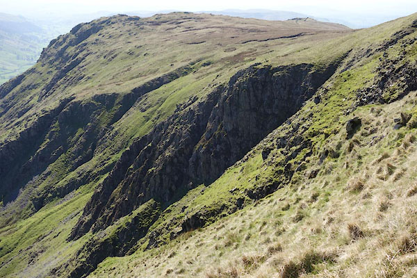 CAK31.jpg (taken 19.4.2014) 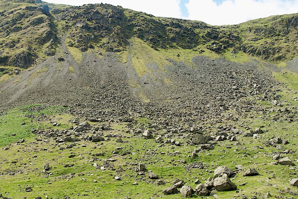 BRB97.jpg (taken 19.7.2009) |
||
|
|
||
| evidence:- | old map:- OS 1881-82 New Series (outline edition) placename:- Raven Crag |
|
| source data:- | Map, engraving, area north of Kendal, Westmorland, New Series
one inch map, outline edition, sheet 39, scale 1 inch to 1 mile,
published by the Ordnance Survey, Southampton, Hampshire,
1881-82.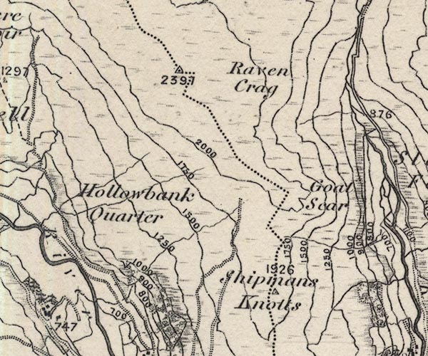 O21NY40T.jpg "Raven Crag" item:- JandMN : 61 Image © see bottom of page |
|
|
|
||
| evidence:- | descriptive text:- Ffinch 1983 |
|
| source data:- | Book, Kendal and the Kent Valley, by Michael Ffinch, published
by Robert Hale, London, 1983. "The River Sprint rises high on the fells about a mile south of Haweswater. From the slope of Adam Seat it begins as Wren Gill flowing south between Raven Crag and Goat Scar on its western side, and Buckbarrow on the east. ..." |
|
|
|
||
| evidence:- | map:- OS Six Inch (1956) placename:- Raven Crag |
|
| source data:- | Map series, various editions with the national grid, scale about
6 inches to 1 mile, published by the Ordnance Survey,
Southampton, Hampshire, scale 1 to 10560 from 1950s to 1960s,
then 1 to 10000 from 1960s to 2000s, superseded by print on
demand from digital data.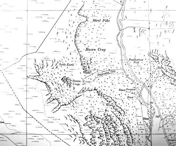 SINY4707.jpg "Raven Crag" |
|
|
|
||
 Lakes Guides menu.