 Old Cumbria Gazetteer
 |
 |
|
| Reagill Grange, Crosby Ravensworth | ||
| Reagill Grange | ||
| locality:- | Reagill | |
| civil parish:- | Crosby Ravensworth (formerly Westmorland) | |
| county:- | Cumbria | |
| locality type:- | buildings | |
| coordinates:- | NY60771699 | |
| 1Km square:- | NY6016 | |
| 10Km square:- | NY61 | |
|
|
||
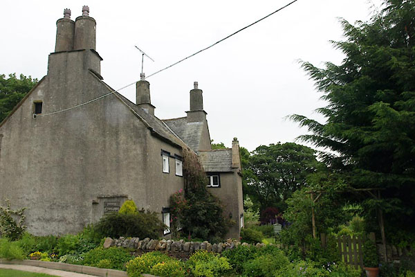 BUS15.jpg (taken 17.6.2011) 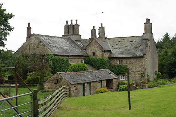 BUS16.jpg (taken 17.6.2011) |
||
|
|
||
| evidence:- | old map:- OS County Series (Wmd 14 12) placename:- Reagill Grange |
|
| source data:- | Maps, County Series maps of Great Britain, scales 6 and 25
inches to 1 mile, published by the Ordnance Survey, Southampton,
Hampshire, from about 1863 to 1948. |
|
|
|
||
| evidence:- | hearth tax returns:- Hearth Tax 1675 placename:- Regill Grainge |
|
| source data:- | Records, hearth tax survey returns, Westmorland, 1674/75. "Regill Grainge" in "Regill and Slegill" |
|
|
|
||
| evidence:- | old photograph:- Bell 1880s-1940s placename:- Reagill Grange |
|
| source data:- | Photograph, Reagill Grange, Reagill, Crosby Ravensworth, Westmorland, by Herbert Bell,
photographer, Ambleside, Westmorland, 1896.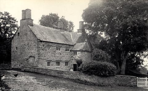 click to enlarge click to enlargeHB0096.jpg Vol.1 no.96 in an album, Examples of Early Domestic and Military Architecture in Westmorland, assembled 1910. ms at bottom:- "96. Reagill Grange. Crosby Ravensworth. W." item:- Armitt Library : 1958.3165.96 Image © see bottom of page |
|
|
|
||
| evidence:- | database:- Listed Buildings 2010 placename:- Reagill Grange |
|
| source data:- | courtesy of English Heritage "REAGILL GRANGE / / / CROSBY RAVENSWORTH / EDEN / CUMBRIA / II[star] / 74067 / NY6077616990" |
|
|
|
||
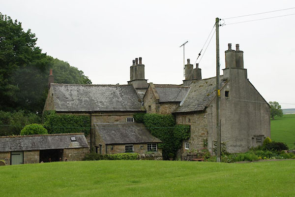 BUS14.jpg (taken 17.6.2011) |
||
|
|
||
| notes:- |
possible fortified manor house |
|
| Perriam, D R &Robinson, J: 1998: Medieval Fortified Buildings of Cumbria: CWAAS::
ISBN 1 873124 23 6; plan and illustration |
||
|
|
||
 Lakes Guides menu.