 Old Cumbria Gazetteer
 |
 |
|
| Redscar, Underbarrow and Bradleyfield | ||
| Redscar | ||
| civil parish:- | Underbarrow and Bradleyfield (formerly Westmorland) | |
| county:- | Cumbria | |
| locality type:- | buildings | |
| coordinates:- | SD45809211 | |
| 1Km square:- | SD4592 | |
| 10Km square:- | SD49 | |
|
|
||
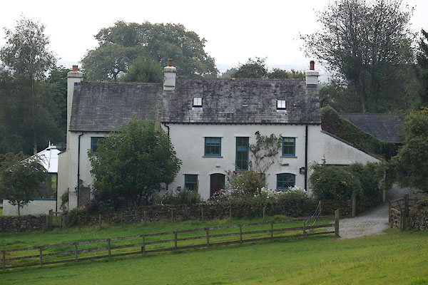 CBQ47.jpg (taken 12.9.2014) |
||
|
|
||
| evidence:- | old map:- OS County Series (Wmd 38 6) placename:- Redscar |
|
| source data:- | Maps, County Series maps of Great Britain, scales 6 and 25
inches to 1 mile, published by the Ordnance Survey, Southampton,
Hampshire, from about 1863 to 1948. |
|
|
|
||
| evidence:- | old map:- Jefferys 1770 (Wmd) placename:- Red Scar |
|
| source data:- | Map, 4 sheets, The County of Westmoreland, scale 1 inch to 1
mile, surveyed 1768, and engraved and published by Thomas
Jefferys, London, 1770.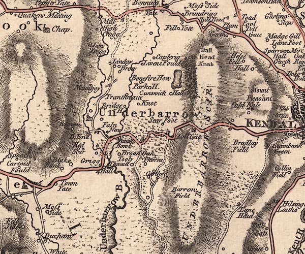 J5SD49SE.jpg "Red Scar" circle, labelled in italic lowercase text; settlement, farm, house, or hamlet? item:- National Library of Scotland : EME.s.47 Image © National Library of Scotland |
|
|
|
||
| evidence:- | database:- Listed Buildings 2010 placename:- Redscar Farm |
|
| source data:- | courtesy of English Heritage "REDSCAR FARMHOUSE (SOUTHERNMOST) / / / UNDERBARROW AND BRADLEYFIELD / SOUTH LAKELAND / CUMBRIA / II / 75313 / SD4577592089" |
|
|
|
||
| evidence:- | database:- Listed Buildings 2010 |
|
| source data:- | courtesy of English Heritage "BARN TO NORTH EAST OF REDSCAR FARMHOUSE (SOUTHERNMOST) / / / UNDERBARROW AND BRADLEYFIELD / SOUTH LAKELAND / CUMBRIA / II / 75314 / SD4580592107" |
|
|
|
||
 Lakes Guides menu.