 Old Cumbria Gazetteer
 |
 |
|
| Riddings, Kirkandrews | ||
| Riddings | ||
| civil parish:- | Kirkandrews (formerly Cumberland) | |
| county:- | Cumbria | |
| locality type:- | buildings | |
| coordinates:- | NY40797503 (etc) | |
| 1Km square:- | NY4075 | |
| 10Km square:- | NY47 | |
|
|
||
| evidence:- | old map:- OS County Series (Cmd 6 4) placename:- Riddings |
|
| source data:- | Maps, County Series maps of Great Britain, scales 6 and 25
inches to 1 mile, published by the Ordnance Survey, Southampton,
Hampshire, from about 1863 to 1948. |
|
|
|
||
| evidence:- | old map:- Burghley 1590 (facsimile) placename:- Rydings, Ye |
|
| source data:- | Facsimile map, A Platt of the Opposete Border of Scotland to ye West Marches of England,
parts of Cumberland and Scotland including the Debateable Land, from a manuscript
drawn for William Cecil, Lord Burghley, about 1590, published by R B Armstrong, 1897. courtesy of the National Library of Scotland 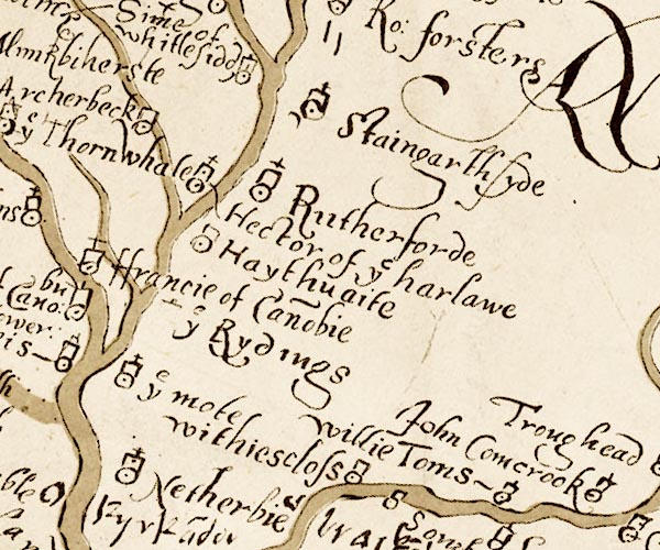 M048NY47.jpg "ye Rydings" circle, tower item:- National Library of Scotland : MS6113 f.267 Image © National Library of Scotland |
|
|
|
||
| evidence:- | old text:- Gents Mag placename:- Ridding item:- rebellion, 1745; 1745 Rebellion |
|
| source data:- | Magazine, The Gentleman's Magazine or Monthly Intelligencer or
Historical Chronicle, published by Edward Cave under the
pseudonym Sylvanus Urban, and by other publishers, London,
monthly from 1731 to 1922. goto source goto sourceGentleman's Magazine 1745 p.603 "... On Friday the 8th they march'd, part of the cavalry to Longholm, and infansry (sic) to Cannoby, on the Scotch side, and the rest of the cavalry cross'd the river and lay at Longtown, and the pretender's son lay at Mr David Murray's at Ridding. ..." |
|
|
|
||
| evidence:- | old map:- Donald 1774 (Cmd) placename:- Riddens |
|
| source data:- | Map, hand coloured engraving, 3x2 sheets, The County of Cumberland, scale about 1
inch to 1 mile, by Thomas Donald, engraved and published by Joseph Hodskinson, 29
Arundel Street, Strand, London, 1774.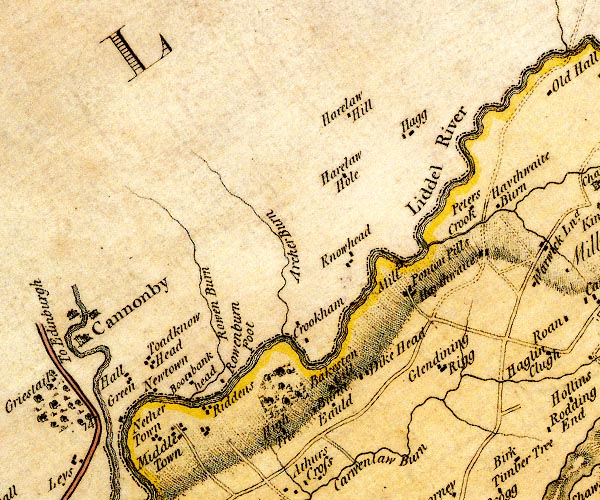 D4NY47NW.jpg "Riddens" block or blocks, labelled in lowercase; a hamlet or just a house item:- Carlisle Library : Map 2 Image © Carlisle Library |
|
|
|
||
| notes:- |
site of a tower or early stone house |
|
| Perriam, D R &Robinson, J: 1998: Medieval Fortified Buildings of Cumbria: CWAAS::
ISBN 1 873124 23 6 |
||
|
|
||
Lakes Guides menu.