 Old Cumbria Gazetteer
 |
 |
|
| Riggindale Crag, Shap Rural | ||
| Riggindale Crag | ||
| civil parish:- | Shap Rural (formerly Westmorland) | |
| county:- | Cumbria | |
| locality type:- | rocks | |
| locality type:- | hill | |
| locality type:- | cirque | |
| coordinates:- | NY447113 (etc) | |
| 1Km square:- | NY4411 | |
| 10Km square:- | NY41 | |
|
|
||
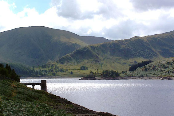
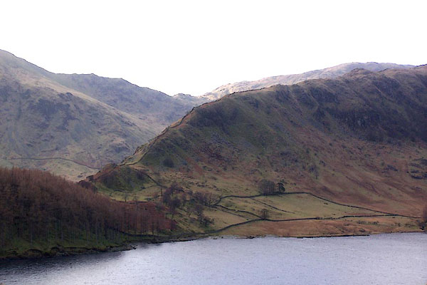 BLO67.jpg Riggindale Crag etc. (taken 25.1.2006) 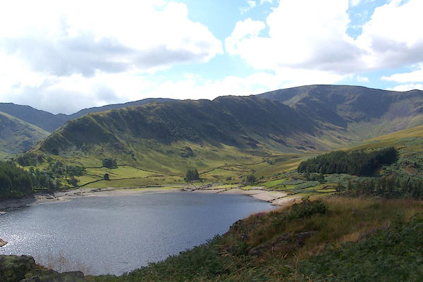 BJT68.jpg Riggindale Crag, High Street, and Haweswater. (taken 22.8.2005) |
||
|
|
||
| evidence:- | old map:- Jefferys 1770 (Wmd) |
|
| source data:- | Map, 4 sheets, The County of Westmoreland, scale 1 inch to 1
mile, surveyed 1768, and engraved and published by Thomas
Jefferys, London, 1770.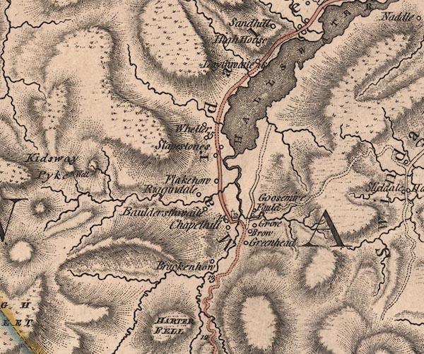 J5NY41SE.jpg hill hachuring; hill or mountain item:- National Library of Scotland : EME.s.47 Image © National Library of Scotland |
|
|
|
||
| evidence:- | descriptive text:- Otley 1823 (5th edn 1834) |
|
| source data:- | Guide book, A Concise Description of the English Lakes, the
mountains in their vicinity, and the roads by which they may be
visited, with remarks on the mineralogy and geology of the
district, by Jonathan Otley, published by the author, Keswick,
Cumberland now Cumbria, by J Richardson, London, and by Arthur
Foster, Kirkby Lonsdale, Cumbria, 1823; published 1823-49,
latterly as the Descriptive Guide to the English Lakes. goto source goto sourcePage 115:- "... and High Street. From ... which a narrow ridge, called Long Stile, projects so far as to seclude it [Mardale Green] from the other parts of the valley; and beyond this rises the apex of Kidstow Pike. ..." |
|
|
|
||
| evidence:- | outline view:- Otley 1823 (8th edn 1849) placename:- Riggindale |
|
| source data:- | Engraving, outline view of mountains, Hawes Water from Measand Beck, drawn by T Binns,
engraved by O Jewitt, opposite p.16 of A Descriptive Guide of the English Lakes, by
Jonathan Otley, 8th edition, 1849.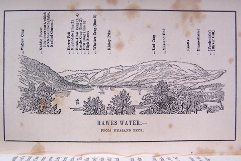 click to enlarge click to enlargeO80E09.jpg item:- Armitt Library : A1180.10 Image © see bottom of page |
|
|
|
||
| evidence:- | outline view:- Black 1856 (23rd edn 1900) placename:- Riggindale Crag |
|
| source data:- | Print, lithograph, Outline Views, Haws and Wastwater - Mountains as seen from Burn-Banks
near the Foot of Hawes Water, and Mountains as seen near Nether Wastdale at the First
Bridge on the road to Wast-Water, by J Flintoft, Keswick, Cumberland, engraved by
R Mason, Edinburgh, Lothian, about 1900.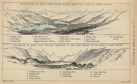 click to enlarge click to enlargeBC08E6.jpg "... Riggindale Crag ..." item:- JandMN : 37.21 Image © see bottom of page |
|
|
|
||
| evidence:- | outline view:- Black 1841 (3rd edn 1846) placename:- Riggindale Crag |
|
| source data:- | Print, engraving, outline view, Mountains as seen from Burn Banks near the Foot of
Hawes Water, and Mountains as seen near Strands in Wastdale at the First bridge on
the Road to Wast Water, by J Flintoft, Keswick, Cumberland, engraved by R Mason, Edinburgh,
Lothian, about 1846.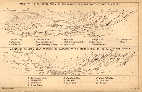 click to enlarge click to enlargeBC02E8.jpg "... Riggindale Crag ..." item:- JandMN : 32.12 Image © see bottom of page |
|
|
|
||
 BJT66.jpg Riggindale Crag - Swine Crag, Heron Crag, Eagle Crag - Harter Fell, and Haweswater. (taken 22.8.2005) 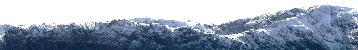 Click to enlarge CHD72.jpg Riggindale Crag in snow - RoughCrag, Caspel Gate, Long Stile. (taken 24.3.2014) |
||
|
|
||
Lakes Guides menu.