Old Cumbria Gazetteer
 |
 |
|
||||||||||||||||||||||||||||||
| included in:- |
 road, Lancaster to Carlisle road, Penrith to Brampton partly road, Lancaster to Carlisle road, Penrith to Brampton partly
|
|||||||||||||||||||||||||||||||
| road, Penrith to Carlisle | ||||||||||||||||||||||||||||||||
| Penrith to Carlisle | ||||||||||||||||||||||||||||||||
| Carlisle to Penrith | ||||||||||||||||||||||||||||||||
| A6 | ||||||||||||||||||||||||||||||||
| civil parish:- | Penrith (formerly Cumberland) | |||||||||||||||||||||||||||||||
| civil parish:- | Hesket (formerly Cumberland) | |||||||||||||||||||||||||||||||
| civil parish:- | Lazonby (formerly Cumberland) | |||||||||||||||||||||||||||||||
| civil parish:- | St Cuthbert Without (formerly Cumberland) | |||||||||||||||||||||||||||||||
| civil parish:- | Carlisle (formerly Cumberland) | |||||||||||||||||||||||||||||||
| county:- | Cumbria | |||||||||||||||||||||||||||||||
| locality type:- | road route | |||||||||||||||||||||||||||||||
| 10Km square:- | NY53 | |||||||||||||||||||||||||||||||
| 10Km square:- | NY43 | |||||||||||||||||||||||||||||||
| 10Km square:- | NY44 | |||||||||||||||||||||||||||||||
| 10Km square:- | NY45 | |||||||||||||||||||||||||||||||
|
|
||||||||||||||||||||||||||||||||
| evidence:- | old map:- Gough 1350s-60s |
|||||||||||||||||||||||||||||||
| source data:- | Map, colour photozincograph copy, reduced size facsimile, Gough
Map of Britain, scale about 28.5 miles to 1 inch, published by
the Ordnance Survey, Southampton, Hampshire, 1875.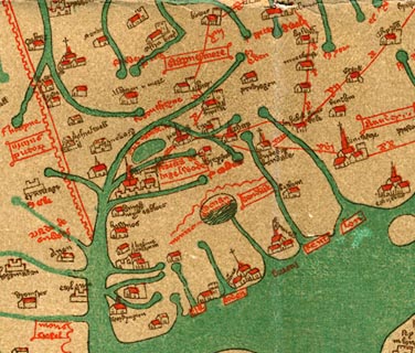 click to enlarge click to enlargeGgh1Cm.jpg Route from Shap through Greystok to Karlil. item:- JandMN : 33 Image © see bottom of page |
|||||||||||||||||||||||||||||||
|
|
||||||||||||||||||||||||||||||||
| evidence:- | old map:- Gough 1350s-60s |
|||||||||||||||||||||||||||||||
| source data:- | Map, lithograph facsimile, Gough Map of Britain, 20 miles to 1
inch? published by the Ordnance Survey, Southampton, Hampshire,
1935.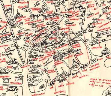 click to enlarge click to enlargeGgh2Cm.jpg Route from Shap through Greystok to Karlil. item:- JandMN : 34 Image © see bottom of page |
|||||||||||||||||||||||||||||||
|
|
||||||||||||||||||||||||||||||||
| evidence:- | old map:- Ogilby 1675 (plate 86) |
|||||||||||||||||||||||||||||||
| source data:- | Road strip map, uncoloured engraving, the Road from Tinmouth ...
to Carlisle, scale about 1 inch to 1 mile, by John Ogilby,
London, 1675.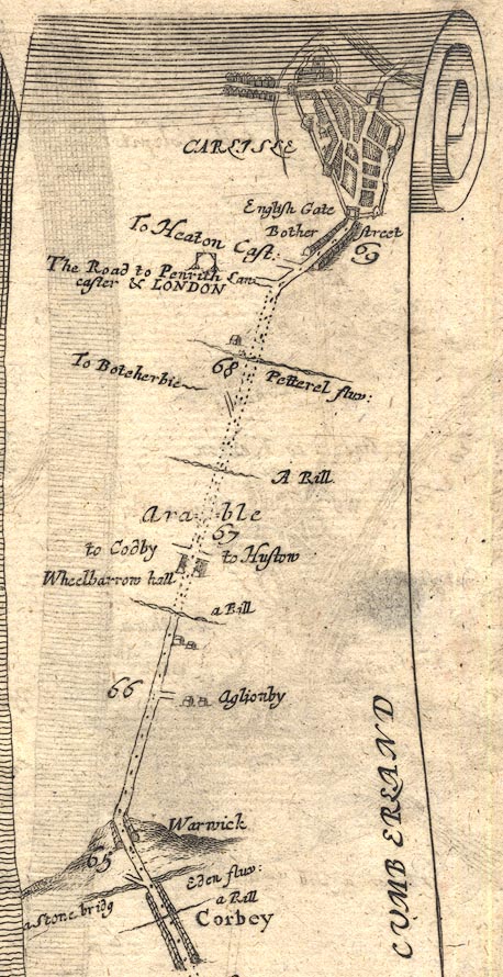 OG86m065.jpg In mile 68, Cumberland. Turning left:- "The Road to Penrith Lancaster &LONDON" (See plate 38.) item:- JandMN : 73 Image © see bottom of page |
|||||||||||||||||||||||||||||||
|
|
||||||||||||||||||||||||||||||||
| evidence:- | old map:- Ogilby 1675 |
|||||||||||||||||||||||||||||||
| source data:- | Road strip map, hand coloured engraving, continuation of the
Road from London to Carlisle, scale about 1 inch to 1 mile, by
John Ogilby, London, 1675.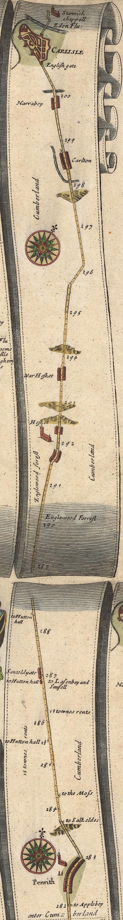 OG38PtoC.jpg item:- JandMN : 21 Image © see bottom of page |
|||||||||||||||||||||||||||||||
|
|
||||||||||||||||||||||||||||||||
| evidence:- | old map:- Morden 1695 (Cmd) |
|||||||||||||||||||||||||||||||
| source data:- | Map, uncoloured engraving, Cumberland, scale about 4 miles to 1
inch, by Robert Morden, 1695, published by Abel Swale, the
Unicorn, St Paul's Churchyard, Awnsham, and John Churchill, the
Black Swan, Paternoster Row, London, 1695-1715.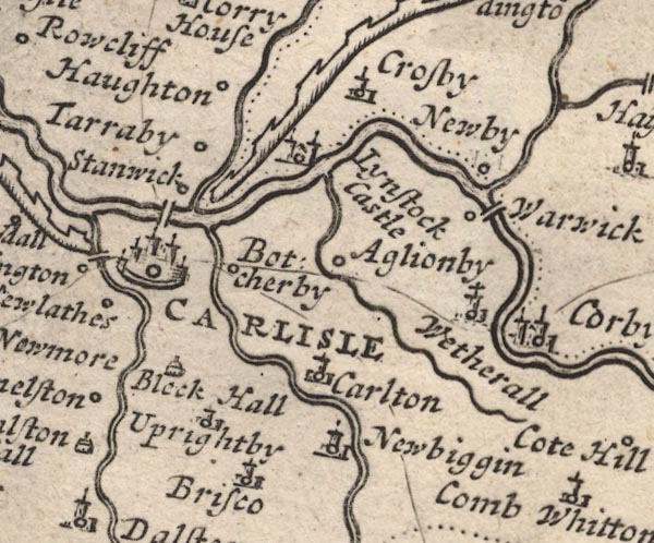 MD12NY45.jpg  MD12NY44.jpg  MD12NY54.jpg 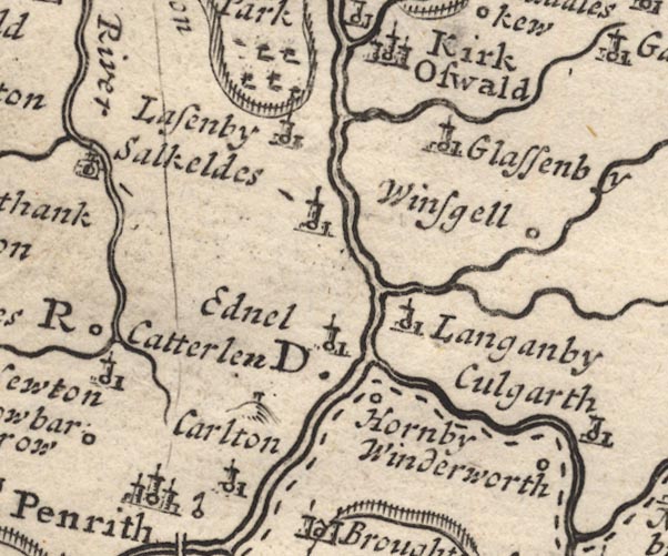 MD12NY53.jpg Single line. item:- JandMN : 90 Image © see bottom of page |
|||||||||||||||||||||||||||||||
|
|
||||||||||||||||||||||||||||||||
| evidence:- | presumably old map:- Morden 1695 (Cmd) placename:- Millitary Way |
|||||||||||||||||||||||||||||||
| source data:- | Map, hand coloured engraving, Westmorland, scale about 2.5 miles to 1 inch, by Robert
Morden, published by Abel Swale, the Unicorn, St Paul's Churchyard, Awnsham, and John
Churchill, the Black Swan, Paternoster Row, London, 1695.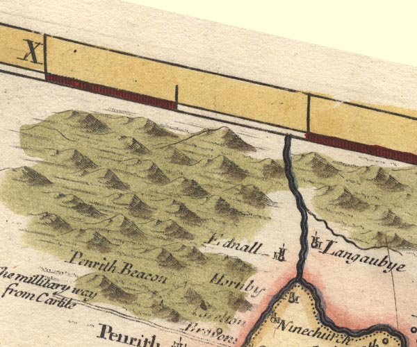 MD10NY53.jpg "The millitary way from Carlile" Double line. item:- JandMN : 24 Image © see bottom of page |
|||||||||||||||||||||||||||||||
|
|
||||||||||||||||||||||||||||||||
| evidence:- | descriptive text:- Fiennes 1698 |
|||||||||||||||||||||||||||||||
| source data:- | Travel book, manuscript record of Journeys through England
including parts of the Lake District, by Celia Fiennes, 1698. "The wayes from thence [penrith, OR Long Meg] to Carlisle over much heath where they have many stone quarrys and cut much peate and turff, which is their chief fuel; its reckon'd but 16 mile from Peroth to Carlisle but they are pretty long, besides my going out of the way above 3 or 4 mile, which made it 20; they were very long and I was a great while rideing it; you pass by the little hutts and hovels the poor live in like barnes some have them daub'd with mud-wall others drye walls." |
|||||||||||||||||||||||||||||||
|
|
||||||||||||||||||||||||||||||||
| evidence:- | old map:- Bowen 1720 (plate 94) |
|||||||||||||||||||||||||||||||
| source data:- | Strip maps, uncoloured engravings, road maps, The Road from
London to Carlisle, scale about 2 miles to 1 inch, with sections
in Lancashire and Westmorland, published by Emanuel Bowen, St
Katherines, London, 1720.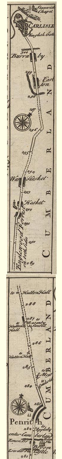 B094PtoC.jpg item:- Dove Cottage : 2007.38.100 Image © see bottom of page |
|||||||||||||||||||||||||||||||
|
|
||||||||||||||||||||||||||||||||
| evidence:- | old map:- Badeslade 1742 placename:- |
|||||||||||||||||||||||||||||||
| source data:- | Map, uncoloured engraving, A Map of Cumberland North from
London, scale about 11 miles to 1 inch, with descriptive text,
by Thomas Badeslade, London, engraved and published by William
Henry Toms, Union Court, Holborn, London, 1742. click to enlarge click to enlargeBD10.jpg "" double line item:- JandMN : 115 Image © see bottom of page |
|||||||||||||||||||||||||||||||
|
|
||||||||||||||||||||||||||||||||
| evidence:- | old map:- Simpson 1746 map (Wmd) placename:- Military Way |
|||||||||||||||||||||||||||||||
| source data:- | Map, uncoloured engraving, Westmorland, scale about 8 miles to 1
inch, printed by R Walker, Fleet Lane, London, 1746. SMP2NYL.jpg "The Military Way to Carlisle" Double line. item:- Dove Cottage : 2007.38.59 Image © see bottom of page |
|||||||||||||||||||||||||||||||
|
|
||||||||||||||||||||||||||||||||
| evidence:- | old map:- Bowen and Kitchin 1760 |
|||||||||||||||||||||||||||||||
| source data:- | Map, hand coloured engraving, A New Map of the Counties of
Cumberland and Westmoreland Divided into their Respective Wards,
scale about 4 miles to 1 inch, by Emanuel Bowen and Thomas
Kitchin et al, published by T Bowles, Robert Sayer, and John
Bowles, London, 1760.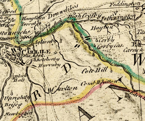 BO18NY45.jpg double line, solid 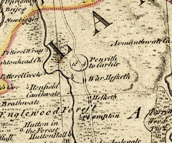 BO18NY44.jpg "Penrith to Carlile 18 4" double line, dotted, road distance 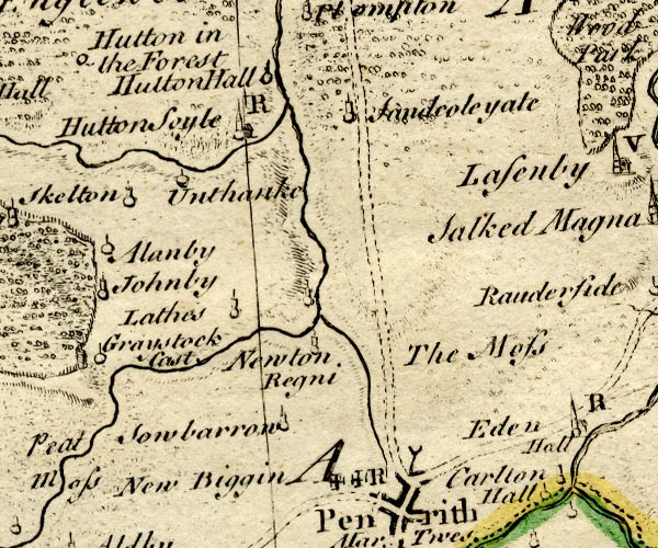 BO18NY43.jpg double line, dotted item:- Armitt Library : 2008.14.10 Image © see bottom of page |
|||||||||||||||||||||||||||||||
|
|
||||||||||||||||||||||||||||||||
| evidence:- | old map:- Kitchin 1767 (plate 40) |
|||||||||||||||||||||||||||||||
| source data:- | Road strip map, uncoloured engraving, The Road from London to
Carlisle, in Kitchin's Post Chaise Companion, by Thomas Kitchin,
published by Robert Sayer, 53 Fleet Street, John Bowles,
Cornhill, and Carington Bowles, St Paul's Church Yard, London,
1767.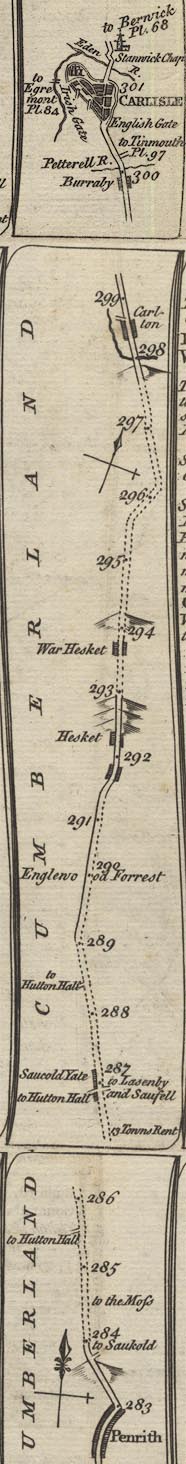 K040PtoC.jpg item:- Hampshire Museums : FA1999.138.40 Image © see bottom of page |
|||||||||||||||||||||||||||||||
|
|
||||||||||||||||||||||||||||||||
| evidence:- | old map:- Donald 1774 (Cmd) |
|||||||||||||||||||||||||||||||
| source data:- | Map, hand coloured engraving, 3x2 sheets, The County of Cumberland, scale about 1
inch to 1 mile, by Thomas Donald, engraved and published by Joseph Hodskinson, 29
Arundel Street, Strand, London, 1774. double line, solid or dotted, with a dot or milestone and number at 1 mile intervals, tinted red; turnpike road 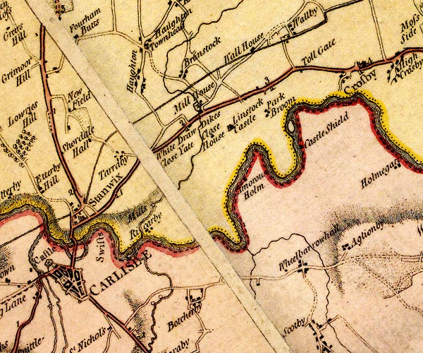 D4NY45NW.jpg from English Gate 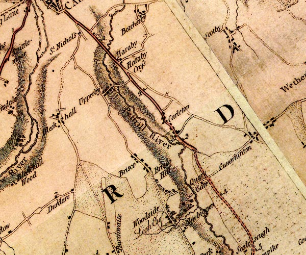 D4NY45SW.jpg 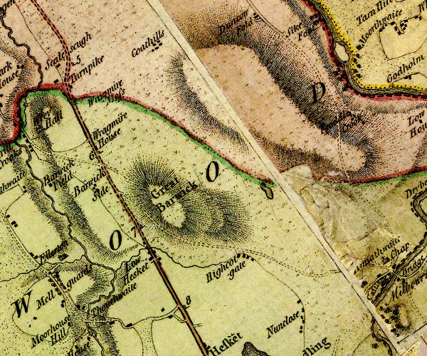 D4NY44NE.jpg 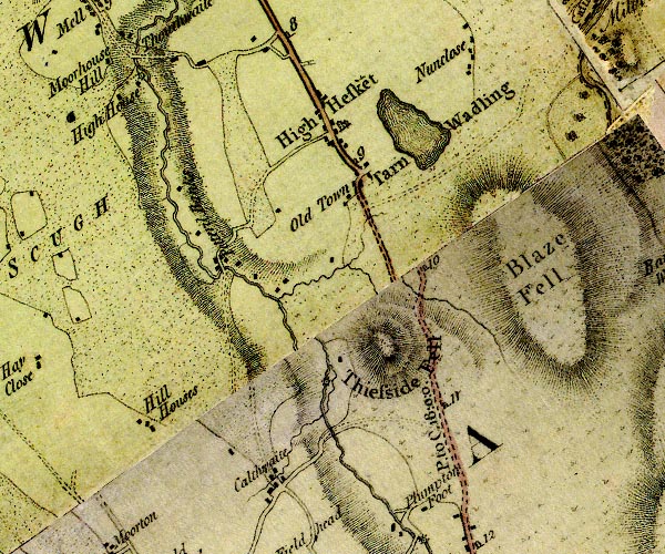 D4NY44SE.jpg "P. to C. 18:0:0" miles.furlongs.poles; Penrith to Carlisle 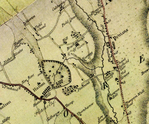 D4NY43NE.jpg 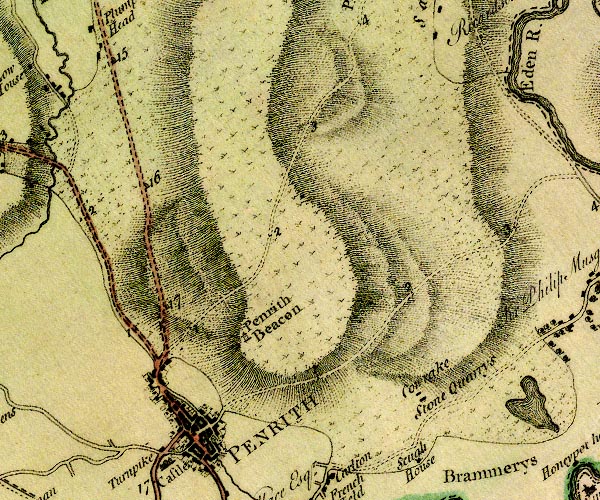 D4NY53SW.jpg item:- Carlisle Library : Map 2 Images © Carlisle Library |
|||||||||||||||||||||||||||||||
|
|
||||||||||||||||||||||||||||||||
| evidence:- | old map:- Donald 1774 (Cmd) placename:- Plumpton Street |
|||||||||||||||||||||||||||||||
| source data:- | Map, hand coloured engraving, 3x2 sheets, The County of Cumberland, scale about 1
inch to 1 mile, by Thomas Donald, engraved and published by Joseph Hodskinson, 29
Arundel Street, Strand, London, 1774. D4NY43NE.jpg "Plumpton Street" road item:- Carlisle Library : Map 2 Image © Carlisle Library |
|||||||||||||||||||||||||||||||
|
|
||||||||||||||||||||||||||||||||
| evidence:- | old map:- Donald 1774 (Cmd) |
|||||||||||||||||||||||||||||||
| source data:- | Map, hand coloured engraving, 3x2 sheets, The County of Cumberland, scale about 1
inch to 1 mile, by Thomas Donald, engraved and published by Joseph Hodskinson, 29
Arundel Street, Strand, London, 1774.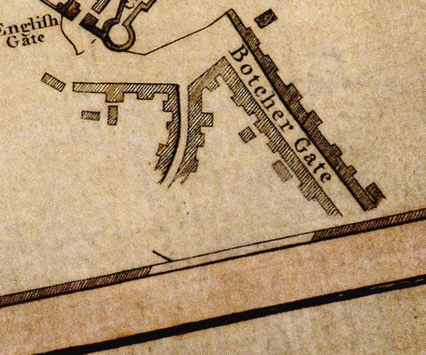 D44055H.jpg road out of town item:- Carlisle Library : Map 2 Image © Carlisle Library |
|||||||||||||||||||||||||||||||
|
|
||||||||||||||||||||||||||||||||
| evidence:- | road map:- Cary 1790 (Cmd/edn 1789) |
|||||||||||||||||||||||||||||||
| source data:- | Road map, hand coloured engraving, Cumberland, scale about 15
miles to 1 inch, by John Cary, 181 Strand, London, 1790, edn
1789. click to enlarge click to enlargeCY47.jpg double line, with road distances from Penrith item:- JandMN : 419 Image © see bottom of page |
|||||||||||||||||||||||||||||||
|
|
||||||||||||||||||||||||||||||||
| evidence:- | road map:- Cary 1790 (Wmd/edn 1792) |
|||||||||||||||||||||||||||||||
| source data:- | Road map, hand coloured engraving, Westmoreland, scale about
11.5 miles to 1 inch, by John Cary, 181 Strand, London, 1790,
edn 1792. click to enlarge click to enlargeCY16.jpg "from Carlisle / the Grt. North Road" double line item:- JandMN : 44 Image © see bottom of page |
|||||||||||||||||||||||||||||||
|
|
||||||||||||||||||||||||||||||||
| evidence:- | old text:- Gents Mag item:- accident; mail coach |
|||||||||||||||||||||||||||||||
| source data:- | Magazine, The Gentleman's Magazine or Monthly Intelligencer or
Historical Chronicle, published by Edward Cave under the
pseudonym Sylvanus Urban, and by other publishers, London,
monthly from 1731 to 1922. goto source Gentleman's Magazine 1792 p.581 "..." "[died] At the Crown Inn at Penrith, Mr. Frederick Sneedorf, a Danish gentleman, professor of history in the University of Copenhagen, and a correspondent in this Magazine (see p.491). On the evening of the 13th, the Manchester mail-coach arrived at the usual time in Penrith, with four inside passengers, viz. a lady and three gentlemen, and one outside passenger, a man. About the first mile-post from Penrith, the nearside leading horse, by some unaccountable accident, got the bridle rubbed off its head; and at a time when all four horses were walking very slowly, and being rather spirited, made a sudden turn, to come back to Penrith. The outside passenger and guard, who had both got off the coach, to ease the horses up the hill, and the coachman, who was perfectly sober, made every effort to prevent the horses turning round, but without effect, having no command of the nearside leader, on account of the bridle being wanting. The coachman thought that by getting off his box, he could, with the assistance of the guard and outside passenger, stop the horses; but all would not do; they set off at a gallop. Mr. Sneedorff, and another gentleman whose name is not known, leaped out of the coach. The latter escaped with a slight scratch on his face; the former, we are sorry to say, in leaping out (it is supposed) pitched upon his head, and received a concussion of the brain, of which he lingered until one o'clock in the morning of the 15th, and then expired. The lady and gentleman who remained in the coach received no injury; and, it is imagined, had the other two" |
|||||||||||||||||||||||||||||||
|
|
||||||||||||||||||||||||||||||||
| evidence:- | old text:- Gents Mag 1792 |
|||||||||||||||||||||||||||||||
| source data:- | goto source Gentleman's Magazine 1792 p.582 "remained, all would have been safe. The coachman was hurt in his endeavours to stop the horses, but is recovering; the horses were slightly hurt." |
|||||||||||||||||||||||||||||||
|
|
||||||||||||||||||||||||||||||||
| evidence:- | road book:- Cary 1798 (2nd edn 1802) |
|||||||||||||||||||||||||||||||
| source data:- | Road book, itineraries, Cary's New Itinerary, by John Cary, 181
Strand, London, 2nd edn 1802. goto source click to enlarge click to enlargeC38267.jpg page 267-268 "LONDON, through Manchester and Carlisle, to Port Patrick" part of goto source click to enlarge click to enlargeC38271.jpg page 271-272 "[PORT PATRICK to Northampton.]" in the reverse route goto source click to enlarge click to enlargeC38283.jpg page 283-284 "LONDON to Glasgow" part of goto source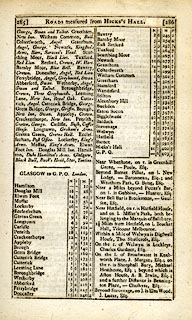 click to enlarge click to enlargeC38285.jpg page 285-286 "GLASGOW to G.P.O. London." part of reverse route goto source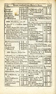 click to enlarge click to enlargeC38319.jpg page 319-320 "Beyond Penrith, on r. a T.R. to Carlisle." item:- JandMN : 228.1 Image © see bottom of page |
|||||||||||||||||||||||||||||||
|
|
||||||||||||||||||||||||||||||||
| evidence:- | descriptive text:- Baker 1802 |
|||||||||||||||||||||||||||||||
| source data:- | Perspective road map with sections in Lancashire, Westmorland,
and Cumberland, by J Baker, London 1802. Page 27:- "The road from Penrith to Carlisle continues for some way on the breast of the hill I just noticed [Beacon Hill]. The river Petterill also bends its course near it, and from hence is a pleasant prospect over the open lands that are contiguous; where countless slips of gaily coloured tillage extend in various directions like the expanded folds of a fan, unto its termination amidst thick woodlands and enclosed pasturage." "After a few miles travel, these highlands cease to prevail, and a wide champaign country opens in great breadth towards the north, in the centre of which the antient city of Carlisle seems lifting its sacred gothic grandeur to the distant view of the traveller. ..." |
|||||||||||||||||||||||||||||||
|
|
||||||||||||||||||||||||||||||||
| evidence:- | old map:- Cooke 1802 |
|||||||||||||||||||||||||||||||
| source data:- | Map, Cumberland, scale about 15.5 miles to 1 inch, by George
Cooke, 1802, bound in Gray's New Book of Roads, 1824, published
by Sherwood, Jones and Co, Paternoster Road, London, 1824. click to enlarge click to enlargeGRA1Cd.jpg double line, feathered edges; post road? item:- Hampshire Museums : FA2000.62.2 Image © see bottom of page |
|||||||||||||||||||||||||||||||
|
|
||||||||||||||||||||||||||||||||
| evidence:- | old map:- Cooke 1802 |
|||||||||||||||||||||||||||||||
| source data:- | Map, Westmoreland ie Westmorland, scale about 12 miles to 1
inch, by George Cooke, 1802, published by Sherwood, Jones and
Co, Paternoster Road, London, 1824. click to enlarge click to enlargeGRA1Wd.jpg "from Carlisle - the Grt. North Road" double line, light dark solid; road item:- Hampshire Museums : FA2000.62.4 Image © see bottom of page |
|||||||||||||||||||||||||||||||
|
|
||||||||||||||||||||||||||||||||
| evidence:- | old map:- Laurie and Whittle 1806 |
|||||||||||||||||||||||||||||||
| source data:- | Road map, Completion of the Roads to the Lakes, scale about 10
miles to 1 inch, by Nathaniel Coltman? 1806, published by Robert
H Laurie, 53 Fleet Street, London, 1834. click to enlarge click to enlargeLw18.jpg double line, light bold; 'Mail-Coach Roads (Direct)' item:- private collection : 18.18 Image © see bottom of page |
|||||||||||||||||||||||||||||||
|
|
||||||||||||||||||||||||||||||||
| evidence:- | old map:- Laurie and Whittle 1806 |
|||||||||||||||||||||||||||||||
| source data:- | Road map, Continuation of the Roads to Glasgow and Edinburgh,
scale about 10 miles to 1 inch, by Nathaniel Coltman? 1806,
published by Robert H Laurie, 53 Fleet Street, London, 1834. click to enlarge click to enlargeLw21.jpg double line, light bold; 'Mail-Coach Roads (Direct)' item:- private collection : 18.21 Image © see bottom of page |
|||||||||||||||||||||||||||||||
|
|
||||||||||||||||||||||||||||||||
| evidence:- | old map:- Cooper 1808 |
|||||||||||||||||||||||||||||||
| source data:- | Map, uncoloured engraving, Cumberland, scale about 10.5 miles to
1 inch, drawn and engraved by Cooper, published by R Phillips,
Bridge Street, Blackfriars, London, 1808. click to enlarge click to enlargeCOP3.jpg double line; road item:- JandMN : 86 Image © see bottom of page |
|||||||||||||||||||||||||||||||
|
|
||||||||||||||||||||||||||||||||
| evidence:- | old map:- Wallis 1810 (Cmd) |
|||||||||||||||||||||||||||||||
| source data:- | Road map, hand coloured engraving, Cumberland, scale about 16
miles to 1 inch, by James Wallis, 77 Berwick Stree, Soho,
London, 1810. click to enlarge click to enlargeWL13.jpg double line, hatched; 'Mail Coach Road' item:- Dove Cottage : 2009.81.10 Image © see bottom of page |
|||||||||||||||||||||||||||||||
|
|
||||||||||||||||||||||||||||||||
| evidence:- | old map:- Hall 1820 (Cmd) |
|||||||||||||||||||||||||||||||
| source data:- | Map, hand coloured engraving, Cumberland, scale about 21 miles
to 1 inch, engraved by Sidney Hall, published by S Leigh, 18
Strand, London, 1820-31. click to enlarge click to enlargeHA14.jpg double line, solid; main road; Penrith, Upper Hesket, Low Heskett, Wragmire House, Carleton, Haraby, Carlisle item:- JandMN : 91 Image © see bottom of page |
|||||||||||||||||||||||||||||||
|
|
||||||||||||||||||||||||||||||||
| evidence:- | descriptive text:- Ford 1839 (3rd edn 1843) |
|||||||||||||||||||||||||||||||
| source data:- | Guide book, A Description of Scenery in the Lake District, by
Rev William Ford, published by Charles Thurnam, Carlisle, by W
Edwards, 12 Ave Maria Lane, Charles Tilt, Fleet Street, William
Smith, 113 Fleet Street, London, by Currie and Bowman,
Newcastle, by Bancks and Co, Manchester, by Oliver and Boyd,
Edinburgh, and by Sinclair, Dumfries, 1839. goto source Page 174:- "..." "XVIII. PENRITH TO CARLISLE.- 18 M."
|
|||||||||||||||||||||||||||||||
|
|
||||||||||||||||||||||||||||||||
| evidence:- | old map:- Ford 1839 map |
|||||||||||||||||||||||||||||||
| source data:- | Map, uncoloured engraving, Map of the Lake District of
Cumberland, Westmoreland and Lancashire, scale about 3.5 miles
to 1 inch, published by Charles Thurnam, Carlisle, and by R
Groombridge, 5 Paternoster Row, London, 3rd edn 1843.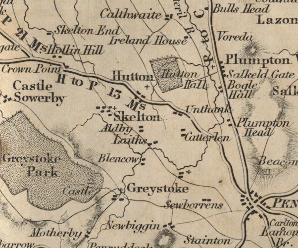 FD02NY43.jpg 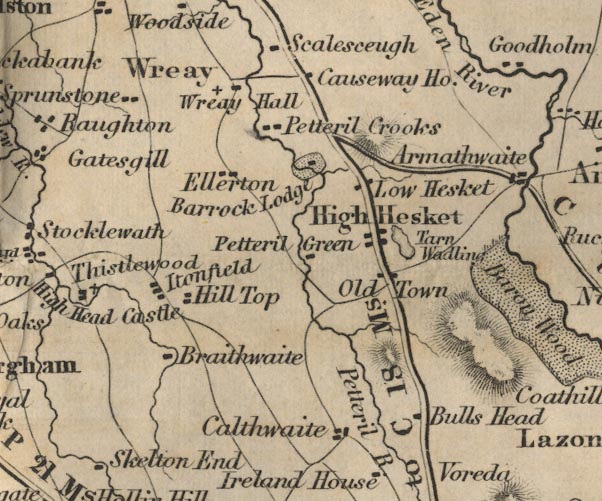 FD02NY44.jpg "P to C 18 Ms." 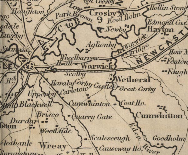 FD02NY45.jpg item:- JandMN : 100.1 Image © see bottom of page |
|||||||||||||||||||||||||||||||
|
|
||||||||||||||||||||||||||||||||
| evidence:- | old map:- Garnett 1850s-60s H |
|||||||||||||||||||||||||||||||
| source data:- | Map of the English Lakes, in Cumberland, Westmorland and
Lancashire, scale about 3.5 miles to 1 inch, published by John
Garnett, Windermere, Westmorland, 1850s-60s.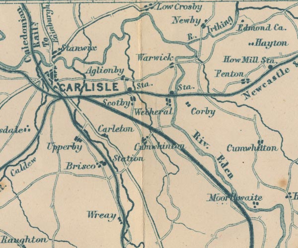 GAR2NY45.jpg double line, bold light, major road 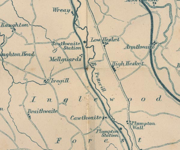 GAR2NY44.jpg 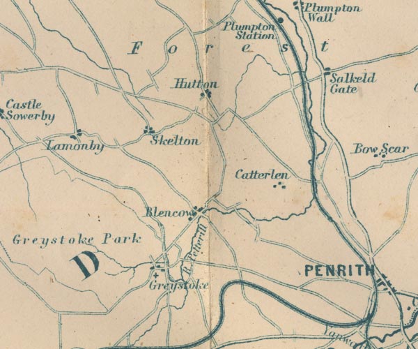 GAR2NY43.jpg 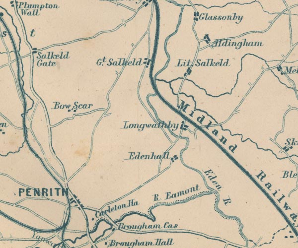 GAR2NY53.jpg item:- JandMN : 82.1 Image © see bottom of page |
|||||||||||||||||||||||||||||||
|
|
||||||||||||||||||||||||||||||||
| evidence:- | old itinerary:- Tinsley 1877 (Roads/Cum) |
|||||||||||||||||||||||||||||||
| source data:- | Itinerary, route 3, London to Edinburgh and Glasgow via Boroughbridge and Carlisle,
including from Bowes, Durham; through Brough, Appleby, Westmorland; then Penrith,
Carlisle, Longtown, Cumberland; and into Scotland, published by Tinsley Bros, 8 Catherine
Street, Strand, London, 1877. click to enlarge click to enlargeTLY138.jpg pp.36-49 in British High Roads, North and North Eastern Routes; pp.37-39. printed at p.36:- "... / ROUTE III. - LONDON to EDINBURGH and GLASGOW via / BOROUGHBRIDGE and CARLISLE (See Maps 31 to 42.) / Boroughbridge 206 (as per Route I.), Leeming 221½, Catterick 228, Greta Bridge 242½, Bowes 248½, Brough 261½, Appleby 269¾, / Penrith 283½, Carlisle 301½, Longtown 310¼, Langholm 321¾, / Hawick 349½, Selkirk 356, Middleton 379½, Edinburgh 392½. / ..."  click to enlarge click to enlargeTLY139.jpg item:- private collection : 270.1 Image © see bottom of page |
|||||||||||||||||||||||||||||||
|
|
||||||||||||||||||||||||||||||||
| evidence:- | old strip map:- Tinsley 1877 (Roads/Cum) |
|||||||||||||||||||||||||||||||
| source data:- | Strip map, road map, part of London to Edinburgh via Boroughbridge and Carlisle, including
from Appleby, Westmorland through Penrith to Carlisle, Cumberland, published by Tinsley
Bros, 8 Catherine Street, Strand, London, 1877.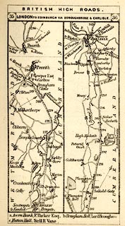 click to enlarge click to enlargeTLY1M2.jpg Map pp.35-36 in British High Roads, North and North Eastern Routes. printed at top:- "BRITISH HIGH ROADS. / 35 LONDON TO EDINBURGH, VIA BOROUGHBRIDGE &CARLISLE. 36" item:- private collection : 270.4 Image © see bottom of page |
|||||||||||||||||||||||||||||||
|
|
||||||||||||||||||||||||||||||||
| evidence:- | gradient diagram:- Gall and Inglis 1890s-1900s (Roads) |
|||||||||||||||||||||||||||||||
| source data:- | Contour Road Book of England, Northern Division, by Harry R G Inglis, published by
Gall and Inglis, 25 Paternoster Square, London and Edinburgh, 1898.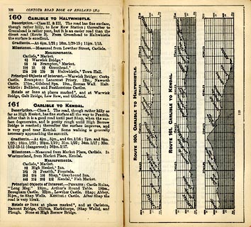 click to enlarge click to enlargeIG5160.jpg Itinerary, with gradient diagram, route 160, Carlisle to Haltwhistle, and route 161, Carlisle to Kendal, Westmorland, Cumberland and Northumberland, 1898. item:- JandMN : 763.8 Image © see bottom of page |
|||||||||||||||||||||||||||||||
|
|
||||||||||||||||||||||||||||||||
| evidence:- | old map:- Bell 1892 |
|||||||||||||||||||||||||||||||
| source data:- | Map, colour lithograph, Road Map of Cumberland, by George Joseph
Bell, scale about 2.5 miles to 1 inch, printed by Charles
Thurnam and Sons, Carlisle, Cumberland, 1892.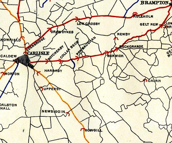 BEL9NY45.jpg 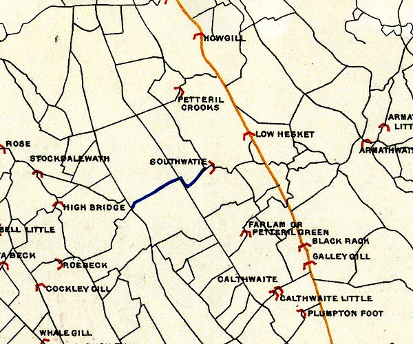 BEL9NY44.jpg 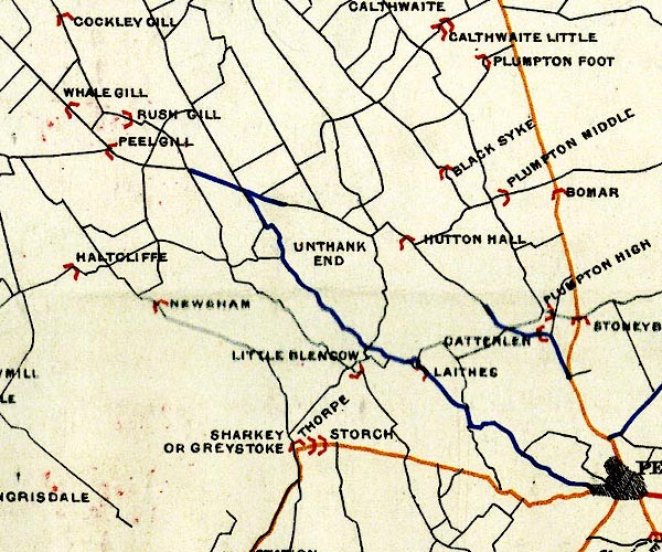 BEL9NY43.jpg 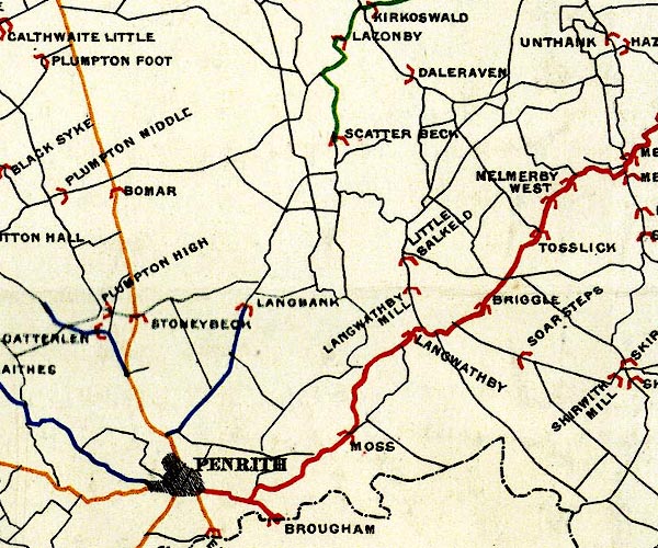 BEL9NY53.jpg orange - disturnpiked 'main road' under section 13 of the Highways Act 1878 since 1 September 1883 Road map of Cumberland showing County Bridges item:- Carlisle Library : Map 38 Images © Carlisle Library |
|||||||||||||||||||||||||||||||
|
|
||||||||||||||||||||||||||||||||
| evidence:- | old text:- Harper 1907 item:- mail coach |
|||||||||||||||||||||||||||||||
| source data:- | Guidebook, The Manchester and Glasgow Road, by Charles G Harper,
published by Chapman and Hall Ltd, London, 1907. HP01p107.txt Page 107:- "..." "It was only right and proper that on such a road as this amateur coachmen were few. It would, indeed, have sounded a higher note of propriety had there been none at all. With regard to the mails, the Post Office regulations, not only on this road, but on roads in general, strictly forbade coachmen allowing amateurs to drive, and expected guards to interpose, to prevent anything of the kind. On one occasion, when young Teather, of Teather &Son, the mail-contractors, had taken the coachman's place, and was about to drive his own horses, a half-indignant and half-terrified passenger seized the reins because the guard did not veto the arrangement. What would have happened to that guard for not fulfilling his instructions to the letter we do not know, for there happened to be a change of Government at the time, and when the guard somewhat impudently desired to know which of the two Postmasters-General - the in-coming or retiring - he was to address in his defence, the matter was allowed to drop." "One of the few privileged amateurs was Mr. James Parkin, who generally worked on Teather's ground out of Penrith, towards Carlisle. He was one of those who would drive only the best of teams, and so gave up when the railways encroached and the horses on the shorter journeys became" HP01p108.txt Page 108:- "inferior. He was wont to say he did not care to be a "screw-driver." He was a very steady but slow-going whip: too slow for the Mail, and lacked energy to make his horses slip along over the galloping ground, where really scientific coachmen always made up for lost time. The guard, in fact, was perpetually holding up his watch, admonishing him to "send 'em along."" "Ramsay of Barnton was a good enough whip when the cattle were good, but he liked to choose his ground. Nightingale, the great coursing judge of that day, was the one to "take a coach through the country." He took the horses as they came, - kickers or jibbers - and, thanks to his fine nerves and delicate handling of the ribbons, kept his time to a second." "..." HP01p136.txt Page 136:- "... "Scotland Road," [Penrith] confronting you, indicates the not far distant Border, and then, at the "White Ox" inn, the ways divide: on the right the Old Carlisle Road, on the left the new. Very steep and rough goes the old road for one mile. Prince Charlie marched it, and has my heartfelt sympathy. After passing the "Inglewood" inn, which seems forlornly to wonder what has become of the traffic, it rejoins the existing highway - which runs along the traces of an ancient Roman road - at Stony Beck. To the left hand, near Plumpton station, are some traces of the Roman station of Voreda, known as Castlesteads, or Old Penrith. It has yielded many relics. Of the ancient Inglewood Forest, and the alarming wild boars that frequented it, there are no signs, and the road - as excellent a road as one would wish to find - goes with little incident away into Carlisle itself, the Petterill Brook on the left hand. The "Pack Horse" inn stands at the cross-road to Lazonby, where Salkeld toll-gate once stood, and then, two miles from High Hesket, on the left hand, rises the hill known suggestively as Thiefside: the thieves in question, no doubt, the old horse-thieves, cattle-raiders, and moss-trooping vagabonds of the Border. Here, appropriately enough, Topliss, the motor-bandit, was shot dead by the police in June, 1920. High Hesket is a tiny wayside village of the rough stone houses, generally whitewashed, that hence-forward are the feature of the road, through Cumberland and into Dumfriesshire. The church of High Hesket, quite a humble little building, with bellcote in lieu of tower, stands shamefaced in a coating of compo, by the way, near another dilapidated old "White Ox" inn, once busy with traffic of a bygone day. The motor-cars disregard it, or merely halt for that last indignity to an inn, a pail of water wherewith to" HP01p137.txt Page 137:- "cool their engines. Dropping downhill to Low Hesket, the road comes quickly to Carleton and then, by the frowzy street of Botchergate, into the midst of Carlisle." "..." |
|||||||||||||||||||||||||||||||
|
|
||||||||||||||||||||||||||||||||
| evidence:- | old strip map:- CTC 1911 (Roads) |
|||||||||||||||||||||||||||||||
| source data:- | Page 15 of Cyclists' Touring Club British Road Book new series vol.6, edited by F
B Sandford, published by Thomas Nelson and Sons, London etc, 1911. click to enlarge click to enlargeCTC215.jpg Strip road map, route 1, Carlisle Penrith Shap, part of Carlisle to Tarporley, scale about 5 miles to 1 inch. Together with an itinerary and gradient diagram. item:- JandMN : 491.15 Image © see bottom of page |
|||||||||||||||||||||||||||||||
|
|
||||||||||||||||||||||||||||||||
| evidence:- | old map:- Burrow 1920s |
|||||||||||||||||||||||||||||||
| source data:- | Road book, On the Road, Dunlop Pictorial Road Plans, volume V,
strip maps with parts in Westmorland, Cumberland etc, irregular
scale about 1.5 miles to 1 inch, by E J Burrow and Co,
Cheltenham, Gloucestershire, 1920s. EJB3PtoC.jpg item:- private collection : 17 Image © see bottom of page |
|||||||||||||||||||||||||||||||
|
|
||||||||||||||||||||||||||||||||
| evidence:- | old text:- Burrow 1920s placename:- |
|||||||||||||||||||||||||||||||
| source data:- | Road book, strip maps with parts in Westmorland, Cumberland etc,
irregular scales about 1.5 miles to 1 inch, by E J Burrow and
Co, Cheltenham, Gloucestershire, 1920s. "... A good road leads from Penrith to Carlisle, descending by way of Plumpton Head and High Hesketh into the valley of the Eden. ..." |
|||||||||||||||||||||||||||||||
|
|
||||||||||||||||||||||||||||||||
 Act of Parliament Act of Parliament |
||||||||||||||||||||||||||||||||
|
|
||||||||||||||||||||||||||||||||
| hearsay:- |
Anyone working to repair the road at Wragmire, which was very boggy, was promised
an indulgence of 40 days of remitted penance by Bishop Welton, 1354. |
|||||||||||||||||||||||||||||||
|
|
||||||||||||||||||||||||||||||||
| places:- | Penrith Plumpton, Hesket High Hesket, Hesket Carleton, St Cuthbert Without Carlisle |
|||||||||||||||||||||||||||||||
|
|
||||||||||||||||||||||||||||||||
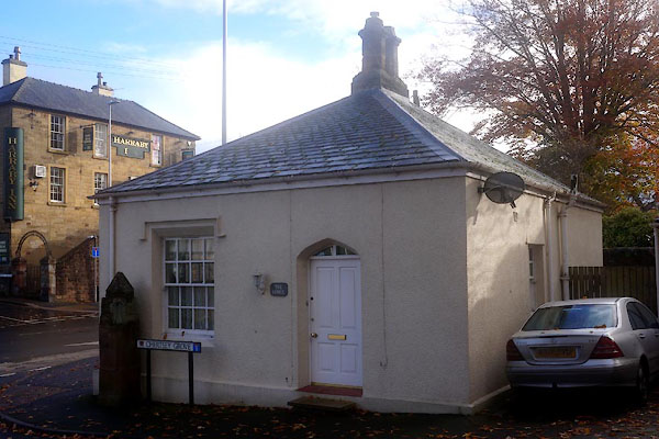
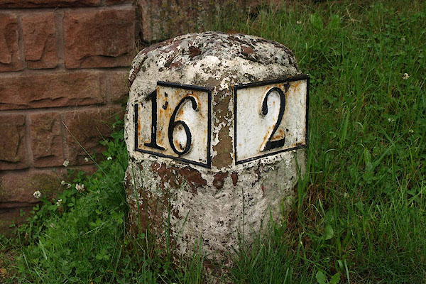
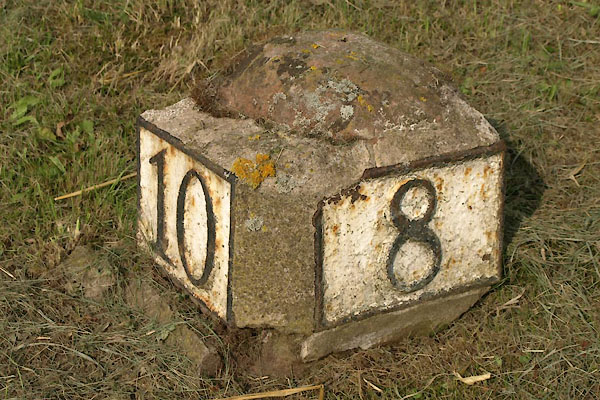
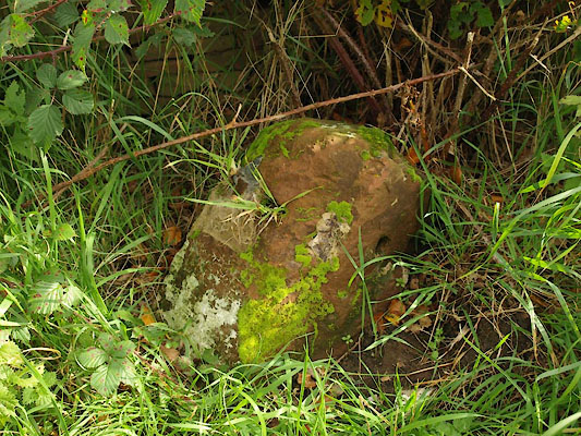
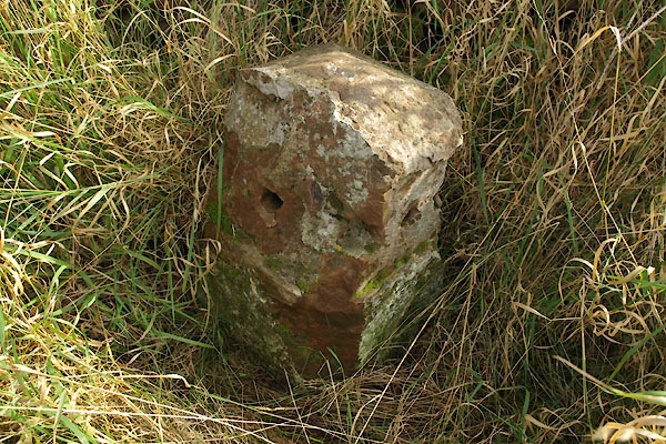
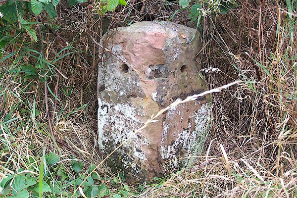
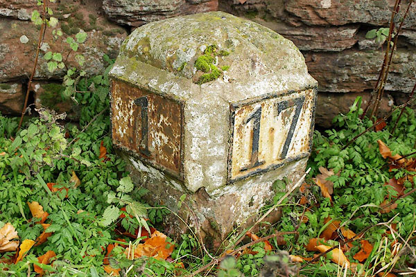
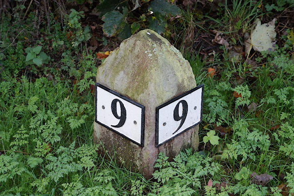
| milestones:- | All milestones known, various dates in sequence, mostly on A6 milestone, Penrith (4) milestone, Penrith (2) milestone, Penrith (3) milestone, Hesket (7) milestone, Hesket (6) milestone, Hesket (5) milestone, Hesket (4) milestone, Lazonby milestone, Hesket (8) on the old road through the village milestone, Hesket (3) milestone, Hesket (2) milestone, Hesket milestone, St Cuthbert Without (2) milestone, St Cuthbert Without milestone, Carlisle (2) milestone, Carlisle (12) |
|||||||||||||||||||||||||||||||
|
|
||||||||||||||||||||||||||||||||
| places:- |
|
|||||||||||||||||||||||||||||||
|
||||||||||||||||||||||||||||||||
|
||||||||||||||||||||||||||||||||
|
||||||||||||||||||||||||||||||||
|
||||||||||||||||||||||||||||||||
|
||||||||||||||||||||||||||||||||
|
||||||||||||||||||||||||||||||||
|
||||||||||||||||||||||||||||||||
|
||||||||||||||||||||||||||||||||
|
||||||||||||||||||||||||||||||||
|
||||||||||||||||||||||||||||||||
|
||||||||||||||||||||||||||||||||
|
||||||||||||||||||||||||||||||||
|
||||||||||||||||||||||||||||||||
|
||||||||||||||||||||||||||||||||
|
||||||||||||||||||||||||||||||||
|
||||||||||||||||||||||||||||||||
|
||||||||||||||||||||||||||||||||
|
||||||||||||||||||||||||||||||||
|
||||||||||||||||||||||||||||||||
|
||||||||||||||||||||||||||||||||
|
||||||||||||||||||||||||||||||||
|
||||||||||||||||||||||||||||||||
Lakes Guides menu.