Old Cumbria Gazetteer
 |
 |
|
||
| included in:- |
 road, Lancaster to Carlisle road, Lancaster to Carlisle |
|||
| road, Shap to Penrith | ||||
| Shap to Penrith | ||||
| Penrith to Shap | ||||
| A6 | ||||
| civil parish:- | Shap (formerly Westmorland) | |||
| civil parish:- | Shap Rural (formerly Westmorland) | |||
| civil parish:- | Thrimby (formerly Westmorland) | |||
| civil parish:- | Lowther (formerly Westmorland) | |||
| civil parish:- | Clifton (formerly Westmorland) | |||
| civil parish:- | Yanwath and Eamont Bridge (formerly Westmorland) | |||
| civil parish:- | Penrith (formerly Cumberland) | |||
| county:- | Cumbria | |||
| locality type:- | road route | |||
| 10Km square:- | NY51 | |||
| 10Km square:- | NY52 | |||
| 10Km square:- | NY53 | |||
|
|
||||
| evidence:- | old map:- Ogilby 1675 |
|||
| source data:- | Road strip map, hand coloured engraving, continuation of the
Road from London to Carlisle, scale about 1 inch to 1 mile, by
John Ogilby, London, 1675.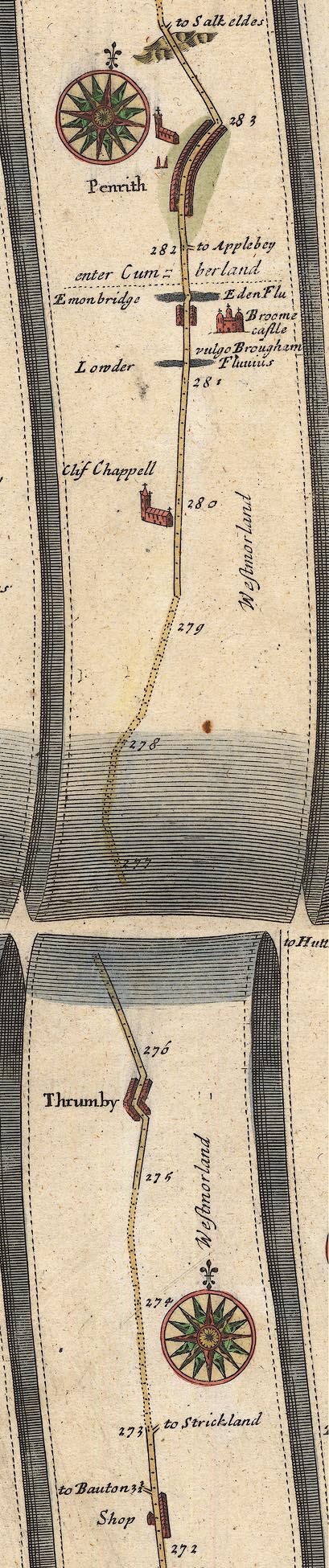 OG38StoP.jpg item:- JandMN : 21 Image © see bottom of page |
|||
|
|
||||
| evidence:- | old map:- Morden 1695 (Wmd) |
|||
| source data:- | Map, hand coloured engraving, Westmorland, scale about 2.5 miles to 1 inch, by Robert
Morden, published by Abel Swale, the Unicorn, St Paul's Churchyard, Awnsham, and John
Churchill, the Black Swan, Paternoster Row, London, 1695.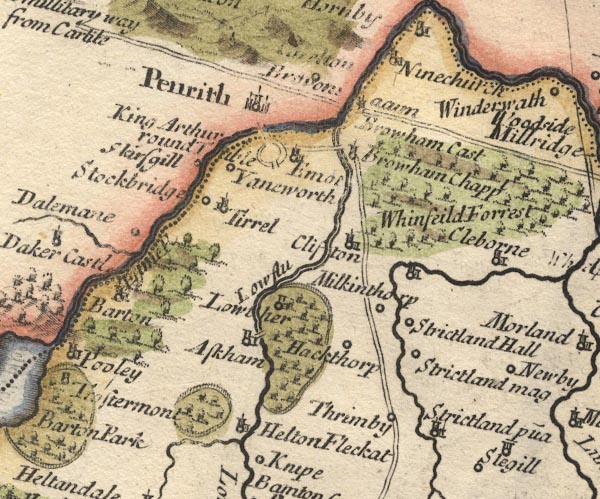 MD10NY52.jpg 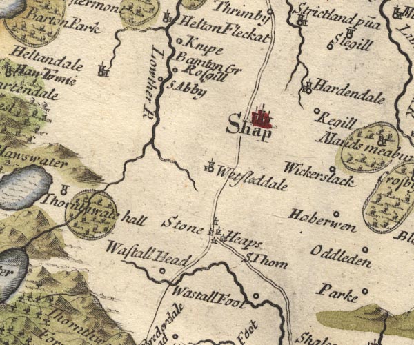 MD10NY51.jpg Double line. item:- JandMN : 24 Image © see bottom of page |
|||
|
|
||||
| evidence:- | old map:- Bowen 1720 (plate 94) |
|||
| source data:- | Strip maps, uncoloured engravings, road maps, The Road from
London to Carlisle, scale about 2 miles to 1 inch, with sections
in Lancashire and Westmorland, published by Emanuel Bowen, St
Katherines, London, 1720.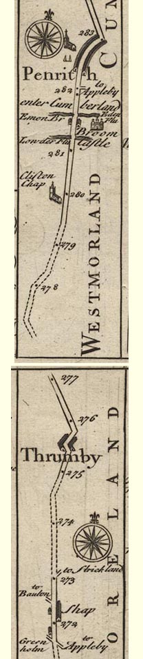 B094StoP.jpg item:- Dove Cottage : 2007.38.100 Image © see bottom of page |
|||
|
|
||||
| evidence:- | old map:- Badeslade 1742 placename:- |
|||
| source data:- | Map, uncoloured engraving, A Map of Westmorland North from
London, scale about 10 miles to 1 inch, with descriptive text,
by Thomas Badeslade, London, engraved and published by William
Henry Toms, Union Court, Holborn, London, 1742. click to enlarge click to enlargeBD12.jpg "" double line item:- Dove Cottage : 2007.38.62 Image © see bottom of page |
|||
|
|
||||
| evidence:- | old map:- Simpson 1746 map (Wmd) |
|||
| source data:- | Map, uncoloured engraving, Westmorland, scale about 8 miles to 1
inch, printed by R Walker, Fleet Lane, London, 1746.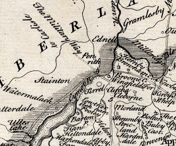 SMP2NYL.jpg Double line. item:- Dove Cottage : 2007.38.59 Image © see bottom of page |
|||
|
|
||||
| evidence:- | old map:- Bowen and Kitchin 1760 |
|||
| source data:- | Map, hand coloured engraving, A New Map of the Counties of
Cumberland and Westmoreland Divided into their Respective Wards,
scale about 4 miles to 1 inch, by Emanuel Bowen and Thomas
Kitchin et al, published by T Bowles, Robert Sayer, and John
Bowles, London, 1760.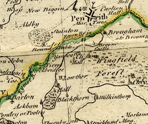 BO18NY42.jpg double line, dotted 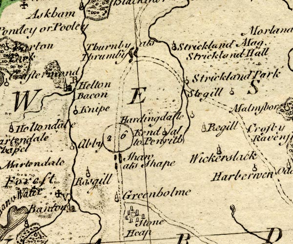 BO18NY41.jpg "Kendal to Penrith 26" double line, dotted item:- Armitt Library : 2008.14.10 Image © see bottom of page |
|||
|
|
||||
| evidence:- | old map:- Kitchin 1767 (plate 40) |
|||
| source data:- | Road strip map, uncoloured engraving, The Road from London to
Carlisle, in Kitchin's Post Chaise Companion, by Thomas Kitchin,
published by Robert Sayer, 53 Fleet Street, John Bowles,
Cornhill, and Carington Bowles, St Paul's Church Yard, London,
1767.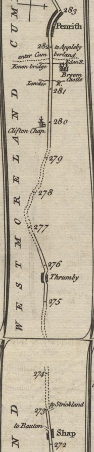 K040StoP.jpg item:- Hampshire Museums : FA1999.138.40 Image © see bottom of page |
|||
|
|
||||
| evidence:- | old map:- Jefferys 1770 (Wmd) |
|||
| source data:- | Map, 4 sheets, The County of Westmoreland, scale 1 inch to 1
mile, surveyed 1768, and engraved and published by Thomas
Jefferys, London, 1770.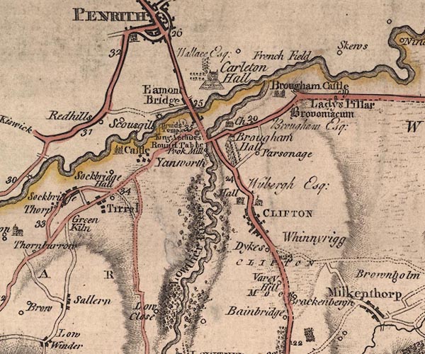 J5NY52NW.jpg 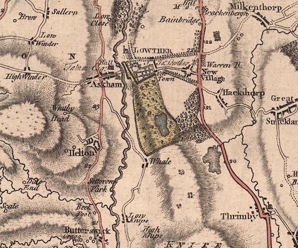 J5NY52SW.jpg 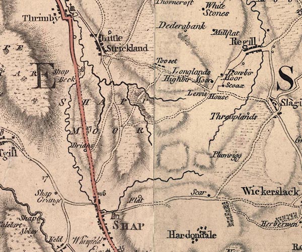 J5NY51NE.jpg double line; road, bold, main road, with mile numbers; old route by Hackthorpe item:- National Library of Scotland : EME.s.47 Images © National Library of Scotland |
|||
|
|
||||
| evidence:- | old map:- Donald 1774 (Cmd) |
|||
| source data:- | Map, hand coloured engraving, 3x2 sheets, The County of Cumberland, scale about 1
inch to 1 mile, by Thomas Donald, engraved and published by Joseph Hodskinson, 29
Arundel Street, Strand, London, 1774. double line, solid or dotted, with a dot or milestone and number at 1 mile intervals, tinted red; turnpike road into Westmorland 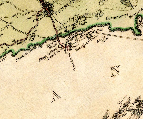 D4NY52NW.jpg "From Kendal" item:- Carlisle Library : Map 2 Image © Carlisle Library |
|||
|
|
||||
| evidence:- | old map:- Cary 1789 (edn 1805) |
|||
| source data:- | Map, uncoloured engraving, Westmoreland, scale about 2.5 miles
to 1 inch, by John Cary, London, 1789; edition 1805. CY24NY52.jpg  CY24NY51.jpg double line, bold light, numbered miles; main road item:- JandMN : 129 Image © see bottom of page |
|||
|
|
||||
| evidence:- | road map:- Cary 1790 (Cmd/edn 1789) |
|||
| source data:- | Road map, hand coloured engraving, Cumberland, scale about 15
miles to 1 inch, by John Cary, 181 Strand, London, 1790, edn
1789.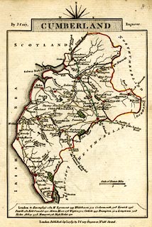 click to enlarge click to enlargeCY47.jpg "to Kendal" double line item:- JandMN : 419 Image © see bottom of page |
|||
|
|
||||
| evidence:- | road map:- Cary 1790 (Wmd/edn 1792) |
|||
| source data:- | Road map, hand coloured engraving, Westmoreland, scale about
11.5 miles to 1 inch, by John Cary, 181 Strand, London, 1790,
edn 1792.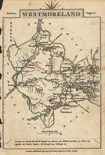 click to enlarge click to enlargeCY16.jpg double line, with road distances from Kendal item:- JandMN : 44 Image © see bottom of page |
|||
|
|
||||
| evidence:- | road book:- Cary 1798 (2nd edn 1802) |
|||
| source data:- | Road book, itineraries, Cary's New Itinerary, by John Cary, 181
Strand, London, 2nd edn 1802. goto source click to enlarge click to enlargeC38267.jpg page 267-268 "LONDON, through Manchester and Carlisle, to Port Patrick" part of goto source click to enlarge click to enlargeC38271.jpg page 271-272 "[PORT PATRICK to Northampton.]" part of reverse route goto source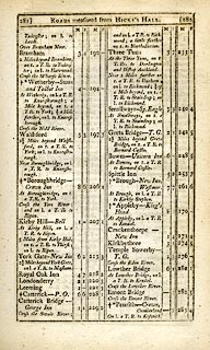 click to enlarge click to enlargeC38281.jpg page 281-282 "At Lowther Bridge, on l. a T.R. to Kendal." item:- JandMN : 228.1 Image © see bottom of page |
|||
|
|
||||
| evidence:- | road book:- Cary 1798 (2nd edn 1802) |
|||
| source data:- | Road book, itineraries, Cary's New Itinerary, by John Cary, 181
Strand, London, 2nd edn 1802. goto source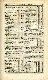 click to enlarge click to enlargeC38733.jpg page 733-734 "At Penrith, on l. a T.R. to Kendal." item:- JandMN : 228.2 Image © see bottom of page |
|||
|
|
||||
| evidence:- | descriptive text:- Baker 1802 |
|||
| source data:- | Perspective road map with sections in Lancashire, Westmorland,
and Cumberland, by J Baker, London 1802. pp.25-26:- "... near Penrith, the country imperceptibly exchanges its savage character for pleasurable views of cultivation and fertility. ..." |
|||
|
|
||||
| evidence:- | old map:- Cooke 1802 |
|||
| source data:- | Map, Westmoreland ie Westmorland, scale about 12 miles to 1
inch, by George Cooke, 1802, published by Sherwood, Jones and
Co, Paternoster Road, London, 1824. click to enlarge click to enlargeGRA1Wd.jpg double line, feathered edges; post road? item:- Hampshire Museums : FA2000.62.4 Image © see bottom of page |
|||
|
|
||||
| evidence:- | old map:- Cooke 1802 |
|||
| source data:- | Map, Cumberland, scale about 15.5 miles to 1 inch, by George
Cooke, 1802, bound in Gray's New Book of Roads, 1824, published
by Sherwood, Jones and Co, Paternoster Road, London, 1824. click to enlarge click to enlargeGRA1Cd.jpg "to Kendal the London Road" item:- Hampshire Museums : FA2000.62.2 Image © see bottom of page |
|||
|
|
||||
| evidence:- | old map:- Laurie and Whittle 1806 |
|||
| source data:- | Road map, Completion of the Roads to the Lakes, scale about 10
miles to 1 inch, by Nathaniel Coltman? 1806, published by Robert
H Laurie, 53 Fleet Street, London, 1834. click to enlarge click to enlargeLw18.jpg double line, light bold; 'Mail-Coach Roads (Direct)' item:- private collection : 18.18 Image © see bottom of page |
|||
|
|
||||
| evidence:- | old map:- Cooper 1808 |
|||
| source data:- | Map, hand coloured engraving, Westmoreland ie Westmorland, scale
about 9 miles to 1 inch, by H Cooper, 1808, published by R
Phillips, Bridge Street, Blackfriars, London, 1808. click to enlarge click to enlargeCOP4.jpg double line; road item:- Dove Cottage : 2007.38.53 Image © see bottom of page |
|||
|
|
||||
| evidence:- | old map:- Wallis 1810 (Wmd) |
|||
| source data:- | Road map, Westmoreland, scale about 19 miles to 1 inch, by James
Wallis, 77 Berwick Street, Soho, 1810, published by W Lewis,
Finch Lane, London, 1835? click to enlarge click to enlargeWAL5.jpg double line, hatched; 'Mail Coach Road' item:- JandMN : 63 Image © see bottom of page |
|||
|
|
||||
| evidence:- | old map:- Wallis 1810 (Cmd) |
|||
| source data:- | Road map, hand coloured engraving, Cumberland, scale about 16
miles to 1 inch, by James Wallis, 77 Berwick Stree, Soho,
London, 1810. click to enlarge click to enlargeWL13.jpg "to Kendal" double line, hatched; 'Mail Coach Road' item:- Dove Cottage : 2009.81.10 Image © see bottom of page |
|||
|
|
||||
| evidence:- | old map:- Hall 1820 (Wmd) |
|||
| source data:- | Map, hand coloured engraving, Westmoreland ie Westmorland, scale
about 14.5 miles to 1 inch, by Sidney Hall, London, 1820,
published by Samuel Leigh, 18 Strand, London, 1820-31. click to enlarge click to enlargeHA18.jpg "To Penrith" double line, solid; main road; Shap, Thrimby, Clifton, ... item:- Armitt Library : 2008.14.58 Image © see bottom of page |
|||
|
|
||||
| evidence:- | old map:- Hall 1820 (Cmd) |
|||
| source data:- | Map, hand coloured engraving, Cumberland, scale about 21 miles
to 1 inch, engraved by Sidney Hall, published by S Leigh, 18
Strand, London, 1820-31. click to enlarge click to enlargeHA14.jpg "To Kendall" double line, solid; main road; ... Penrith item:- JandMN : 91 Image © see bottom of page |
|||
|
|
||||
| evidence:- | old map:- Ford 1839 map |
|||
| source data:- | Map, uncoloured engraving, Map of the Lake District of
Cumberland, Westmoreland and Lancashire, scale about 3.5 miles
to 1 inch, published by Charles Thurnam, Carlisle, and by R
Groombridge, 5 Paternoster Row, London, 3rd edn 1843.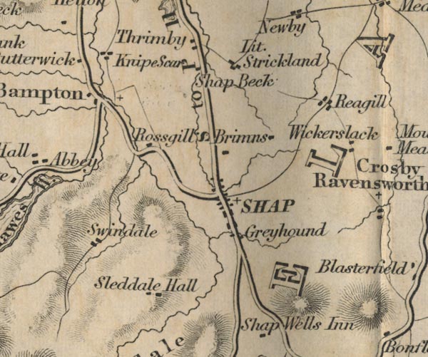 FD02NY51.jpg "S to P 11 Ms." 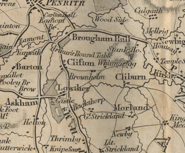 FD02NY52.jpg 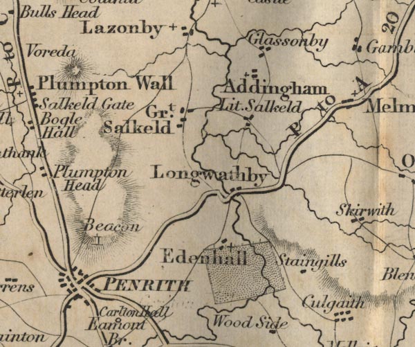 FD02NY53.jpg item:- JandMN : 100.1 Image © see bottom of page |
|||
|
|
||||
| evidence:- | old map:- Garnett 1850s-60s H |
|||
| source data:- | Map of the English Lakes, in Cumberland, Westmorland and
Lancashire, scale about 3.5 miles to 1 inch, published by John
Garnett, Windermere, Westmorland, 1850s-60s.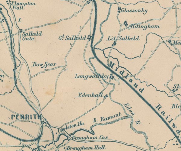 GAR2NY53.jpg double line, bold light, major road 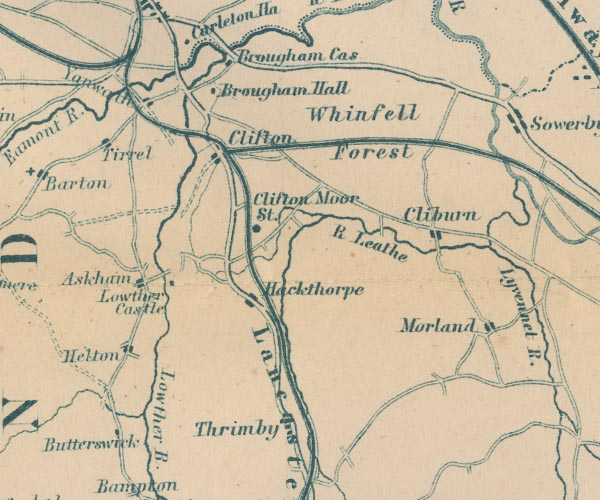 GAR2NY52.jpg 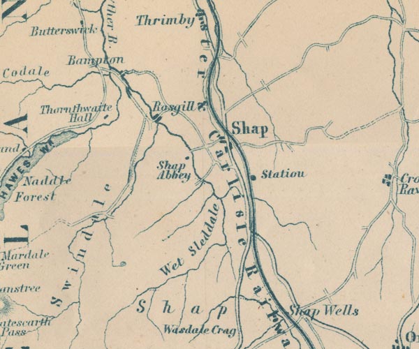 GAR2NY51.jpg item:- JandMN : 82.1 Image © see bottom of page |
|||
|
|
||||
| evidence:- | gradient diagram:- Gall and Inglis 1890s-1900s (Roads) |
|||
| source data:- | Contour Road Book of England, Northern Division, by Harry R G Inglis, published by
Gall and Inglis, 25 Paternoster Square, London and Edinburgh, 1898.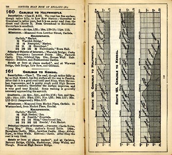 click to enlarge click to enlargeIG5160.jpg Itinerary, with gradient diagram, route 160, Carlisle to Haltwhistle, and route 161, Carlisle to Kendal, Westmorland, Cumberland and Northumberland, 1898. item:- JandMN : 763.8 Image © see bottom of page |
|||
|
|
||||
| evidence:- | old text:- Harper 1907 item:- mail coach; stage coach; snow; horse |
|||
| source data:- | Guidebook, The Manchester and Glasgow Road, by Charles G Harper,
published by Chapman and Hall Ltd, London, 1907. HP01p109.txt Page 109:- "..." "The Telfers were coachmen ... and well known over Shap way. Jem Barnes, on the other hand, was fat and lumbersome and lacked fire; so that people did say he had his sleeping-ground as well as his galloping-ground. But, one night, at least, when he was driving north over Shap Fell, there was little chance of sleeping. He had on that occasion not only to gallop at all the snow-drifts, but to put a postboy and a pair on in front. The pole-hook broke in midst of the blinding, snow-wreathed journey, and the hand of his almost namesake, Jem Byrns, the guard, was nearly frozen to the screw-wrench when he brought out a spare pole-hook and fastened it on. The snow was falling in flakes as large as crown-pieces all the while, and the only comic relief was the voice of a "heavy swell" issuing from the box seat, beneath a perfect tortoise-shell covering of capes and furs, "What are you fellows keeping me here in this cold for, and warming your own hands at the lamp?"" "George Eade, another of this distinguished company, was very deaf, but with hearing enough to be cognisant of a great many objurgations from Mr. Richardson, of the "Greyhound" at Shap, for taking it out of his horses. One day Richardson came out and was particularly bland - nothing to complain of at all - but George, unable to distinguish anything, and concluding he was on the old subject, had his back up in an instant. "Hang you!" said he, "I'm not before my time; I'll bet you ~5 of it; look at my watch!"" "..." HP01p110.txt Page 110:- "..." "The mail-coachmen on the Shap and Penrith stage were for some time afflicted with a mare that stopped with every one of them in turn at the end of two miles. At last they all wearied of her, and orders were issued that if she refused again, she was not to be brought back alive. On this fateful journey she started, and, according to her use and wont, suddenly sulked and sat down on her haunches in the middle of the road, like a dog, with her fore-legs straight out in front. The coachman, armed by the contractor with power of life or death, did not proceed to tragical extremities. He got down, took a rail out of the hedge, and struck her nine times below the knees with the flat side of it. The treatment proved effectual, not only for that journey, but for all time, and she was docile and willing ever after." "How bravely and doggedly the mails and stages battled on winter nights against the howling blasts of Shap and Stainmoor, sometimes contending with snowstorms and drifts in which not only the coachman and guard, but the passengers also, bore a hand at the snow-shovels and dug and delved until hands and feet, previously numbed with cold, glowed again! How anxiously, when the digging and delving seemed almost ineffectual and the drifts impassable, did they strain their vision to catch a glimpse through the murky night, filled with driving snowflakes for the cheerful lights of that roadside inn, the "Welcome into Cumberland," telling travellers accustomed to this road not only of comfort available at hand, but a farewell to the terrors of Westmoreland and approach to the sheltered little town of Penrith." |
|||
|
|
||||
| evidence:- | old strip map:- CTC 1911 (Roads) |
|||
| source data:- | Page 15 of Cyclists' Touring Club British Road Book new series vol.6, edited by F
B Sandford, published by Thomas Nelson and Sons, London etc, 1911.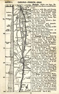 click to enlarge click to enlargeCTC215.jpg Strip road map, route 1, Carlisle Penrith Shap, part of Carlisle to Tarporley, scale about 5 miles to 1 inch. Together with an itinerary and gradient diagram. item:- JandMN : 491.15 Image © see bottom of page |
|||
|
|
||||
| evidence:- | old map:- Burrow 1920s |
|||
| source data:- | Road book, On the Road, Dunlop Pictorial Road Plans, volume V,
strip maps with parts in Westmorland, Cumberland etc, irregular
scale about 1.5 miles to 1 inch, by E J Burrow and Co,
Cheltenham, Gloucestershire, 1920s.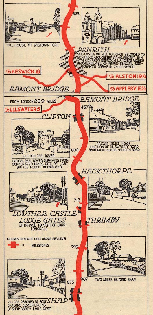 EJB3StoP.jpg item:- private collection : 17 Image © see bottom of page |
|||
|
|
||||
| evidence:- | old text:- Burrow 1920s placename:- |
|||
| source data:- | Road book, strip maps with parts in Westmorland, Cumberland etc,
irregular scales about 1.5 miles to 1 inch, by E J Burrow and
Co, Cheltenham, Gloucestershire, 1920s. "... At Shap we are not far from Lowther Castle, Lord Lonsdale's seat, which is to the left of the road. At Clifton, farther along, is one of the peel towers which were considered an indispensable adjunct to any house of importance during the troublous times of Border raids. ... Beyond here the grand old fortress of Brougham Castle, partly Norman, is to the right, while on the other side is soon passed the prehistoric earthwork called King Arthur's Round Table. The Eamont River is crossed by a fifteenth-century bridge and the climb beyond carries us into Cumberland." "Penrith is now close ahead, ..." |
|||
|
|
||||
 Act of Parliament Act of Parliament |
||||
|
|
||||
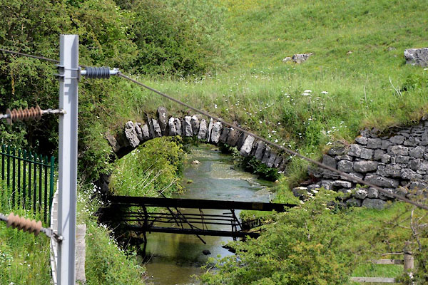
| places:- | Shap Clifton Lowther Bridge, Yanwath etc Eamont Bridge, Eamont Bridge Penrith |
|||
|
|
||||
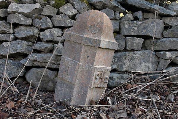
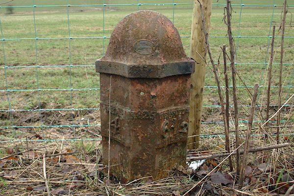
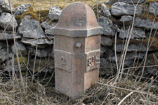
| milestones:- | All milestones known, various dates in sequence, mostly on A6 milestone, Shap (7) milestone, Shap milestone, Shap Rural (5) milestone, Thrimby (5) milestone, Thrimby (4) milestone, Thrimby (6) milestone, Thrimby (3) milestone, Thrimby milestone, Thrimby (2) on westerly route through Lowther milestone, Lowther (3) milestone, Lowther (5) on westerly route through Lowther milestone, Lowther milestone, Lowther (4) milestone, Clifton (2) milestone, Clifton (4) milestone, Clifton milestone, Clifton (5) milestone, Clifton (3) milestone, Yanwath etc |
|||
|
|
||||
| places:- |
|
|||
|
||||
|
||||
|
||||
|
||||
|
||||
|
||||
|
||||
|
||||
|
||||
|
||||
|
||||
|
||||
|
||||
|
||||
|
||||
|
||||
|
||||
|
||||
|
||||
|
||||
Lakes Guides menu.