 Old Cumbria Gazetteer
 |
 |
|
| Rumbling Hole, Lancashire | ||
| Rumbling Hole | ||
| Fairies' Workshop | ||
| county:- | Lancashire | |
| locality type:- | pothole | |
| locality type:- | cave | |
| coordinates:- | SD67117910 | |
| 1Km square:- | SD6779 | |
| 10Km square:- | SD67 | |
| altitude:- | 1115 feet | |
| altitude:- | 340m | |
| SummaryText:- | Explored by Yorkshire Ramblers Club, 1932. | |
| SummaryText:- | Grade IV; permission from Council of Northern Caving Clubs. | |
| references:- | Brook, D & Davies, G & Long, M H &Sutcliffe, J R: 1975: Northern Caves, vol.4 Whernside
and Gragareth: Dalesman Books:: ISBN 0 85206 259 1 |
|
|
|
||
| evidence:- | descriptive text:- Balderston c1890 placename:- Rumbling Hole placename:- Fairies' Workshop |
|
| source data:- | Book, Ingleton, Bygone and Present, by Robert R and Margaret
Balderston, published by Simpkin, Marshall and Co, London, and
by Edmndson and Co, 24 High Street, Skipton, Yorkshire, about
1890. goto source goto sourcepage 71:- "..." "Rumbling Hole, or the Fairies' Workshop." "Having ended our researches regarding caverns properly so-called, the same pasture [Fenwick's Allotment] was found to contain four other scenes of an analogous nature, two of these combining loveliness and sublime magnificence in a wonderful degree. How it is, that such awesome and stupendous chasms can combine these features appears strange, but yet such is the case. We ascended the groove which hollows the field, for a short distance until a plot, encircled by a railing and wire netting, was reached, and came upon the spot from the south western side, so that when our eyes fell upon the opening before us, they glanced upon its north eastern margin. We felt spell-bound for the moment, and quite unmatched in our cave-hunting attire for the felicitous loveliness before us. 'And yet not so,' for though 'the garb doth oft proclaim the man,' in this case at least, it was at fault in its revelations, for the heart beat in unison with the scene, whilst the quick brain was photographing its impressions. There lay an abysmal gulf most certainly; but its head was festooned with long and trailing, or rather pendant locks of ivy. One could have wished to have been so beauteously enwreathed. The verge was adorned with holly, hawthorn, and bilberry, whilst rocks and ledges were carpetted with moss, polypody, blechnum, and oxalis, as well as other plants. In the tables of our memory we set it down, that others might revel in what had so delighted us, accustomed as we have been both from youth and observation to such scenes. The plummet had, however, to do its work; that duty was incumbent upon it, and it indicated the depth as being one hundred and thirty-five" goto sourcepage 72:- "feet to the edge of the rock, and one hundred and fifty feet to the level of the ground above." "But hark! tap, tap, tap, comes slowly from the distant depths; this is the home of the gnomes or fairies; they are at work below in their workshop, and a far-off hammering can be heard. Leave them in peace! Some day the good fays may work your weal, although the ill-natured have designated as Rumbling Hole, what we prefer to dream of as The Fairies' Workshop." |
|
|
|
||
| evidence:- | old map:- Balderston c1890 map placename:- Rumbling Hole |
|
| source data:- | Map, the hills in the Ingleton area, probably by Robert R
Balderston, engraved by Goodall and Suddick, Leeds, West
Yorkshire, about 1890.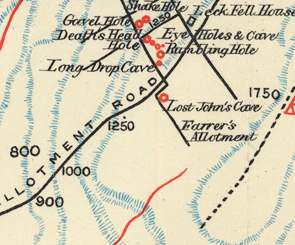 BS1SD67U.jpg "Rumbling Hole" item:- private collection : 27.1 Image © see bottom of page |
|
|
|
||
Lakes Guides menu.