 Old Cumbria Gazetteer
 |
 |
|
| Saddleback Old Mine, Mungrisdale | ||
| Saddleback Old Mine | ||
| civil parish:- | Mungrisdale (formerly Cumberland) | |
| county:- | Cumbria | |
| locality type:- | lead mine (none) | |
| locality type:- | mine | |
| coordinates:- | NY33202859 | |
| 1Km square:- | NY3328 | |
| 1Km square:- | NY3427 | |
| 10Km square:- | NY32 | |
|
|
||
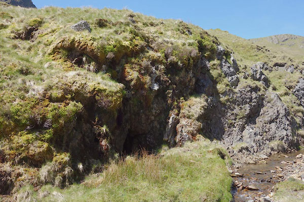 CDI47.jpg (taken 11.6.2015) 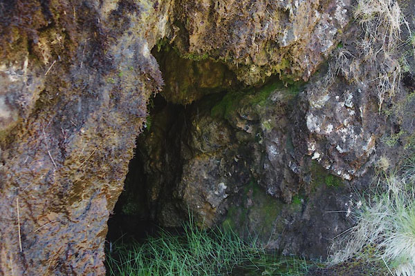 CDI49.jpg (taken 11.6.2015) |
||
|
|
||
| evidence:- | old map:- Postlethwaite 1877 (3rd edn 1913) |
|
| source data:- | Map, uncoloured engraving, Map of the Lake District Mining Field, Westmorland, Cumberland,
Lancashire, scale about 5 miles to 1 inch, by John Postlethwaite, published by W H
Moss and Sons, 13 Lowther Street, Whitehaven, Cumberland, 1877 edn 1913.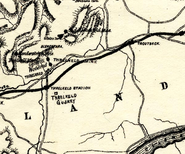 PST2NY32.jpg "[ ]d Mine" mine symbol item:- JandMN : 162.2 Image © see bottom of page |
|
|
|
||
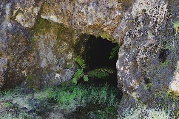 CDI48.jpg (taken 11.6.2015) 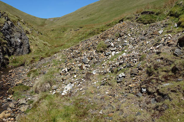 CDI50.jpg Spoil heap across the beck. (taken 11.6.2015) |
||
|
|
||
| :- |
The intention was to find lead, but only orange brown limonite was found, which might
have been used as a pigment - this failed. |
|
| The term limonite is used to hydrated oxides of iron with poorly crystalline characters
whose real identity is not known! |
||
| Adams, John: 1988: Mines of the Lake District Fells: Dalesman Books (Lancaster, Lancashire)::
ISBN 0 85206 931 6 Deer, W A & Howie, R A &Zusmann, J: 1966: Introduction to the Rock Forming Minerals: Longmans (London) |
||
|
|
||
 Lakes Guides menu.