 Old Cumbria Gazetteer
 |
 |
|
||||||||||||||||||||||||
| Saddleback, Threlkeld | ||||||||||||||||||||||||||
| Saddleback | ||||||||||||||||||||||||||
| Blencathra | ||||||||||||||||||||||||||
| civil parish:- | Threlkeld (formerly Cumberland) | |||||||||||||||||||||||||
| county:- | Cumbria | |||||||||||||||||||||||||
| locality type:- | hill | |||||||||||||||||||||||||
| coordinates:- | NY32342773 (etc) | |||||||||||||||||||||||||
| 1Km square:- | NY3227 | |||||||||||||||||||||||||
| 10Km square:- | NY32 | |||||||||||||||||||||||||
| altitude:- | 2847 feet | |||||||||||||||||||||||||
| altitude:- | 868m | |||||||||||||||||||||||||
|
|
||||||||||||||||||||||||||
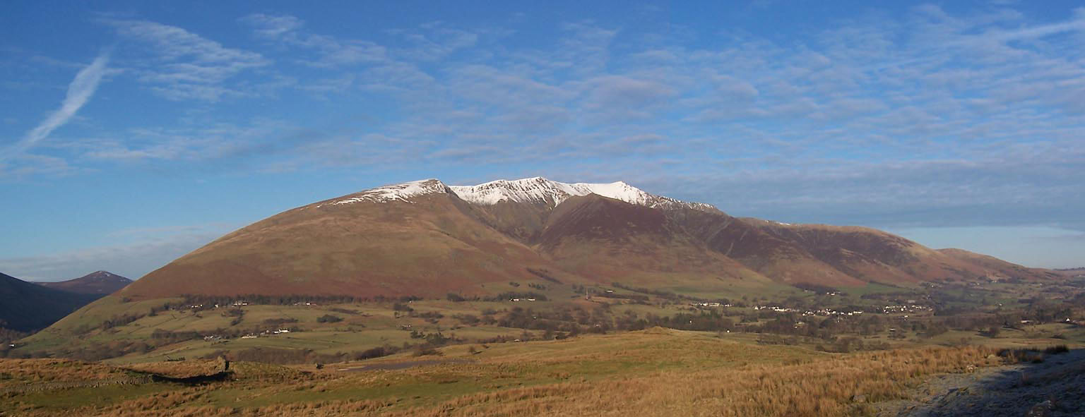 Click to enlarge BXT46.jpg From the south-west, Blease Fell, Gategill Fell, Hallsfell Top in snow, etc. (taken 13.12.2012) 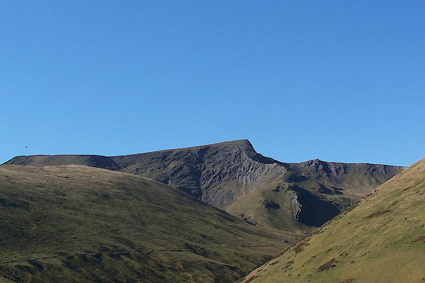 BWE01.jpg Sharp Edge leading to Atkinson Pike. (taken 26.3.2012) |
||||||||||||||||||||||||||
|
|
||||||||||||||||||||||||||
| evidence:- | old map:- OS County Series (Cmd 56 12) placename:- Saddleback |
|||||||||||||||||||||||||
| source data:- | Maps, County Series maps of Great Britain, scales 6 and 25
inches to 1 mile, published by the Ordnance Survey, Southampton,
Hampshire, from about 1863 to 1948. |
|||||||||||||||||||||||||
|
|
||||||||||||||||||||||||||
| evidence:- | old map:- Gents Mag 1747 placename:- Sadle Beck Mountain |
|||||||||||||||||||||||||
| source data:- | Map, uncoloured engraving, perspective view, Caudbeck Fells ie
Caldbeck Fells, scale about 1+ miles to 1 inch, published in the
Gentleman's Magazine, 1747.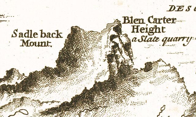 GM1401.jpg "Sadle beck Mount." knobbly hillocks; mountains item:- Carlisle Library : Map 43 Image © Carlisle Library |
|||||||||||||||||||||||||
|
|
||||||||||||||||||||||||||
| evidence:- | old text:- Gents Mag 1747 placename:- Sadleback Mount placename:- Saddle Back |
|||||||||||||||||||||||||
| source data:- | Map, perspective view, Caudbeck Fells ie Caldbeck Fells, scale about 1+ miles to 1
inch, and descriptive text, published in the Gentleman's Magazine, November 1747. goto source goto sourcePage 523:- "... Saddle back, a Parnassian eminence, with two prominent peaks; the most northerly is called Blencarter, a suprizingly high precipice of the quarry kind." |
|||||||||||||||||||||||||
|
|
||||||||||||||||||||||||||
| evidence:- | old map:- Donald 1774 (Cmd) placename:- Saddle Back |
|||||||||||||||||||||||||
| source data:- | Map, hand coloured engraving, 3x2 sheets, The County of Cumberland, scale about 1
inch to 1 mile, by Thomas Donald, engraved and published by Joseph Hodskinson, 29
Arundel Street, Strand, London, 1774.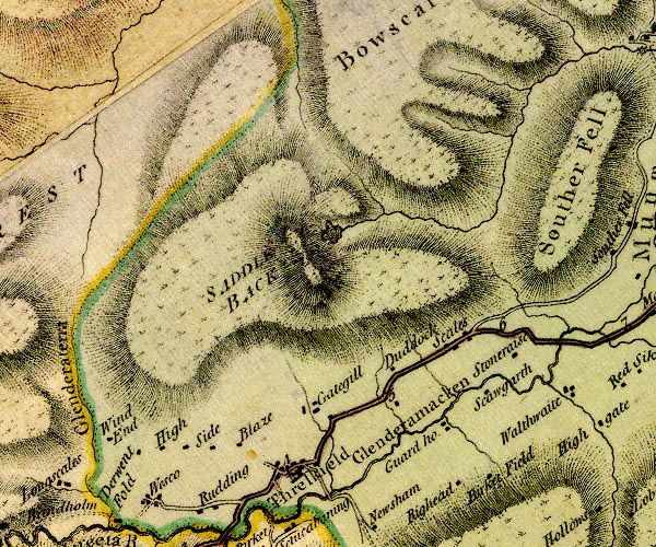 D4NY32NW.jpg "SADDLE BACK" hill hachuring; a hill or mountain item:- Carlisle Library : Map 2 Image © Carlisle Library |
|||||||||||||||||||||||||
|
|
||||||||||||||||||||||||||
| evidence:- | descriptive text:- West 1778 (11th edn 1821) placename:- Saddleback |
|||||||||||||||||||||||||
| source data:- | Guide book, A Guide to the Lakes, by Thomas West, published by
William Pennington, Kendal, Cumbria once Westmorland, and in
London, 1778 to 1821. goto source Addendum; Mr Gray's Journal, 1769 Page 202:- "..." "Oct. 2. I set out at ten for Keswick [from Penrith], ... passed through Penruddock and Threlkeld at the foot of Saddleback, whose furrowed sides were gilt by the noon-day sun, whilst its brow appeared of a sad purple, from the shadow of the clouds as they sailed slowly by it. ..." goto sourcePage 208:- "[from Fawe Park] ... in front rises Wallow-crag and Castle-hill, the town, the road to Penrith, Skiddaw, and Saddleback. ..." goto sourceMrs Radcliffe's Ride over Skiddaw, 1794 Page 308:- "[on Skiddaw] ... an indistinct multitude of Westmorland and Yorkshire highlands, whose lines disappeared behind Saddleback, now evidently pre-eminent over Skiddaw, so much so as too exclude many a height beyond it.- ..." |
|||||||||||||||||||||||||
|
|
||||||||||||||||||||||||||
| evidence:- | old map:- West 1784 map placename:- Saddle Back |
|||||||||||||||||||||||||
| source data:- | Map, hand coloured engraving, A Map of the Lakes in Cumberland,
Westmorland and Lancashire, scale about 3.5 miles to 1 inch,
engraved by Paas, 53 Holborn, London, about 1784.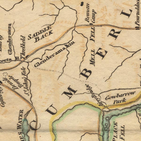 Ws02NY32.jpg "SADDLE BACK" item:- Armitt Library : A1221.1 Image © see bottom of page |
|||||||||||||||||||||||||
|
|
||||||||||||||||||||||||||
| evidence:- | old text:- Clarke 1787 placename:- Saddleback item:- echoes |
|||||||||||||||||||||||||
| source data:- | Guide book, A Survey of the Lakes of Cumberland, Westmorland,
and Lancashire, written and published by James Clarke, Penrith,
Cumberland, and in London etc, 1787; published 1787-93. goto source Page 58:- "... take a view of that rugged and stupendous mountain SADDLEBACK, a mountain which is itself a fund of curiosities: how Mr Gray passed it without notice I cannot say; but, if I may be allowed to conjecture, it was in the same manner as he actually visited several other scenes of awful grandeur, blind-folded! Let us however consider, that Mr Grey was not a mountaineer:- His tender, melancholy, and delicate muse, delighted to sport in sunny vales; or to recline under the shade of the spreading oak, listening to the warbling of the feathered choir over his head, or the tinkling of the stream that run purling at his feet." "As the mountain we have just named exhibits so very conspicuous and awful a view, I hope that a particular description of it will not be thought tedious, more particularly as it seems to throw light upon some of our other natural curiosities; I shall therefore copy, verbatim, the account given me by Mr Crosfeild, who very diligently searched into the nature of this and other of our Cumbrian mountains." ""Having been often struck with the singular situation and appearance of that piece of water which is commonly known by the name of Threlkeld Tarn, I formed many conjectures respecting its formation. I was for some time of opinion that it had been formed by water spouts frequently breaking on top of the mountain; but when I reflected that water could hardly be powerful enough to excavate solid rocks in so wonderful a manner, I was obliged to give up this opinion, and began to imagine that no agent of nature, except fire, could produce such an astonishing effect. In order to satisfy myself on that head, I determined to inspect narrowly into the minerals of the adjacent country. My first researches were naturally directed to the brooks in the neighbourhood: there I was pleasingly astonished to find vitrified lumps, resembling glass-house slags, in some places lying loose, in others evidently fitted by fusion to the crevices and irregularities of the stones among which they lay. I likewise found many large blocks of stone intermixed with marcasite in such plenty as to be inflammable; in other places there was a stratum of matter, a foot or more in thickness, which lay upon the rocks, and which seemed to have undergone a great degree of heat; above this was a stratum of sand intermixed with clay, pebbles, &c.; above that another stratum like the first; and, finally, a stratum of the common compost of the country soil, covered with peat earth. These appearances induced me to undertake a journey to the mountain; and accordingly taking the advantage of a fine day, I set off about eight in the morning, without any companion but my dog and my fowling-piece." ""Nothing material appeared till I reached the foot of the mountain, except a ridge about twenty yards broad and fifteen feet high, which extended from the basis of the mountain to the distance of about half a mile, and seemed to consist of some very hard materials; I followed this, and about nine o'clock I began to ascend the mountain. The road leads obliquely along the side of Souther-Fell, which is remarkable for nothing, except there is scarcely any trace of stratum to be seen, the whole resembling a mass of rubbish, and is evidently as steep as the nature of the soil will allow. After an ascent of a mile and upwards, I arrived at the top of Souther-Fell, which may be reckoned the first landing-place: here the ground is composed of loose fragments of stone intermixed with detached lumps of quartz and killas. I then pro-" |
|||||||||||||||||||||||||
| source data:- | goto source Page 59:- ""[pro]ceeded along the top of this hill, ascending gently about half a mile, when I arrived at the top of Scales-Fell, which may be called the second landing-place. Here I came to the brink of the first of those hideous chasms which furrow the southern face of this mountain. Nearly on a level with this is the Tairn, of which more hereafter. This first chasm, though by far the least formidable, is inconceivably horrid; its width is about two hundred yards, and its depth at least six hundred! There was now no more climbing, till I came at the mountain properly called Saddleback, to which the others are appendages: after a steep and painful ascent of about a mile, I came to the brink of the other gulfs. Here a point of the mountain juts out like the angle of a bastion between two of these horrid abysses. I stood upon this, (though my head turned so giddy I could not go to the extremity of it,) and had on each side a gulf about two hundred yards wide, and at least eight hundred deep! their sides were rocky, bare, and rough, scarcely an appearance of vegetation upon them; and their bottoms, which seemed narrow, were covered with pointed, broken rocks, of many shapes and dimensions. Passing this, I arrived at the farthest point, where the mountain has every appearance of having been split; and at the bottom I saw hills about forty yards high, and a mile in length, which seem to have been raised from the rubbish that has fallen from the mountain. From hence I went to the summit, where I could see the Tairn, which, as I was elevated upwards of two hundred yards above it, appeared very small: here, likewise, I had a most beautiful view of the country for many miles round, and could not help observing, that the back of this mountain is as remarkably smooth as its front is horrid. I then descended towards the Tairn, which is an oval piece of water, about two hundred yards from East to West, and about an hundred and fifty from North to South; it is surrounded by rocks, except an opening towards the East, where they have evidently broken down. Standing near this opening I discharged my gun, when the echo was inconceivable: it resembled a peal of thunder bursting over my head, and was so prodigiously loud and fierce, that my dog (though a staunch pointer) crept trembling behind me." ""Hence I proceeded along the rivulet which issues from the Tairn, seeking for minerals, and found some, which I sent to Edinburgh, to that incomparable chemist Dr Black, Professor of Chemistry in that University. I likewise found several immense stones, whose original places I could sometimes trace; and one in particular, which must have weighed near a hundred tons, and which must have been forced at least three hundred yards from its original situation: another I remarked of prodigious size separated about a foot and an half from its parent rock, and which cannot have fallen, as it lies now rather higher than the place it came from, as may be plainly traced by the veins and inequalities of each:- Evident marks of some dreadful convulsion! I then returned, partly along the rivulet, and partly the road I came. Upon the whole, I cannot help concluding, that this mountain has been formerly in a volcanic state, and that this Tairn has been the mouth or crater of the mountain. A collateral proof, indeed, I draw from the stones in the neighbourhood, which have almost every one of them the appearance of having been burnt."" |
|||||||||||||||||||||||||
| source data:- | goto source Page 60:- "Thus far the comments of my ingenious Friend: Let me now add some remarks of my own, ... Another thing I must remark, the silent running of the springs down the rocks on the back of the mountain. It may seem a little paradoxical, that a stream of water should flow silently down a precipice: the solution is easy; the rocks are covered with a soft delicate moss, of various colours, red, yellow, and green; the water flowing over this makes not the least noise: in some places, however, where it has formed for itself subterraneous channels, it makes a very singular and audible sound. These springs are of a remarkably pure and pleasant water, insomuch, that after a severe day's exercise upon the mountains, I have thought it more agreeable than any other liquor." |
|||||||||||||||||||||||||
|
|
||||||||||||||||||||||||||
| evidence:- | old print:- Clarke 1787 placename:- Sattleback |
|||||||||||||||||||||||||
| source data:- | circle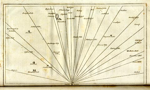 click to enlarge click to enlargeCL18.jpg "Sattleback" item:- Armitt Library : A6615.12 Image © see bottom of page |
|||||||||||||||||||||||||
|
|
||||||||||||||||||||||||||
| evidence:- | old map:- Cooke 1802 placename:- Saddle Back |
|||||||||||||||||||||||||
| source data:- | Map, The Lakes, Westmorland and Cumberland, scale about 8.5
miles to 1 inch, engravedby Neele and Son, published by
Sherwood, Jones and Co, Paternoster Road, London, 1824. click to enlarge click to enlargeGRA1Lk.jpg "Saddle Back" hillock; mountain item:- Hampshire Museums : FA2000.62.5 Image © see bottom of page |
|||||||||||||||||||||||||
|
|
||||||||||||||||||||||||||
| evidence:- | old map:- Cooper 1808 placename:- Saddle Back |
|||||||||||||||||||||||||
| source data:- | Map, uncoloured engraving, Cumberland, scale about 10.5 miles to
1 inch, drawn and engraved by Cooper, published by R Phillips,
Bridge Street, Blackfriars, London, 1808. click to enlarge click to enlargeCOP3.jpg "Saddle Back" hill hachuring; mountain or hill item:- JandMN : 86 Image © see bottom of page |
|||||||||||||||||||||||||
|
|
||||||||||||||||||||||||||
| evidence:- | old print with text:- Farington 1816 placename:- Saddleback item:- altitude, Saddleback; Trigonometrical Survey |
|||||||||||||||||||||||||
| source data:- | Print, uncoloured engraving and descriptive text, Saddleback and the River Rothay,
corrected to the River Greta by the text, Cumberland, drawn by Joseph Farington, engraved
by W Woolnoth, published by T Cadell and W Davies, Strand, London, 1815.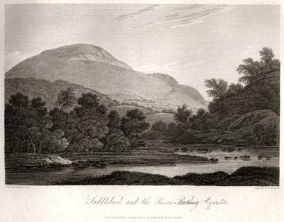 click to enlarge click to enlargeFA0405.jpg printed, bottom left, right, centre "Drawn by J. Farington R.A. / Engraved by W. Woolnoth. / Saddleback and the River Rothay. / London Published Septr. 15, 1815, by T. Cadell &W. Davies, Strand." Descriptive text:- "SADDLEBACK AND THE RIVER GRETA." "SADDLEBACK, a vast mountain united with the declivities of Skiddaw, forms the Eastern boundary of the alpine heights of this part of Cumberland. The road between Penrith and Keswick runs along its Southern base. It has obtained its appellation from its shape somewhat resembling a Saddle, when seen from different points of view. Its height is 2787 feet.[star] White farms, each with its grove to shelter it from descending gusts of wind, and pastures of the brightest verdure, intermingled with corn-fields, enliven the skirts of this mountain, at whose foot flows the little river Greta, which adds much to the picturesque effect of the scenery. The southern face of this lofty mountain is furrowed by several hideous chasms; and its summit is, in many parts, frightful and desolate. The view here given comprehends Saddleback only, and represents its appearance as seen from the western side of the mountain." "[star] Observations made in the Course of the Trigonometrical Survey. 1811. 4to." item:- Armitt Library : A6666.5 Image © see bottom of page |
|||||||||||||||||||||||||
|
|
||||||||||||||||||||||||||
| evidence:- | old map:- Otley 1818 placename:- Saddleback |
|||||||||||||||||||||||||
| source data:- | Map, uncoloured engraving, The District of the Lakes,
Cumberland, Westmorland, and Lancashire, scale about 4 miles to
1 inch, by Jonathan Otley, 1818, engraved by J and G Menzies,
Edinburgh, Scotland, published by Jonathan Otley, Keswick,
Cumberland, et al, 1833.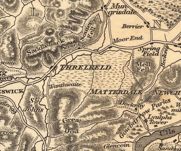 OT02NY32.jpg item:- JandMN : 48.1 Image © see bottom of page |
|||||||||||||||||||||||||
|
|
||||||||||||||||||||||||||
| evidence:- | old print:- Westall 1820 placename:- Saddleback |
|||||||||||||||||||||||||
| source data:- | Print, uncoloured mezzotint, Keswick Lake, from Saddleback, Cumberland, drawn and
engraved by William Westall, published by Rodwell and Martin, New Bond Street, London,
1820.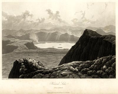 click to enlarge click to enlargeWTL103.jpg printed, bottom left, centre "Drawn & Engraved by W. Westall A.R.A. / Keswick Lake. / From Saddleback. / Published April 1, 1820, by Hurst, Robinson &Co. Cheapside." item:- Armitt Library : A6671.3 Image © see bottom of page |
|||||||||||||||||||||||||
|
|
||||||||||||||||||||||||||
| evidence:- | old print:- Fielding and Walton 1821 (plate 1) placename:- Saddleback |
|||||||||||||||||||||||||
| source data:- | Print, coloured aquatint, Saddleback and St John's Vale, Cumberland, drawn by Theodore
H A Fielding, published by R Ackermann, 101 Strand, London, 1821.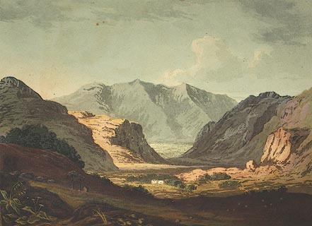 click to enlarge click to enlargeFW0101.jpg Frontispiece in A Picturesque Tour of the English Lakes. item:- Dove Cottage : 1993.R566.1 Image © see bottom of page |
|||||||||||||||||||||||||
|
|
||||||||||||||||||||||||||
| evidence:- | outline view:- Otley 1823 (8th edn 1849) placename:- Saddleback |
|||||||||||||||||||||||||
| source data:- | Engraving, outline view of mountains, Skiddaw, and Saddleback ... as seen on entering
Keswick from the South, drawn by T Binns, engraved by O Jewitt, opposite p.46 of A
Descriptive Guide of the English Lakes, by Jonathan Otley, 8th edition, 1849.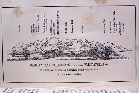 click to enlarge click to enlargeO80E16.jpg item:- Armitt Library : A1180.17 Image © see bottom of page |
|||||||||||||||||||||||||
|
|
||||||||||||||||||||||||||
| evidence:- | outline view:- Otley 1823 (5th edn 1834) placename:- Blencathera |
|||||||||||||||||||||||||
| source data:- | Print, woodcut outline view, Skiddaw and Saddleback, by Jonathan Otley, Keswick, Cumberland,
1830.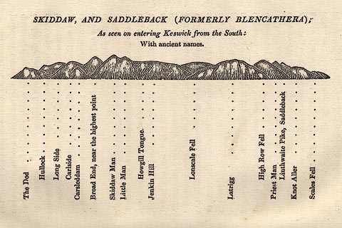 click to enlarge click to enlargeOT2E08.jpg Printed on p.49 of A Concise Description of the English Lakes, by Jonathan Otley, 5th edition, 1834. "SKIDDAW, AND SADDLEBACK (FORMERLY BLENCATHRA): As seen entering Keswick from the South: With ancient names." "The Dod / Hullock / Long Side / Carlside / Carsleddam / Broad End, near the highest point / Skiddaw Man / Little Man / Howgill Tongue / Jenkin Hill / Lonscale Fell / Latrigg / High Row Fell / Priest Man / Linthwaite Pike, Saddleback / Knot Aller / Scales Fell" item:- JandMN : 48.9 Image © see bottom of page |
|||||||||||||||||||||||||
|
|
||||||||||||||||||||||||||
| evidence:- | descriptive text:- Otley 1823 (5th edn 1834) placename:- Blencathera item:- latitude; longitude; lat and long; geology |
|||||||||||||||||||||||||
| source data:- | Guide book, A Concise Description of the English Lakes, the
mountains in their vicinity, and the roads by which they may be
visited, with remarks on the mineralogy and geology of the
district, by Jonathan Otley, published by the author, Keswick,
Cumberland now Cumbria, by J Richardson, London, and by Arthur
Foster, Kirkby Lonsdale, Cumbria, 1823; published 1823-49,
latterly as the Descriptive Guide to the English Lakes. goto source Page 69:- "SADDLEBACK" "- Being at a greater distance from the station at Keswick than Skiddaw, of somewhat inferior elevation, and the ascent not quite so easy - is seldom visited by strangers. It is better situated than Skiddaw for a view towards the south, and also of the neighbourhood of Lowther and Penrith; but the western view is greatly intercepted. It has formerly been called Blencathera, and it is from its shape, as seen from the vicinity of Penrith, that it has received the name of Saddleback. Its height is 2787 feet, and its rock is a primitive clay slate, similar to that of Skiddaw. In walking along the ridge it is worth while to notice, how the southern side is formed into a series of deep ravines and rocky projections; while to the north, it descends in a smooth grassy slope: and in a deep hollow, below a rocky precipice on its eastern end, a small, dark tarn is curiously placed." goto sourcePage 78:- "STATION II.- SKIDDAW." "Latitude 54° 39′ 12″ N. Longitude 3° 8′ 9″W." "..." "Saddleback BEARINGS 78 SE Distances in miles 4 Height in feet 2787" goto sourcePage 152:- "The greatest bulk of these mountain rocks have been commonly included under the general appellation of slate; although many of them shew no disposition to the slaty cleavage. They may be classed in three principal divisions." "Of these divisions, the FIRST or lowest in the series, forms ... Saddleback, ..." "..." goto sourcePage 154:- "... Veins of lead ore occur in several places; and have been worked between Skiddaw and Saddleback, in Thornthwaite, Newlands, and Buttermere; but one in the parish of Loweswater, and one below the level of Derwent Lake, are the most productive at present in this district." |
|||||||||||||||||||||||||
|
|
||||||||||||||||||||||||||
| evidence:- | descriptive text:- Ford 1839 (3rd edn 1843) placename:- Blencathra placename:- Saddleback item:- altitude, Saddleback |
|||||||||||||||||||||||||
| source data:- | Guide book, A Description of Scenery in the Lake District, by
Rev William Ford, published by Charles Thurnam, Carlisle, by W
Edwards, 12 Ave Maria Lane, Charles Tilt, Fleet Street, William
Smith, 113 Fleet Street, London, by Currie and Bowman,
Newcastle, by Bancks and Co, Manchester, by Oliver and Boyd,
Edinburgh, and by Sinclair, Dumfries, 1839. goto source "... THE Lake district ... consists of large masses or clusters of mountains, generally terminating in one aspiring and pre-eminent point, with the intermediate valleys occupied either by lakes and their subsidiary tarns, or by winding rivers." "The chief nuclei of these clusters are, Skiddaw and Blencathra, Helvellyn, Fairfield, Coniston Old Man, Blackcomb, Scafell, Gable, Red Pike, Grasmoor, Grisdale Pike, and the Langdale Pikes. Many noble and commanding mountains rise around these, rivalling them in height and grandeur, but still" goto sourcePage iv:- "serving as large buttresses only. In the presentation of endlessly-diversified forms, these Mountains yield to none, however individually inferior they may be, owing to their being seldom seen in a detached point of view; although, on the other hand, they have thus the advantage of forming combinations at once grand and sublime, towering above each other, or rising in ridges, like the mighty billows of the ocean." goto sourcePage 65:- "..." "BLENCATHRA OR SADDLEBACK." "In order to reach the top of this mountain, it is best to go along the road towards Penrith as far as Scales, a hamlet six miles from Keswick; here a bye-road keeps close under the fell, which must be pursued till a shepherd's green path can be traced, winding up the hill-side. The first ridge this path reaches, gives a glimpse down into the vale, watered by the Glenderamaken; thence to the summit it is easy. From Linthwaite Pike, the highest point, the prospect is open to the north, east, and south. At the base of an enormous perpendicular crag, called Tarn Crag, depending from the top, is Scales Tarn, a beautiful circular piece of transparent water, with a well defined shore, covering an area of three acres and a half, and being eighteen feet deep. Here you are engulphed in a basin of steeps, having Tarn Crag on the north, the rocks falling from Sharp Edge on the east, and on the west the soft turf on which the descent has been made. From the summit of the mountain you may descend either directly upon Threlkeld, or by Lile Fell, Priestman, and Knott Crags, to the Glenderaterra, the stream" goto sourcePage 178:- "ELEVATION OF THE MOUNTAINS," "ACCORDING TO DIFFERENT AUTHORITIES."
|
|||||||||||||||||||||||||
|
|
||||||||||||||||||||||||||
| evidence:- | old map:- Ford 1839 map placename:- Saddleback |
|||||||||||||||||||||||||
| source data:- | Map, uncoloured engraving, Map of the Lake District of
Cumberland, Westmoreland and Lancashire, scale about 3.5 miles
to 1 inch, published by Charles Thurnam, Carlisle, and by R
Groombridge, 5 Paternoster Row, London, 3rd edn 1843. FD02NY32.jpg "Saddleback" Hill hachuring. item:- JandMN : 100.1 Image © see bottom of page |
|||||||||||||||||||||||||
|
|
||||||||||||||||||||||||||
| evidence:- | old map:- Garnett 1850s-60s H placename:- Saddleback |
|||||||||||||||||||||||||
| source data:- | Map of the English Lakes, in Cumberland, Westmorland and
Lancashire, scale about 3.5 miles to 1 inch, published by John
Garnett, Windermere, Westmorland, 1850s-60s.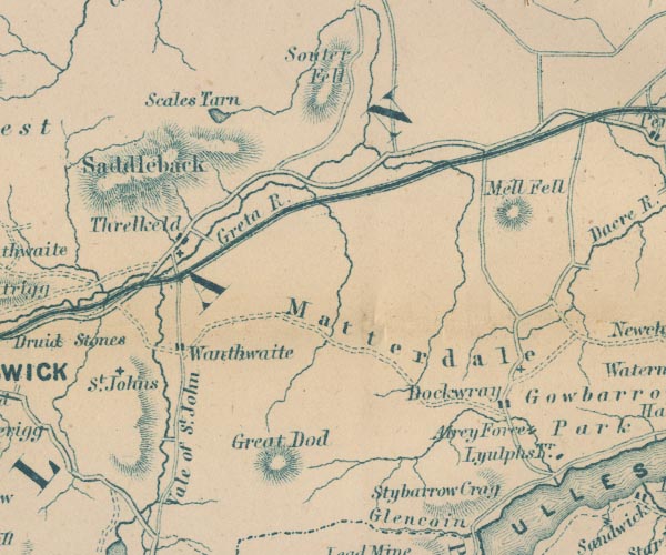 GAR2NY32.jpg "Saddleback" hill hachuring item:- JandMN : 82.1 Image © see bottom of page |
|||||||||||||||||||||||||
|
|
||||||||||||||||||||||||||
| evidence:- | outline view:- Martineau 1855 placename:- Blencathra placename:- Saddleback |
|||||||||||||||||||||||||
| source data:- | Print, engraving, outline view, Mountains seen from the West Side of Thirlmere, drawn
by L Aspland, engraved by W Banks, Edinburgh, published by John Garnett, Windermere,
Westmorland, and by Whittaker and Co, London, 1855.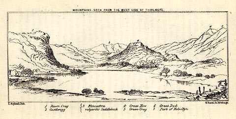 click to enlarge click to enlargeMNU110.jpg Opposite p.69 in A Complete Guide to the English Lakes, by Harriet Martineau. "MOUNTAINS SEEN FROM THE WEST SIDE OF THIRLMERE." "L Aspland Delt. / W Banks Sc Edinr." The view is captioned, numbers referring to mountains in the image:- "1 Raven Crag, 2 Castlerigg, 3 Blancathra vulgariter Saddleback, 4 Great How, 5 Green Crag, 6, Great Dod, 7 Part of Helvellyn." item:- Armitt Library : A1159.10 Image © see bottom of page |
|||||||||||||||||||||||||
|
|
||||||||||||||||||||||||||
| evidence:- | old text:- Martineau 1855 placename:- Blencathra item:- altitude, Saddleback |
|||||||||||||||||||||||||
| source data:- | Guide book, A Complete Guide to the English Lakes, by Harriet
Martineau, published by John Garnett, Windermere, Westmorland,
and by Whittaker and Co, London, 1855; published 1855-76. goto source Page 179:- "A TABLE OF THE HEIGHTS OF MOUNTAINS IN THE COUNTIES OF CUMBERLAND, WESTMORLAND, AND LANCASHIRE." "No. : Names of Mountains. : Counties. : Height in Feet above the Sea Level." "10 : Blencathra, Saddleback : Cumberland : 2787" |
|||||||||||||||||||||||||
|
|
||||||||||||||||||||||||||
| evidence:- | old print:- Walton 1876 placename:- Saddleback item:- snow |
|||||||||||||||||||||||||
| source data:- | Print, colour lithograph, Saddleback, from the Vale of St John's, Cumberland, from
a painting by Elijah Walton, published by W M Thompson, 20 Cockspur Street, Pall Mall,
and Burlington Gallery, Piccadilly, London, 1876.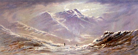 click to enlarge click to enlargeWLT319.jpg Plate 19 in English Lake Scenery, with a description by T G Bonney. item:- JandMN : 469.19 Image © see bottom of page |
|||||||||||||||||||||||||
|
|
||||||||||||||||||||||||||
| evidence:- | text:- Mason 1907 (edn 1930) |
|||||||||||||||||||||||||
| source data:- | Text book, The Ambleside Geography Books bk.III, The Counties of
England, by Charlotte M Mason, published by Kegan Paul, Trench,
Trubner and Co, Broadway House, 68-74 Carter Lane, and the
Parents' Educational Union Office, 26 Victoria Street, London,
edn 1930. MSN1P023.txt Page 23:- "..." "... to know that ... Saddleback rises like a saddle; ..." |
|||||||||||||||||||||||||
|
|
||||||||||||||||||||||||||
| evidence:- | old map:- Postlethwaite 1877 (3rd edn 1913) placename:- Blencathra |
|||||||||||||||||||||||||
| source data:- | Map, uncoloured engraving, Map of the Lake District Mining Field, Westmorland, Cumberland,
Lancashire, scale about 5 miles to 1 inch, by John Postlethwaite, published by W H
Moss and Sons, 13 Lowther Street, Whitehaven, Cumberland, 1877 edn 1913.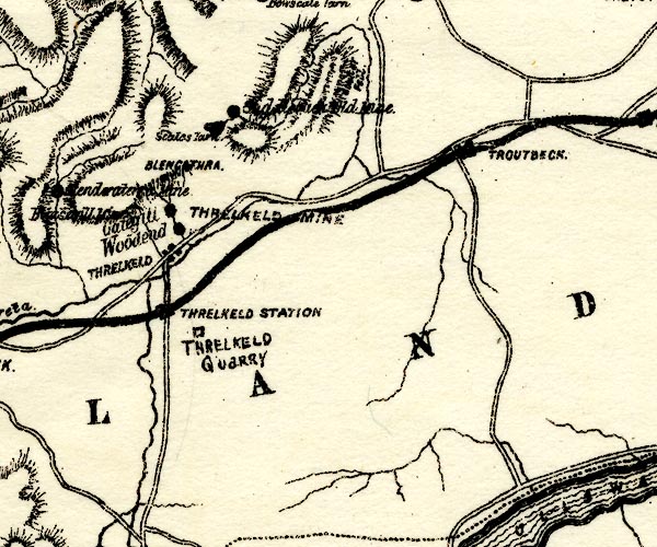 PST2NY32.jpg "BLENCATHRA" hill hachuring item:- JandMN : 162.2 Image © see bottom of page |
|||||||||||||||||||||||||
|
|
||||||||||||||||||||||||||
| evidence:- | old photograph:- Marr 1916 placename:- Saddleback |
|||||||||||||||||||||||||
| source data:- | Photograph, halftone print, Truncated Spurs, Saddleback, Threlkeld, Cumberland, 1916.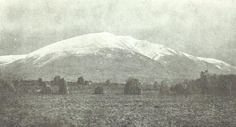 click to enlarge click to enlargeMA1213.jpg item:- JandMN : 173.21 Image © see bottom of page |
|||||||||||||||||||||||||
|
|
||||||||||||||||||||||||||
| evidence:- | outline view:- LMS 1920s |
|||||||||||||||||||||||||
| source data:- | Hills from Penrith Station, published in the LMS Route Book No.3, The Track of the
Royal Scot, by the London, Midland and Scottish Railway, LMS, 1920s.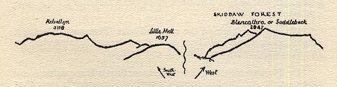 click to enlarge click to enlargeLS1E40.jpg item:- JandMN : 95.13 Image © see bottom of page |
|||||||||||||||||||||||||
|
|
||||||||||||||||||||||||||
| evidence:- | old print:- Robertson 1911 placename:- Blencathra |
|||||||||||||||||||||||||
| source data:- | Print, lithograph? Threlkeld Hall and Blencathra, from a watercolour by Arthur Tucker,
published by Chatto and Windus, London, 1911.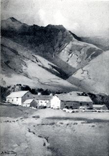 click to enlarge click to enlargeRSN114.jpg Tipped in opposite p.52 of Wordsworthshire by Eric Robertson. printed at bottom:- "THRELKELD HALL AND BLENCATHRA / (Scene of 'Shepherd Lord's' early life)" signed at painting lower left:- "Arthur Tucker" item:- JandMN : 197.14 Image © see bottom of page |
|||||||||||||||||||||||||
|
|
||||||||||||||||||||||||||
| evidence:- | outline view:- Jenkinson 1875 placename:- Blencathra |
|||||||||||||||||||||||||
| source data:- | Print, lithograph, outline view, Panoramic Sketches from Helvellyn, Westmorland, by
Edwin A Pettitt, London, published by Edward Stanford, 55 Charing Cross, London, 1875.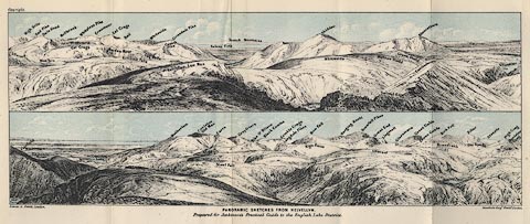 click to enlarge click to enlargeJk01E1.jpg "... Blencathra ..." item:- JandMN : 28.5 Image © see bottom of page |
|||||||||||||||||||||||||
|
|
||||||||||||||||||||||||||
| evidence:- | outline view:- Jenkinson 1875 placename:- Blencathra |
|||||||||||||||||||||||||
| source data:- | Print, lithograph, outline view, Panoramic Sketches from Skiddaw, Cumberland, by Edwin
A Pettitt, London, published by Edward Stanford, 55 Charing Cross, London, 1875.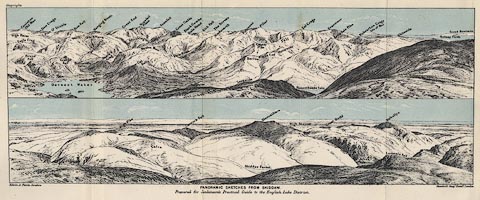 click to enlarge click to enlargeJk01E2.jpg "... Blencathra ..." item:- JandMN : 28.8 Image © see bottom of page |
|||||||||||||||||||||||||
|
|
||||||||||||||||||||||||||
| evidence:- | outline view:- Jenkinson 1875 placename:- Blencathra |
|||||||||||||||||||||||||
| source data:- | Print, lithograph, outline view, Panoramic Sketches from Scawfell Pike, Cumberland,
by Edwin A Pettitt, London, published by Edward Stanford, 55 Charing Cross, London,
1875.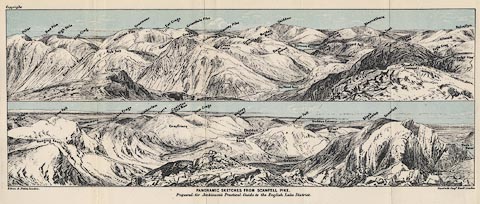 click to enlarge click to enlargeJk01E3.jpg "... Blencathra ..." item:- JandMN : 28.9 Image © see bottom of page |
|||||||||||||||||||||||||
|
|
||||||||||||||||||||||||||
| evidence:- | outline view:- Matthew 1866 placename:- Saddleback placename:- Blencathra |
|||||||||||||||||||||||||
| source data:- | Print, engraving, outline view, Helvellyn from above Harrop Tarn, Poney Road from
Wythburn to Whatendlath and Borrowdale, Cumberland, published by J Richardson, Highgate,
Kendal, Westmorland, 1866.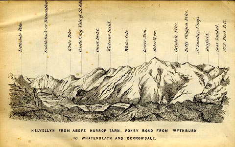 click to enlarge click to enlargeMW1E02.jpg Tipped in before p.1 of The English Lakes, Peaks and Passes, from Kendal to Keswick, by George King Matthew. printed at bottom:- "HELVELLYN FROM ABOVE HARROP TARN, PONEY ROAD FROM WYTHBURN TO WHATENDLATH AND BORROWDALE." printed at caption to mountains:- "... Saddleback or Blencathra. ..." item:- Armitt Library : A1168.2 Image © see bottom of page |
|||||||||||||||||||||||||
|
|
||||||||||||||||||||||||||
| evidence:- | old print:- placename:- Saddleback |
|||||||||||||||||||||||||
| source data:- | Print, uncoloured engraving, Skiddaw and Saddleback from Bolton Moor, Cumberland,
drawn by C Stansfield, engraved by R Brandard, published by R Cadel, Edinburgh, late
19th century?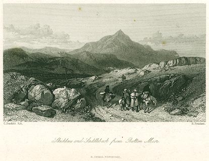 click to enlarge click to enlargePR0299.jpg A family travelling on a bleak road; the viewpoint is about NY2638, perhaps on the road from Caldbeck to Boltongate? printed at bottom left, right, centre:- "C. Stansfield, R.S. / R. Brandard. / Skiddaw and Saddleback from Bolton Moor. / R. CADELL, EDINBURGH." item:- Dove Cottage : 2008.107.299 Image © see bottom of page |
|||||||||||||||||||||||||
|
|
||||||||||||||||||||||||||
| evidence:- | old print:- Harwood 1842 |
|||||||||||||||||||||||||
| source data:- | Print, uncoloured engraving, Saddleback from the Vale of St John, Cumberland, engraved
and published by John and Frederick Harwood, 26 Fenchurch Street, London, 1842.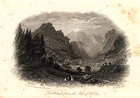 click to enlarge click to enlargeHRW211.jpg printed at bottom left, right, centre:- "London, J &F. Harwood, 26, Fenchurch Street. / No.471 Augt. 18, 1842. / Saddleback from the Vale of St. John." item:- JandMN : 166.11 Image © see bottom of page |
|||||||||||||||||||||||||
|
|
||||||||||||||||||||||||||
| evidence:- | outline view:- Tattersall 1836 placename:- Saddleback |
|||||||||||||||||||||||||
| source data:- | Print, engraving, Newlands Vale, from Robinson Fall, Cumberland, drawn by George Tattersall,
engraved by W F Topham, published by Sherwood and Co, Paternoster Row, London, about
1836.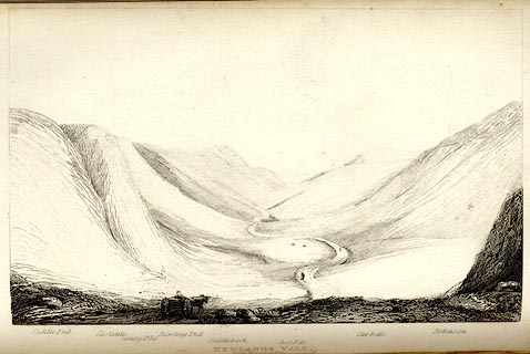 click to enlarge click to enlargeTAT129.jpg The print is captioned with mountain names and acts as an outline view. Tipped in opposite p.75 of The Lakes of England, by George Tattersall. printed at bottom:- "NEWLANDS VALE, / from Robinson Fall." printed at bottom left to right:- "Saddle End. / Caskettle. / Causey Pike. / Rawling End. / Saddleback. / Cross Fell. / Cat-bells. / Robinson." item:- Armitt Library : A1204.30 Image © see bottom of page |
|||||||||||||||||||||||||
|
|
||||||||||||||||||||||||||
| evidence:- | outline view:- placename:- Saddleback |
|||||||||||||||||||||||||
| source data:- | Print, hand coloured engraving, Vale of St John from the South, Cumberland, published
by Sherwood and Co, London, 1836?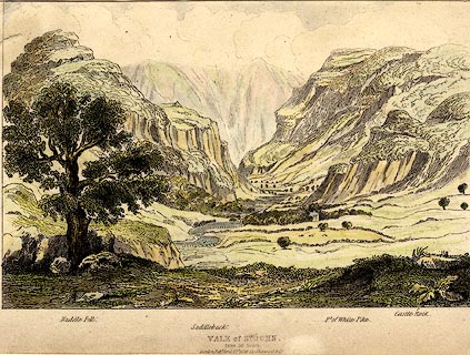 click to enlarge click to enlargePR0372.jpg Objects in the view are identified by a caption at the bottom - Naddle Fell, Saddleback, Pt. of White Pike, Castle Rock. printed at bottom:- "VALE of ST. JOHN, / from the South. / London, Pubd. April 15th 1836 by Sherwood &Co." item:- Dove Cottage : 2008.107.372 Image © see bottom of page |
|||||||||||||||||||||||||
|
|
||||||||||||||||||||||||||
| evidence:- | old print with text:- Farington 1816 (plate 33) placename:- Saddleback |
|||||||||||||||||||||||||
| source data:- | Print, uncoloured engraving, Saddleback and the River Rothay (the Greta), drawn by
Joseph Farington, engraved by W Woolnoth, published by T Cadell and W Davies, Strand,
London, 1815.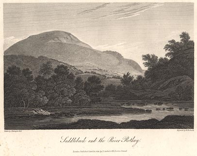 click to enlarge click to enlargeBNV36.jpg Plate 33 in The Lakes of Lancashire, Westmorland and Cumberland ... with text by Thomas Hartwell Horne:- "SADDLEBACK AND THE RIVER GRETA. / SADDLEBACK, a vast mountain united with the declivities of Skiddaw, forms the Eastern boundary of the alpine heights in this part of Cumberland. The road between Penrith and Keswick runs along its Southern base. It has obtained its appellation from its shape somewhat resembling a Saddle, when seen from different points of view. Its height is 2787 feet. (Observations made in the course of the Trigonmetrical Survey. 1811. 4to.) White farms, each with its grove to shelter it from descending gusts of wind, and pastures of brightest verdure, intermingled with corn-fields, enliven the skirts of this mountain, at whose foot flows the little river Greta, which adds much to the picturesque effect of the scenery. The southern face of this lofty mountain is furrowed by several hideous chasms; and its summit is, in many parts, frightful and desolate. The view here given comprehends Saddleback only, and represents its appearance as seen from the western side of the mountain." item:- private collection : 77 Image © see bottom of page |
|||||||||||||||||||||||||
|
|
||||||||||||||||||||||||||
 ascent 1855 ascent 1855 |
||||||||||||||||||||||||||
|
|
||||||||||||||||||||||||||
| evidence:- | old print:- Sylvan 1847 placename:- Saddleback |
|||||||||||||||||||||||||
| source data:- | Print, engraving, Vale of St John, and Saddleback, Cumberland, published by John Johnstone,
Paternoster Row, London, et al, 1847.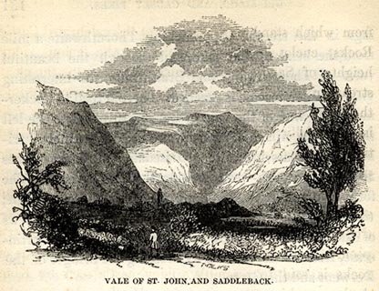 click to enlarge click to enlargeSYL144.jpg On p.182 of Sylvan's Pictorial Guide to the English Lakes. printed at bottom:- "VALE OF ST. JOHN, AND SADDLEBACK." item:- Armitt Library : A1201.44 Image © see bottom of page |
|||||||||||||||||||||||||
|
|
||||||||||||||||||||||||||
| evidence:- | outline view:- Tattersall 1836 (version 1869) placename:- Saddleback |
|||||||||||||||||||||||||
| source data:- | Print, hand coloured, Vale of St John, from the South, Cumberland, drawn by George
Tattersall, 1836, engraved by W F Topham, published by T J Allman, 463 Oxford Street,
London, 1869.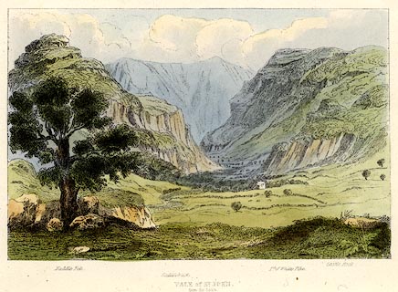 click to enlarge click to enlargeTAT208.jpg Included in The Lakes of England, by W F Topham. printed at bottom:- "VALE OF ST. JOHN, / from the South." printed at bottom:- "Naddle Fell. / Saddleback. / Pt. of White Pike. / Castle Rock." item:- Armitt Library : A1067.8 Image © see bottom of page |
|||||||||||||||||||||||||
|
|
||||||||||||||||||||||||||
 BLT66.jpg Blease Fell, Blease Gill from the south-west. (taken 3.4.2006)  CDI84.jpg Rocks above Blease Gill. (taken 11.6.2015) 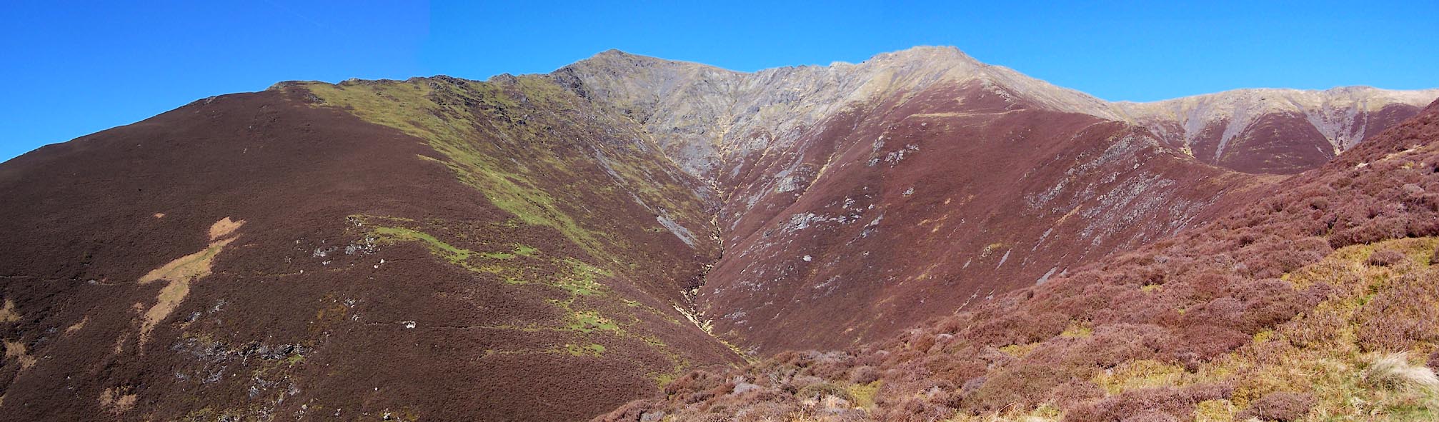 Click to enlarge BWD91.jpg Looking up Doddick Gill. (taken 26.3.2012) 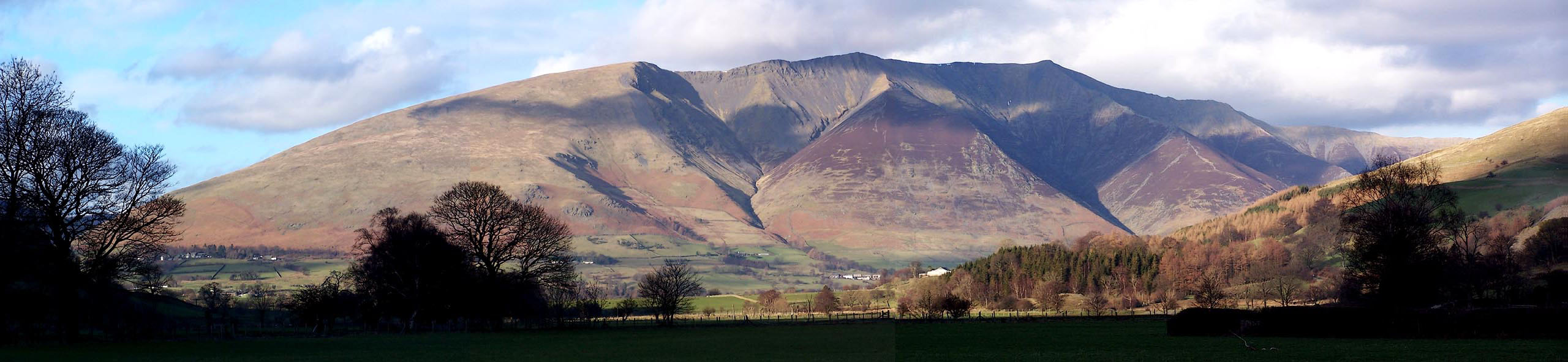 Click to enlarge BND91.jpg From the south, Blease Fell. Gategill Fell, Hall's Fell. (taken 5.2.2007)  Click to enlarge BNT74.jpg From the east, with Souther Fell, The Tongue, Bowswcale Fell. (taken 1.6.2007) 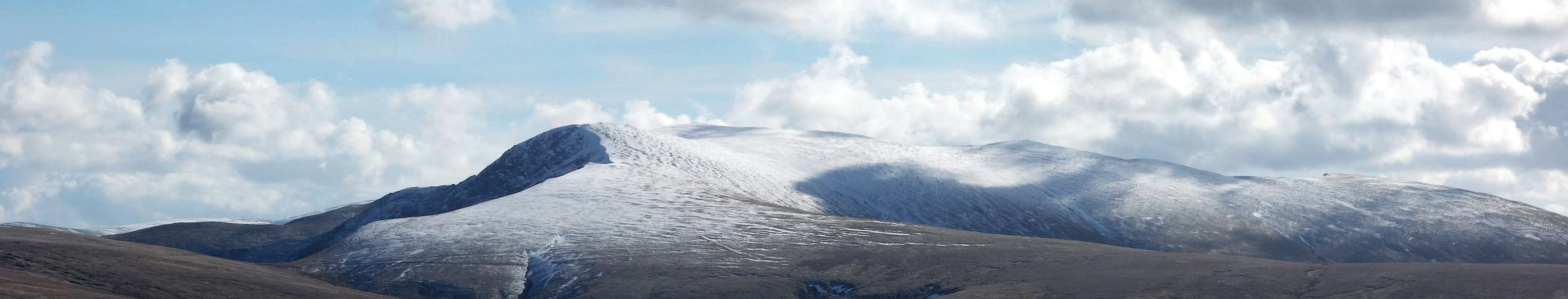 Click to enlarge CAA86.jpg From the north. (taken 3.3.2014) 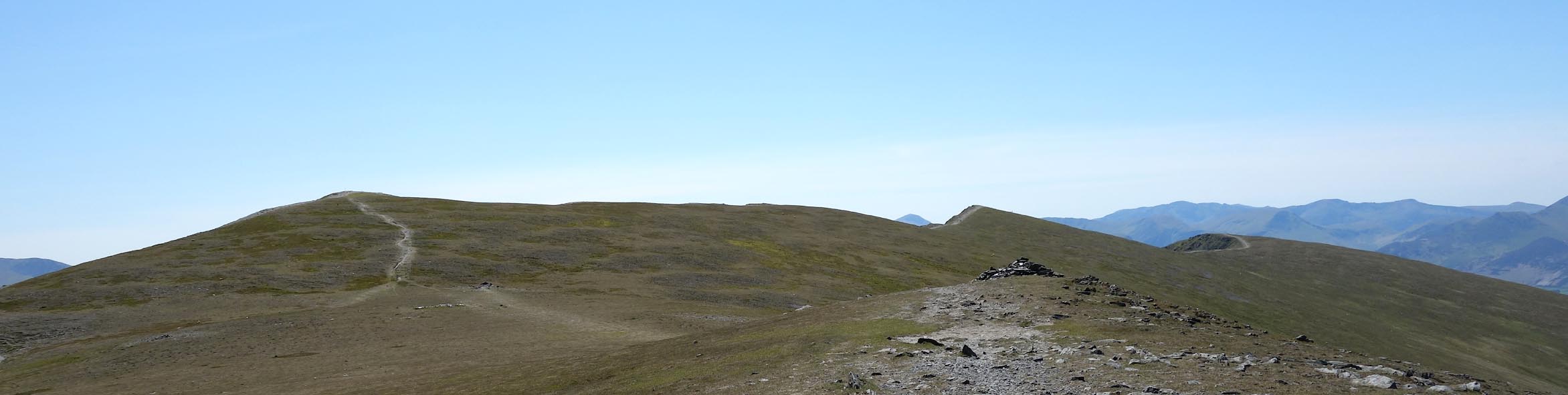 Click to enlarge CDI65.jpg The saddle, looking towards Hallsfell Top. (taken 11.6.2015) 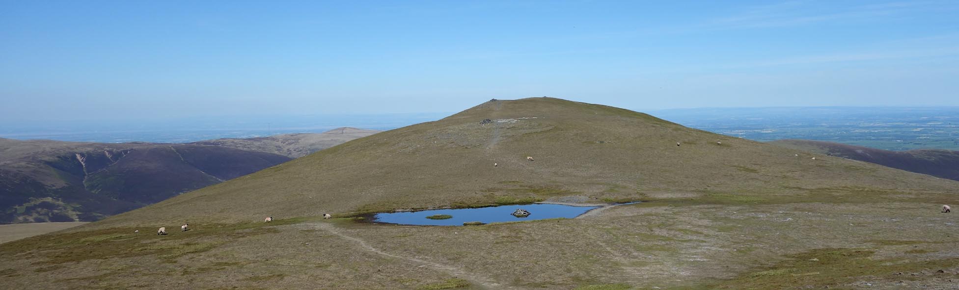 Click to enlarge CDI70.jpg The saddle, looking towards Atkinson Pike. (taken 11.6.2015) 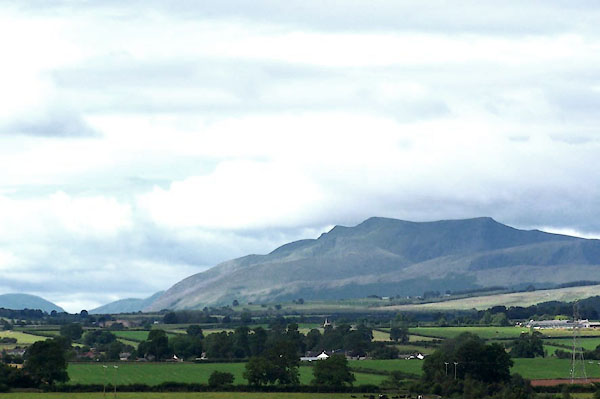 BML93.jpg The Saddle - from the A6 above Penrith. (taken 11.8.2006) 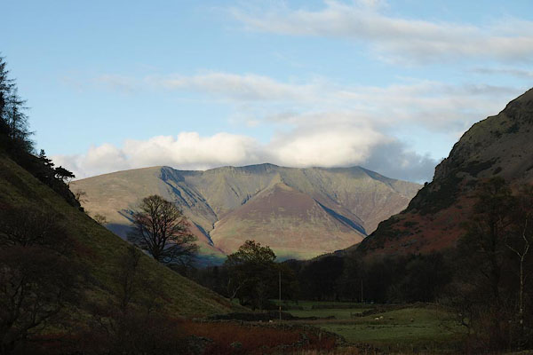 BRV38.jpg From St John's in the Vale. (taken 11.11.2009) |
||||||||||||||||||||||||||
|
|
||||||||||||||||||||||||||
| MN photo:- |
Three dimensional jigsaw puzzle made for an exhibition about the mountain at Keswick
Museum, 2017. |
|||||||||||||||||||||||||
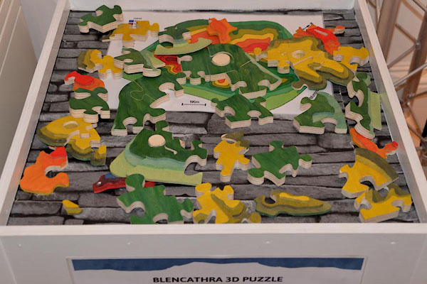 CGJ63.jpg (taken 15.8.2017) 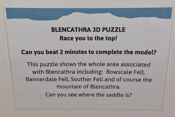 CGJ64.jpg (taken 15.8.2017) 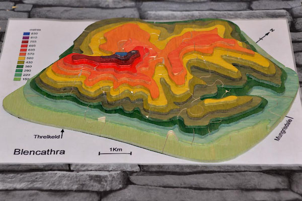 CGJ65.jpg (taken 15.8.2017) |
||||||||||||||||||||||||||
|
|
||||||||||||||||||||||||||
Lakes Guides menu.