Old Cumbria Gazetteer
 |
 |
|
||
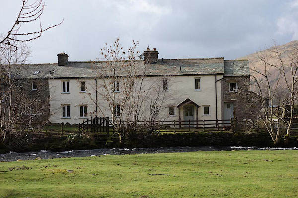
| Sandwick, Martindale | ||||
| Sandwick | ||||
| civil parish:- | Martindale (formerly Westmorland) | |||
| county:- | Cumbria | |||
| locality type:- | locality | |||
| locality type:- | buildings | |||
| coordinates:- | NY42351964 (etc) | |||
| 1Km square:- | NY4219 | |||
| 10Km square:- | NY41 | |||
|
|
||||
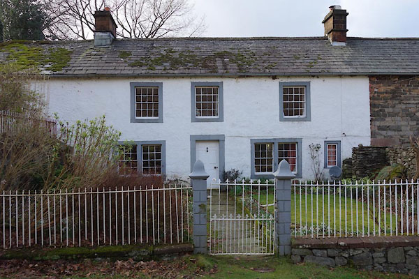
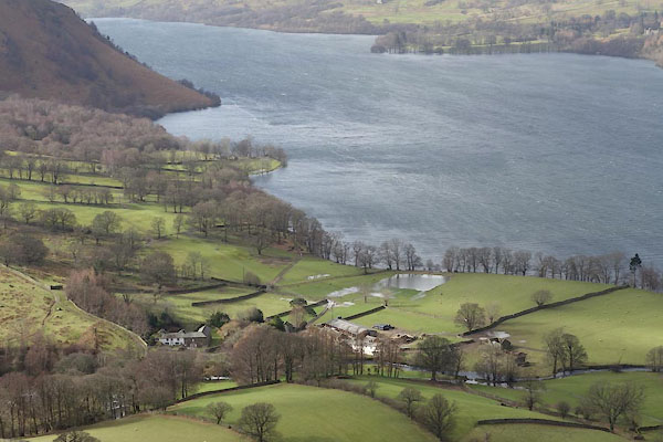 BZZ13.jpg (taken 27.2.2014)  BLN58.jpg Sandwick from across the lake; Hallin Fell on the far left, valley of the Howegrain Beck and Boredale Beck, Sleet Fell on the right. (taken 4.1.2006) |
||||
|
|
||||
| evidence:- | old map:- OS County Series (Wmd 12 4) placename:- Sandwick |
|||
| source data:- | Maps, County Series maps of Great Britain, scales 6 and 25
inches to 1 mile, published by the Ordnance Survey, Southampton,
Hampshire, from about 1863 to 1948. |
|||
|
|
||||
| evidence:- | hearth tax returns:- Hearth Tax 1675 placename:- Sandwicke |
|||
| source data:- | Records, hearth tax survey returns, Westmorland, 1674/75. "Sandwicke" in "Martindale" |
|||
|
|
||||
| evidence:- | old map:- Crosthwaite 1783-94 (Ull) placename:- Sand Wike |
|||
| source data:- | Map, uncoloured engraving, Accurate Map of the Beautiful Lake of
Ullswater, scale about 3 inches to 1 mile, by Peter Crosthwaite,
Keswick, Cumberland, 1783, version published 1800.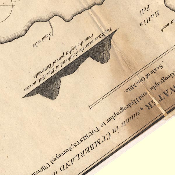 CT5NY41J.jpg "Sand-wike" item:- Armitt Library : 1959.191.7 Image © see bottom of page |
|||
|
|
||||
| evidence:- | old map:- Clarke 1787 map (Ullswater) placename:- Sandwike |
|||
| source data:- | Map, A Map of the Lake Ullswater and its Environs, scale about
6.5 ins to 1 mile, by James Clarke, engraved by S J Neele, 352
Strand, published by James Clarke, Penrith, Cumberland and in
London etc, 1787.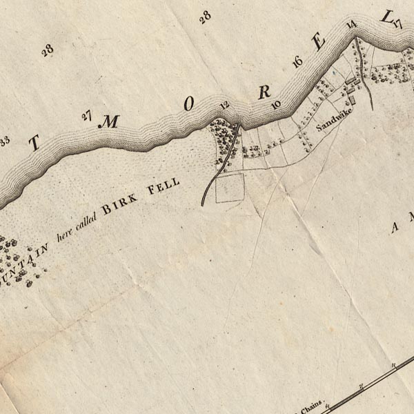 CL4NY41E.jpg "Sandwike" item:- private collection : 10.4 Image © see bottom of page |
|||
|
|
||||
| evidence:- | old text:- Wordsworth 1810 placename:- Sandwyke |
|||
| source data:- | Guide book, A Description of the Scenery of the Lakes, later A
Guide through the District of The Lakes, by William Wordsworth,
1810-35. goto source goto sourcepage xxiii "... the village of Sandwyke, a few straggling houses, that with the small estates attached to them, occupy an opening opposite to Lyulph's Tower and Gowbarrow Park. ..." |
|||
|
|
||||
| evidence:- | old map:- Otley 1818 placename:- Sandwike |
|||
| source data:- | Map, uncoloured engraving, The District of the Lakes,
Cumberland, Westmorland, and Lancashire, scale about 4 miles to
1 inch, by Jonathan Otley, 1818, engraved by J and G Menzies,
Edinburgh, Scotland, published by Jonathan Otley, Keswick,
Cumberland, et al, 1833.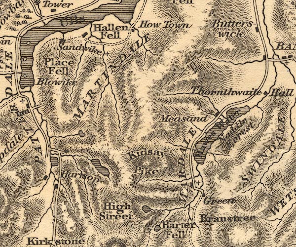 OT02NY41.jpg item:- JandMN : 48.1 Image © see bottom of page |
|||
|
|
||||
| evidence:- | old map:- Ford 1839 map placename:- Sandwick |
|||
| source data:- | Map, uncoloured engraving, Map of the Lake District of
Cumberland, Westmoreland and Lancashire, scale about 3.5 miles
to 1 inch, published by Charles Thurnam, Carlisle, and by R
Groombridge, 5 Paternoster Row, London, 3rd edn 1843.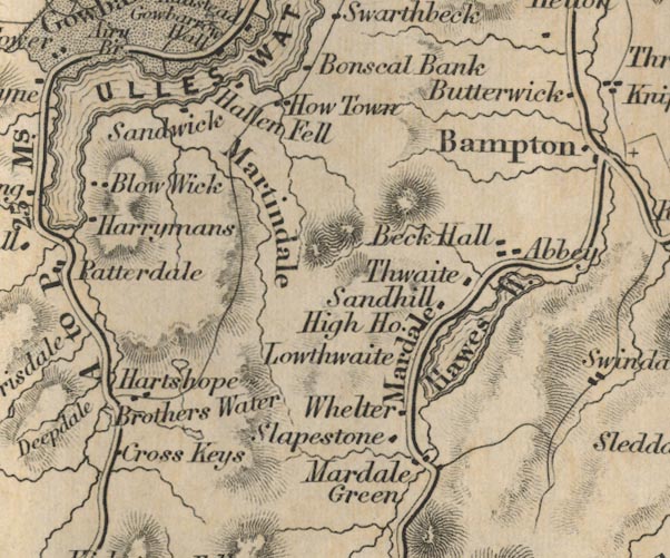 FD02NY41.jpg "Sandwick" item:- JandMN : 100.1 Image © see bottom of page |
|||
|
|
||||
| evidence:- | old map:- Garnett 1850s-60s H placename:- Sandwicks |
|||
| source data:- | Map of the English Lakes, in Cumberland, Westmorland and
Lancashire, scale about 3.5 miles to 1 inch, published by John
Garnett, Windermere, Westmorland, 1850s-60s.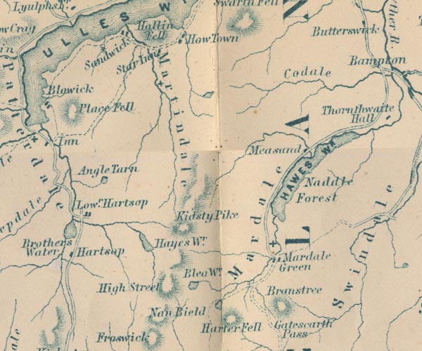 GAR2NY41.jpg "Sandwicks" block, building item:- JandMN : 82.1 Image © see bottom of page |
|||
|
|
||||
| evidence:- | old print:- Heaton Cooper 1905 (edn 1908) placename:- Sandwick |
|||
| source data:- | Print, colour halftone, A Mountain Path, Sandwick, Ullswater, Martindale, Westmorland,
from a watercolour painting by Alfred Heaton Cooper, published by Adam and Charles
Black, London, 2nd edn 1908.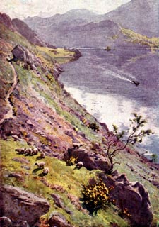 click to enlarge click to enlargeHC0165.jpg Opposite p.194 of The English Lakes, painted by Alfred Heaton Cooper, described by William T Palmer. printed at tissue opposite the print:- "A MOUNTAIN PATH, SANDWICK, ULLSWATER" item:- JandMN : 468.65 Image © see bottom of page |
|||
|
|
||||
| evidence:- | old map:- Post Office 1850s-1900s placename:- Sandwich |
|||
| source data:- | Post road maps, General Post Office Circulation Map for England
and Wales, for the General Post Office, London, 1850s-1900s. click to enlarge click to enlargePOF7Cm.jpg "Sandwich" map date 1909 |
|||
|
|
||||
| :- |
images courtesy of the British Postal Museum and Hampshire CC Museums |
|||
|
|
||||
| hearsay:- |
Fairies were last seen in Westmorland by Jack Wilson, on his way home across Sandwick
Rigg. A gathering of the small folk were playing in the moonlight, but when they saw
Jack they fled up a ladder into the clouds, which they closed behind them. |
|||
| "Yance gane, ae gane, and nivver saw mair o' them." |
||||
| Robertson, Dawn & Koronka, Peter: 1992: Secrets and Legends of Old Westmorland: Pagan
Press (Kirkby Stephen, Cumbria) &Cumbria CC (library service) |
||||
|
|
||||
| places:- |
|
|||
|
||||
|
||||
|
||||
|
||||
|
||||
|
||||
|
||||
|
||||
Lakes Guides menu.