 Old Cumbria Gazetteer
 |
 |
|
| Scotch Dyke Station, Kirkandrews | ||
| Scotch Dyke Station | ||
| Scotsdyke Station | ||
| site name:- | Border Union Railway | |
| civil parish:- | Kirkandrews (formerly Cumberland) | |
| county:- | Cumbria | |
| locality type:- | railway station | |
| coordinates:- | NY38757234 | |
| 1Km square:- | NY3872 | |
| 10Km square:- | NY37 | |
| SummaryText:- | Opened 1861-62; closed 1949. | |
|
|
||
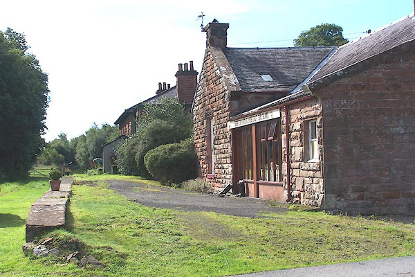 BMQ29.jpg Now a house. Over the front it says:- "SPEED AND COMFORT BY RAIL" and the British Rail symbol. The owner had just arrived back with his rod, the River Esk is only a short way down the lane. (taken 15.9.2006)  BMQ30.jpg View NE. (taken 15.9.2006) |
||
|
|
||
| evidence:- | old map:- OS County Series (Cmd 6) placename:- Scotsdike Station |
|
| source data:- | Maps, County Series maps of Great Britain, scales 6 and 25
inches to 1 mile, published by the Ordnance Survey, Southampton,
Hampshire, from about 1863 to 1948. "Scotsdike Station" |
|
|
|
||
 Lakes Guides menu.