 Old Cumbria Gazetteer
 |
 |
|
| Sedbergh Station, Sedbergh | ||
| Sedbergh Station | ||
| site name:- | Low Gill and Ingleton branch railway | |
| locality:- | Marthwaite | |
| locality:- | Sedbergh | |
| civil parish:- | Sedbergh (formerly Yorkshire) | |
| county:- | Cumbria | |
| locality type:- | railway station | |
| coordinates:- | SD64319189 | |
| 1Km square:- | SD6491 | |
| 10Km square:- | SD69 | |
| SummaryText:- | Opened with the railway 1861; closed 1954. | |
|
|
||
| evidence:- | old map:- OS County Series (Yrk 63 3) placename:- Sedbergh Station item:- railway signal; weighing machine; goods shed; crane; water crane |
|
| source data:- | Maps, County Series maps of Great Britain, scales 6 and 25
inches to 1 mile, published by the Ordnance Survey, Southampton,
Hampshire, from about 1863 to 1948.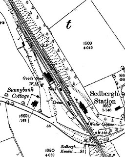 click to enlarge click to enlargeCSRY0205.jpg "Sedbergh Station / W.M. / S.P. / Goods Shed / Crane / Water Column" |
|
|
|
||
| MN photo:- |
Not much of Sedbergh Station is now visible. |
|
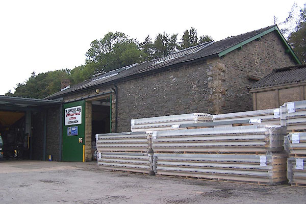 BMW85.jpg (taken 20.10.2006) 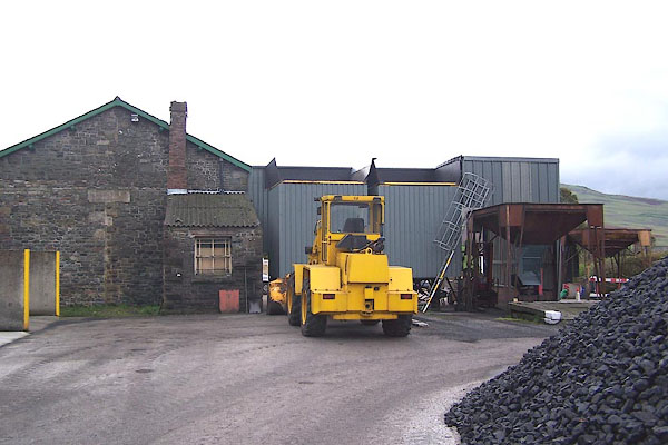 BMW86.jpg (taken 20.10.2006) |
||
|
|
||
 Lakes Guides menu.