 Old Cumbria Gazetteer
 |
 |
|
| shelter, Underbarrow and Bradleyfield | ||
| locality:- | Scout Scar | |
| civil parish:- | Underbarrow and Bradleyfield (formerly Westmorland) | |
| county:- | Cumbria | |
| locality type:- | shelter | |
| locality type:- | outline view | |
| coordinates:- | SD48659198 | |
| 1Km square:- | SD4891 | |
| 10Km square:- | SD49 | |
|
|
||
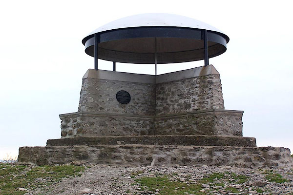 BJX20.jpg Erected in 1912 commemorating the coronation of George V; refurbished 2002. (taken 5.10.2005) 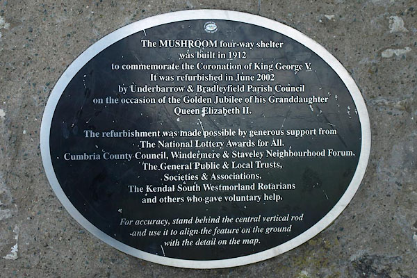 BTK90.jpg Plaque. (taken 27.8.2010) |
||
|
|
||
| MN photo:- |
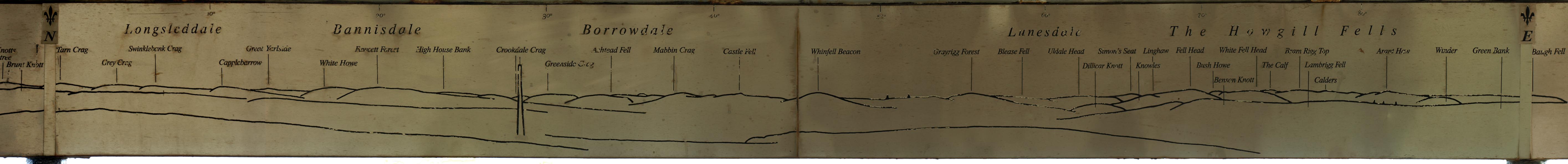
There is a 360 degree outline view around the inside of the dome, view from the centre
pole for accuracy. |
|
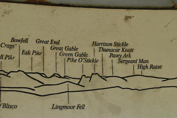 BTK91.jpg Detail of the outline view inside the dome; Bowfell, Langdale Pikes, etc. (taken 27.8.2010) 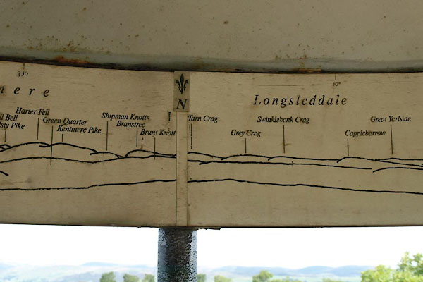 BTK92.jpg Detail of the outline view inside the dome; Kentmere Longsleddale, etc. (taken 27.8.2010) |
||
|
|
||
| MN photo:- |
Three pairs of photos were taken to see how well this outline view works, the answer
is, very well. Plus two other quadrants of the outline view. Do notice the errors
in the degree numbering! |
|
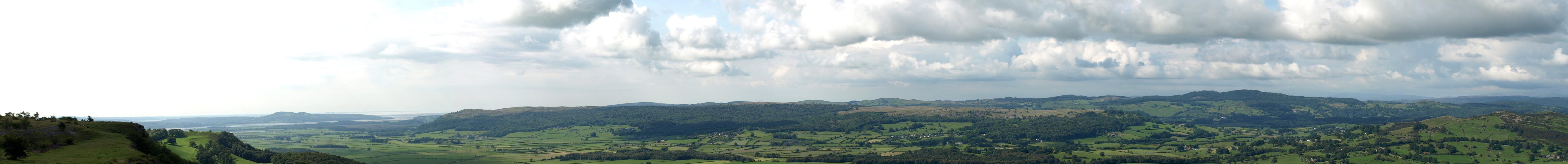 Click to enlarge BTO05.jpg The actual view from S to W. (taken 27.8.2010) 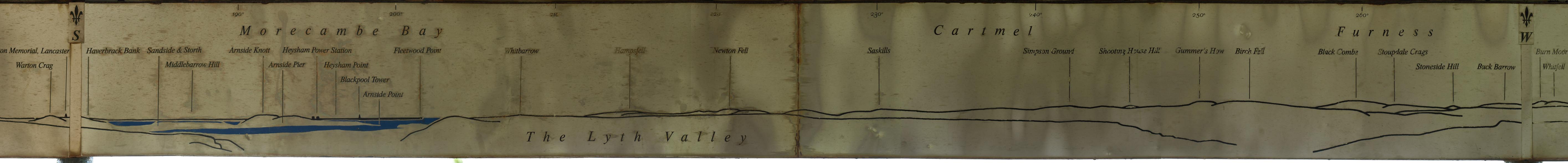 Click to enlarge BTO06.jpg The outline view from S to W. (taken 27.8.2010) |
||
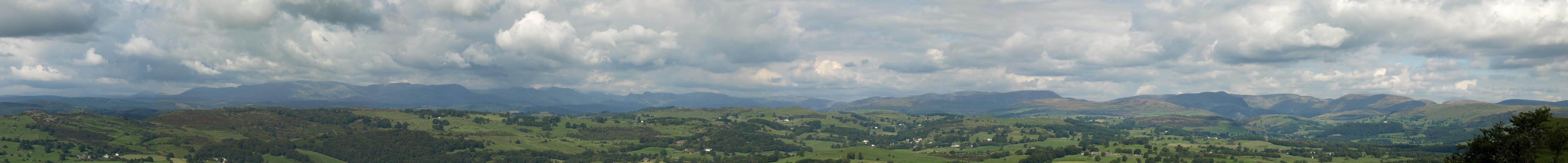 Click to enlarge BTO07.jpg The actual view from W to N. (taken 27.8.2010) 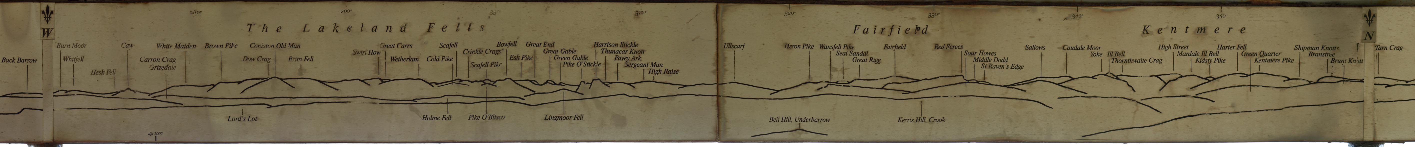 Click to enlarge BTO08.jpg The outline view from W to N. (taken 27.8.2010) |
||
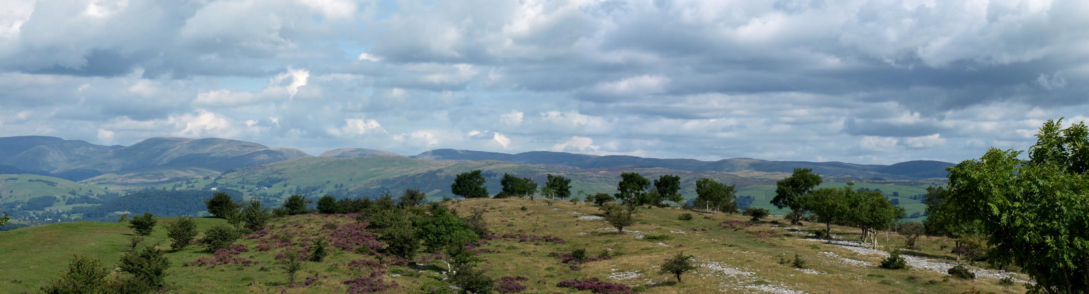 Click to enlarge BTO09.jpg The actual view N to Longsleddale. (taken 27.8.2010) 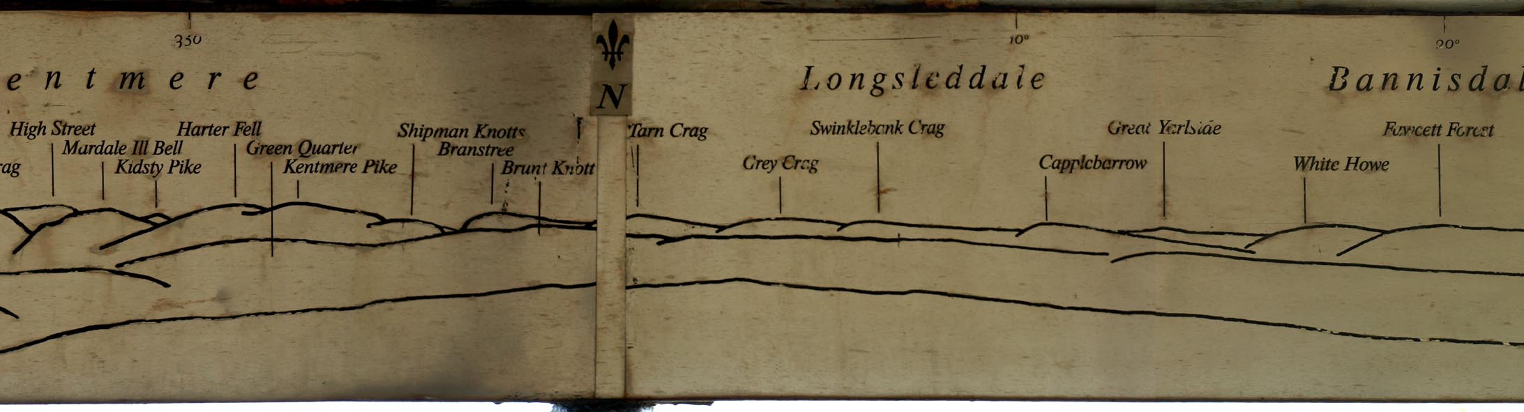 Click to enlarge BTO10.jpg The outline view N to Longsleddale. (taken 27.8.2010) |
||
 Click to enlarge BTO11.jpg The outline view from N to E. (taken 27.8.2010) 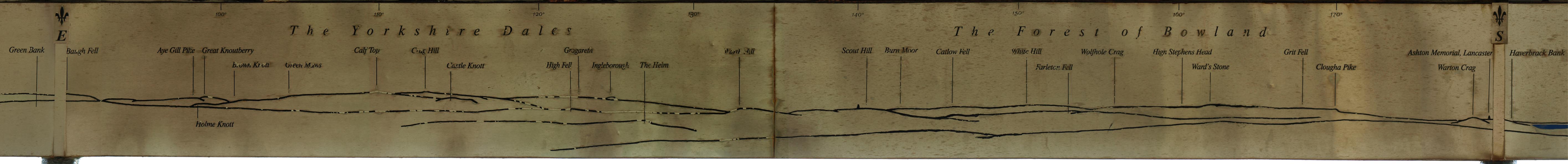 Click to enlarge BTO12.jpg The outline view from E to S. (taken 27.8.2010) |
||
|
|
||
 Lakes Guides menu.