Old Cumbria Gazetteer
 |
 |
|
||
| Skinburness, Silloth-on-Solway | ||||
| Skinburness | ||||
| civil parish:- | Silloth-on-Solway (formerly Cumberland) | |||
| county:- | Cumbria | |||
| locality type:- | locality | |||
| locality type:- | buildings | |||
| locality type:- | port | |||
| locality type:- | market town | |||
| coordinates:- | NY12715593 | |||
| 1Km square:- | NY1255 | |||
| 10Km square:- | NY15 | |||
|
|
||||
| evidence:- | old map:- OS County Series (Cmd 20 8) placename:- Skinburness |
|||
| source data:- | Maps, County Series maps of Great Britain, scales 6 and 25
inches to 1 mile, published by the Ordnance Survey, Southampton,
Hampshire, from about 1863 to 1948. |
|||
|
|
||||
| evidence:- | old text:- placename:- Skinburness |
|||
| source data:- | Ferguson, Richard S: 1890: History of Cumberland: (London) "The market town of Skinburness, which stood a few yards westward of the present village,
and not in the Waver and Wampool estuary, was washed away by the sea about the year
1305. From a Roman altar, coins and other relics having been found on the beach here,
the Romans probably used this place as a port. They may even have had a fort at it,
now drowned under the sea." also see:- Holmes, T V: : On the Destruction of Skinburness by the Sea, about the Year 1305: TCWAAS: vol.6: pp.121-Whelan:: History of Cumberland::: p.241 |
|||
|
|
||||
| evidence:- | old map:- Saxton 1579 placename:- Skinburnenesse |
|||
| source data:- | Map, hand coloured engraving, Westmorlandiae et Cumberlandiae Comitatus ie Westmorland
and Cumberland, scale about 5 miles to 1 inch, by Christopher Saxton, London, engraved
by Augustinus Ryther, 1576, published 1579-1645.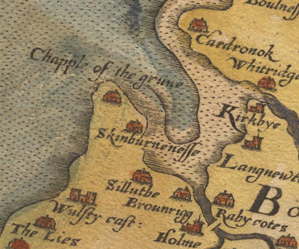 Sax9NY15.jpg Building, symbol for a hamlet, which may or may not have a nucleus. "Skinburnenesse" item:- private collection : 2 Image © see bottom of page |
|||
|
|
||||
| evidence:- | old map:- Burghley 1590 (facsimile) placename:- Skinburness |
|||
| source data:- | Facsimile map, A Platt of the Opposete Border of Scotland to ye West Marches of England,
parts of Cumberland and Scotland including the Debateable Land, from a manuscript
drawn for William Cecil, Lord Burghley, about 1590, published by R B Armstrong, 1897. courtesy of the National Library of Scotland 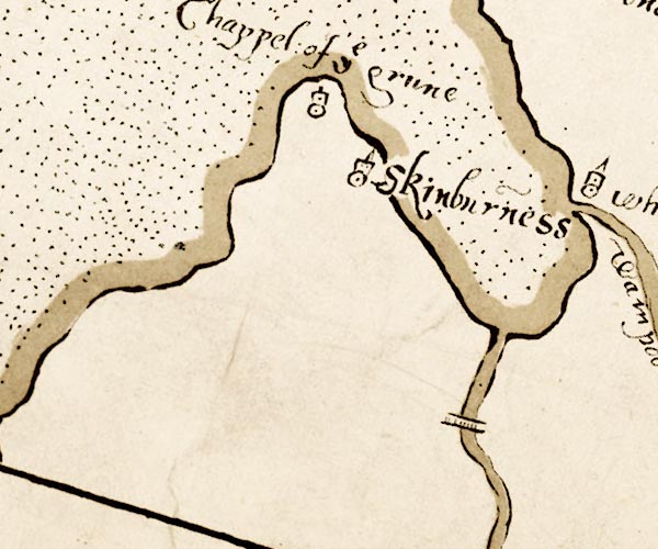 M048NY15.jpg "Skinburness" circle, tower item:- National Library of Scotland : MS6113 f.267 Image © National Library of Scotland |
|||
|
|
||||
| evidence:- | old map:- Speed 1611 (Cmd) placename:- Skinburness |
|||
| source data:- | Map, hand coloured engraving, Cumberland and the Ancient Citie
Carlile Described, scale about 4 miles to 1 inch, by John Speed,
1610, published by J Sudbury and George Humble, Popes Head
Alley, London, 1611-12.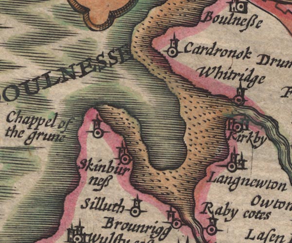 SP11NY15.jpg "Skinburness" circle, tower item:- private collection : 16 Image © see bottom of page |
|||
|
|
||||
| evidence:- | old map:- Jansson 1646 placename:- Skinburness |
|||
| source data:- | Map, hand coloured engraving, Cumbria and Westmoria, ie
Cumberland and Westmorland, scale about 3.5 miles to 1 inch, by
John Jansson, Amsterdam, Netherlands, 1646.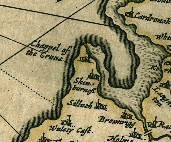 JAN3NY15.jpg "Skinburness" Buildings and tower. item:- JandMN : 88 Image © see bottom of page |
|||
|
|
||||
| evidence:- | old map:- Morden 1695 (Cmd) placename:- Skinburnes |
|||
| source data:- | Map, uncoloured engraving, Cumberland, scale about 4 miles to 1
inch, by Robert Morden, 1695, published by Abel Swale, the
Unicorn, St Paul's Churchyard, Awnsham, and John Churchill, the
Black Swan, Paternoster Row, London, 1695-1715.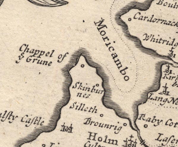 MD12NY15.jpg "Skinburnes" Circle. item:- JandMN : 90 Image © see bottom of page |
|||
|
|
||||
| evidence:- | old text:- Gents Mag placename:- Skinburn Naze item:- smuggling |
|||
| source data:- | Magazine, The Gentleman's Magazine or Monthly Intelligencer or
Historical Chronicle, published by Edward Cave under the
pseudonym Sylvanus Urban, and by other publishers, London,
monthly from 1731 to 1922. goto source goto sourceGentleman's Magazine 1748 p.291 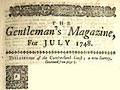 click to enlarge click to enlargeG748E04.jpg "... There has been an old castle at the cote of Skinburn-naze, probably to guard the bay [Moricambe] ..." |
|||
|
|
||||
| evidence:- | old map:- Bowen and Kitchin 1760 placename:- Skinburns |
|||
| source data:- | Map, hand coloured engraving, A New Map of the Counties of
Cumberland and Westmoreland Divided into their Respective Wards,
scale about 4 miles to 1 inch, by Emanuel Bowen and Thomas
Kitchin et al, published by T Bowles, Robert Sayer, and John
Bowles, London, 1760.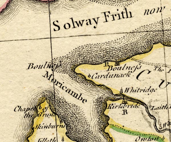 BO18NY15.jpg "Skinburns" circle, tower item:- Armitt Library : 2008.14.10 Image © see bottom of page |
|||
|
|
||||
| evidence:- | old map:- Donald 1774 (Cmd) placename:- Skinburness |
|||
| source data:- | Map, hand coloured engraving, 3x2 sheets, The County of Cumberland, scale about 1
inch to 1 mile, by Thomas Donald, engraved and published by Joseph Hodskinson, 29
Arundel Street, Strand, London, 1774.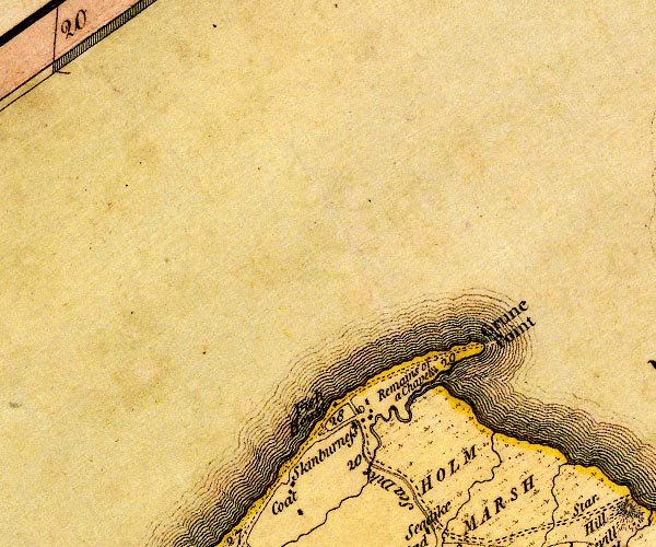 D4NY15NW.jpg "Skinburness" block or blocks, labelled in lowercase; a hamlet or just a house item:- Carlisle Library : Map 2 Image © Carlisle Library |
|||
|
|
||||
| evidence:- | old map:- Hall 1820 (Cmd) placename:- Skinburness |
|||
| source data:- | Map, hand coloured engraving, Cumberland, scale about 21 miles
to 1 inch, engraved by Sidney Hall, published by S Leigh, 18
Strand, London, 1820-31. click to enlarge click to enlargeHA14.jpg "Skinburness" circle, italic lowercase text; settlement item:- JandMN : 91 Image © see bottom of page |
|||
|
|
||||
| evidence:- | old map:- Ford 1839 map placename:- Skinburness |
|||
| source data:- | Map, uncoloured engraving, Map of the Lake District of
Cumberland, Westmoreland and Lancashire, scale about 3.5 miles
to 1 inch, published by Charles Thurnam, Carlisle, and by R
Groombridge, 5 Paternoster Row, London, 3rd edn 1843.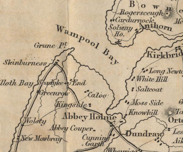 FD02NY15.jpg "Skinburness" item:- JandMN : 100.1 Image © see bottom of page |
|||
|
|
||||
| evidence:- | old painting:- |
|||
| source data:- | Painting, watercolour, Skinburness, Silloth-on-Solway, Cumberland, by Matthew Ellis
Nutter, 1844.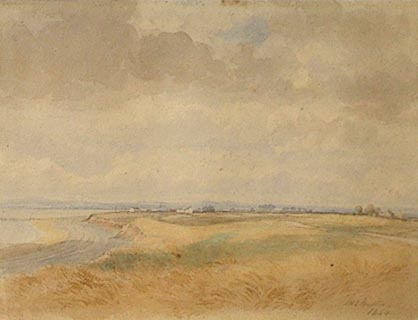 click to enlarge click to enlargePR1351.jpg View of coastline, Solway and Skinburness in the distance. signed at bottom right:- "M E Nutter 1844" item:- Tullie House Museum : 1999.803.1 Image © Tullie House Museum |
|||
|
|
||||
| evidence:- | old map:- Garnett 1850s-60s H placename:- Skinburness |
|||
| source data:- | Map of the English Lakes, in Cumberland, Westmorland and
Lancashire, scale about 3.5 miles to 1 inch, published by John
Garnett, Windermere, Westmorland, 1850s-60s. GAR2NY15.jpg "Skinburness" blocks, settlement item:- JandMN : 82.1 Image © see bottom of page |
|||
|
|
||||
| evidence:- | old text:- Gents Mag |
|||
| source data:- | Magazine, The Gentleman's Magazine or Monthly Intelligencer or
Historical Chronicle, published by Edward Cave under the
pseudonym Sylvanus Urban, and by other publishers, London,
monthly from 1731 to 1922. goto source Gentleman's Magazine 1866 part 2 p.641 "INSCRIBED ROMAN ALTAR FOUND NEAR SKINBURNESS." "... MR. URBAN, - I have read with much interest in your October number, bearing particularly on the inscribed Roman altar which I lately picked up on the sea-shore between Silloth and Skinburness. The finding of this relic confirms, I think, Dr. Bruce's statement referred to at page 34 of his second edition of "The Roman Wall," viz., "A military way ran along the coast from this station (Moresby, near Whitehaven), by way of Maryport, to the extremity of the wall at Bowness."" "I also think it very probable the Romans used the creek or harbour at Skinburness. In confirmation of this, the following extract from the second volume of Nicolson and Burn's "History of Westmorland and Cumberland," p.117, would almost lead to the infernce that the town and harbour of Skinburness existed in the time of the Romans:-" ""In the year 1301, Bishop Hatton being informed that the inhabitants of the village or town near the port of Skinburness were at a great distance from all manner of Divine service, grants a power to the abbot and convent of Holm Cultram to erect a church there which should be endowed with all manner of tithes and enjoy all parochial rights. The abbot and convent to have the power of advowson, and the bishop of Carlisle and his successors all ordinary jurisdiction."" "The town of Skinburness was at this time not only privileged with a market, but seems also to have been the chief place for the king's magazines in these parts for supplying the armies then employed against the Scots. But the case was most miserably altered very soon after. For in 1305, we find it thus mentioned in the parliament records:-" ""At the petition of the abbot, requesting that whereas he had paid a fine of 100 marks to the king for a fair and market to be had in Skinburness, and now that town, together with the way leading to it, is carried away by the sea, the king would grant that he may have such fair and market at his town of Kirkeby Johan instead of the other place aforesaid, and that his charter upon this may be renewed. It is answered, Let the first charter be annulled, and then let him have a like charter in the place as he desireth. ... And for the same reason, as it seemeth, the church was also removed to Kirkeby Johan or Newton Arlosh."" "So much for the interest which the finding of a portion of an inscribed Roman altar near Skinburness has already led to. - I am, &c." "CHARLES WILKINSON." "Bank House, Kendal," "Oct. 16, 1866." |
|||
|
|
||||
| evidence:- | old text:- Gents Mag item:- inscription, roman; roman inscription; roman altar |
|||
| source data:- | Magazine, The Gentleman's Magazine or Monthly Intelligencer or
Historical Chronicle, published by Edward Cave under the
pseudonym Sylvanus Urban, and by other publishers, London,
monthly from 1731 to 1922. goto source Gentleman's Magazine 1866 part 2 p.470 "... ..." "Cumberland. - A portion of an inscribed Roman altar has recently been discovered by Mr. Wilkinson of Kendal. It was lying amongst boulder stones on the sea-shore, to the south of a small haven called Skinburness, on the Cumberland coast. It reads:" "MATRIBV. PARVITI. VAC.IM ? ... ... ..." "which Dr. Bruce reads, no doubt correctly, Matribus Parcis, etc." "Inscriptions to the Parcae were heretofore so rarely found in this country, that Horsley does not appear to give a single example. Yet Dr. Bruce,for the third edition of his "Roman Wall," has collected no less than three, including the above. ..." "... ..." "... In a private letter Dr. Bruce writes: "In the second edition of my book on the Wall, p.347, I say:- 'A military way ran along the coast from this station (Moresby, near Whitehaven), by way of Maryport, to the extremity of the Wall at Bowness.' This altar is confirmatory of my statement. I have no doubt that the Romans used the creek or harbour of Skinburness. in the 13th century, Skinburness was a considerable market-town (founded, I have little doubt, upon Roman remains); but in 1301, by a great irruption of the" |
|||
|
|
||||
| evidence:- | old text:- Gents Mag 1866 |
|||
| source data:- | goto source Gentleman's Magazine 1866 part 2 p.471 "sea, the town was destroyed, and never after attained to its former prosperity. The reason of the altar's turning up just now is this: A new harbour has been formed at Silloth, a little to the south of Skinburness; and its piers have caused the sea to scour the shore between the two places more thoroughly than before. By this means the sand has been washed away, and the boulders below exposed: hence the discovery of the altar!" |
|||
|
|
||||
| evidence:- | market notes:- item:- market |
|||
| source data:- | www.history.ac.uk/cmh/gaz/gazweb2.htm | |||
|
|
||||
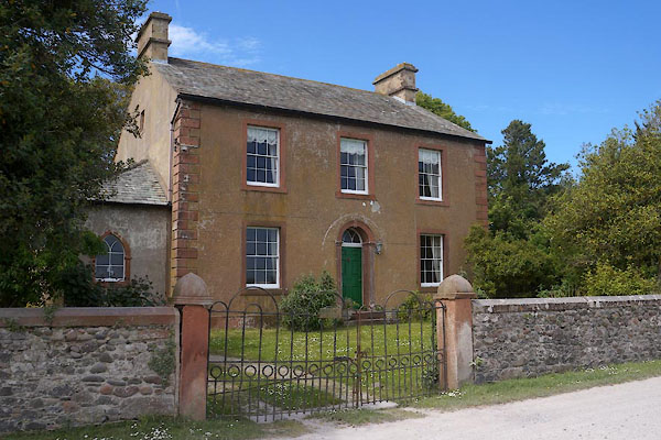
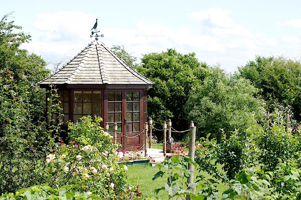 BRB10.jpg Summer house. (taken 10.7.2009) |
||||
|
|
||||
| hearsay:- |
It is said to have been developed as a port, and given a market charter, by Edward
I, 12 February 1301. He saw the place as a supply point for his military campaigns
in Scotland. A charter was granted to the Abbey of Holm Coultram to build a chapel,
but this was never done as the town was washed away. The surviving inhabitants settled
at Newton Arlosh, a 'new town on the marsh'. |
|||
|
|
||||
| notes:- |
Possible site of a tower or stone house |
|||
| Perriam, D R &Robinson, J: 1998: Medieval Fortified Buildings of Cumbria: CWAAS::
ISBN 1 873124 23 6 |
||||
|
|
||||
| places:- |
|
|||
|
||||
|
||||
|
||||
|
||||
|
||||
|
||||
|
||||
|
||||
|
||||
Lakes Guides menu.