 Old Cumbria Gazetteer
 |
 |
|
| Slaggyford, Northumberland | ||
| Slaggyford | ||
| county:- | Northumberland | |
| locality type:- | buildings | |
| coordinates:- | NY677524 | |
| 1Km square:- | NY6752 | |
| 10Km square:- | NY65 | |
|
|
||
| evidence:- | old map:- Saxton 1579 placename:- Slaggesford |
|
| source data:- | Map, hand coloured engraving, Westmorlandiae et Cumberlandiae Comitatus ie Westmorland
and Cumberland, scale about 5 miles to 1 inch, by Christopher Saxton, London, engraved
by Augustinus Ryther, 1576, published 1579-1645.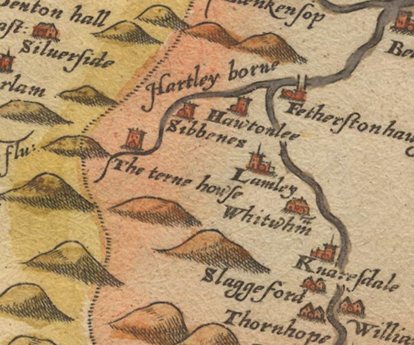 Sax9NY65.jpg Building, symbol for a hamlet, which may or may not have a nucleus. "Slaggesford" item:- private collection : 2 Image © see bottom of page |
|
|
|
||
| evidence:- | old map:- Donald 1774 (Cmd) placename:- Slaggyford |
|
| source data:- | Map, hand coloured engraving, 3x2 sheets, The County of Cumberland, scale about 1
inch to 1 mile, by Thomas Donald, engraved and published by Joseph Hodskinson, 29
Arundel Street, Strand, London, 1774.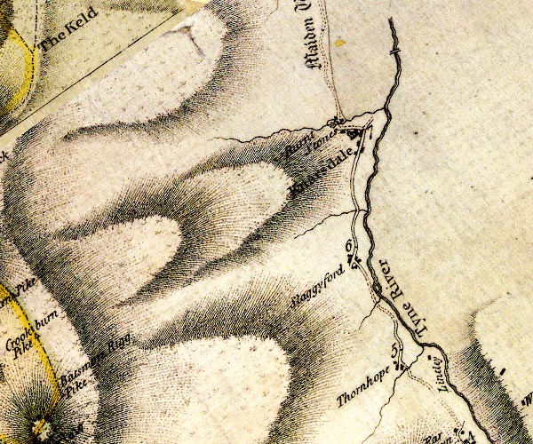 D4NY65SE.jpg "Slaggyford" block or blocks, labelled in lowercase; a hamlet or just a house item:- Carlisle Library : Map 2 Image © Carlisle Library |
|
|
|
||
| evidence:- | old map:- Ford 1839 map placename:- Slaggyford |
|
| source data:- | Map, uncoloured engraving, Map of the Lake District of
Cumberland, Westmoreland and Lancashire, scale about 3.5 miles
to 1 inch, published by Charles Thurnam, Carlisle, and by R
Groombridge, 5 Paternoster Row, London, 3rd edn 1843.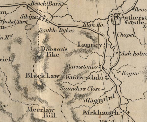 FD02NY65.jpg "Slaggyford" item:- JandMN : 100.1 Image © see bottom of page |
|
|
|
||
 Lakes Guides menu.